|
Burwood, New South Wales
Burwood is a suburb in the Inner West of Sydney, in the state of New South Wales, Australia. It is west of the Sydney central business district and is the administrative centre for the Local government in Australia, local government area of Municipality of Burwood. People from Burwood are colloquially known as Burwoodiens or Burwooders. Burwood Heights, New South Wales, Burwood Heights is a separate suburb to the south. The Appian Way, Burwood, Appian Way is a street in Burwood, known for its architecturally designed Federation architecture, Federation-style homes. History Archaeological evidence indicates people were living in the Sydney area for at least 11,000 years. This long association had led to a harmonious relationship between the Indigenous peoples, indigenous inhabitants and their environment, which was interrupted by the arrival of the British in 1788. The European desire to cultivate the land aided and abetted by a smallpox epidemic that forced the local people, t ... [...More Info...] [...Related Items...] OR: [Wikipedia] [Google] [Baidu] |
Burwood Post Office
The Burwood Post Office is a heritage-listed former Aboriginal land, farm and former post office and now unused retail building located at 168a Burwood Road in the Sydney suburb of Burwood in the Municipality of Burwood local government area of New South Wales, Australia. It was designed by Walter Liberty Vernon and George Oakeshott (assistant draughtsman) and built by New South Wales Works Branch. It is also known as Burwood Post Office (former). It was added to the New South Wales State Heritage Register on 18 May 2001. History Burwood Burwood derived its name from a grant of 250 acres made by Governor Hunter on 3 August 1799 to Captain Thomas Rowley of the NSW Corps, who named the land Burwood Farm, after the land on which he had lived in his native Cornwall, England. Along with John Macarthur and Rev. Samuel Marsden, Rowley was one of the men who purchased merino sheep from the original flock brought to Australia by Captain Waterhouse in 1797. Although Rowley had anot ... [...More Info...] [...Related Items...] OR: [Wikipedia] [Google] [Baidu] |
New South Wales
) , nickname = , image_map = New South Wales in Australia.svg , map_caption = Location of New South Wales in AustraliaCoordinates: , subdivision_type = Country , subdivision_name = Australia , established_title = Before federation , established_date = Colony of New South Wales , established_title2 = Establishment , established_date2 = 26 January 1788 , established_title3 = Responsible government , established_date3 = 6 June 1856 , established_title4 = Federation , established_date4 = 1 January 1901 , named_for = Wales , demonym = , capital = Sydney , largest_city = capital , coordinates = , admin_center = 128 local government areas , admin_center_type = Administration , leader_title1 = Monarch , leader_name1 = Charles III , leader_title2 = Governor , leader_name2 = Margaret Beazley , leader_title3 = Premier , leader_name3 = Dominic Perrottet (Liberal) , national_representation = Parliament of Australia , national_representation_type1 = Senat ... [...More Info...] [...Related Items...] OR: [Wikipedia] [Google] [Baidu] |
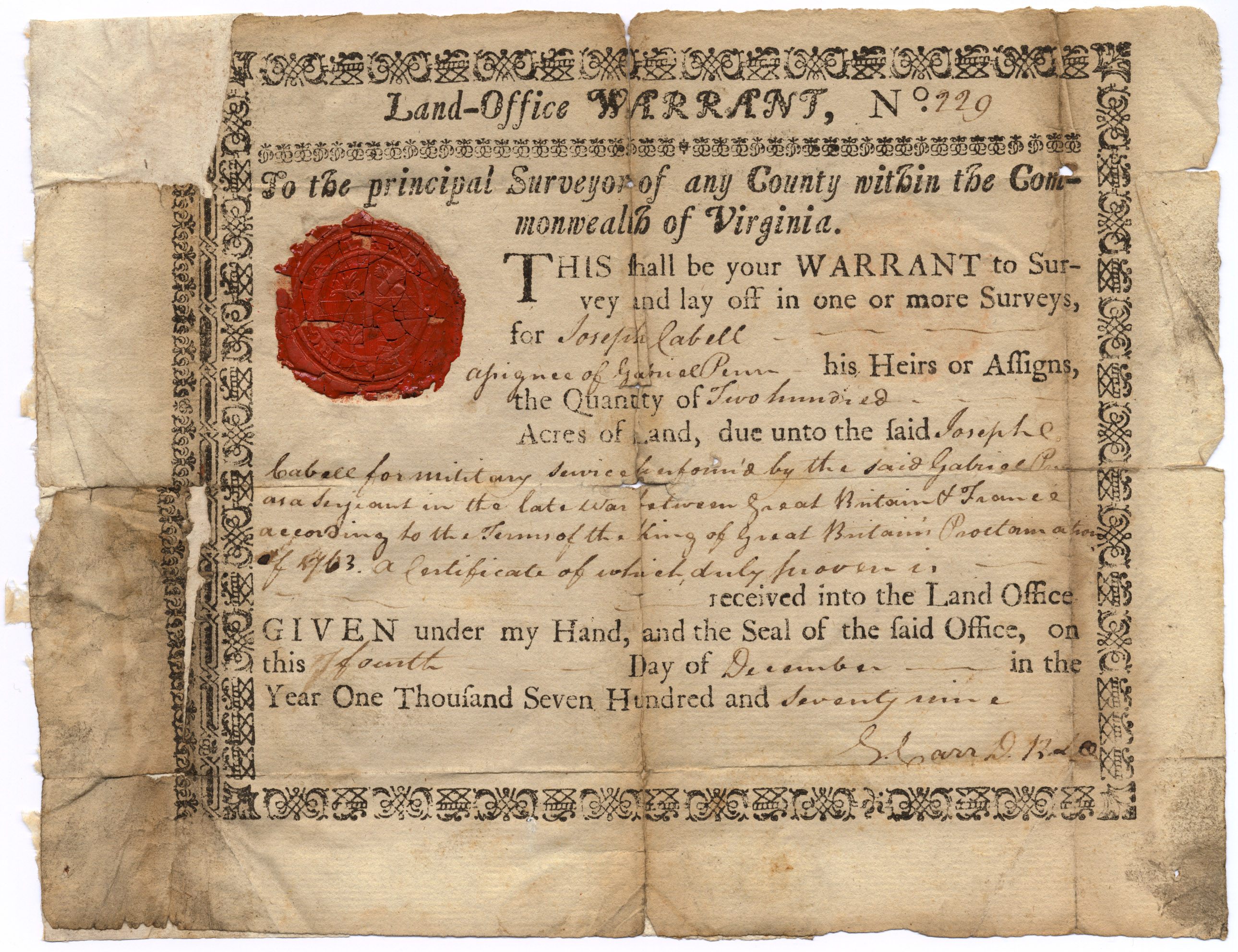
Land Grant
A land grant is a gift of real estate—land or its use privileges—made by a government or other authority as an incentive, means of enabling works, or as a reward for services to an individual, especially in return for military service. Grants of land are also awarded to individuals and companies as incentives to develop unused land in relatively unpopulated countries; the process of awarding land grants are not limited to the countries named below. The United States historically gave out numerous land grants as Homesteads to individuals desiring to prove a farm. The American Industrial Revolution was guided by many supportive acts of legislatures (for example, the Main Line of Public Works legislation of 1826) promoting commerce or transportation infrastructure development by private companies, such as the Cumberland Road turnpike, the Lehigh Canal, the Schuylkill Canal and the many railroads that tied the young United States together. Ancient Rome Roman soldiers were given pe ... [...More Info...] [...Related Items...] OR: [Wikipedia] [Google] [Baidu] |
England
England is a country that is part of the United Kingdom. It shares land borders with Wales to its west and Scotland to its north. The Irish Sea lies northwest and the Celtic Sea to the southwest. It is separated from continental Europe by the North Sea to the east and the English Channel to the south. The country covers five-eighths of the island of Great Britain, which lies in the North Atlantic, and includes over 100 smaller islands, such as the Isles of Scilly and the Isle of Wight. The area now called England was first inhabited by modern humans during the Upper Paleolithic period, but takes its name from the Angles, a Germanic tribe deriving its name from the Anglia peninsula, who settled during the 5th and 6th centuries. England became a unified state in the 10th century and has had a significant cultural and legal impact on the wider world since the Age of Discovery, which began during the 15th century. The English language, the Anglican Church, and Engli ... [...More Info...] [...Related Items...] OR: [Wikipedia] [Google] [Baidu] |
Burwood Park
Burwood Park is an historic private estate located in Hersham, Surrey, England. Spanning six miles of road, Burwood Park is situated in a former deer park that belonged to Henry VIII. The 360 acre estate is known both for its extensive wildlife — more than 150 species of birds and mammals have been recorded in the woods and parkland around its lakes and communal areas —.as well as the high level of security and privacy provided to its residents; it is one of the few remaining residential areas in the United Kingdom never to have been filmed by Google Streetview. Acquired by Henry Askew in 1877, the first new houses in Burwood Park were constructed in the 1920s, with major new developments arriving in the following decade. It soon became a popular destination for the British elite, owing to its semi-rural feel and commutable distance to London. Comprising 384 properties by 2021, Burwood Park is of a geometric design within an approximate semicircle and many of its roads ... [...More Info...] [...Related Items...] OR: [Wikipedia] [Google] [Baidu] |
Thomas Rowley (soldier)
Captain Thomas Rowley ( – 27 May 1806) was a soldier and landholder in the convict settlement of New South Wales, Australia. Biography He was appointed adjutant of the New South Wales Corps in 1789 and promoted to lieutenant in 1791. Rowley arrived at Port Jackson in 1792, he had the convict Simeon Lord assigned as servant. He was promoted to captain in 1796 and in 1799 he commenced a tour of duty on Norfolk Island. When Captain John Townson departed prematurely in November, Rowley, as the senior officer, took charge of the settlement. During his rule he ordered liquor stills to be demolished to reduce the drunkenness on the island, and this move brought threats of prosecution from the owners. He was relieved by Major Joseph Foveaux in July 1800 and returned to Sydney. He claimed that his rule was sufficiently creditable to earn the respect of the settlers and Governor King. In 1802 he resigned his commission and became a farmer. He had received his first land grant in 1793 ... [...More Info...] [...Related Items...] OR: [Wikipedia] [Google] [Baidu] |
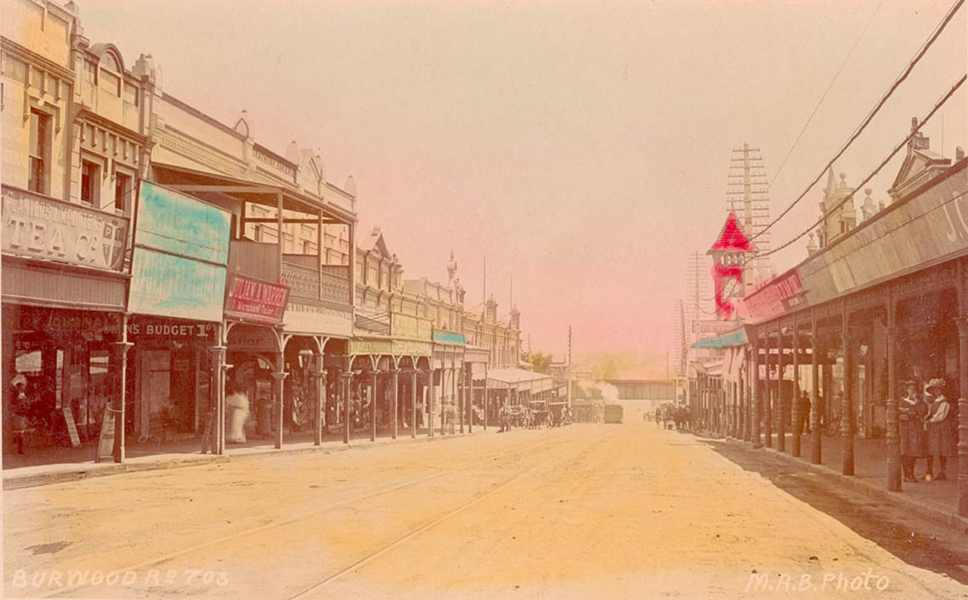
SLNSW 796172 Burwood Rd
The State Library of New South Wales, part of which is known as the Mitchell Library, is a large heritage-listed special collections, reference and research library open to the public and is one of the oldest libraries in Australia. Established in 1869 its collections date back to the Australian Subscription Library established in the colony of New South Wales (now a state of Australia) in 1826. The library is located on the corner of Macquarie Street and Shakespeare Place, in the Sydney central business district adjacent to the Domain and the Royal Botanic Gardens, in the City of Sydney. The library is a member of the National and State Libraries Australia (NSLA) consortium. The State Library of New South Wales building was designed by Walter Liberty Vernon, assisted by H. C. L. Anderson and was built from 1905 to 1910, with further additions by Howie Bros in 1939; by FWC Powell & Sons in 1959; and by Mellocco Bros in 1964. The property was added to the New South Wales St ... [...More Info...] [...Related Items...] OR: [Wikipedia] [Google] [Baidu] |
Wangal People
The Wangal people ( Wanegal or Won-gal,) are a clan of the Dharug ( ?) Aboriginal people whose heirs are custodians of the lands and waters of what is now the Inner West of Sydney, New South Wales, centred around the Municipality of Strathfield, Municipality of Burwood, City of Canada Bay and former Ashfield Council (now part of Inner West Council) and extending west into the City of Parramatta. History Archaeological evidence of human occupation alongside the Parramatta River has been dated back 20,000 years, and is likely to date back much further (people have been dated as being present elsewhere in Australia more than 60,000 years ago – see Australian Aboriginal Prehistoric Sites). Sydney's geomorphology 20,000 years ago was very different from what it is today. In the middle of the last ice age, the Sydney coast was approximately 15 km to the east and what is now Port Jackson (Sydney Harbour) was freshwater creeks and rivers. Wangal predecessors would have been ... [...More Info...] [...Related Items...] OR: [Wikipedia] [Google] [Baidu] |
Smallpox
Smallpox was an infectious disease caused by variola virus (often called smallpox virus) which belongs to the genus Orthopoxvirus. The last naturally occurring case was diagnosed in October 1977, and the World Health Organization (WHO) certified the global eradication of the disease in 1980, making it the only human disease to be eradicated. The initial symptoms of the disease included fever and vomiting. This was followed by formation of ulcers in the mouth and a skin rash. Over a number of days, the skin rash turned into the characteristic fluid-filled blisters with a dent in the center. The bumps then scabbed over and fell off, leaving scars. The disease was spread between people or via contaminated objects. Prevention was achieved mainly through the smallpox vaccine. Once the disease had developed, certain antiviral medication may have helped. The risk of death was about 30%, with higher rates among babies. Often, those who survived had extensive scarring of their ... [...More Info...] [...Related Items...] OR: [Wikipedia] [Google] [Baidu] |
Indigenous Peoples
Indigenous peoples are culturally distinct ethnic groups whose members are directly descended from the earliest known inhabitants of a particular geographic region and, to some extent, maintain the language and culture of those original peoples. The term ''Indigenous'' was first, in its modern context, used by Europeans, who used it to differentiate the Indigenous peoples of the Americas from the European settlers of the Americas and from the Sub-Saharan Africans who were brought to the Americas as enslaved people. The term may have first been used in this context by Sir Thomas Browne in 1646, who stated "and although in many parts thereof there be at present swarms of ''Negroes'' serving under the ''Spaniard'', yet were they all transported from ''Africa'', since the discovery of ''Columbus''; and are not indigenous or proper natives of ''America''." Peoples are usually described as "Indigenous" when they maintain traditions or other aspects of an early culture that is assoc ... [...More Info...] [...Related Items...] OR: [Wikipedia] [Google] [Baidu] |
Federation Architecture
Federation architecture is the architectural style in Australia that was prevalent from around 1890 to 1915. The name refers to the Federation of Australia on 1 January 1901, when the Australian colonies collectively became the Commonwealth of Australia. The architectural style had antecedents in the Queen Anne style architecture, Queen Anne style and Edwardian architecture, Edwardian style of the United Kingdom, combined with various other influences like the Arts and Crafts style. Other styles also developed, like the Federation Warehouse style, which was heavily influenced by the Romanesque Revival style. In Australia, Federation architecture is generally associated with cottages in the Queen Anne style, but some consider that there were twelve main styles that characterized the Federation period. Definition and features The Federation period overlaps the Edwardian architecture, Edwardian period, which was so named after the reign of Edward VII of the United Kingdom, King Edwa ... [...More Info...] [...Related Items...] OR: [Wikipedia] [Google] [Baidu] |
Appian Way, Burwood
Appian Way is a street in the suburb of Burwood in Sydney. The state heritage listed Appian Way has been described as one of the finest streets of Federation houses in Australia. The picturesque houses create an asymmetrical, multi-gabled roofscape with a variety of materials used such as slate and terracotta tiles and feature varied designs. The houses are complemented with landscaped gardens, manicured lawns and a nature strip with Brush Box trees. The serpentine street runs between Burwood Road and Liverpool Road with a communal reserve that has been converted into a lawn tennis club. Homes in the street are designed in various Federation styles. Many are in the Federation Queen Anne style, but other styles are also represented. ''Erica'' and ''St Ellero'' are designed in the Federation Arts and Crafts style, while ''Casa Tasso'' and ''Ostia'' are just two out of several examples of the Federation Bungalow style. History Also known as the Hoskins Estate, Appian Way was a mo ... [...More Info...] [...Related Items...] OR: [Wikipedia] [Google] [Baidu] |


.jpg)


Caerleon-3.jpg)