|
Bumba, Democratic Republic Of The Congo
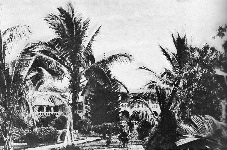
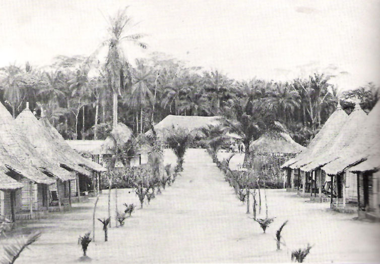
Bumba is a town and river port in Mongala Province, in the northern part of the Democratic Republic of Congo, lying on the River Congo. As of 2009 it had an estimated population of 107,626. The town has neither electricity nor running water. Transport The narrow gauge Vicicongo line from Bumba to Isiro as of 2007 is not operational (see Transport in DR Congo). The town is served by Bumba Airport. The Congo River serves as the main transportation artery. Notable People * Marcel Lihau See also * List of railway stations in the Democratic Republic of the Congo * Dr. Ngoy Mushola Ebola, also known as Ebola virus disease (EVD) and Ebola hemorrhagic fever (EHF), is a viral hemorrhagic fever in humans and other primates, caused by ebolaviruses. Symptoms typically start anywhere between two days and three weeks after bec ... * AS Lokole References Populated places in Mongala {{DRCongo-geo-stub ... [...More Info...] [...Related Items...] OR: [Wikipedia] [Google] [Baidu] |
Flag Of The Democratic Republic Of The Congo
The national flag of the Democratic Republic of the Congo (french: drapeau de la république démocratique du Congo) is a sky blue flag, adorned with a yellow star in the upper left canton and cut diagonally by a red stripe with a yellow fimbriation. It was adopted on 20 February 2006. A new constitution, ratified in December 2005 and which came into effect in February 2006, promoted a return to a flag similar to that flown between 1963 and 1971, with a change from a royal blue to sky blue background. Blue represents peace. Red stands for "the blood of the country's martyrs", yellow the country's wealth; and the star symbol the future for the country. Colours The colours approximation is listed below: Previous flags The previous flag was adopted in 2003. It was similar to the flag used between 1960 and 1963. That flag, in turn, was based on the flag which was originally used by King Leopold's Association Internationale Africaine and was first used in 1877. The 1877 design ... [...More Info...] [...Related Items...] OR: [Wikipedia] [Google] [Baidu] |
Narrow-gauge Railway
A narrow-gauge railway (narrow-gauge railroad in the US) is a railway with a track gauge narrower than standard-gauge railway, standard . Most narrow-gauge railways are between and . Since narrow-gauge railways are usually built with Minimum railway curve radius, tighter curves, smaller structure gauges, and lighter rails, they can be less costly to build, equip, and operate than standard- or broad-gauge railways (particularly in mountainous or difficult terrain). Lower-cost narrow-gauge railways are often used in mountainous terrain, where engineering savings can be substantial. Lower-cost narrow-gauge railways are often built to serve industries as well as sparsely populated communities where the traffic potential would not justify the cost of a standard- or broad-gauge line. Narrow-gauge railways have specialised use in mines and other environments where a small structure gauge necessitates a small loading gauge. In some countries, narrow gauge is the standard; Japan, Indone ... [...More Info...] [...Related Items...] OR: [Wikipedia] [Google] [Baidu] |
Ngoy Mushola
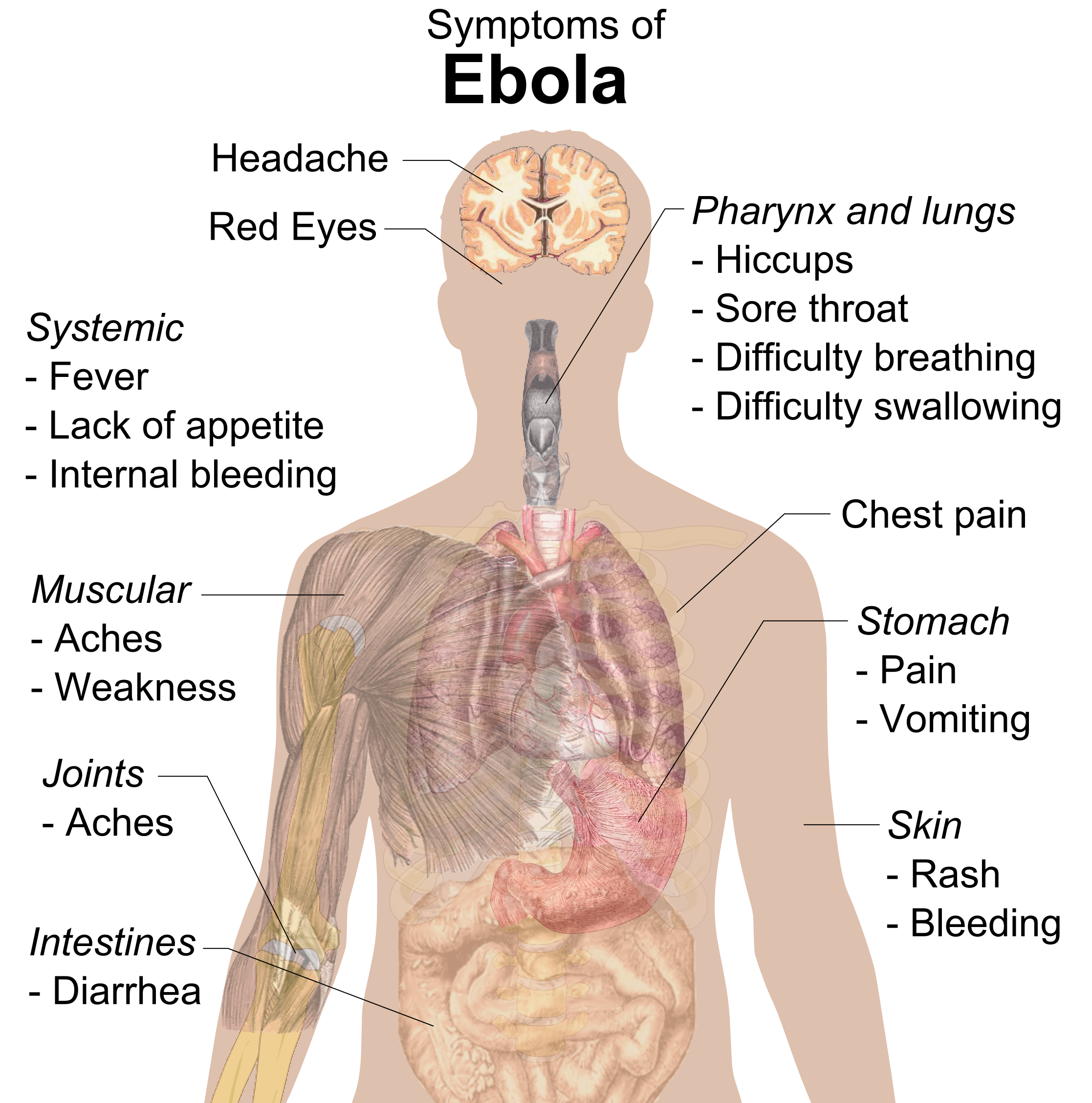
Ebola, also known as Ebola virus disease (EVD) and Ebola hemorrhagic fever (EHF), is a viral hemorrhagic fever in humans and other primates, caused by ebolaviruses. Symptoms typically start anywhere between two days and three weeks after becoming infected with the virus. The first symptoms are usually fever, sore throat, muscle pain, and headaches. These are usually followed by vomiting, diarrhoea, rash and decreased liver and kidney function, at which point, some people begin to bleed both internally and externally. The disease kills between 25% and 90% of those infected – about 50% on average. Death is often due to shock from fluid loss, and typically occurs between six and 16 days after the first symptoms appear. Early treatment of symptoms increases the survival rate considerably compared to late start. The virus spreads through direct contact with body fluids, such as blood from infected humans or other animals, or from contact with items that have recently been conta ... [...More Info...] [...Related Items...] OR: [Wikipedia] [Google] [Baidu] |
List Of Railway Stations In The Democratic Republic Of The Congo
Railway stations in the Democratic Republic of Congo (DR Congo) include: Maps UN Map WestUN Map East* Stations served by passenger trains Stations served by rail Existing Matadi–Kinshasa Railway * Ango-Ango * Matadi * Mpozo * Kenge * Songololo * Mbanza-Ngungu * Kimpese * Lukala- cement works * Kintoni * Kwilu Ngongo * Kisuntu * Inkisi aka Kisantu * Matete * Madimba * Kindamba ** Dembo * Kasangulu * (start of suburban area) * Mont Ngafula * Kinsenso * Matete * Ndjili * Limete - Kinshasa - national capital; (river port railhead) * (proposed road-rail bridge on border.) * Brazzaville ---- * Barumbu * La Gombe * Kitambo * Ngaliema * (local line to west) ---- * (local line to east) * Limbe * Masina * Kinshasa Airport ---- Inland lines ---- * Ilebo - (river port railhead) * Bakwa-Kasanga * Mweka * Demba * Kananga (was Luluabourg) * Kamwandu * Kazumba * Mwene Ditu * Lusuku * Kamina - junction to north * Tenke - junction to Angola * ... [...More Info...] [...Related Items...] OR: [Wikipedia] [Google] [Baidu] |
Marcel Lihau
Marcel Antoine Lihau or Ebua Libana la Molengo Lihau (29 September 1931 – 9April 1999) was a Congolese jurist, law professor and politician who served as the inaugural First President of the Supreme Court of Justice of the Congo from 1968 until 1975 and was involved in the creation of two constitutions for the Democratic Republic of the Congo. Lihau attended the Catholic University of Leuven in Belgium with the help of sympathetic Jesuit educators, becoming one of the first Congolese to study law. While there he encouraged Congolese politicians to form an alliance that allowed them to secure the independence of the Congo from Belgium. He served briefly as a justice official and negotiator for the Congolese central government before being appointed to lead a commission to draft a permanent national constitution. He was made dean of law faculty at Lovanium University in 1963. The following year he helped deliver the Luluabourg Constitution to the Congolese, which was adopted b ... [...More Info...] [...Related Items...] OR: [Wikipedia] [Google] [Baidu] |
Congo River
The Congo River ( kg, Nzâdi Kôngo, french: Fleuve Congo, pt, Rio Congo), formerly also known as the Zaire River, is the second longest river in Africa, shorter only than the Nile, as well as the second largest river in the world by discharge volume, following only the Amazon. It is also the world's deepest recorded river, with measured depths around . The Congo- Lualaba- Chambeshi River system has an overall length of , which makes it the world's ninth- longest river. The Chambeshi is a tributary of the Lualaba River, and ''Lualaba'' is the name of the Congo River upstream of Boyoma Falls, extending for . Measured along with the Lualaba, the main tributary, the Congo River has a total length of . It is the only major river to cross the Equator twice. The Congo Basin has a total area of about , or 13% of the entire African landmass. Name The name ''Congo/Kongo'' originates from the Kingdom of Kongo once located on the southern bank of the river. The kingdom in turn was name ... [...More Info...] [...Related Items...] OR: [Wikipedia] [Google] [Baidu] |
Bumba Airport
Bumba Airport is an airport serving the Congo River port city of Bumba in Mongala Province, Democratic Republic of the Congo. The Bumba (BBA) NDB is located east of the runway. Airlines and destinations See also * * * Transport in the Democratic Republic of the Congo * List of airports in the Democratic Republic of the Congo This is a list of airports in the Democratic Republic of the Congo, sorted by location. Airports Airport names shown in bold indicate the airport has scheduled service on commercial airlines. See also * Transport in the Democratic Republic ... References External links OpenStreetMap - Bumba AirportOurAirports - Bumba Airport* Airports in Mongala {{DRCongo-airport-stub ... [...More Info...] [...Related Items...] OR: [Wikipedia] [Google] [Baidu] |
Transport In DR Congo
Ground transport in the Democratic Republic of the Congo (DRC) has always been difficult. The terrain and climate of the Congo Basin present serious barriers to road and rail construction, and the distances are enormous across this vast country. Furthermore, chronic economic mismanagement and internal conflict has led to serious under-investment over many years. On the other hand, the DRC has thousands of kilometres of navigable waterways, and traditionally water transport has been the dominant means of moving around approximately two-thirds of the country. Transport problems As an illustration of transport difficulties in the DRC, even before wars damaged the infrastructure, the so-called "national" route, used to get supplies to Bukavu from the seaport of Matadi, consisted of the following: *Matadi to Kinshasa – rail *Kinshasa to Kisangani – river boat *Kisangani to Ubundu – rail *Ubundu to Kindu – river boat *Kindu to Kalemie – rail *Kalemie to Kalundu (the lake po ... [...More Info...] [...Related Items...] OR: [Wikipedia] [Google] [Baidu] |
Isiro
Isiro (pronounced ) is the capital of Haut-Uele Province in the northeastern part of the Democratic Republic of the Congo. It lies between the equatorial forest and the savannah and its main resource is coffee. Isiro's population is estimated at approximately 182,000. Most people speak, Pa-Zande (Zande language), Lingala, Swahili and which is somehow uncommon. History Isiro was named ''Paulis'' after colonel, later diplomat, Albert Paulis when it was part of the Belgian Congo. The city was developed in 1934 and reached its peak in 1957. Université d'Uélé (in French). Accessed November 4, 2006. In the troubled days of Congo's independence and its aftermath, operation ''Black Dragoon'' brought fighting between Belgian paratroopers and local Simba Rebellion, Si ... [...More Info...] [...Related Items...] OR: [Wikipedia] [Google] [Baidu] |
Vicicongo Line
Chemins de fer des Uele (Uele Railways or Vicicongo line) is a narrow-gauge line in the north east of the Democratic Republic of the Congo. It was built between 1924 and 1937 as a portage railway bypassing Congo River rapids. Route The line runs from the Congo river port Bumba in Mongala via Lower Uele to Mungbere in Upper Uele with branch lines to Bondo, Buta and Titule city. The total network is long.Durrant, A.E., A.A. Jorgensen, C.P. Lewis. Steam in Africa, London, 1981, Hamlyn. Operationally, the network consists of the following sections: * Bumba–Aketi * Aketi–Bondo * Aketi–Buta–Isiro * Liénart–Titule * Buta–Buta Triangle Town * Isiro–Mungbere History The Uele railways were built 1924–1937 by a Belgian company, the Société des Chemins de Fer Vicinaux du Congo (Vicicongo). The first line ran from Aketi to Bondo and was built from leftover German army stocks used in trench railways or heeresfeldbahnen, which the Belgians acquired after World War ... [...More Info...] [...Related Items...] OR: [Wikipedia] [Google] [Baidu] |
River Congo
The Congo River ( kg, Nzâdi Kôngo, french: Fleuve Congo, pt, Rio Congo), formerly also known as the Zaire River, is the second longest river in Africa, shorter only than the Nile, as well as the second largest river in the world by discharge volume, following only the Amazon. It is also the world's deepest recorded river, with measured depths around . The Congo- Lualaba- Chambeshi River system has an overall length of , which makes it the world's ninth- longest river. The Chambeshi is a tributary of the Lualaba River, and ''Lualaba'' is the name of the Congo River upstream of Boyoma Falls, extending for . Measured along with the Lualaba, the main tributary, the Congo River has a total length of . It is the only major river to cross the Equator twice. The Congo Basin has a total area of about , or 13% of the entire African landmass. Name The name ''Congo/Kongo'' originates from the Kingdom of Kongo once located on the southern bank of the river. The kingdom in turn was nam ... [...More Info...] [...Related Items...] OR: [Wikipedia] [Google] [Baidu] |
Democratic Republic Of The Congo
The Democratic Republic of the Congo (french: République démocratique du Congo (RDC), colloquially "La RDC" ), informally Congo-Kinshasa, DR Congo, the DRC, the DROC, or the Congo, and formerly and also colloquially Zaire, is a country in Central Africa. It is bordered to the northwest by the Republic of the Congo, to the north by the Central African Republic, to the northeast by South Sudan, to the east by Uganda, Rwanda, and Burundi, and by Tanzania (across Lake Tanganyika), to the south and southeast by Zambia, to the southwest by Angola, and to the west by the South Atlantic Ocean and the Cabinda exclave of Angola. By area, it is the second-largest country in Africa and the 11th-largest in the world. With a population of around 108 million, the Democratic Republic of the Congo is the most populous officially Francophone country in the world. The national capital and largest city is Kinshasa, which is also the nation's economic center. Centered on the Cong ... [...More Info...] [...Related Items...] OR: [Wikipedia] [Google] [Baidu] |


