|
Brunswick, Manchester
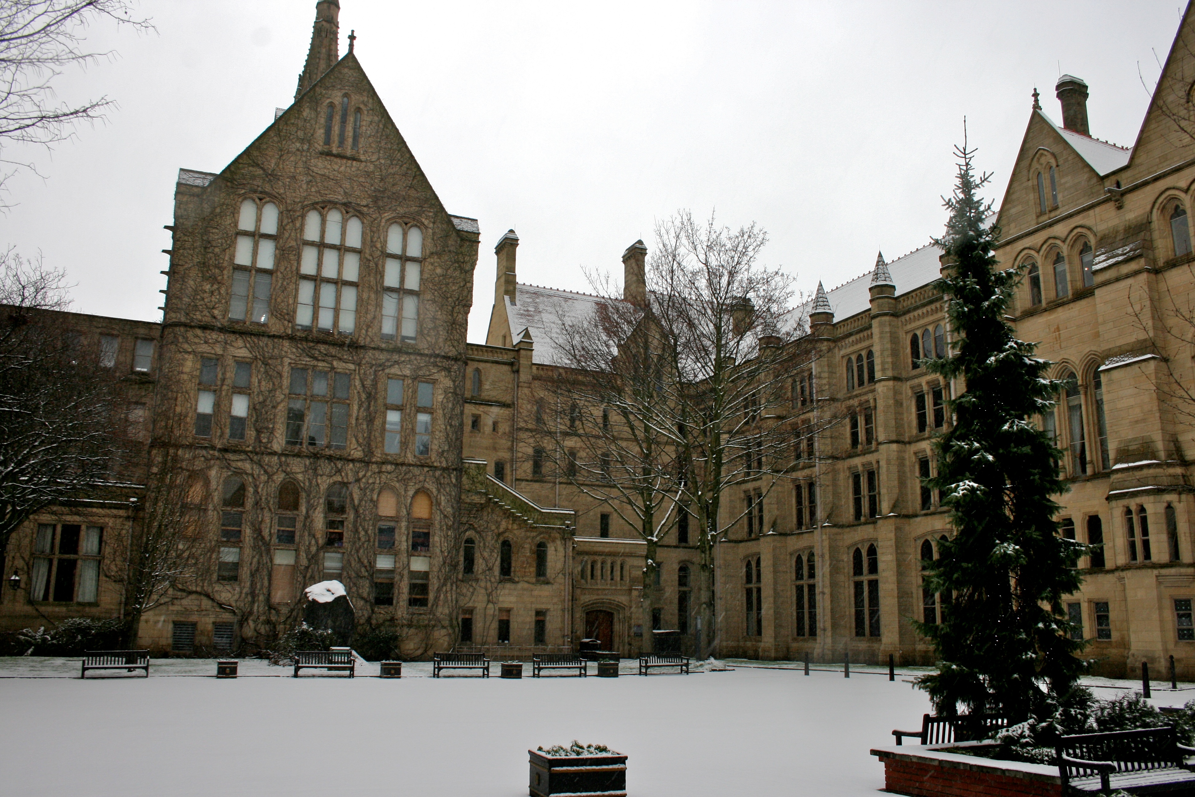
Brunswick is an inner-city area of south Manchester, England, south of Manchester Piccadilly railway station and north of Manchester Royal Infirmary, between Manchester city centre to the north, Ardwick to the east, and Chorlton-on-Medlock to the south and west. It was historically part of Chorlton-on-Medlock and acquired its name from Brunswick Street which runs through it. Its western edge is dominated by campus buildings of Manchester University, east of Oxford Road, and its northern edge by the Mancunian Way. The campus buildings have all been built since 1957, and several large new buildings have appeared since the inauguration of the present University A university () is an institution of higher (or tertiary) education and research which awards academic degrees in several academic disciplines. Universities typically offer both undergraduate and postgraduate programs. In the United States, t ... in 2004, such as University Place on the site of the former Mathematics Bu ... [...More Info...] [...Related Items...] OR: [Wikipedia] [Google] [Baidu] |
Manchester
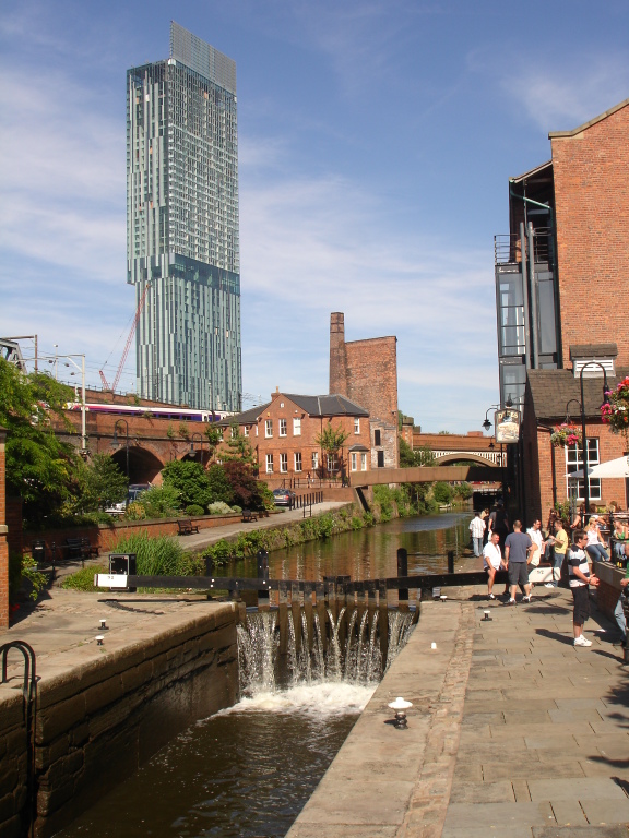
Manchester () is a city in Greater Manchester, England. It had a population of 552,000 in 2021. It is bordered by the Cheshire Plain to the south, the Pennines to the north and east, and the neighbouring city of Salford to the west. The two cities and the surrounding towns form one of the United Kingdom's most populous conurbations, the Greater Manchester Built-up Area, which has a population of 2.87 million. The history of Manchester began with the civilian settlement associated with the Roman fort ('' castra'') of ''Mamucium'' or ''Mancunium'', established in about AD 79 on a sandstone bluff near the confluence of the rivers Medlock and Irwell. Historically part of Lancashire, areas of Cheshire south of the River Mersey were incorporated into Manchester in the 20th century, including Wythenshawe in 1931. Throughout the Middle Ages Manchester remained a manorial township, but began to expand "at an astonishing rate" around the turn of the 19th century. Manchest ... [...More Info...] [...Related Items...] OR: [Wikipedia] [Google] [Baidu] |
Manchester Piccadilly Railway Station
Manchester Piccadilly is the principal railway station in Manchester, England. Opened as Store Street in 1842, it was renamed Manchester London Road in 1847 and became Manchester Piccadilly in 1960. Located to the south-east of Manchester city centre, it hosts long-distance intercity and cross-country services to national destinations including Euston railway station, London, Birmingham New Street railway station, Birmingham, Nottingham station, Nottingham, Glasgow Central station, Glasgow, Edinburgh Waverley station, Edinburgh, Cardiff Central railway station, Cardiff, Bristol Temple Meads railway station, Bristol, Exeter St Davids railway station, Exeter, Plymouth railway station, Plymouth, Reading railway station, Reading, Southampton Central railway station, Southampton and Bournemouth railway station, Bournemouth; regional services to destinations in Northern England including Liverpool Lime Street railway station, Liverpool, Leeds railway station, Leeds, Sheffield railway s ... [...More Info...] [...Related Items...] OR: [Wikipedia] [Google] [Baidu] |
Manchester Royal Infirmary
Manchester Royal Infirmary (MRI) is a large NHS teaching hospital in Chorlton-on-Medlock, Manchester, England. Founded by Charles White in 1752 as part of the voluntary hospital movement of the 18th century, it is now a major regional and national medical centre. It is the largest Hospital within Manchester University NHS Foundation Trust, and based on its Oxford Road Campus in South Manchester where it shares a site with the Royal Manchester Children's Hospital, Manchester Royal Eye Hospital and Saint Mary's Hospital as well as several other educational and research facilities. The Hospital is also a key site for medical educational within Manchester, serving as a main teaching hospital for School of Medical Sciences, University of Manchester. History The first premises was a house in Garden Street, off Withy Grove, Manchester, which were opened on Monday 27 July 1752, financed by subscriptions. Government of the institution was in the hands of the trustees. Any subscriber ... [...More Info...] [...Related Items...] OR: [Wikipedia] [Google] [Baidu] |
Manchester City Centre
Manchester City Centre is the central business district of Manchester in Greater Manchester, England situated within the confines of Great Ancoats Street, A6042 Trinity Way, and A57(M) Mancunian Way which collectively form an inner ring road. The City Centre ward had a population of 17,861 at the 2011 census. Manchester city centre evolved from the civilian ''vicus'' of the Roman fort of Mamucium, on a sandstone bluff near the confluence of the rivers Medlock and Irwell. This became the township of Manchester during the Middle Ages, and was the site of the Peterloo Massacre of 1819. Manchester was granted city status in 1853, after the Industrial Revolution, from which the city centre emerged as the global centre of the cotton trade which encouraged its "splendidly imposing commercial architecture" during the Victorian era, such as the Royal Exchange, the Corn Exchange, the Free Trade Hall, and the Great Northern Warehouse. After the decline of the cotton trade and the Ma ... [...More Info...] [...Related Items...] OR: [Wikipedia] [Google] [Baidu] |
Ardwick
Ardwick is a district of Manchester in North West England, one mile south east of the city centre. The population of the Ardwick Ward at the 2011 census was 19,250. Historically in Lancashire, by the mid-nineteenth century Ardwick had grown from being a village into a pleasant and wealthy suburb of Manchester, but by the end of that century it had become heavily industrialised. When its industries later fell into decline then so did Ardwick itself, becoming one of the city's most deprived areas. Substantial development has taken place more recently in Ardwick and other areas of Manchester to reverse the decline, notably the construction of many facilities for the 2002 Commonwealth Games held nearby at the City of Manchester Stadium. In the late nineteenth century Ardwick had many places of entertainment, but the only remnant of that history today is the Art Deco-style Manchester Apollo, a venue for pop and rock music concerts. History Prior to the Industrial Revolution, Ardwic ... [...More Info...] [...Related Items...] OR: [Wikipedia] [Google] [Baidu] |
Chorlton-on-Medlock
Chorlton-on-Medlock or Chorlton-upon-Medlock is an inner city area of Manchester, England. Historically in Lancashire, Chorlton-on-Medlock is bordered to the north by the River Medlock, which runs immediately south of Manchester city centre. Its other borders roughly correspond to Stockport Road, Hathersage Road, Moss Lane East and Boundary Lane. Neighbouring districts are Hulme to the west, Ardwick to the east and Victoria Park, Rusholme and Moss Side to the south. A large portion of the district along Oxford Road is occupied by the campuses of the University of Manchester, Manchester Metropolitan University, and the Royal Northern College of Music. To the south of the university's Oxford Road campus a considerable area is occupied by a group of contiguous hospitals including Manchester Royal Infirmary, to the west of which is Whitworth Park. History In medieval times, the district was known as Chorlton Row and was a township of the ancient parish of Manchester in the Sal ... [...More Info...] [...Related Items...] OR: [Wikipedia] [Google] [Baidu] |
University Of Manchester
, mottoeng = Knowledge, Wisdom, Humanity , established = 2004 – University of Manchester Predecessor institutions: 1956 – UMIST (as university college; university 1994) 1904 – Victoria University of Manchester 1880 – Victoria University 1851 – Owens College 1824 – Manchester Mechanics' Institute , endowment = £242.2 million (2021) , budget = £1.10 billion (2020–21) , chancellor = Nazir Afzal (from August 2022) , head_label = President and vice-chancellor , head = Nancy Rothwell , academic_staff = 5,150 (2020) , total_staff = 12,920 (2021) , students = 40,485 (2021) , undergrad = () , postgrad = () , city = Manchester , country = England, United Kingdom , campus = Urban and suburban , colours = Manchester Purple Manchester Yellow , free_label = Scarf , free = , website = , logo = UniOfManchesterLogo.svg , affiliations = Universities Research Association Sutton 30 Russell Group EUA N8 Group NWUA ACUUniversities UK The Universit ... [...More Info...] [...Related Items...] OR: [Wikipedia] [Google] [Baidu] |
Oxford Road, Manchester
Wilmslow Road is a major road in Manchester, England, running from Parrs Wood northwards to Rusholme. There it becomes Oxford Road and the name changes again to Oxford Street when it crosses the River Medlock and reaches the city centre. The road runs through the centres of Didsbury, Withington and Fallowfield, including the major student residential campus of Owens Park, to Rusholme. Oxford Road passes through the University of Manchester campus and the All Saints campus of the Manchester Metropolitan University. Several hospitals including the Christie Hospital and Manchester Royal Infirmary have been built along the road. It also features several parks and gardens such as Fletcher Moss Gardens, Platt Fields and Whitworth Park. The road is part of a major bus corridor with bus movements of over one a minute at peak times and is a key centre for business, culture and higher education. Route Wilmslow Road, Oxford Road and Oxford Street are part of an 18th-century rout ... [...More Info...] [...Related Items...] OR: [Wikipedia] [Google] [Baidu] |
Mancunian Way
The Mancunian Way is a two mile long grade separated elevated motorway in Manchester, England. It is officially made up of the A57(M) and A635(M) motorways, although the latter does not appear on road signs for practical reasons. It is also part of two other roads: the A57 to the west, which runs east–west through Greater Manchester linking the M602 and M67 motorways, and a short section of non-motorway A635 to the east. Part of this non-motorway section collapsed on 14 August 2015 due to a sinkhole. Route The road forms a major part of the Manchester-Salford Inner Ring Road and runs south of the city centre. Running eastbound, it starts as a two-lane dual carriageway and passes underneath the A56. Following this, the road widens to three lanes. At the next junction which leads to the A5103, the road reduces to two lanes and becomes an elevated highway. This section runs atop link roads and two roundabouts before reaching the next junction with the A34. At this p ... [...More Info...] [...Related Items...] OR: [Wikipedia] [Google] [Baidu] |
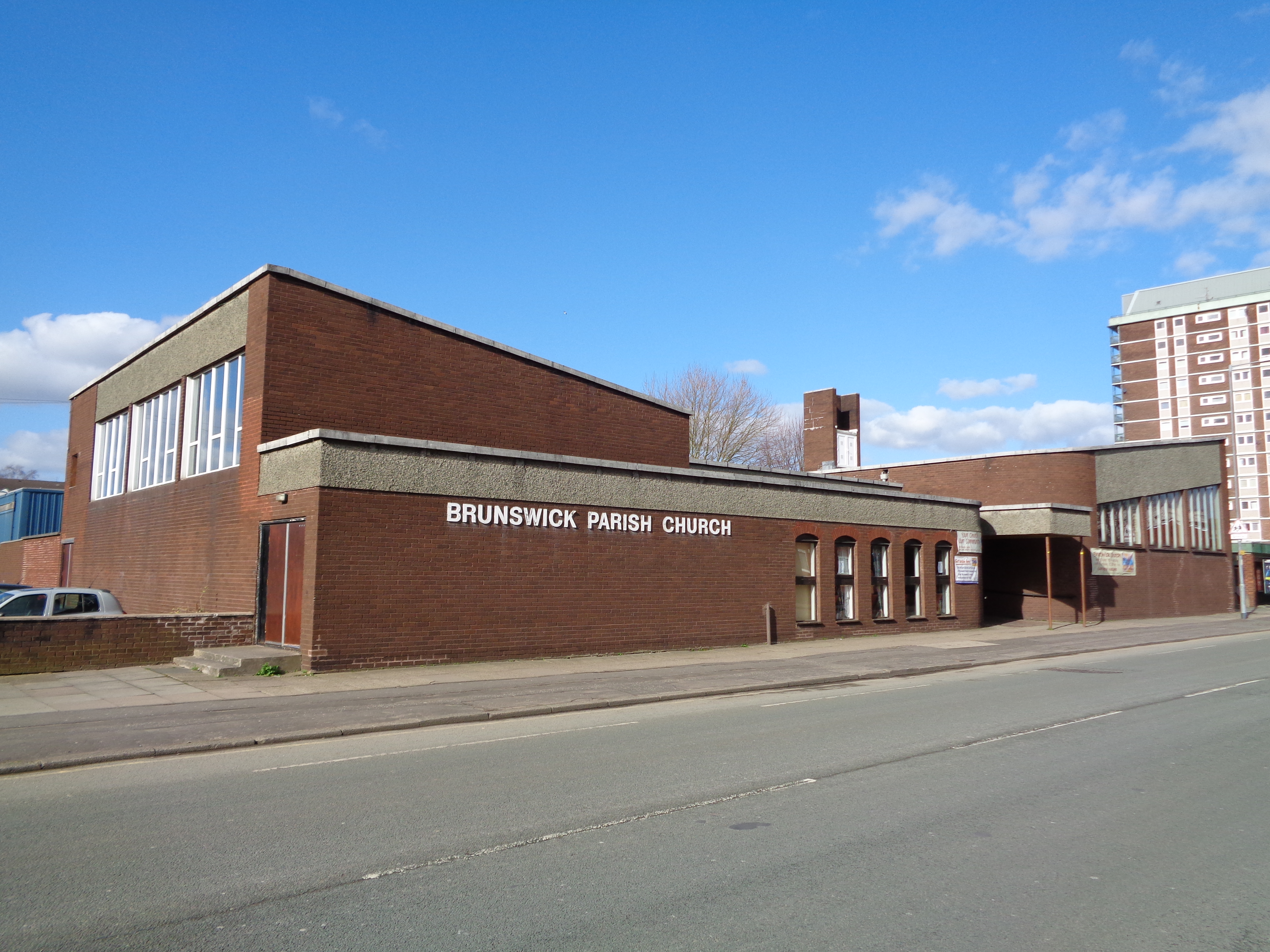
Brunswick Parish Church, Manchester
Brunswick is the historical English name for the German city of Braunschweig (Low German: ''Brunswiek'', Braunschweig dialect: ''Bronswiek''). Brunswick may also refer to: Places and other topographs Australia * Brunswick, Victoria, a suburb of Melbourne * Electoral district of Brunswick, an electoral district in Victoria * Brunswick Junction, Western Australia, a town near Bunbury * Brunswick Heads, a town on the North Coast of New South Wales Canada * New Brunswick, province in the Maritimes ** Brunswick Parish, New Brunswick, in Queens County * Brunswick Mountain, North Shore Mountains, British Columbia * Brunswick House First Nation, Ontario Chile * Brunswick Peninsula Germany * County of Brunswick, historic Saxon vassal county, elevated to Duchy of Brunswick-Lüneburg in 1235 * Brunswick-Lüneburg, historic German duchy since 1235 ** Brunswick-Bevern, a branch principality (1666–1735) ** Brunswick-Calenberg, a branch principality (1485–1692/1708) ** Brunswick-Celle ... [...More Info...] [...Related Items...] OR: [Wikipedia] [Google] [Baidu] |


