|
Brothers Volcano
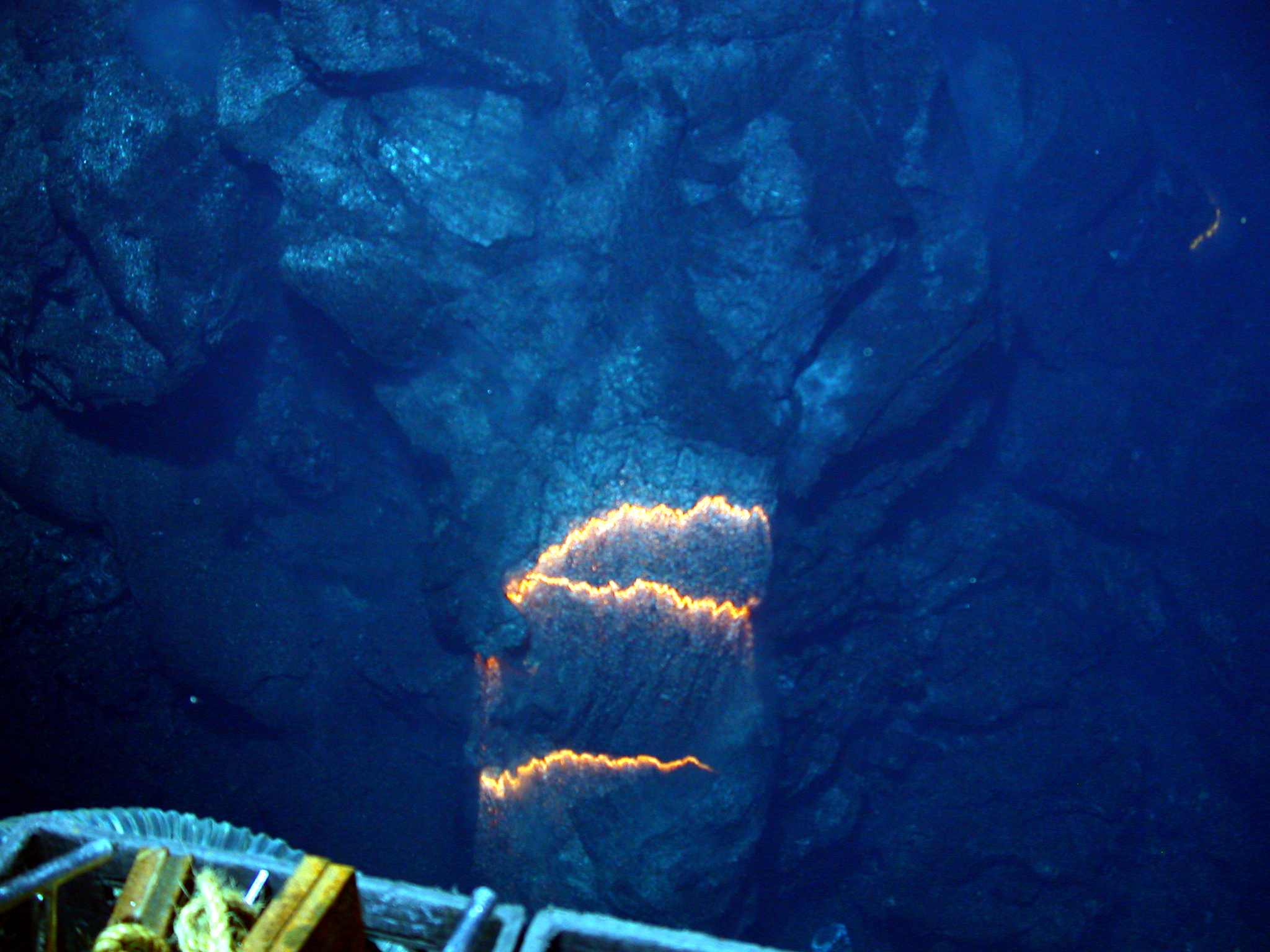
The Brothers Seamount (also Brothers Volcano) is a Pacific Ocean submarine volcano in the Kermadec Arc, north east of New Zealand's Whakaari/White Island. It is one of the South Kermadec Ridge Seamounts. Geology It was formed by volcanic activity within a graben structure delimited by regional faults created by subduction of the Pacific Plate under the Australian Plate. Within its oval outline, which measures , it contains a wide caldera with walls high. It is three times bigger than Whakaari / White Island. A dacite dome named the Upper Cone rises 350 m from the caldera floor (which lies 1850 m below sea level), with a smaller dome just to its northeast. There is now detailed magnetic anomaly mapping of the Brothers caldera with very extreme range variation from −2000 to +2000 nT. Such mapping has shown that the local magnetic highs correlate with the morphology of the caldera, in particular its rim and the Upper Cone, whereas magnetic lows correlate with zon ... [...More Info...] [...Related Items...] OR: [Wikipedia] [Google] [Baidu] |
Submarine Volcano
Submarine volcanoes are underwater vents or fissures in the Earth's surface from which magma can erupt. Many submarine volcanoes are located near areas of tectonic plate formation, known as mid-ocean ridges. The volcanoes at mid-ocean ridges alone are estimated to account for 75% of the magma output on Earth.Martin R. Speight, Peter A. Henderson, "Marine Ecology: Concepts and Applications", John Wiley & Sons, 2013. . Although most submarine volcanoes are located in the depths of seas and oceans, some also exist in shallow water, and these can discharge material into the atmosphere during an eruption. The total number of submarine volcanoes is estimated to be over 1 million (most are now extinct) of which some 75,000 rise more than 1 km above the seabed. Only 119 submarine volcanoes in Earth's oceans and seas are known to have erupted during the last 11,700 years. Hydrothermal vents, sites of abundant biological activity, are commonly found near submarine volcanoes. Effe ... [...More Info...] [...Related Items...] OR: [Wikipedia] [Google] [Baidu] |
GNS Science
GNS Science ( mi, Te Pū Ao), officially registered as the Institute of Geological and Nuclear Sciences Limited, is a New Zealand Crown Research Institute. It focuses on geology, geophysics (including seismology and volcanology), and nuclear science (particularly ion-beam technologies, isotope science and carbon dating). GNS Science was known as the Institute of Geological and Nuclear Sciences (IGNS) from 1992 to 2005. Originally part of the New Zealand Government's Department of Scientific and Industrial Research (DSIR), it was established as an independent organisation when the Crown Research Institutes were set up in 1992. Crown Research Institutes Act 1992. As well as undertaking basic research, and operating the national geological hazards monitoring network (GeoNet) [...More Info...] [...Related Items...] OR: [Wikipedia] [Google] [Baidu] |
Submarine Volcanoes
Submarine volcanoes are underwater vents or fissures in the Earth's surface from which magma can erupt. Many submarine volcanoes are located near areas of tectonic plate formation, known as mid-ocean ridges. The volcanoes at mid-ocean ridges alone are estimated to account for 75% of the magma output on Earth.Martin R. Speight, Peter A. Henderson, "Marine Ecology: Concepts and Applications", John Wiley & Sons, 2013. . Although most submarine volcanoes are located in the depths of seas and oceans, some also exist in shallow water, and these can discharge material into the atmosphere during an eruption. The total number of submarine volcanoes is estimated to be over 1 million (most are now extinct) of which some 75,000 rise more than 1 km above the seabed. Only 119 submarine volcanoes in Earth's oceans and seas are known to have erupted during the last 11,700 years. Hydrothermal vents, sites of abundant biological activity, are commonly found near submarine volcanoes. Eff ... [...More Info...] [...Related Items...] OR: [Wikipedia] [Google] [Baidu] |
Calderas Of New Zealand
A caldera ( ) is a large cauldron-like hollow that forms shortly after the emptying of a magma chamber in a volcano eruption. When large volumes of magma are erupted over a short time, structural support for the rock above the magma chamber is gone. The ground surface then collapses into the emptied or partially emptied magma chamber, leaving a large depression at the surface (from one to dozens of kilometers in diameter). Although sometimes described as a crater, the feature is actually a type of sinkhole, as it is formed through subsidence and collapse rather than an explosion or impact. Compared to the thousands of volcanic eruptions that occur each century, the formation of a caldera is a rare event, occurring only a few times per century. Only seven caldera-forming collapses are known to have occurred between 1911 and 2016. More recently, a caldera collapse occurred at Kīlauea, Hawaii in 2018. Etymology The term ''caldera'' comes from Spanish ', and Latin ', meaning "coo ... [...More Info...] [...Related Items...] OR: [Wikipedia] [Google] [Baidu] |
Seamounts Of New Zealand
A seamount is a large geologic landform that rises from the ocean floor that does not reach to the water's surface (sea level), and thus is not an island, islet or cliff-rock. Seamounts are typically formed from extinct volcanoes that rise abruptly and are usually found rising from the seafloor to in height. They are defined by oceanographers as independent features that rise to at least above the seafloor, characteristically of conical form.IHO, 2008. Standardization of Undersea Feature Names: Guidelines Proposal form Terminology, 4th ed. International Hydrographic Organization and Intergovernmental Oceanographic Commission, Monaco. The peaks are often found hundreds to thousands of meters below the surface, and are therefore considered to be within the deep sea. During their evolution over geologic time, the largest seamounts may reach the sea surface where wave action erodes the summit to form a flat surface. After they have subsided and sunk below the sea surface such flat ... [...More Info...] [...Related Items...] OR: [Wikipedia] [Google] [Baidu] |


