|
Bromley, New Zealand
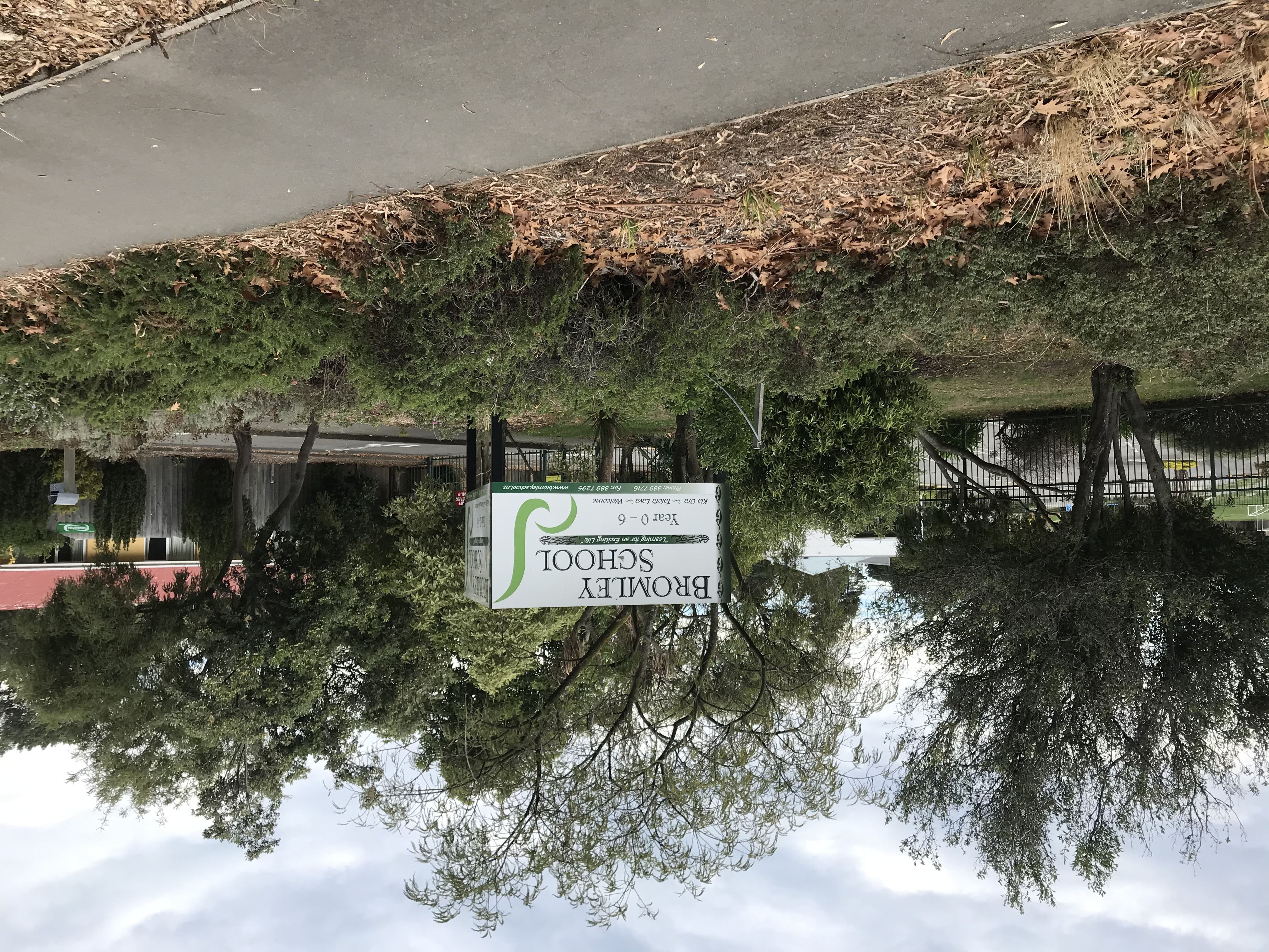
Bromley is a suburb of the city of Christchurch, New Zealand. It lies to the east of the city centre, mostly between Pages Road and the Avon river estuary. History Bromley was named after the town in north-west Kent in England. In 1883, a sewage farm was established next to the Avon estuary. This was later developed when sewage works were built between 1958 and 1962. As of 2018, the area includes oxidation ponds and a wildlife reserve. From 1913, Christchurch City Council looked for additional cemetery space and one of the options under consideration was a reserve that the city owned in Bromley, which at the time was located in Heathcote County. In 1915, the designation of the land was changed, preparatory work happened in 1917, and in July the Bromley Cemetery opened for burials. This was just prior to the 1918 flu pandemic and the new cemetery became the main burial ground for flu victims from the eastern part of the city. The cemetery was extended in size in 1940. Ruru La ... [...More Info...] [...Related Items...] OR: [Wikipedia] [Google] [Baidu] |
The Encyclopedia Of New Zealand
''Te Ara: The Encyclopedia of New Zealand'' is an online encyclopedia established in 2001 by the New Zealand Government's Ministry for Culture and Heritage. The web-based content was developed in stages over the next several years; the first sections were published in 2005, and the last in 2014 marking its completion. ''Te Ara'' means "the pathway" in the Māori language, and contains over three million words in articles from over 450 authors. Over 30,000 images and video clips are included from thousands of contributors. History New Zealand's first recognisable encyclopedia was ''The Cyclopedia of New Zealand'', a commercial venture compiled and published between 1897 and 1908 in which businesses or people usually paid to be covered. In 1966 the New Zealand Government published ''An Encyclopaedia of New Zealand'', its first official encyclopedia, in three volumes. Although now superseded by ''Te Ara'', its historical importance led to its inclusion as a separate digital reso ... [...More Info...] [...Related Items...] OR: [Wikipedia] [Google] [Baidu] |
2006 New Zealand Census
The New Zealand Census of Population and Dwellings ( mi, Te Tatauranga o ngā Tāngata Huri Noa i Aotearoa me ō rātou Whare Noho) is a national population and housing census conducted by government department Statistics New Zealand every five years. There have been 34 censuses since 1851. In addition to providing detailed information about national demographics, the results of the census play an important part in the calculation of resource allocation to local service providers. The 2018 census took place on Tuesday 6 March 2018. The next census is expected in March 2023. Census date Since 1926, the census has always been held on a Tuesday and since 1966, the census always occurs in March. These are statistically the month and weekday on which New Zealanders are least likely to be travelling. The census forms have to be returned by midnight on census day for them to be valid. Conducting the census Until 2018, census forms were hand-delivered by census workers during the lead ... [...More Info...] [...Related Items...] OR: [Wikipedia] [Google] [Baidu] |
2013 New Zealand Census
The 2013 New Zealand census was the thirty-third national census. "The National Census Day" used for the census was on Tuesday, 5 March 2013. The population of New Zealand was counted as 4,242,048, – an increase of 214,101 or 5.3% over the 2006 census. The 2013 census forms were the same as the forms developed for the 2011 census which was cancelled due to the February 2011 major earthquake in Christchurch. There were no new topics or questions. New Zealand's next census was conducted in March 2018. Collection methods The results from the post-enumeration survey showed that the 2013 census recorded 97.6 percent of the residents in New Zealand on census night. However, the overall response rate was 92.9 percent, with a non-response rate of 7.1 percent made up of the net undercount and people who were counted in the census but had not received a form. Results Population and dwellings Population counts for New Zealand regions. Note: All figures are for the census usually r ... [...More Info...] [...Related Items...] OR: [Wikipedia] [Google] [Baidu] |
2018 New Zealand Census
Eighteen or 18 may refer to: * 18 (number), the natural number following 17 and preceding 19 * one of the years 18 BC, AD 18, 1918, 2018 Film, television and entertainment * ''18'' (film), a 1993 Taiwanese experimental film based on the short story ''God's Dice'' * ''Eighteen'' (film), a 2005 Canadian dramatic feature film * 18 (British Board of Film Classification), a film rating in the United Kingdom, also used in Ireland by the Irish Film Classification Office * 18 (''Dragon Ball''), a character in the ''Dragon Ball'' franchise * "Eighteen", a 2006 episode of the animated television series ''12 oz. Mouse'' Music Albums * ''18'' (Moby album), 2002 * ''18'' (Nana Kitade album), 2005 * '' 18...'', 2009 debut album by G.E.M. Songs * "18" (5 Seconds of Summer song), from their 2014 eponymous debut album * "18" (One Direction song), from their 2014 studio album ''Four'' * "18", by Anarbor from their 2013 studio album '' Burnout'' * "I'm Eighteen", by Alice Cooper commo ... [...More Info...] [...Related Items...] OR: [Wikipedia] [Google] [Baidu] |
2011 Christchurch Earthquake
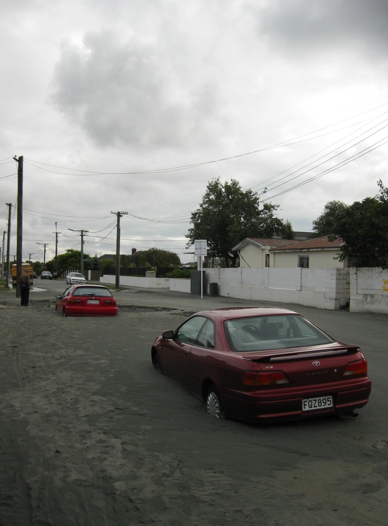
A major earthquake occurred in Christchurch on Tuesday 22 February 2011 at 12:51 p.m. local time (23:51 UTC, 21 February). The () earthquake struck the entire of the Canterbury region in the South Island, centred south-east of the central business district. It caused widespread damage across Christchurch, killing 185 people, in New Zealand's fifth-deadliest disaster. Christchurch's central city and eastern suburbs were badly affected, with damage to buildings and infrastructure already weakened by the magnitude 7.1 Canterbury earthquake of 4 September 2010 and its aftershocks. Significant liquefaction affected the eastern suburbs, producing around 400,000 tonnes of silt. The earthquake was felt across the South Island and parts of the lower and central North Island. While the initial quake only lasted for approximately 10 seconds, the damage was severe because of the location and shallowness of the earthquake's focus in relation to Christchurch as well as ... [...More Info...] [...Related Items...] OR: [Wikipedia] [Google] [Baidu] |
Avon River (Canterbury)
River Avon may refer to: Australia * Avon River (Mid-Coast Council), New South Wales * Avon River (Wollongong), New South Wales * Avon River (Gippsland, Victoria) * Avon River (Grampians, Victoria) * Avon River (Western Australia) Canada * Avon River (Nova Scotia) * Avon River (Ontario) New Zealand * Avon River / Ōtākaro, in the Canterbury Region, where it runs through Christchurch. * Avon River (Marlborough) United Kingdom England * River Avon, Bristol, running from Acton Turville to Avonmouth * River Avon, Devon, running from Ryder's Hill to Bigbury (also known as River Aune) * River Avon, Warwickshire, running from Naseby to Tewkesbury (also known as Shakespeare's Avon) * River Avon, Hampshire, running from Pewsey to Christchurch (also known as Salisbury Avon) * Avon Water, Hampshire, running from Holmsley in the New Forest to Keyhaven * Little Avon River, running from Wickwar to Berkeley, in Gloucestershire * Tetbury Avon, a tributary of the Bristol Avon (also called Littl ... [...More Info...] [...Related Items...] OR: [Wikipedia] [Google] [Baidu] |
Ballantyne's Fire
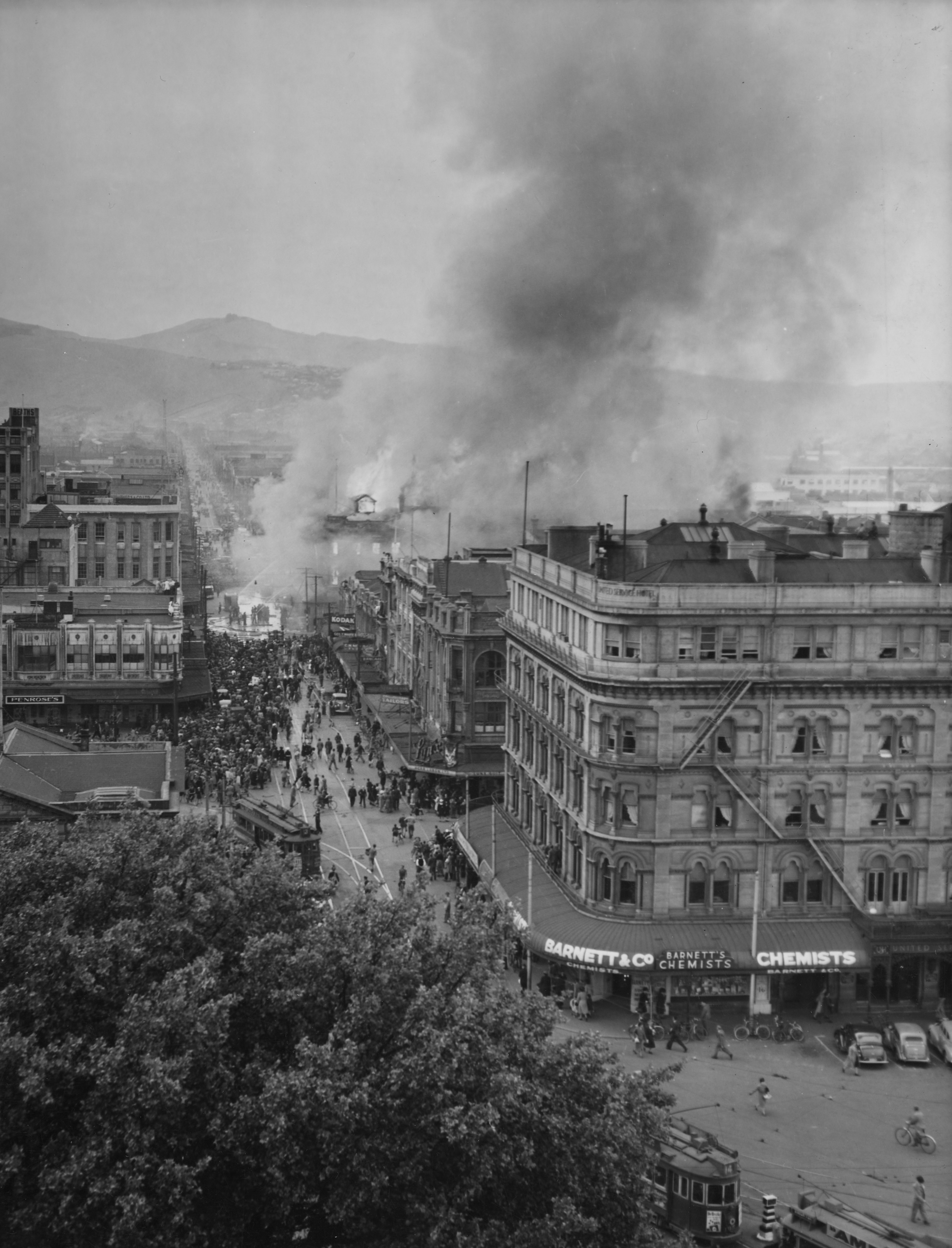
On Tuesday, 18 November 1947, a fire engulfed Ballantynes department store in central Christchurch, New Zealand. 41 people died; 39 employees and two auditors, who found themselves trapped by the fire, or were overcome by smoke while evacuating the store complex without a fire alarm or evacuation plan. It remains the deadliest fire in New Zealand history. Background Ballantynes is a Christchurch department store that traces its origins back to a millinery and drapery business that began in the front room of a Cashel Street residence in 1854. After being named ''Dunstable House'' and going through various of owners and buildings as it grew, it was purchased by John Ballantyne in 1872. The business was managed as a series of partnerships involving Ballantyne family members until the company formed as J. Ballantyne & Co. in 1920. From its humble beginnings the Ballantyne's business expanded until, by 1947, it occupied 80 m of street front in Cashel Street, 50 m in Colomb ... [...More Info...] [...Related Items...] OR: [Wikipedia] [Google] [Baidu] |
Christchurch City Libraries
Christchurch City Libraries is operated by the Christchurch City Council and is a network of 21 libraries and a mobile book bus. Following the 2011 Christchurch earthquake the previous Christchurch Central Library building was demolished, and was replaced by a new central library building in Cathedral Square, ''Tūranga'', which opened in 2018. Early history The library began as the Mechanics' Institute in 1859, when 100 subscribers leased temporary premises in the then Town Hall. The collection consisted of a few hundred books. By 1863, with the help of a grant from the Provincial Government, the Mechanics' Institute opened a building on a half-acre of freehold land on the corner of Cambridge Terrace and Hereford Street, purchased the year before at a cost of £262.10.0. This site was to remain the home of the library until 1982. Debt, dwindling subscribers and other problems forced the institute to hand over the building to the Provincial Government in 1873. By this time t ... [...More Info...] [...Related Items...] OR: [Wikipedia] [Google] [Baidu] |
1918 Flu Pandemic
The 1918–1920 influenza pandemic, commonly known by the misnomer Spanish flu or as the Great Influenza epidemic, was an exceptionally deadly global influenza pandemic caused by the H1N1 influenza A virus. The earliest documented case was March 1918 in Kansas, United States, with further cases recorded in France, Germany and the United Kingdom in April. Two years later, nearly a third of the global population, or an estimated 500 million people, had been infected in four successive waves. Estimates of deaths range from 17 million to 50 million, and possibly as high as 100 million, making it one of the deadliest pandemics in history. The pandemic broke out near the end of World War I, when wartime censors suppressed bad news in the belligerent countries to maintain morale, but newspapers freely reported the outbreak in neutral Spain, creating a false impression of Spain as the epicenter and leading to the "Spanish flu" misnomer. Limited historical epidemiological ... [...More Info...] [...Related Items...] OR: [Wikipedia] [Google] [Baidu] |
Heathcote County
Heathcote County was one of the former counties of New Zealand. It covered the southern parts of Christchurch. History Heathcote County was preceded by the Heathcote Road Board, which had its first meeting on 27 January 1864. An 1863 ordinance from the Canterbury Provincial Council established three road boards along the Heathcote River: East, Central, and South Heathcote. The Roads Ordinance was amended in 1864, and East Heathcote became the Heathcote Road Board, Central Heathcote became the Spreydon Road Board, and South Heathcote became the Halswell Road Board. Heathcote became a county in 1911. The county was abolished through the 1989 local government reforms. Chairmen Road Board The Road Board had 19 chairmen between 1864 and 1911. County Council The County Council had 16 chairmen between 1911 and 1989. The last chairman of the Road Board became the first chairman of the County Council. Table footnotes: See also * List of former territorial authorities in New Zea ... [...More Info...] [...Related Items...] OR: [Wikipedia] [Google] [Baidu] |
Bromley
Bromley is a large town in Greater London, England, within the London Borough of Bromley. It is south-east of Charing Cross, and had an estimated population of 87,889 as of 2011. Originally part of Kent, Bromley became a market town, chartered in 1158. Its location on a coaching route and the opening of a railway station in 1858 were key to its development and the shift from an agrarian village to an urban town. As part of the suburban growth of London in the 20th century, Bromley significantly increased in population and was Municipal Borough of Bromley, incorporated as a municipal borough in 1903 and became part of the London Borough of Bromley in 1965. Bromley today forms a major retail and commercial centre. It is identified in the London Plan as one of the 13 metropolitan centres of Greater London. History Bromley is first recorded in an Anglo-Saxon charter of 862 as ''Bromleag'' and means 'woodland clearing where Cytisus scoparius, broom grows'. It shares this Old ... [...More Info...] [...Related Items...] OR: [Wikipedia] [Google] [Baidu] |


.jpg)