|
Broken Bow, Oklahoma
Broken Bow is a city in McCurtain County, Oklahoma, United States. The population was 4,120 at the 2010 census. It is named after Broken Bow, Nebraska, the former hometown of the city's founders, the Dierks brothers. Other Dierks-associated legacies in town include Dierks Elementary School, Dierks Street, and Dierks Train #227 which is preserved in Broken Bow. History The land that would become Broken Bow was owned by the Choctaw tribe prior to being settled by colonizers. Growing around a lumber company started by two brothers, Broken Bow had a population of 1,983, just a decade after its incorporation in 1911. The city lies within the Little Dixie region of Oklahoma, an area originally settled largely by Southerners seeking a new start following the American Civil War. The city was the location of the wounding and capture of murderer Richard Wayne Snell in 1984, following his shootout with local police. Snell had shot and killed two men in Arkansas, a pawn shop owner and ... [...More Info...] [...Related Items...] OR: [Wikipedia] [Google] [Baidu] |
City
A city is a human settlement of notable size.Goodall, B. (1987) ''The Penguin Dictionary of Human Geography''. London: Penguin.Kuper, A. and Kuper, J., eds (1996) ''The Social Science Encyclopedia''. 2nd edition. London: Routledge. It can be defined as a permanent and densely settled place with administratively defined boundaries whose members work primarily on non-agricultural tasks. Cities generally have extensive systems for housing, transportation, sanitation, utilities, land use, production of goods, and communication. Their density facilitates interaction between people, government organisations and businesses, sometimes benefiting different parties in the process, such as improving efficiency of goods and service distribution. Historically, city-dwellers have been a small proportion of humanity overall, but following two centuries of unprecedented and rapid urbanization, more than half of the world population now lives in cities, which has had profound consequences for g ... [...More Info...] [...Related Items...] OR: [Wikipedia] [Google] [Baidu] |
Choctaw Nation Of Oklahoma
The Choctaw Nation (Choctaw: ''Chahta Okla'') is a Native American territory covering about , occupying portions of southeastern Oklahoma in the United States. The Choctaw Nation is the third-largest federally recognized tribe in the United States and the second-largest Indian reservation in area after the Navajo. As of 2011, the tribe has 223,279 enrolled members, of whom 84,670 live within the state of Oklahoma and 41,616 live within the Choctaw Nation's jurisdiction. A total of 233,126 people live within these boundaries, with its tribal jurisdictional area comprising 10.5 counties in the state, with the seat of government being located in Durant, Oklahoma. It shares borders with the reservations of the Chickasaw, Muscogee, and Cherokee, as well as the U.S. states of Texas and Arkansas. By area, the Choctaw Nation is larger than eight U.S. states. The chief of the Choctaw Nation is Gary Batton, who took office on April 29, 2014, after the retirement of Gregory E. Pyle. Th ... [...More Info...] [...Related Items...] OR: [Wikipedia] [Google] [Baidu] |
Intercity Bus Service
An intercity bus service (North American English) or intercity coach service (British English and Commonwealth English), also called a long-distance, express, over-the-road, commercial, long-haul, or highway bus or coach service, is a public transport service using coach (bus), coaches to carry passengers significant distances between different city, cities, towns, or other populated areas. Unlike a transit bus service, which has frequent stops throughout a city or town, an intercity bus service generally has a single stop at one location in or near a city, and travels long distances without stopping at all. Intercity bus services may be operated by government agencies or private industry, for profit and non-profit, not for profit. Intercity coach travel can serve areas or countries with no train services, or may be set up to competition (economics), compete with trains by providing a more flexible or cheaper alternative. Intercity bus services are of prime importance in lightly ... [...More Info...] [...Related Items...] OR: [Wikipedia] [Google] [Baidu] |
Oklahoma State Highway 3
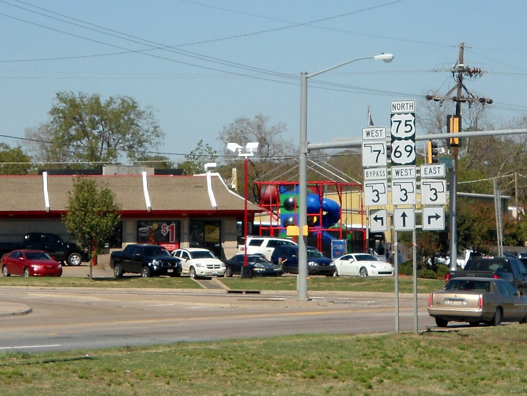
State Highway 3, also abbreviated as SH-3 or OK-3, is a highway maintained by the U.S. state of Oklahoma. Traveling diagonally through Oklahoma, from the Panhandle to the far southeastern corner of the state, SH-3 is the longest state highway in the Oklahoma road system, at a total length of via SH-3E ( see below). Route description In the northwest Highway 3 begins at the Colorado state line north of Boise City, Oklahoma. At this terminus, it is concurrent with US-287/ US-385. It remains concurrent with the two U.S. Routes until reaching Boise City, where it encounters a traffic circle which contains five other highways. After the circle, US-385 splits off, and SH-3 overlaps US-287, US-56, US-64, and US-412, though US-56 and US-287 both split off within the next . In Guymon, US-64 splits off. At Elmwood, US-270 joins US-412, coming from a concurrency with State Highway 23. SH-3 remains concurrent with US-270 through Watonga. In Seiling, US-183 leaves the concurrenc ... [...More Info...] [...Related Items...] OR: [Wikipedia] [Google] [Baidu] |
US Route 259
U.S. Route 259 (US 259, US-259) is a north–south spur of U.S. Route 59 that runs for through rural areas of northeast Texas and southeast Oklahoma. The highway's southern terminus is near Nacogdoches, Texas at an interchange with its parent route, US 59. Its northern terminus is in the Ouachita Mountains, about south of Heavener, Oklahoma where it reunites with US 59. For most of its length, US 259 lies to the west of its parent route. Route description Texas US 259 begins at an intersection with its parent, US 59 (Future Interstate 69), on the north side of Nacogdoches, Texas. The highway continues due north, passing through Mount Enterprise, and around the eastern side of Henderson and Kilgore. In Kilgore, Texas, US 259 is known as the ''Charles K. Devall Memorial Highway,'' as named by the Texas legislature.Acts 2001, 77th Leg., ch. 1193, § 1, eff. June 15, 2001 It then has a concurrency with Interstate 20 of about , then continues north around the eastern ... [...More Info...] [...Related Items...] OR: [Wikipedia] [Google] [Baidu] |
US Route 70
U.S. Route 70 or U.S. Highway 70 (US 70) is an east–west United States highway that runs for from eastern North Carolina to east-central Arizona. It is a major east–west highway of the Southeastern, Southern and Southwestern United States. Established as one of the original highways of 1926, it originally ran only to Holbrook, Arizona, then was extended in 1934 as a coast to coast route, with the current Eastern terminus near the Atlantic Ocean in Atlantic, North Carolina, and the former Western terminus near the Pacific Ocean in Los Angeles, California. The current Western terminus was then truncated to US 60 / SR 77 in Globe, Arizona. Before the completion of the Interstate system, U.S. Highway 70 was sometimes referred to as the "Broadway of America", due to its status as one of the main east–west thoroughfares in the nation. It was also promoted as the "Treasure Trail" by the U.S. Highway 70 Association as of 1951. In the early years, US 70 had a different route ... [...More Info...] [...Related Items...] OR: [Wikipedia] [Google] [Baidu] |
Apukshunnubbee District
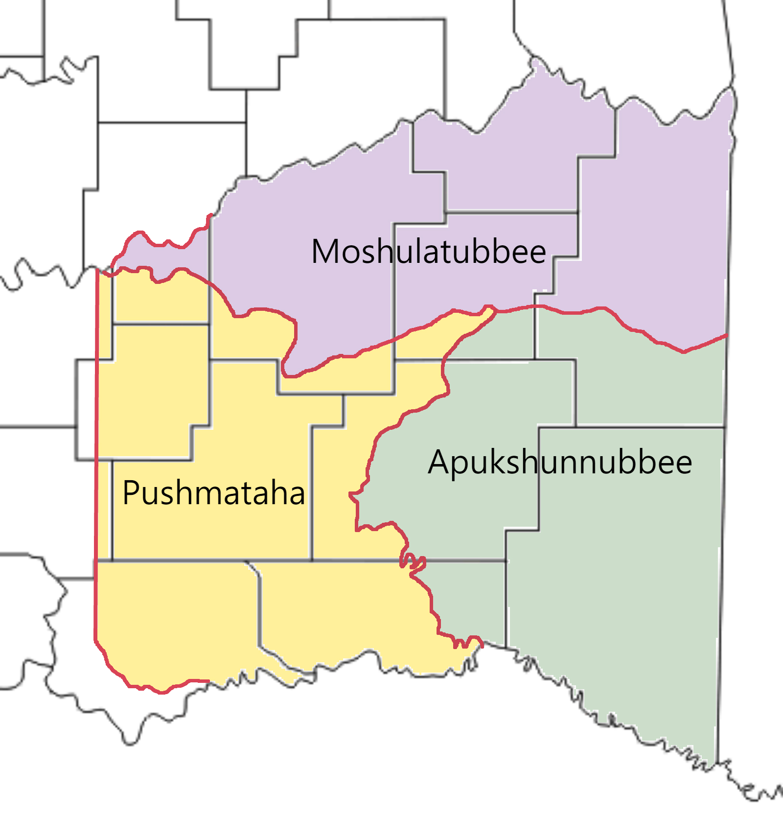
Apukshunnubbee District was one of three administrative super-regions comprising the former Choctaw Nation in Indian Territory. Also called the Second District, it encompassed the southeastern one-third of the nation. The Apukshunnubbee District was named in honor of Chief Apukshunnubbee (also spelled Apuckshunubbee), a Choctaw warrior and statesman. He was district chief of the Okla Falaya ("Upper Towns") District in the original Choctaw Nation of the Southeast. Many Choctaw from that area referred to the Apukshunnubbee District as the Okla Falaya District. The other two districts were the Moshulatubbee District and Pushmataha District. History The districts were established when the Choctaw Nation relocated via the Trail of Tears to the Indian Territory—present-day Oklahoma. They were originally intended to be homelands for settlers from the three major clans or divisions of the Choctaw comprising the nation. In practice, the clan affiliations and allegiances rapidly became ... [...More Info...] [...Related Items...] OR: [Wikipedia] [Google] [Baidu] |
Bok Tuklo, Choctaw Nation
Bok Tuklo County was a political subdivision of the Choctaw Nation of Indian Territory, prior to Oklahoma being admitted as a state. The county formed part of the Nation’s Apukshunnubbee District, or Second District, one of three administrative super-regions. History Bok Tuklo County, Choctaw Nation was named from the Choctaw words ''bok'', or “creek,” and ''tuklo'', or “two.” The two creeks commemorated by the name were Lukfata Creek and Yasho Bok (now called Yasho Creek), which ran parallel to one another north to south, across much of the county.“Organization of Counties in the Choctaw and Chickasaw Nations,” ''Chronicles of Oklahoma'', Vol. 8, No. 3, September 1930, p. 322. Bok Tuklo County’s boundaries were established and designated according to easily recognizable natural landmarks, as were the boundaries of all Choctaw Nation counties. Little River formed its southern and eastern boundaries. The county’s eastern boundary was formed by a line drawn ... [...More Info...] [...Related Items...] OR: [Wikipedia] [Google] [Baidu] |
Arkansas State Police
The Arkansas State Police is a state police division of the Arkansas Department of Public Safety and the "premier" law enforcement agency in the State of Arkansas. The Arkansas State Police is responsible for enforcing motor vehicle laws, traffic laws, and criminal laws. The Arkansas State Police serves as an assisting agency to local law enforcement agencies within the State of Arkansas and has statewide authority to conduct law enforcement activities, criminal investigations, and crimes against children investigations. History The Arkansas State Police was created on 19 March 1935 through Act 120 of 1935, which was passed by the Arkansas General Assembly and signed into law by the 30th Governor of Arkansas J.M. Futrell. Upon the creation of the Arkansas State Police in 1935, the agency consisted of approximately thirteen Rangers who were charged with enforcing liquor laws and traffic laws. From its creation in 1935, the Arkansas State Police has been an assisting agency t ... [...More Info...] [...Related Items...] OR: [Wikipedia] [Google] [Baidu] |
Pawn Shop
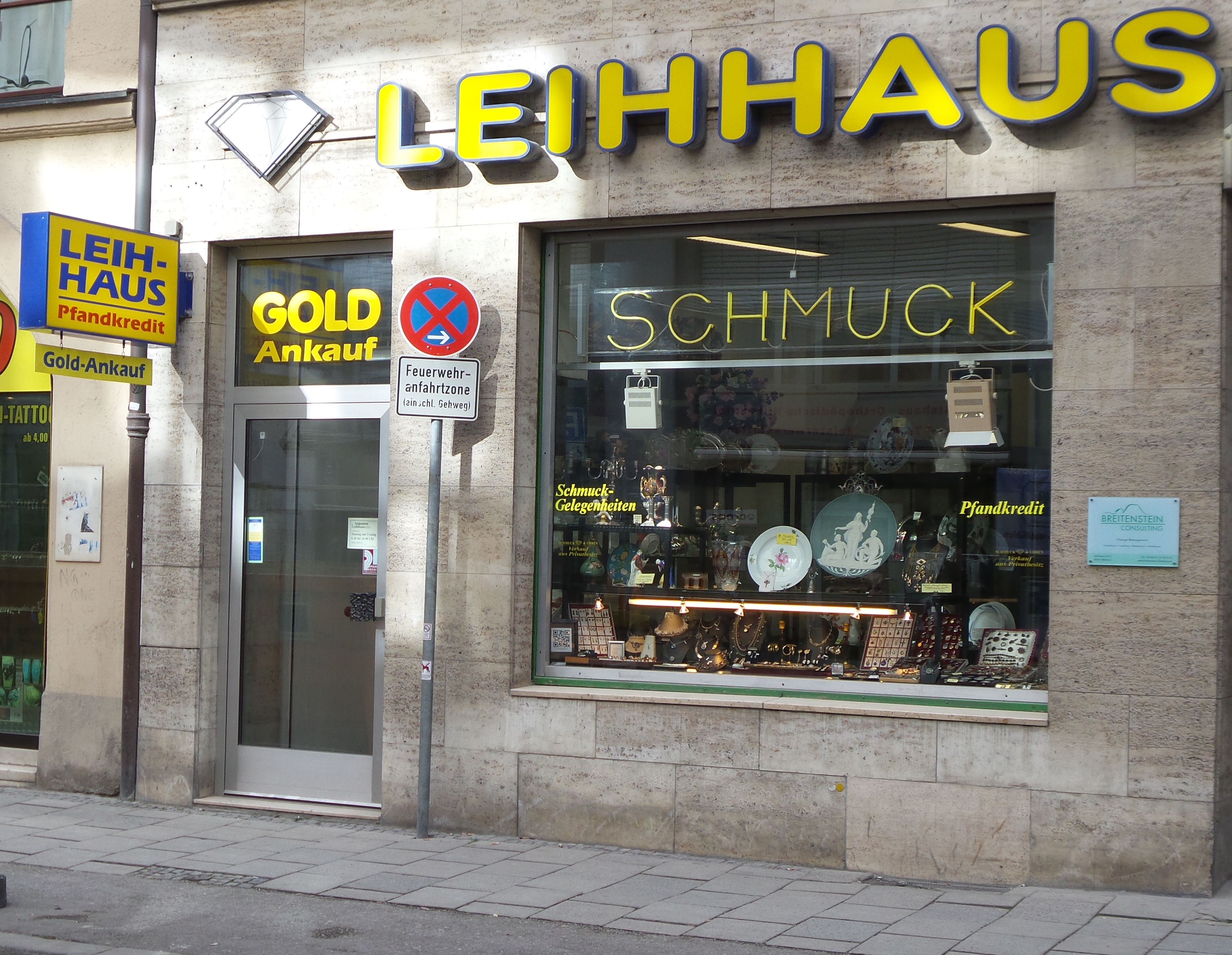
A pawnbroker is an individual or business (pawnshop or pawn shop) that offers secured loans to people, with items of personal property used as collateral. The items having been ''pawned'' to the broker are themselves called ''pledges'' or ''pawns'', or simply the collateral. While many items can be pawned, pawnshops typically accept jewelry, musical instruments, home audio equipment, computers, video game systems, coins, gold, silver, televisions, cameras, power tools, firearms, and other relatively valuable items as collateral. If an item is pawned for a loan (colloquially "hocked" or "popped"), within a certain contractual period of time the pawner may redeem it for the amount of the loan plus some agreed-upon amount for interest. In the United States the amount of time, and rate of interest, is governed by law and by the state commerce department policies. They have the same license as a bank, which is highly regulated. If the loan is not paid (or extended, if applica ... [...More Info...] [...Related Items...] OR: [Wikipedia] [Google] [Baidu] |
Arkansas
Arkansas ( ) is a landlocked state in the South Central United States. It is bordered by Missouri to the north, Tennessee and Mississippi to the east, Louisiana to the south, and Texas and Oklahoma to the west. Its name is from the Osage language, a Dhegiha Siouan language, and referred to their relatives, the Quapaw people. The state's diverse geography ranges from the mountainous regions of the Ozark and Ouachita Mountains, which make up the U.S. Interior Highlands, to the densely forested land in the south known as the Arkansas Timberlands, to the eastern lowlands along the Mississippi River and the Arkansas Delta. Arkansas is the 29th largest by area and the 34th most populous state, with a population of just over 3 million at the 2020 census. The capital and most populous city is Little Rock, in the central part of the state, a hub for transportation, business, culture, and government. The northwestern corner of the state, including the Fayetteville–Springdale� ... [...More Info...] [...Related Items...] OR: [Wikipedia] [Google] [Baidu] |
Richard Wayne Snell
Richard Wayne Snell (May 21, 1930 – April 19, 1995) was an American white supremacist convicted of killing of two people in Arkansas between November 3, 1983 and June 30, 1984. Snell was sentenced to death for one of the murders, and executed by lethal injection in 1995. Background Richard Snell was a member of the white supremacist group The Covenant, The Sword, and the Arm of the Lord (known as the CSA), which was started in 1971 in the small community of Elijah, Missouri, by polygamist James Ellison. He was also a believer in the Christian Identity religion, and frequented Elohim City, a private community located in Oklahoma. The Bureau of Alcohol, Tobacco, Firearms and Explosives (ATF) had ongoing investigations into the organization. By the end of their operations, the ATF obtained 155 Krugerrands (gold coins), one live light antitank rocket (LAW), 94 long guns, 30 handguns, 35 sawed-off shotguns and machine guns, one light machine gun (a Japanese copy of ... [...More Info...] [...Related Items...] OR: [Wikipedia] [Google] [Baidu] |


