|
Brighstone Down
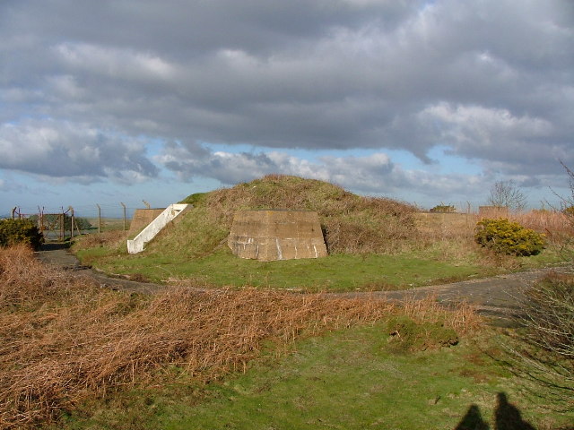
Brighstone Down is a chalk down on the Isle of Wight. It is located close to the village of Brighstone, in the southwest of the island (the Back of the Wight), and rises to at its highest point, northeast of the village of Mottistone. Towards the west part is called Mottistone Down, to the East, Shorwell Down. The Northern part is covered by Brighstone Forest the largest forest on the Island. On 19 November 1947, an BOAC Short S.25 Sunderland 3 (G-AGHW) was on a ferry flight from Hythe Seaplane Base to Poole Seaplane Base. The aircraft crashed into Brighstone Down in bad weather caused by to pilot error, killing One of the Four crew. " '' |
Toposcope
A toposcope, topograph, or orientation table is a kind of graphic display erected at viewing points on hills, mountains or other high places which indicates the direction, and usually the distance, to notable landscape features which can be seen from that point. They are often placed in public parks, country parks, the grounds of stately homes, at popular vantage points (especially accompanying or built into triangulation stations) or places of historical note, such as battlefields. Toposcopes usually show the points of the compass, or at least North. Smaller toposcopes usually consist of a circular plaque, or a plaque with a circle marked on it, mounted horizontally on a plinth. They will have radiating lines indicating the direction to various landmarks, together with the distance and often a pictorial representation of the landmark. They are frequently constructed of a metal such as bronze, cast or etched, set on top of a concrete or stone block, which provides weather- and ... [...More Info...] [...Related Items...] OR: [Wikipedia] [Google] [Baidu] |
Brighstone Forest
Brighstone Forest is located in the southwest of the Isle of Wight. It is the largest forest on the Isle of Wight, being just a few hectares larger than Parkhurst Forest. It is spread over a number of hilly ridges which form the backbone of the Isle of Wight. From west to east the ridges are Chessell Down, Westover Down, Brighstone Down, Newbarn Down, Rowborough Down and Idlecombe Down. The main entrance is located at grid reference SZ 419849. The forest lies close to the small town of Brighstone, and is part of the Isle of Wight AONB. Shalcombe Down is an outlying block of woodland to the west of Brighstone Forest. The entrance to this block is located at grid reference SZ 395852. Both woods are managed by the Forestry Commission The Forestry Commission is a non-ministerial government department responsible for the management of publicly owned forests and the regulation of both public and private forestry in England. The Forestry Commission was previously also respon ... [...More Info...] [...Related Items...] OR: [Wikipedia] [Google] [Baidu] |
Mountains And Hills Of The United Kingdom With Toposcopes
A mountain is an elevated portion of the Earth's crust, generally with steep sides that show significant exposed bedrock. Although definitions vary, a mountain may differ from a plateau in having a limited Summit (topography), summit area, and is usually higher than a hill, typically rising at least 300 metres (1,000 feet) above the surrounding land. A few mountains are Monadnock, isolated summits, but most occur in mountain ranges. Mountain formation, Mountains are formed through Tectonic plate, tectonic forces, erosion, or volcanism, which act on time scales of up to tens of millions of years. Once mountain building ceases, mountains are slowly leveled through the action of weathering, through Slump (geology), slumping and other forms of mass wasting, as well as through erosion by rivers and glaciers. High elevations on mountains produce Alpine climate, colder climates than at sea level at similar latitude. These colder climates strongly affect the Montane ecosystems, ecosys ... [...More Info...] [...Related Items...] OR: [Wikipedia] [Google] [Baidu] |
Marilyns Of England
This is a list of Marilyn hills and mountains in the United Kingdom, Isle of Man and Ireland by height. Marilyns are defined as peaks with a prominence of or more, regardless of height or any other merit (e.g. topographic isolation, as used in Munros). Thus, Marilyns can be mountains, with a height above , or relatively small hills. there were 2,011 recorded Marilyns. Definition The Marilyn classification was created by Alan Dawson in his 1992 book ''The Relative Hills of Britain''. The name Marilyn was coined by Dawson as a punning contrast to the ''Munro'' classification of Scottish mountains above , but which has no explicit prominence threshold, being homophonous with (Marilyn) '' Monroe''. The list of Marilyns was extended to Ireland by Clem Clements. Marilyn was the first of several subsequent British Isles classifications that rely solely on prominence, including the P600s, the HuMPs, and the TuMPs. Topographic prominence is a more difficult to estimate than to ... [...More Info...] [...Related Items...] OR: [Wikipedia] [Google] [Baidu] |
Hills Of The Isle Of Wight
A hill is a landform that extends above the surrounding terrain. It often has a distinct summit. Terminology The distinction between a hill and a mountain is unclear and largely subjective, but a hill is universally considered to be not as tall, or as steep as a mountain. Geographers historically regarded mountains as hills greater than above sea level, which formed the basis of the plot of the 1995 film ''The Englishman who Went up a Hill but Came down a Mountain''. In contrast, hillwalkers have tended to regard mountains as peaks above sea level. The ''Oxford English Dictionary'' also suggests a limit of and Whittow states "Some authorities regard eminences above as mountains, those below being referred to as hills." Today, a mountain is usually defined in the UK and Ireland as any summit at least high, while the official UK government's definition of a mountain is a summit of or higher. Some definitions include a topographical prominence requirement, typically o ... [...More Info...] [...Related Items...] OR: [Wikipedia] [Google] [Baidu] |
Aviation Safety Network
The Flight Safety Foundation (FSF) is an independent, nonprofit, international organization concerning research, education, advocacy, and communications in the field of aviation safety. FSF brings together aviation professionals from all sectors to help solve safety problems facing the industry. With a membership that spreads throughout the world, FSF brings an international perspective to aviation issues for its members, the media, and the traveling public. History Since its founding in 1947, the foundation has acted as a non-profit, independent clearinghouse to disseminate safety information, identify threats to safety, and recommend practical solutions. Today, the foundation provides leadership to more than 1200 members in more than 75 countries. AvCIR The Aviation Crash Injury Research (AvCIR) Division became part of FSF in April 1959, being transferred from Cornell University.''Army Aviation Safety - Crash Injury, Crashworthiness'', AvCIR 70-0-128, Flight Safety Foundation, ... [...More Info...] [...Related Items...] OR: [Wikipedia] [Google] [Baidu] |
Poole
Poole () is a large coastal town and seaport in Dorset, on the south coast of England. The town is east of Dorchester and adjoins Bournemouth to the east. Since 1 April 2019, the local authority is Bournemouth, Christchurch and Poole Council which is a unitary authority. Poole had an estimated population of 151,500 (mid-2016 census estimates) making it the second-largest town in the ceremonial county of Dorset. Together with Bournemouth and Christchurch, the conurbation has a total population of nearly 400,000. Human settlement in the area dates back to before the Iron Age. The earliest recorded use of the town's name was in the 12th century when the town began to emerge as an important port, prospering with the introduction of the wool trade. Later, the town had important trade links with North America and, at its peak during the 18th century, it was one of the busiest ports in Britain. In the Second World War, Poole was one of the main departing points for the Normandy l ... [...More Info...] [...Related Items...] OR: [Wikipedia] [Google] [Baidu] |
Hythe, Hampshire
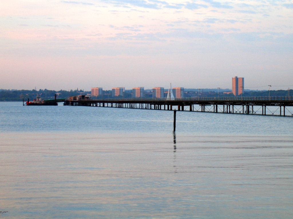
Hythe () is a town near Southampton, Hampshire, England. It is located by the shore of Southampton Water, and has a ferry service connecting it to Southampton. Hythe has a small shopping area, a pier, and a marina for yachts. History The name Hythe means landing-place or haven. Hythe is recorded in a Parliamentary roll from 1293.squadron. Hythe was a village up to the 1950s, but the expansion of Fawley Refinery led to a demand for more houses for workers, and Hythe and Dibden Purlieu were allowed to expand into a small town. In 1983, following the growth of Hythe, the parish of Dibden was renamed to Hythe and Dibden, to reflect the importance of Hythe as a new focal point of the Parish.What is the Parish Council , Hythe and Dibden Parish Council Geography Hythe has a small shopp ...[...More Info...] [...Related Items...] OR: [Wikipedia] [Google] [Baidu] |
Short Sunderland
The Short S.25 Sunderland is a British flying boat patrol bomber, developed and constructed by Short Brothers for the Royal Air Force (RAF). The aircraft took its service name from the town (latterly, city) and port of Sunderland in North East England. Developed in parallel with the civilian Short Empire, S.23 ''Empire'' flying boat, the flagship of Imperial Airways, the Sunderland was developed specifically to conform to the requirements of British Air Ministry List of Air Ministry specifications#1930.E2.80.931939, Specification R.2/33 for a long-range patrol/reconnaissance flying boat to serve with the Royal Air Force (RAF). As designed, it served as a successor to the earlier Short Sarafand flying boat. Sharing several similarities with the S.23, it featured a more advanced aerodynamic hull and was outfitted with various offensive and defensive armaments, including machine gun Gun turret#Aircraft, turrets, bombs, Parachute mine, aerial mines, and depth charges. The Sunderland ... [...More Info...] [...Related Items...] OR: [Wikipedia] [Google] [Baidu] |
British Overseas Airways Corporation
British Overseas Airways Corporation (BOAC) was the British state-owned airline created in 1939 by the merger of Imperial Airways and British Airways Ltd. It continued operating overseas services throughout World War II. After the passing of the Civil Aviation Act 1946, European and South American services passed to two further state-owned airlines, British European Airways (BEA) and British South American Airways (BSAA). BOAC absorbed BSAA in 1949, but BEA continued to operate British domestic and European routes for the next quarter century. A 1971 Act of Parliament merged BOAC and BEA, effective 31 March 1974, forming today's British Airways. For most of its history its main rival was Pan Am. History War years On 24 November 1939, BOAC was created by Act of Parliament to become the British state airline, formed from the merger of Imperial Airways and British Airways Ltd. The companies had been operating together since war was declared on 3 September 1939, when their ... [...More Info...] [...Related Items...] OR: [Wikipedia] [Google] [Baidu] |
Mottistone
Mottistone is a village on the Isle of Wight, located in the popular tourist area the Back of the Wight.http://www.backofthewight.net It is located 8 Miles southwest of Newport in the southwest of the island, and is home to the National Trust's Mottistone Manor. History The Island's only megalithic monument, the Longstone is situated nearby. The name Mottistone (the Speaker's or pleader's stone) almost certainly derives from the Longstone, which was used as a meeting place (or "moot-stone") in Anglo-Saxon times. Geography Mottistone Down is a Site of Special Scientific Interest north of Mottistone, and covering ; it adjoins the Brighstone Down, the central part of the ridge. Most of the area is owned by the National Trust, including the manor, down and cottages, and is biologically important due to its chalk and neutral grasslands. Today Public transport is provided by Southern Vectis buses on route 12. The church of St Peter and St Paul's hosts part of an annual Ch ... [...More Info...] [...Related Items...] OR: [Wikipedia] [Google] [Baidu] |
St Boniface Down
St Boniface Down is a chalk down near Ventnor, on the Isle of Wight, England. Its summit, , is the highest point on the island, with views stretching from Beachy Head to the east, Portsmouth to the north and the Isle of Portland to the west. It is north of the town. There is reputed to be a wishing well on its southern slope, which requires the wisher to climb up from the south without looking back. In 1545, a French invasion force attempted this against a force of the Isle of Wight Militia commanded by Sir John Fyssher – which allegedly included several women archers- and were routed. In 1940, the radar station was bombed by Ju 87 Stuka dive bombers, which is reconstructed in the film "The Battle of Britain". The top is surmounted by a round barrow. At the eastern foot of the down, on the A3055 road between Bonchurch and Luccombe, a path descends into Bonchurch Landslips via a scenic rock cleft, the Devil's Chimney. Wildlife St Boniface Down is home to the largest c ... [...More Info...] [...Related Items...] OR: [Wikipedia] [Google] [Baidu] |


