|
Bridal Veil Falls (Macon County)
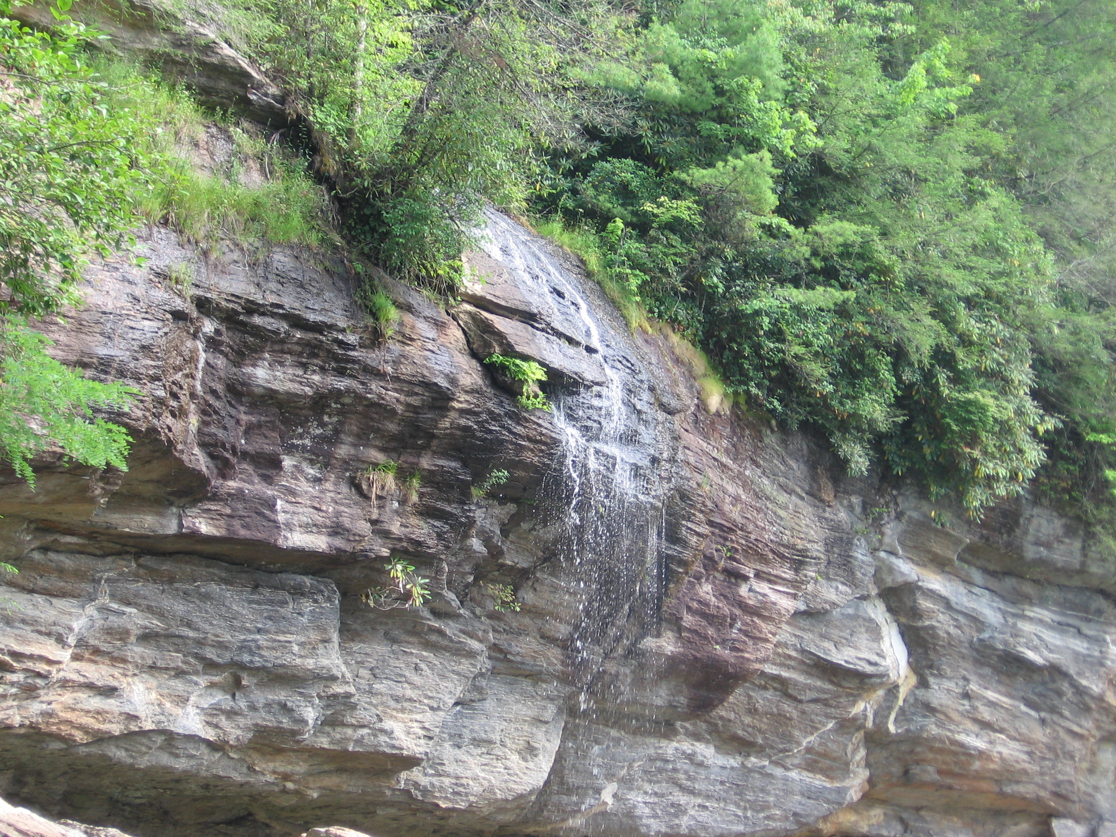
Bridal Veil Falls is a waterfall located in the Nantahala National Forest, northwest of Highlands, North Carolina. With a short curve of roadway located behind the falls, it had the distinction of being the only waterfall in the state that one could drive a vehicle under, however this has since been closed and is now used for pedestrian access only. Geology Bridal Veil Falls flows on a tributary of the Cullasaja River through the Nantahala National Forest. The falls flows over an overhanging bluff that allows visitors to walk behind the falls and remain dry when the waterflow is low. During periods of drought, the stream may nearly dry up, though visitors will get wet if the waterflow is moderate or high. Location Bridal Veil Falls is located on the side of US 64 2.3 miles (3.7 km) north of Highlands, North Carolina. Highway 64 originally used the curve of roadway behind the falls exclusively so that all traffic went behind them; however, this caused problems with ... [...More Info...] [...Related Items...] OR: [Wikipedia] [Google] [Baidu] |
Nantahala National Forest
The Nantahala National Forest ( /ˌnæntəˈheɪlə/), is the largest of the four national forests in North Carolina, lying in the mountains and valleys of western North Carolina. The Nantahala is the second wettest region in the country, after the Pacific Northwest. Due to its environmental importance and historical ties with the Cherokee, the forest was officially established on January 29, 1920 by President Woodrow Wilson. The word ''"Nantahala"'' is a Cherokee derived, meaning "Land of the Noonday Sun." In some spots, the sun reaches the floors of the deep gorges of the forest only when it is high overhead at midday. This was part of the homeland of the historic Cherokee and their indigenous ancestors, who have occupied the region for thousands of years. History Cherokee Colonists from South Carolina established a trade of deer hides with Cherokees from the Nantahala region, their homeland. This eventually lead to several signed treaties that left the Cherokee to give up the ... [...More Info...] [...Related Items...] OR: [Wikipedia] [Google] [Baidu] |
Macon County, NC
Macon County is a county located in the U.S. state of North Carolina. As of the 2020 census, the population was 37,014. Its county seat is Franklin. The Nantahala River runs through Macon County, flowing into the Little Tennessee River in Swain County. The Nantahala is one of the most popular whitewater rafting destinations in the nation. History The river valleys were long occupied by indigenous peoples, some of whom built earthwork mounds about 1000 CE. Some are still visible in this region. It was part of the homeland of the historic Cherokee people, who had towns throughout the river valleys. The county was formed in 1828 from the western part of Haywood County. It was named for Nathaniel Macon, who represented North Carolina in the United States House of Representatives from 1791 to 1815 (serving as Speaker of the House from 1801 to 1807), and in the United States Senate from 1815 to 1828. In 1839 the western part of Macon County became Cherokee County. In 1851 p ... [...More Info...] [...Related Items...] OR: [Wikipedia] [Google] [Baidu] |
Blue Ridge Mountains
The Blue Ridge Mountains are a physiographic province of the larger Appalachian Mountains range. The mountain range is located in the Eastern United States, and extends 550 miles southwest from southern Pennsylvania through Maryland, West Virginia, Virginia, North Carolina, South Carolina, Tennessee, and Georgia. This province consists of northern and southern physiographic regions, which divide near the Roanoke River gap. To the west of the Blue Ridge, between it and the bulk of the Appalachians, lies the Great Appalachian Valley, bordered on the west by the Ridge and Valley province of the Appalachian range. The Blue Ridge Mountains are known for having a bluish color when seen from a distance. Trees put the "blue" in Blue Ridge, from the isoprene released into the atmosphere. This contributes to the characteristic haze on the mountains and their perceived color. Within the Blue Ridge province are two major national parks – the Shenandoah National Park in the northern secti ... [...More Info...] [...Related Items...] OR: [Wikipedia] [Google] [Baidu] |
North Carolina
North Carolina () is a state in the Southeastern region of the United States. The state is the 28th largest and 9th-most populous of the United States. It is bordered by Virginia to the north, the Atlantic Ocean to the east, Georgia and South Carolina to the south, and Tennessee to the west. In the 2020 census, the state had a population of 10,439,388. Raleigh is the state's capital and Charlotte is its largest city. The Charlotte metropolitan area, with a population of 2,595,027 in 2020, is the most-populous metropolitan area in North Carolina, the 21st-most populous in the United States, and the largest banking center in the nation after New York City. The Raleigh-Durham-Cary combined statistical area is the second-largest metropolitan area in the state and 32nd-most populous in the United States, with a population of 2,043,867 in 2020, and is home to the largest research park in the United States, Research Triangle Park. The earliest evidence of human occupation i ... [...More Info...] [...Related Items...] OR: [Wikipedia] [Google] [Baidu] |
Waterfall
A waterfall is a point in a river or stream where water flows over a vertical drop or a series of steep drops. Waterfalls also occur where meltwater drops over the edge of a tabular iceberg or ice shelf. Waterfalls can be formed in several ways, but the most common method of formation is that a river courses over a top layer of resistant bedrock before falling on to softer rock, which Erosion, erodes faster, leading to an increasingly high fall. Waterfalls have been studied for their impact on species living in and around them. Humans have had a distinct relationship with waterfalls for years, travelling to see them, exploring and naming them. They can present formidable barriers to navigation along rivers. Waterfalls are religious sites in many cultures. Since the 18th century they have received increased attention as tourist destinations, sources of hydropower, andparticularly since the mid-20th centuryas subjects of research. Definition and terminology A waterfall is gen ... [...More Info...] [...Related Items...] OR: [Wikipedia] [Google] [Baidu] |
Highlands, North Carolina
Highlands is an incorporation (municipal government), incorporated town in Macon County, North Carolina, Macon County in the U.S. state of North Carolina. Located on a plateau in the southern Appalachian Mountains, within the Nantahala National Forest, it lies mostly in southeastern Macon County and slightly in southwestern Jackson County, North Carolina, Jackson County, in the Highlands and Cashiers Townships, respectively. The permanent population was 1,014 at the 2020 United States Census, 2020 census. History Highlands was founded in 1875 after its two founders, Samuel Truman Kelsey and Clinton Carter Hutchinson, drew lines from Chicago to Savannah, Georgia, Savannah and from New Orleans to New York City. They felt that the place where these lines met would eventually become a great trading center and commercial crossroads. Highlands was named for its lofty elevation. In the 1930s the town became a golfing mecca when Bobby Jones (golfer), Bobby Jones of Atlanta and some of h ... [...More Info...] [...Related Items...] OR: [Wikipedia] [Google] [Baidu] |
Cullasaja River
The Cullasaja River () , from the North Carolina Collection's website at the . Retrieved 2013-02-08. is a short located entirely in Macon County, . It is a |
Quarry Falls (Macon County)
Quarry Falls is a small waterfall (or perhaps large rapid in high water) located beside US Hwy. 64 west of Highlands, North Carolina, United States. It is best known for the large, deep pool at the bottom and is a popular place for swimming during warm weather. Quarry Falls is known to the locals as "Bust-Your-Butt-Falls" or “”Mud-Butt-Falls” Nearby Falls *Dry Falls *Cullasaja Falls *Bridal Veil Falls Bridal Veil Falls, Bridalveil Falls or Bridalveil Fall is a frequently-used name for waterfalls that observers fancy resemble a bride's veil: Australia * Bridal Veil Falls, Leura, in the Blue Mountains National Park, New South Wales * Govetts Le ... External links Quarry Falls- information and photos Protected areas of Macon County, North Carolina Waterfalls of North Carolina Waterfalls of Macon County, North Carolina {{waterfall-stub ... [...More Info...] [...Related Items...] OR: [Wikipedia] [Google] [Baidu] |
Cullasaja Falls
Cullasaja Falls () , from the North Carolina Collection's website at the . Retrieved 2013-02-08. is a in south. The waterfall is located on the in the |
Dry Falls (Macon County)
Dry Falls, also known as Upper Cullasaja Falls, is a 65-foot (20.1 m) waterfall located in the Nantahala National Forest, northwest of Highlands, North Carolina. Geology Dry Falls flows on the Cullasaja River through the Nantahala National Forest. It is part of a series of waterfalls on an 8.7-mile (14 km) stretch of the river that eventually ends with Cullasaja Falls. Dry Falls flows over an overhanging bluff that allows visitors to walk up under the falls and remain relatively dry when the waterflow is low, hence its name. Visitors will get wet if the waterflow is high. History The falls has been called Dry Falls for a long time, but has also gone by a few other names, including High Falls, Pitcher Falls, and Cullasaja Falls.Kevin Adams, ''North Carolina Waterfalls'', p. 467 It received its name because supposedly, you can walk behind the falls and stay dry, however this is only true in periods of low flow. Visiting The Falls Dry Falls is located on the side of U.S. Hi ... [...More Info...] [...Related Items...] OR: [Wikipedia] [Google] [Baidu] |
Waterfalls Of North Carolina
The waterfalls of North Carolina, U.S.A., are a prominent feature of the geography of the Piedmont and mountain regions of the state, as well as a major focus of tourism and outdoor recreation. Many of these falls are located in state parks, national forests, wildlife management areas, and other public lands, as well as private property. Many are accessible via established hiking trails, and some developed areas include boardwalks, observation platforms, picnic areas, and other amenities. Some of the highest and most voluminous waterfalls in the eastern United States are located in North Carolina. Many of the waterfalls in the state are located in Transylvania County, which is called "The Land of Waterfalls". This is due to the orographic lift that results in the area having one of the highest average rainfalls in the United States (90 inches per year). Falls by county This list is incomplete. Please feel free to add waterfalls to this list and to create articles about the ... [...More Info...] [...Related Items...] OR: [Wikipedia] [Google] [Baidu] |


