|
Brambles Farm
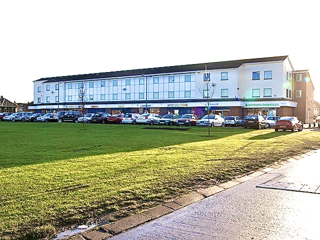
Brambles Farm is a small housing estate in east Middlesbrough, England with a population of 3,200. It lies to the north of Thorntree Thorntree is a housing estate in east Middlesbrough, North Yorkshire, England. The former Thorntree Ward's population was 6,290, at the 2011 census. Since 2015, the estate shares a ward with Brambles Farm. The housing estate was built in the l ... and east of Pallister. Schools Brambles Primary Academy, part of the Navigate Academies Trust, is a primary school in Brambles Farm. Teaching and learning at Brambles Primary Academy are considered to be ‘outstanding’, by Ofsted. The school works closely with its partner academies in the Navigate Academies Trust, including Pennyman Primary Academy, in nearby Netherfields. Brambles Farm FC Local residents formed this football team to combat anti-social behaviour among some of its youths. References External links Areas within Middlesbrough {{Middlesbrough-geo-stub ... [...More Info...] [...Related Items...] OR: [Wikipedia] [Google] [Baidu] |
Middlesbrough
Middlesbrough ( ) is a town on the southern bank of the River Tees in North Yorkshire, England. It is near the North York Moors national park. It is the namesake and main town of its local borough council area. Until the early 1800s, the area was rural farming land. By 1830, a new industrial town and port started to be developed, driven by the coal and later ironworks. Steel production and ship building began in the late 1800s, remaining associated with the town until post-industrial decline occurred in the late twentieth century. Trade (notably through ports) and digital enterprise sectors contemporarily contribute to the local economy, Teesside University and Middlesbrough College to local education. In 1853, it became a town. The motto ("We shall be" in Latin) was adopted, it reflects ("We have been") of the Bruce clan which were Cleveland's mediaeval lords. The town's coat of arms is three ships representing shipbuilding and maritime trade and an azure (blue) lion, ... [...More Info...] [...Related Items...] OR: [Wikipedia] [Google] [Baidu] |
England
England is a country that is part of the United Kingdom. It shares land borders with Wales to its west and Scotland to its north. The Irish Sea lies northwest and the Celtic Sea to the southwest. It is separated from continental Europe by the North Sea to the east and the English Channel to the south. The country covers five-eighths of the island of Great Britain, which lies in the North Atlantic, and includes over 100 smaller islands, such as the Isles of Scilly and the Isle of Wight. The area now called England was first inhabited by modern humans during the Upper Paleolithic period, but takes its name from the Angles, a Germanic tribe deriving its name from the Anglia peninsula, who settled during the 5th and 6th centuries. England became a unified state in the 10th century and has had a significant cultural and legal impact on the wider world since the Age of Discovery, which began during the 15th century. The English language, the Anglican Church, and Engli ... [...More Info...] [...Related Items...] OR: [Wikipedia] [Google] [Baidu] |
Thorntree
Thorntree is a housing estate in east Middlesbrough, North Yorkshire, England. The former Thorntree Ward's population was 6,290, at the 2011 census. Since 2015, the estate shares a ward with Brambles Farm. The housing estate was built in the late 1940s, in the lands of the former Thorntree Farm, after people started to move away from the terraced housing of Middlesbrough town centre and North Ormesby. It has a public park called Thorntree Park. The main roads of the estate are College Road and The Greenway. Thorntree Ward had a population of 5,000 and was identified as the 3rd most deprived (out of 8,414) housing ward in England, in 2000. Since the Index of Multiple Deprivation started measuring smaller output areas with a mean population of 1,500, the three areas of Thorntree later ranked 192nd, 205th and 378th most deprived (out of 34,412) in England respectively. History Much of Thorntree stands on what used to be a farmland. In all, of Thorntree Farm and of Low Bottoms F ... [...More Info...] [...Related Items...] OR: [Wikipedia] [Google] [Baidu] |
Pallister
Pallister is an area in the borough of Middlesbrough, North Yorkshire, England. It is located within the TS3 postcode area. The Pallister Ward (shared with the larger Berwick Hills) had population at the 2011 Census of 6,069, the ward was later renamed in 2015 to Berwick Hills and Pallister. The area, made up of mostly council houses, has developed a reputation over the years for crime and anti-social behaviour, although Middlesbrough Council and Erimus Housing have made it a target to reduce crime rates. File:Pallister Park - geograph.org.uk - 854119.jpg, Pallister Park File:Pallister Park - geograph.org.uk - 854116.jpg, Pallister Park field It is also known as Pallister Park or Pally Park because of the public park located at the northern edge of the area. Education There are two primary schools in the area - Pallister Park Primary School, on Gribdale Road and Corpus Christi RC Primary School, on Cargo Fleet Lane. There is a secondary school, Unity City Academy, towards ... [...More Info...] [...Related Items...] OR: [Wikipedia] [Google] [Baidu] |
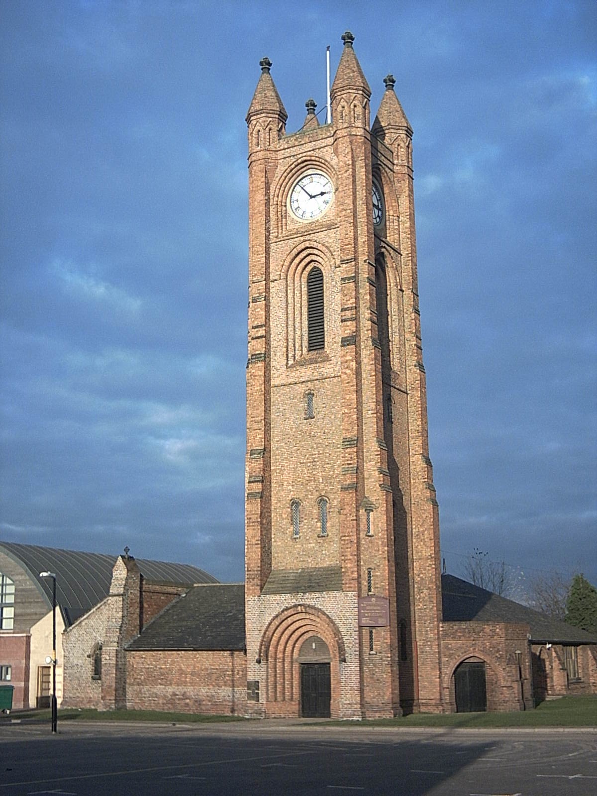
The Church Of Jesus Christ Of Latter-Day Saints ,Brambles Farm - Panoramio
''The'' () is a grammatical article in English, denoting persons or things that are already or about to be mentioned, under discussion, implied or otherwise presumed familiar to listeners, readers, or speakers. It is the definite article in English. ''The'' is the most frequently used word in the English language; studies and analyses of texts have found it to account for seven percent of all printed English-language words. It is derived from gendered articles in Old English which combined in Middle English and now has a single form used with nouns of any gender. The word can be used with both singular and plural nouns, and with a noun that starts with any letter. This is different from many other languages, which have different forms of the definite article for different genders or numbers. Pronunciation In most dialects, "the" is pronounced as (with the voiced dental fricative followed by a schwa) when followed by a consonant sound, and as (homophone of the archaic pron ... [...More Info...] [...Related Items...] OR: [Wikipedia] [Google] [Baidu] |
Netherfields
Netherfields is an area in the Park End and Beckfield ward of the Borough of Middlesbrough, North Yorkshire, England. It forms the north-east side of the Ormesby. The area includes Outwood Academy Ormesby, Priory Woods (School and Arts College), and Pennyman Primary Academy. Fulbeck Road is the main road through the area. Housing Erimus Housing is the main housing provider, managing the social housing which in the past was owned by Middlesbrough Council. The housing stock has gone through several stages in the evolution of netherfields. Most housing is traditional, 1960s terraced houses, but there have also been rows of flats with communal stairways, demolished in the 1980s, and several blocks of high-rise flats. In 2009, two of Netherfields' three high-rise blocks of flats were demolished, after a lengthy consultation with Netherfields' residents. The flats, which were built in 1968, each contained 90 flats. Concerns from residents indicated problems within each of the bl ... [...More Info...] [...Related Items...] OR: [Wikipedia] [Google] [Baidu] |
North Ormesby
North Ormesby is an area in the town of Middlesbrough, in the Borough of Middlesbrough, North Yorkshire, England. The area has gained the common nickname of Doggy, it is of unknown origin. Population of the North Ormesby and Brambles Farm ward, as taken at the 2011 census, was 6,268. The area became its own ward in 2015. It is situated to the south of the River Tees, the A66 and adjacent to the Cargo Fleet and South Bank areas of Middlesbrough. The Teesdale Way long-distance trail passes just to the north of the area. North Ormesby is located next to Middlesbrough F.C.'s Riverside Stadium and is a popular route for match-goers. History Its name, as well as those of various streets in the locality, alludes to the support given to the initial construction of North Ormesby, a new town, in the later 19th century by members of the nearby Ormesby-based Pennyman family. The name therefore comes from being in the northern part of the former Ormesby parish. The neighbourhood has i ... [...More Info...] [...Related Items...] OR: [Wikipedia] [Google] [Baidu] |
South Bank, Redcar And Cleveland
South Bank is a township in the Redcar and Cleveland borough in North Yorkshire, England on the south bank of the River Tees. It is east of Middlesbrough and south-west of Redcar. The town is served by railway station. The namesake ward had a population of 6,548 at the 2011 census. It forms part of the Teesside built-up area's Middlesbrough subdivision in 2011. The area is part of Greater Eston; which also includes Eston, Grangetown, Normanby, Teesville and part of Ormesby. Ormesby's ancient parish was split into civil parishes. The area was in Normanby civil parish. In 1894, the area gained a higher population with South Bank in Normanby Urban District Council created. A town hall was built for the district in 1878 and was demolished before the urban district merged with Eston Urban District in 1915. The Eston Urban District was abolished in 1968 with the district becoming part of the County Borough of Teesside. In 1974, the county borough, with the area remaining unpari ... [...More Info...] [...Related Items...] OR: [Wikipedia] [Google] [Baidu] |
Teesville
Teesville is an area in the borough of Redcar and Cleveland, North Yorkshire, England. A ward covering the area had a population of 6,517 at the 2011 census. It is part of Greater Eston, which includes the area and the settlements of Eston, Normanby, South Bank, Teesville and part of Ormesby. Politics Teesville is part of the Redcar constituency in the House of Commons. 2015 local elections results In the 2015 local elections, the following members were returned to Redcar and Cleveland Borough Council: Municipal buildings The town hall of Teesville was used by the Eston Urban District council from 1961 to 1968. When the County Borough of Teesside was abolished in 1974, the Borough of Langbaurgh, as part of the secord tier of local government within Cleveland County, used the town hall for the borough. The borough changed its name in 1988 to Langbaurgh-on-Tees and, as a unitary authority, after the abolition of Cleveland County, to Redcar and Cleveland in 1996. Th ... [...More Info...] [...Related Items...] OR: [Wikipedia] [Google] [Baidu] |
Normanby, Redcar And Cleveland
Normanby is an area in the borough of Redcar and Cleveland, North Yorkshire, England. A ward covering the area had a population of 6,930 at the United Kingdom Census 2011, 2011 census. It is part of Greater Eston, which includes the area and the outlying settlements of Eston, Grangetown, North Yorkshire, Grangetown, South Bank, Middlesbrough, South Bank, Teesville and part of Ormesby. Ormesby's ancient parish was split into civil parishes. As a township (England), township, Normanby civil parish was formed with South Bank, it was under the South Bank in Normanby Urban District Council from 1894-1915. The Urban district (Great Britain and Ireland), urban district and parish merged into the Eston Urban District which was abolished in 1968 with the district becoming part of the County Borough of Teesside. In 1974, the county borough was abolished with the area remaining unparished area, unparished since the abolition. History In 1870–72, John Marius Wilson's Imperial Gazetteer ... [...More Info...] [...Related Items...] OR: [Wikipedia] [Google] [Baidu] |


.png)


