|
Braeriach
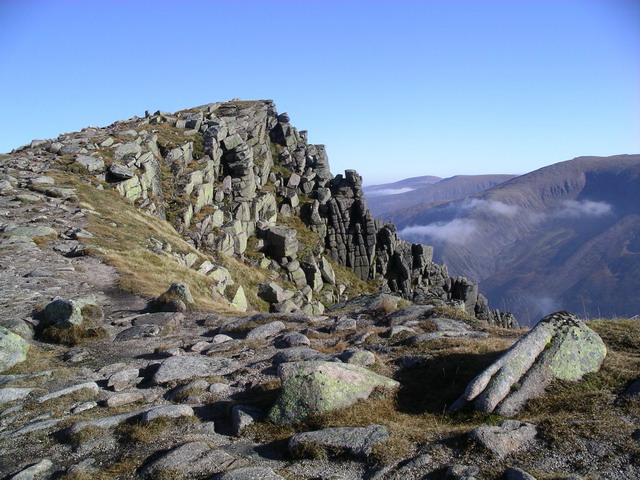
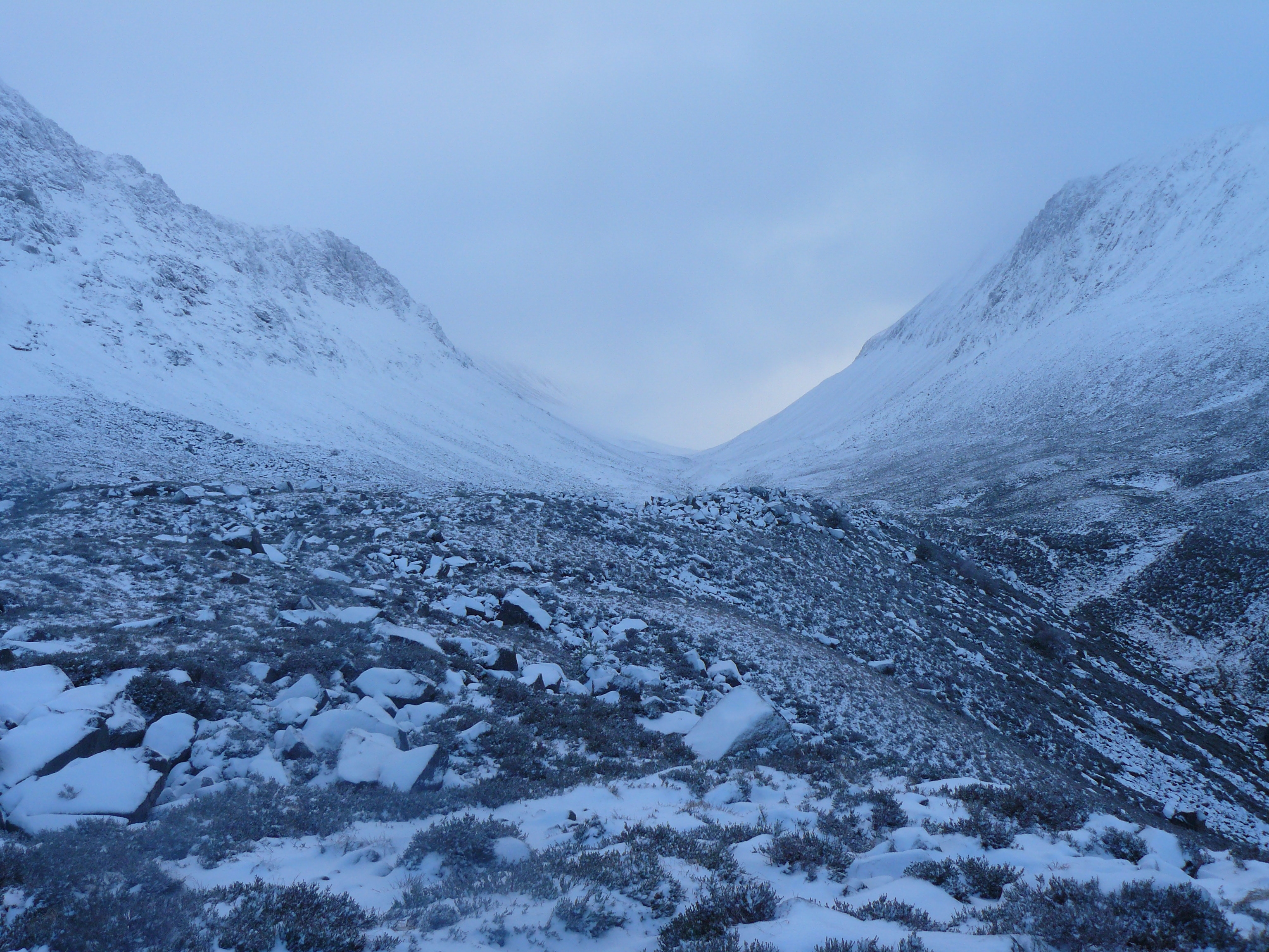
Braeriach or Brae Riach ( gd, Am Bràigh Riabhach, 'the brindled upland') is the third-highest mountain in Scotland and all of the British Isles, after Ben Nevis and Ben Macdui, rising above sea level. It is in the Scottish Highlands and is the highest point in the western massif of the Cairngorms, separated from the central section by the Lairig Ghru pass. The summit is a crescent-shaped plateau, overlooking several Cirque, corries. The lingering snows of Braeriach are amongst the most persistent snow patches in Scotland and the whole British Isles. The north-facing Cirque, corrie of Garbh Coire Mor has been snow-free just nine times in the last one hundred years: 1933, 1959, 1996, 2003, 2006, 2017, 2018, 2021 and 2022 – but four times in the six years to 2022. The rate and occurrence of melting appears to be increasing. Probably the most commonly used route up Braeriach starts from Sugar Bowl car park, on the road leading to the Cairn Gorm ski area. From here a path lea ... [...More Info...] [...Related Items...] OR: [Wikipedia] [Google] [Baidu] |
Cairngorms
The Cairngorms ( gd, Am Monadh Ruadh) are a mountain range in the eastern Highlands of Scotland closely associated with the mountain Cairn Gorm. The Cairngorms became part of Scotland's second national park (the Cairngorms National Park) on 1 September 2003. Although the Cairngorms give their name to, and are at the heart of, the Cairngorms National Park, they only form one part of the national park, alongside other hill ranges such as the Angus Glens and the Monadhliath, and lower areas like Strathspey. The Cairngorms consists of high plateaux at about above sea level, above which domed summits (the eroded stumps of once much higher mountains ) rise to around . Many of the summits have tors, free-standing rock outcrops that stand on top of the boulder-strewn landscape. In places, the edges of the plateau form steep cliffs of granite and they are excellent for skiing, rock climbing and ice climbing. The Cairngorms form an arctic-alpine mountain environment, with tundra-like ... [...More Info...] [...Related Items...] OR: [Wikipedia] [Google] [Baidu] |
Lairig Ghru
The Lairig Ghru ( gd, Làirig Dhrù) is one of the mountain passes through the Cairngorms of Scotland. The route and mountain pass partially lies on the Mar Lodge Estate. Like many traditional routes, the ends of the route through the Lairig Ghru are like the ends of a frayed rope. From the south the Lairig Ghru can be approached from Braemar though Glen Lui, or Glen Dee, and from Blair Atholl through Glen Tilt. From the north the Lairig Ghru can be approached from Glenmore through the Chalamain Gap, and from Aviemore through the Rothiemurchus Forest by way of the ''Crossroads'' above Allt Drùidh. Name Watson gives the place name "Làirig Dhrù", meaning ''pass of Dhru or Druie'', with the local pronunciation "Laarig Groo". He suggests the "probable" derivation as from ''Drùdhadh'' meaning oozing. Any visitor to the summit of the Lairig Ghru would accept that as a possible derivation because two watercourses, one on each side of the summit, appear to "ooze" from the valley ... [...More Info...] [...Related Items...] OR: [Wikipedia] [Google] [Baidu] |
Chalamain Gap
The Lairig Ghru ( gd, Làirig Dhrù) is one of the mountain passes through the Cairngorms of Scotland. The route and mountain pass partially lies on the Mar Lodge Estate. Like many traditional routes, the ends of the route through the Lairig Ghru are like the ends of a frayed rope. From the south the Lairig Ghru can be approached from Braemar though Glen Lui, or Glen Dee, and from Blair Atholl through Glen Tilt. From the north the Lairig Ghru can be approached from Glenmore through the Chalamain Gap, and from Aviemore through the Rothiemurchus Forest by way of the ''Crossroads'' above Allt Drùidh. Name Watson gives the place name "Làirig Dhrù", meaning ''pass of Dhru or Druie'', with the local pronunciation "Laarig Groo". He suggests the "probable" derivation as from ''Drùdhadh'' meaning oozing. Any visitor to the summit of the Lairig Ghru would accept that as a possible derivation because two watercourses, one on each side of the summit, appear to "ooze" from the valley f ... [...More Info...] [...Related Items...] OR: [Wikipedia] [Google] [Baidu] |
Snow Patches In Scotland
Long-lying snow patches in Scotland have been noted from at least the 18th century, with snow patches on Ben Nevis being observed well into summer and autumn. Indeed, the summit observatory, which operated from 1883 to 1904, reported that snow survived on the north-east cliffs through more years than it vanished. More recently, additional and methodical field study on the subject has been carried out by others, most notably by ecologist Dr Adam Watson. Most of this work concentrated on the mountains of north-east Scotland (in particular, the Cairngorms), but more recent observations by him and others has shed light on various locations throughout Scotland where long-lying snow persists. The available information systematically gathered by observers over the last 50 years or so, and greatly increased since the 1990s, has built up a level of knowledge that points to Scotland's snow patches being now amongst the best documented in the world. General locations There are many loc ... [...More Info...] [...Related Items...] OR: [Wikipedia] [Google] [Baidu] |
List Of Munro Mountains
This is a list of Munro mountains and Munro Tops in Scotland by height. Munros are defined as Scottish mountains over in height, and which are on the Scottish Mountaineering Club ("SMC") official list of Munros. In addition, the SMC define Munro Tops, as Scottish peaks above that are not considered Munros. Where the SMC lists a Munro Top, due to "insufficient separation", it will also list the "Parent Peak", a Munro, of the Munro Top. As of 6 September 2012, there were 282 Scottish Munros after the SMC confirmed that Beinn a' Chlaidheimh had been downgraded to a Corbett and as of 10 December 2020, there were 226 Scottish Munro Tops after Stob Coire na Cloiche, a Munro Top to Parent Peak Sgùrr nan Ceathramhnan, was surveyed at 912.5m and was deleted as a Munro Top and downgraded to a Corbett Top. The current SMC list totals 508 summits. While the SMC does not use a prominence metric for classifying Munros, all but one of the 282 Munros have a prominence above , the exception ... [...More Info...] [...Related Items...] OR: [Wikipedia] [Google] [Baidu] |
Munros
A Munro () is defined as a mountain in Scotland with a height over , and which is on the Scottish Mountaineering Club (SMC) official list of Munros; there is no explicit topographical prominence requirement. The best known Munro is Ben Nevis (Beinn Nibheis), the highest mountain in the British Isles at . Munros are named after Sir Hugh Munro, 4th Baronet (1856–1919), who produced the first list of such hills, known as ''Munro's Tables'', in 1891. Also included were what Munro considered lesser peaks, now known as Munro Tops, which are also over 3,000 feet but are lower than the nearby primary mountain. The publication of the original list is usually considered to be the epoch event of modern peak bagging. The list has been the subject of subsequent variation and as of 10 December 2020, the Scottish Mountaineering Club has listed 282 Munros and 226 Munro Tops. "Munro bagging" is the activity of climbing all the listed Munros. As of 31 December 2021, 7,098 people had reported ... [...More Info...] [...Related Items...] OR: [Wikipedia] [Google] [Baidu] |
Mountains And Hills Of Scotland
Scotland is the most mountainous country in the United Kingdom. Scotland's mountain ranges can be divided in a roughly north to south direction into: the Scottish Highlands, the Central Belt and the Southern Uplands, the latter two primarily belonging to the Scottish Lowlands. The highlands eponymously contains the country's main mountain ranges, but hills and mountains are to be found south of these as well. The below lists are not exhaustive; there are countless subranges throughout the country. Ben Nevis (Beinn Nibheis), the highest mountain in Scotland and the United Kingdom at , is in the Highland region at the western end of the Grampian Mountains. A Scottish mountain over is referred to as a Munro, of which there are 282. As of 2019, hundreds of thousands of people visit mountains in Scotland every winter and 130,000 climb to the summit of Ben Nevis every year. Highlands Scotland's main mountainous region can be broadly further split into the Northwest Highlands, ... [...More Info...] [...Related Items...] OR: [Wikipedia] [Google] [Baidu] |
Ben Macdui
Ben Macdui ( gd, Beinn MacDuibh, meaning "MacDuff's mountain") is the second-highest mountain in Scotland and all of the British Isles, after Ben Nevis, and the highest of the Cairngorm Mountains. The summit is above sea level and it is classed as a Munro. Ben Macdui sits on the southwestern edge of the Cairngorm plateau, overlooking the Lairig Ghru pass to the west, and Loch Etchachan to the east. It lies on the boundary between the historic counties of Aberdeenshire and Banffshire. Before the production of accurate maps of Scotland in the 19th century, it was not known for certain that Ben Nevis was the highest point in Britain, and it was often thought that Ben Macdui might be higher. Following surveys of both peaks in 1846–47, Ben Nevis was confirmed as the higher. The summit of the mountain has a direction indicator erected in 1925 by the Cairngorm Club of Aberdeen in memory of former president Alexander Copland. The indicator shows the directions of the most notew ... [...More Info...] [...Related Items...] OR: [Wikipedia] [Google] [Baidu] |


