|
Bonner Springs, Kansas
Bonner Springs is a city in Wyandotte, Leavenworth, and Johnson counties, Kansas, United States. It is part of the Kansas City Metropolitan Area. As of the 2020 census, the population of the city was 7,837. Bonner Springs was incorporated as a city on November 10, 1898. Bonner Springs is home to the Azura Amphitheater (commonly known as the Sandstone Amphitheater), the National Agricultural Center and Hall of Fame, Wyandotte County Historical Museum, and the annual Kansas City Renaissance Festival. History Early settlers The Kanza people had settled the area because of the mineral springs and abundant fish and game when, in 1812, two French fur traders, the Chouteau brothers, made their way from St. Louis and temporally settled in the area that would eventually become Bonner Springs, starting a trading post named "Four Houses". The location allowed easy access to trade items, and a ferry to cross the Kansas River was added. With a date of 1812, it is reputed to be the fi ... [...More Info...] [...Related Items...] OR: [Wikipedia] [Google] [Baidu] |
City
A city is a human settlement of notable size.Goodall, B. (1987) ''The Penguin Dictionary of Human Geography''. London: Penguin.Kuper, A. and Kuper, J., eds (1996) ''The Social Science Encyclopedia''. 2nd edition. London: Routledge. It can be defined as a permanent and densely settled place with administratively defined boundaries whose members work primarily on non-agricultural tasks. Cities generally have extensive systems for housing, transportation, sanitation, utilities, land use, production of goods, and communication. Their density facilitates interaction between people, government organisations and businesses, sometimes benefiting different parties in the process, such as improving efficiency of goods and service distribution. Historically, city-dwellers have been a small proportion of humanity overall, but following two centuries of unprecedented and rapid urbanization, more than half of the world population now lives in cities, which has had profound consequences for g ... [...More Info...] [...Related Items...] OR: [Wikipedia] [Google] [Baidu] |
Area Code 913
Area code 913 is the telephone area code in the North American Numbering Plan (NANP) for northeastern Kansas. The numbering plan area (NPA) consists of a small ribbon of eight counties bordering Missouri—an area largely coextensive with the Kansas portion of the Kansas City Metropolitan Area. Prior to July 20, 1997, numbering plan area 913 comprised all of northern Kansas from the Colorado state line to the Missouri state line, running along the entire border with Nebraska. History Despite a small population of less that two million, Kansas was divided lengthwise into two numbering plan areas during the establishment of the first formulation of the North American Numbering Plan by AT&T in 1947.W.H. Nunn, ''Nationwide Numbering Plan'', Bell System Technical Journal 31(5), 851 (1952) The southern half of the state, including the largest city of the state, Wichita, as well as Dodge City, Emporia, and Garden City, received area code 316. The northern half, with its major populati ... [...More Info...] [...Related Items...] OR: [Wikipedia] [Google] [Baidu] |
Lenape
The Lenape (, , or Lenape , del, Lënapeyok) also called the Leni Lenape, Lenni Lenape and Delaware people, are an indigenous peoples of the Northeastern Woodlands, who live in the United States and Canada. Their historical territory included present-day northeastern Delaware, New Jersey and eastern Pennsylvania along the Delaware River watershed, New York City, western Long Island, and the lower Hudson Valley. Today, Lenape people belong to the Delaware Nation and Delaware Tribe of Indians in Oklahoma; the Stockbridge–Munsee Community in Wisconsin; and the Munsee-Delaware Nation, Moravian of the Thames First Nation, and Delaware of Six Nations in Ontario. The Lenape have a matrilineal clan system and historically were matrilocal. During the last decades of the 18th century, most Lenape were removed from their homeland by expanding European colonies. The divisions and troubles of the American Revolutionary War and United States' independence pushed them farther west. ... [...More Info...] [...Related Items...] OR: [Wikipedia] [Google] [Baidu] |
North American Fur Trade
The North American fur trade is the commercial trade in furs in North America. Various Indigenous peoples of the Americas traded furs with other tribes during the pre-Columbian era. Europeans started their participation in the North American fur trade from the initial period of their colonization of the Americas onward, extending the trade's reach to Europe. European merchants from France, England and the Dutch Republic established trading posts and forts in various regions of North America to conduct the trade with local Indigenous communities. The trade reached the peak of its economic importance in the 19th century, by which time it relied upon elaborately developed trade networks. The trade soon became one of the main economic drivers in North America, attracting competition amongst European nations which maintained trade interests in the Americas. The United States sought to remove the substantial British control over the North American fur trade during the first decades of ... [...More Info...] [...Related Items...] OR: [Wikipedia] [Google] [Baidu] |
Kaw People
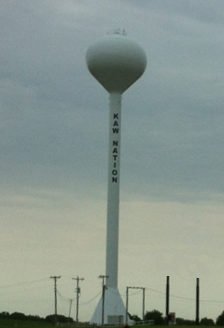
The Kaw Nation (or Kanza or Kansa) is a federally recognized Native American tribe in Oklahoma and parts of Kansas. It comes from the central Midwestern United States. It has also been called the "People of the South wind","Constitution of the Kaw Nation." ''Kaw Nation.'' 2011. Retrieved 30 April 2012. "People of water", ''Kansa'', ''Kaza'', ''Konza'', ''Conza'', ''Quans'', ''Kosa'', and ''Kasa''. Their tribal language is Kansa, classified as a .Unrau, William [...More Info...] [...Related Items...] OR: [Wikipedia] [Google] [Baidu] |
Kansas City Renaissance Festival
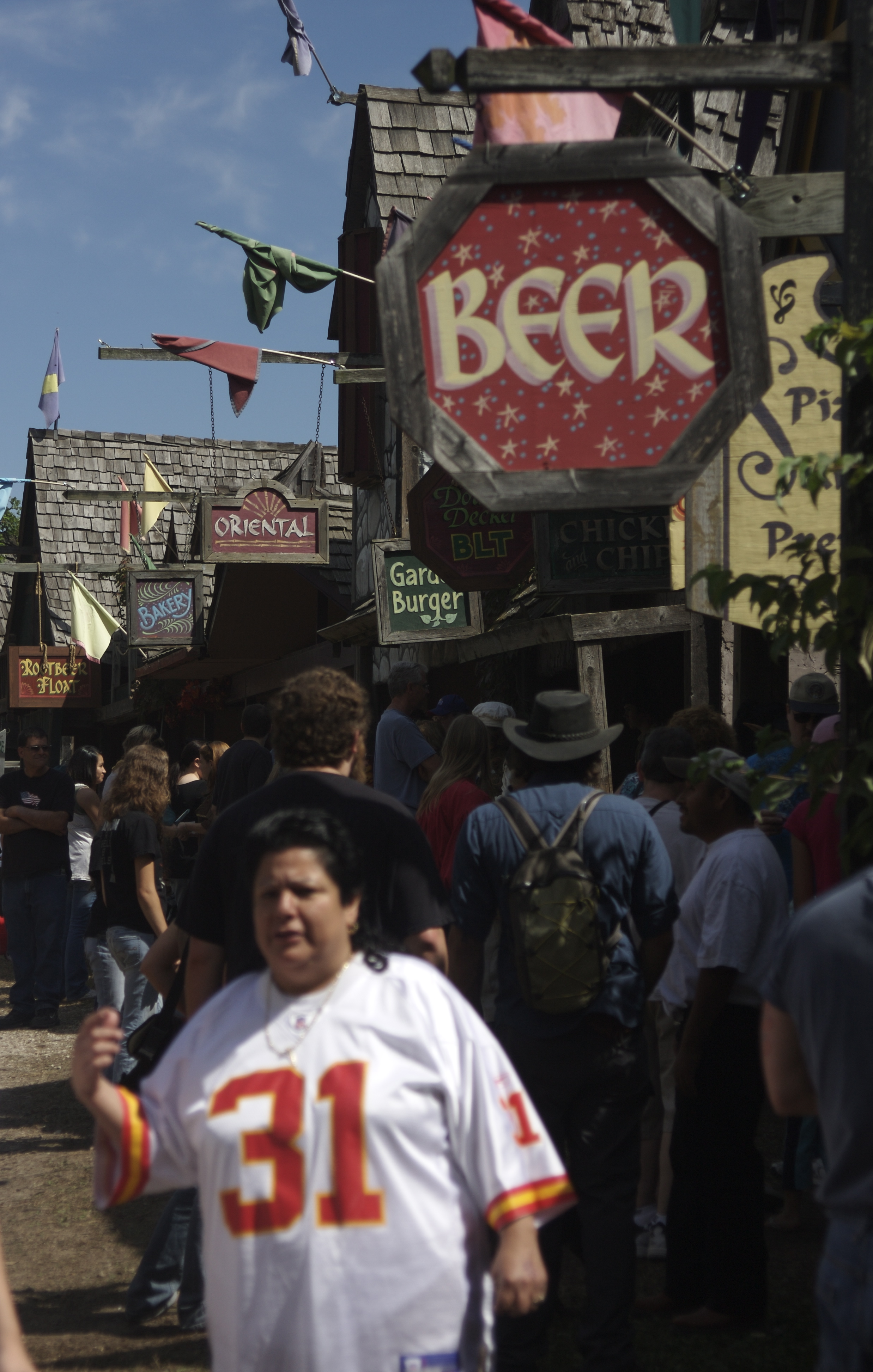
The Kansas City Renaissance Festival is a Renaissance fair held each fall in Bonner Springs, Kansas, United States, next to Sandstone Amphitheater. Each year the fair begins on Labor Day weekend and continues for seven weekends, open on Saturdays and Sundays as well as Labor Day and Columbus Day. The faire began in 1977 as a benefit for the Kansas City Art Institute, and became a stand-alone event in the late 1990s. Presently, the fair has 165 booths and 13 stages, entertaining 180,000 patrons annually on 16 operating days. In keeping with its artistic beginnings, KCRF features over 150 shops and vendors, many of which sell original crafts and artwork. The site itself is artistic, featuring winding tree-lined lanes, painted murals, and banner-strewn, fancifully decorated buildings. In particular, the Institute for Historic and Educational Arts (IHEA) maintains a large presence. Its artisans demonstrate a variety of textile, wood and metal crafting techniques, even operating a ful ... [...More Info...] [...Related Items...] OR: [Wikipedia] [Google] [Baidu] |
National Agricultural Center And Hall Of Fame
The National Agricultural Center and Hall of Fame is a museum and educational facility in Bonner Springs, Kansas, United States. The group holds a congressional charter under Title 36 of the United States Code (issued in 1960). It is located east of K-7 and south of State Avenue (US-24, near 126th Street) next to the Sandstone Amphitheater and Kansas City Renaissance Festival. It is north of the Kansas Turnpike "Bonner Springs" exit, and about 1 miles west of the Kansas Speedway. Components Main Building The Main Building built in 1963-64 includes:Museum Tour webpage. National Agricultural Center and Hall of Fame website. * Gallery of Rural Art * National Agricultural Hall of Fame * Hall of Rural Living * National Farm Broadcasters Hall of Fame * Rural Electric Conference Theater * National Farmer's Memorial * National Poultry Museum [...More Info...] [...Related Items...] OR: [Wikipedia] [Google] [Baidu] |
Azura Amphitheater
Azura Amphitheater, also known as Sandstone Amphitheater, is an open-air amphitheater located in Bonner Springs, Kansas, United States. It is owned by the unified government of Wyandotte County and Kansas City, Kansas, shares its grounds with the Kansas City Renaissance Festival and National Agricultural Center and Hall of Fame and is located adjacent to the Wyandotte County Park. History Designed by Bird Engineering, it originally opened in 1984, as the Sandstone Center for the Performing Arts. It was renamed 'Verizon Wireless Amphitheater' in June 2002, after Verizon Wireless bought the naming rights for seven years from Houston-based Clear Channel Entertainment for an undisclosed amount. Clear Channel Communications spun off its live events management division in 2005 to form Los Angeles-based Live Nation, which continued to manage the venue through the 2007 concert season. Locals simply refer to the venue as "Sandstone". In September 2007, Live Nation announced that it woul ... [...More Info...] [...Related Items...] OR: [Wikipedia] [Google] [Baidu] |
Kansas City Metropolitan Area
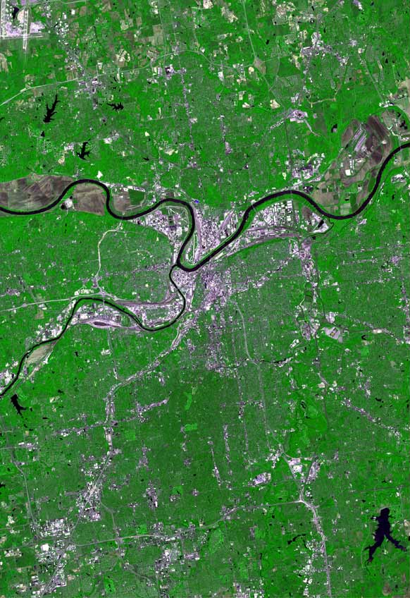
The Kansas City metropolitan area is a bi-state metropolitan area anchored by Kansas City, Missouri. Its 14 counties straddle the border between the U.S. states of Missouri (9 counties) and Kansas (5 counties). With and a population of more than 2.2 million people, it is the second-largest metropolitan area centered in Missouri (after Greater St. Louis) and is the largest metropolitan area in Kansas, though Wichita is the largest metropolitan area centered in Kansas. Alongside Kansas City, Missouri, these are the suburbs with populations above 100,000: Overland Park, Kansas; Kansas City, Kansas; Olathe, Kansas; Independence, Missouri; and Lee's Summit, Missouri. Business enterprises and employers include Cerner Corporation (the largest, with almost 10,000 local employees and about 20,000 global employees), AT&T Inc., AT&T, BNSF Railway, GEICO, Asurion, T-Mobile (formerly Sprint Corporation, Sprint), Black & Veatch, AMC Theatres, Citigroup, Garmin, Hallmark Cards, Macquarie Grou ... [...More Info...] [...Related Items...] OR: [Wikipedia] [Google] [Baidu] |
Kansas City International Airport
Kansas City International Airport (originally Mid-Continent International Airport) is a public airport in Kansas City, Missouri located northwest of Downtown Kansas City in Platte County, Missouri., effective December 30, 2021. The airport opened in 1972 and replaced Kansas City Municipal Airport (MKC) with all scheduled passenger airline flights being moved from MKC to MCI. It serves the Kansas City Metropolitan Area and is the primary passenger airport for much of western Missouri and eastern Kansas. The airport covers and has three runways. The airport has always been a civilian airport and has never had an Air National Guard unit assigned to it. Since the shut-down of the 2020 pandemic, the number of peak-day scheduled aircraft departures has been steadily recovering. As of October, 2022, there were 303 daily arrivals and departures. Nonstop service was offered to 47 airports, including Cancun and Toronto. History Beginnings Kansas City Industrial Airport was built aft ... [...More Info...] [...Related Items...] OR: [Wikipedia] [Google] [Baidu] |
I-435 (KS)
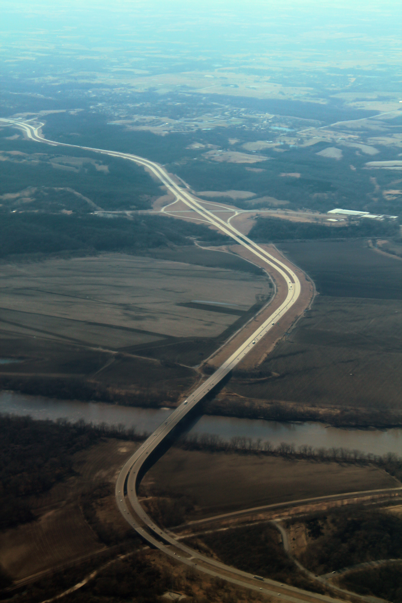
Interstate 435 (I-435) is an Interstate Highway beltway that encircles much of the Kansas City metropolitan area within the states of Kansas and Missouri in the United States. Route description I-435, a loop route of I-35, is long and intersects with nearly every other Interstate Highway in the Kansas City area (except for I-635 and I-670). An additional near Kansas City International Airport is signed along with I-29 and U.S. Route 71 (US 71), making I-435 the second-longest complete beltway numbered as a single Interstate Highway in the US and seventh longest in the world after I-275 in Cincinnati, Ohio, at ; Beltway 8 in Houston, Texas, at ; Bundesautobahn 10 in Berlin at ; and M25 motorway in London at ; as well as 7th and 8th ring roads in Beijing. The majority——of I-435 is within the state of Missouri, and most of that roadway lies within the city limits of Kansas City. The first/last exit is at I-435's parent route, I-35, in Lenexa, Kansa ... [...More Info...] [...Related Items...] OR: [Wikipedia] [Google] [Baidu] |
I-70 (KS)
Interstate 70 (I-70) is a mainline route of the Interstate Highway System in the United States connecting Cove Fort, Utah, to Baltimore, Baltimore, Maryland. In the US state of Kansas, I-70 extends just over from the Colorado border near the town of Kanorado, Kansas, Kanorado to the Missouri border in Kansas City. I-70 in Kansas contains the first segment in the country to start being paved and to be completed in the Interstate Highway System. The route passes through several of the state's principal cities in the process, including Kansas City, Kansas, Kansas City, Topeka, Kansas, Topeka, and Salina, Kansas, Salina. The route also passes through the cities of Lawrence, Kansas, Lawrence, Junction City, Kansas, Junction City, and Abilene, Kansas, Abilene. The section of I-70 from Topeka to the Missouri border is co-designated as the Kansas Turnpike; only the section between Topeka and just west of Kansas City is tolled. Route description I-70 runs concurrently with U.S. ... [...More Info...] [...Related Items...] OR: [Wikipedia] [Google] [Baidu] |


