|
Boltby
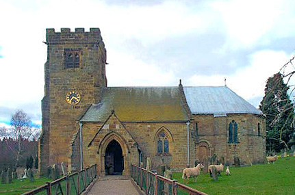
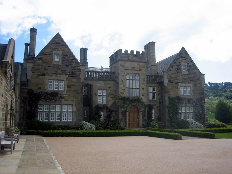
Boltby is a village and civil parish in the Hambleton District of North Yorkshire, England. It is on the edge of the North York Moors National Park at , and about north-east of Thirsk. According to the 2011 census, it had a population of 143. There are nine grade II listed structures in Boltby including a bridge over Gurtof Beck. Ravensthorpe Manor House, built in the mid 19th century, is situate west of the village. History Boltby is mentioned in the ''Domesday Book'' as ''Boltebi'' in the ''Yalestre'' hundred. After the Norman invasion, the land was owned by ''Hugh, son of Baldric''. He granted Lordship of the local manor to ''Gerald of Boltby''. Previously the Lord of the manor was ''Sumarlithi, son of Karli''. Fewer than five new houses have been built in the village in the 20th century, giving a total of 43 in 2005. The eastern part of the Boltby was affected by flooding in 2005 when Gurtof Beck overflowed and damaged or destroyed buildings. Local reports were of w ... [...More Info...] [...Related Items...] OR: [Wikipedia] [Google] [Baidu] |
William De Cantilupe, 1st Baron Cantilupe
William de Cantilupe, 1st Baron Cantilupe (1262-1308) of Greasley Castle in Nottinghamshire and of Ravensthorpe Castle in the parish of Boltby, North Yorkshire, was created Baron Cantilupe in 1299 by King Edward I. He was one of the magnates who signed and sealed the Barons' Letter of 1301 to the pope and was present at the Siege of Caerlaverock Castle in Scotland in 1300, when his armorials were blazoned in Norman-French verse in the Caerlaverock Roll. Origins He was born in 1262 at Lenton Priory in Nottinghamshire (to which his maternal ancestors the de Greasley family had been benefactors), the son and heir of Sir Nicholas de Cantilupe (d.1266) of Withcall (an ancient Cantilupe possession) in Lincolnshire, Greasley in Nottinghamshire and Ilkeston in Derbyshire, by his wife Eustachia FitzHugh, daughter and heiress of Ralph FitzHugh of Greasley (whose mother was Agnes de Greasley, heiress of Greasley and Ilkeston) and of Middle Claydon in Buckinghamshire. William's father ... [...More Info...] [...Related Items...] OR: [Wikipedia] [Google] [Baidu] |
Felixkirk
Felixkirk is a village and civil parish in the Hambleton District of North Yorkshire, England. The village is situated about three miles north-east of Thirsk. The population of the civil parish was estimated at 100 in 2014. History The village is named after its church, itself dedicated to St Felix, a Burgundian who travelled with St Paulinus converting Saxons in England to Christianity during the seventh century. It may have not been known by its current name at the time of the Norman invasion as it does not appear in this form in the Domesday Book of 1086. Instead it is referenced as ''Fridebi'' with the manor lands shared between ''Gamal, son of Kalri'' and ''Ligulf'', subsequently passing after invasion to ''Hugh, son of Baldric'', who made ''Gerard of Boltby'' lord of the manor. There are competing etymologies for ''Fridebi''. It is the same as the old place name of nearby Firby sometimes taken to mean ''Peaceful Place'' from ''fred'', a Danish word for ''peace''. A ... [...More Info...] [...Related Items...] OR: [Wikipedia] [Google] [Baidu] |
Kirby Knowle
Kirby Knowle is a village and civil parish in Hambleton District of North Yorkshire, England, on the border of the North Yorkshire Moors and near Upsall, about 4 miles north-east of Thirsk. Historically part of the North Riding of Yorkshire, the population of the civil parish was estimated at 60 in 2014. In the 2011 census the population of Kirby Knowle was included with Cowesby parish and not counted separately. History The village is mentioned in the ''Domesday Book'' as ''Chirchebi'' in the ''Yalestre'' hundred. The lands were in the possession of ''Orm, son of Gamal'', but passed to ''Hugh , son of Baldric'' after the Norman invasion. The lands became the possession of Robert de Mowbray who granted tenancy to Baldwin le Wake and then to the Upsall family, eventually passing to the Lascelles family. The Lascelles built a castle here in the 13th century which burnt down in 1568. During this time the manor was in the hands of the Constable family. The Constables were Cathol ... [...More Info...] [...Related Items...] OR: [Wikipedia] [Google] [Baidu] |
Thirsk
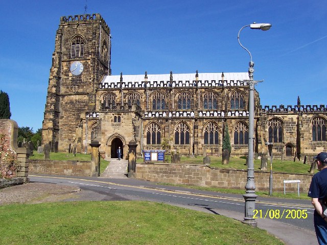
Thirsk is a market town and civil parish in the Hambleton district of North Yorkshire, England known for its racecourse; quirky yarnbomber displays, and depiction as local author James Herriot's fictional Darrowby. History Archeological finds indicate there was a settlement in Thirsk around 500–600 BC. The town's name is derived from the Old Norse word ''þresk'' meaning fen or lake. Thirsk is mentioned twice in the 1086 ''Domesday Book'' as ''Tresche'', in the ''Yarlestre'' wapentake, a village with ten households. At the time of the Norman invasion the manor was split between ''Orm'' and ''Thor'', local Anglo-Saxon landowners. Afterwards, it was split between ''Hugh, son of Baldric'' and the Crown. House of Mowbray Most of Thirsk was granted to a Robert from Montbray for whose descendant House of Mowbray the vale of Mowbray is named. By 1145, what is now Old Thirsk, gained a Market charter giving it town and borough status. The remaining land in the parish was sti ... [...More Info...] [...Related Items...] OR: [Wikipedia] [Google] [Baidu] |
Cowesby
Cowesby is a village and civil parish in the Hambleton District of North Yorkshire, England. Part of the village including The Cowesby Hall Estate is within the North York Moors National Park and about north of Thirsk. The population of the civil parish was estimated at 70 in 2014. In the 2011 census the population of Cowesby was included with Kirby Knowle parish and not counted separately. History The village is mentioned in the ''Domesday Book'' as being in the ''Allerton'' Hundred and listed as ''Cahosbi''. At the time of the Norman invasion the lands were recorded as belonging to Edwin, Earl of Mercia, but were ceded soon afterwards to King William I, though the manor was in the hands of '' Hugh, son of Baldric''. Governance The village lies within the Thirsk and Malton UK Parliament constituency. It also lies within the Thirsk electoral district of North Yorkshire County Council. The village is within the Whitestonecliffe ward of Hambleton District Council. The paris ... [...More Info...] [...Related Items...] OR: [Wikipedia] [Google] [Baidu] |
Thirlby
Thirlby is a village and civil parish in Hambleton district of North Yorkshire, England. With a population of about 120 in 2003, measured at 134 at the 2011 Census, Thirlby is situated approximately east of Thirsk. Unlike its near neighbours, the village is not mentioned in the ''Domesday Book''. Governance The village lies within the Thirsk and Malton UK Parliament constituency. It is also within the Thirsk electoral division of North Yorkshire County Council and the Whitestonecliffe ward of Hambleton District Council. Geography According to the 2001 UK Census, the village had a population of 127, of which 103 were over the age of sixteen. Of these, 68 were in employment. The village had 54 dwellings of which 43 were detached. The nearest settlements are Felixkirk to the north west; Sutton-under-Whitestonecliffe to the south south west; Cold Kirby to the east and Boltby to the north. Thirlby Beck runs through the east of the village and is part of the tributary s ... [...More Info...] [...Related Items...] OR: [Wikipedia] [Google] [Baidu] |
Ravensthorpe
{{geodis ...
Ravensthorpe may refer to any of the following places. England *Ravensthorpe, Dewsbury in West Yorkshire **Ravensthorpe railway station, Dewsbury *Ravensthorpe, Northamptonshire *Ravensthorpe, Peterborough in Cambridgeshire *Ravensthorpe, an historic manor in the parish of Boltby, North Yorkshire Australia *Ravensthorpe, Western Australia **Shire of Ravensthorpe **Ravensthorpe Airport **Ravensthorpe Nickel Mine The Ravensthorpe Nickel Mine is a nickel mine and hydrometallurgical processing plant located at Bandalup Hill, east of Ravensthorpe, Western Australia. Built by BHP Billiton, it was closed in January 2009, after less than a year of operation ... [...More Info...] [...Related Items...] OR: [Wikipedia] [Google] [Baidu] |
Upsall
Upsall is a hamlet in and civil parish in the Hambleton district of North Yorkshire, England. It is situated approximately four miles north-east of Thirsk. Upsall is part of the Upsall and Roxby estates owned by the Turton family. The population of the civil parish was estimated at 60 in 2014. History The village is mentioned in two entries of the ''Domesday Book'' as ''Upsale'' in the ''Yarlestre'' hundred. Lands at the time of the Norman invasion were in the possession of ''Earl Waltheof'', but soon passed to the Crown from whence it was granted to '' Count Robert of Mortain''. Some of the land was held for him by ''Richard of Soudeval''. The lands passed to Robert de Mowbray, for whom the local Upsall family held the manor until 1327 when they were sold to Geoffrey Scrope. For a short while, the estates were Crown property before being granted to John Farnham in 1577. Thereafter, the lands passed through the Constable family to the Turtons in 1768. The name Upsall is tho ... [...More Info...] [...Related Items...] OR: [Wikipedia] [Google] [Baidu] |
North York Moors
The North York Moors is an upland area in north-eastern Yorkshire, England. It contains one of the largest expanses of Calluna, heather moorland in the United Kingdom. The area was designated as a national parks of England and Wales, National Park in 1952, through the National Parks and Access to the Countryside Act 1949. Covering an area of , the National Park has a population of 23,380. It is administered by the North York Moors National Park Authority, whose head office is based in Helmsley. Location and transport To the east the area is clearly defined by the impressive cliffs of the North Sea coast. The northern and western boundaries are defined by the steep scarp slopes of the Cleveland Hills edging the Tees lowlands and the Hambleton Hills above the Vale of Mowbray. To the south lies the broken line of the Tabular Hills and the Vale of Pickering. Four roads cross the North York Moors from north to south. In the east the A171 road, A171 joins Whitby and Scarborough, Nor ... [...More Info...] [...Related Items...] OR: [Wikipedia] [Google] [Baidu] |
Moat Of Ravensthorp Manor - Geograph
A moat is a deep, broad ditch, either dry or filled with water, that is dug and surrounds a castle, fortification, building or town, historically to provide it with a preliminary line of defence. In some places moats evolved into more extensive water defences, including natural or artificial lakes, dams and sluices. In older fortifications, such as hillforts, they are usually referred to simply as ditches, although the function is similar. In later periods, moats or water defences may be largely ornamental. They could also act as a sewer. Historical use Ancient Some of the earliest evidence of moats has been uncovered around ancient Egyptian castles. One example is at Buhen, a castle excavated in Nubia. Other evidence of ancient moats is found in the ruins of Babylon, and in reliefs from ancient Egypt, Assyria, and other cultures in the region. Evidence of early moats around settlements has been discovered in many archaeological sites throughout Southeast Asia, including No ... [...More Info...] [...Related Items...] OR: [Wikipedia] [Google] [Baidu] |
Jurassic
The Jurassic ( ) is a Geological period, geologic period and System (stratigraphy), stratigraphic system that spanned from the end of the Triassic Period million years ago (Mya) to the beginning of the Cretaceous Period, approximately Mya. The Jurassic constitutes the middle period of the Mesozoic, Mesozoic Era and is named after the Jura Mountains, where limestone strata from the period were first identified. The start of the Jurassic was marked by the major Triassic–Jurassic extinction event, associated with the eruption of the Central Atlantic magmatic province, Central Atlantic Magmatic Province. The beginning of the Toarcian Stage started around 183 million years ago and is marked by an extinction event associated with widespread Anoxic event, oceanic anoxia, ocean acidification, and elevated temperatures likely caused by the eruption of the Karoo-Ferrar, Karoo-Ferrar large igneous provinces. The end of the Jurassic, however, has no clear boundary with the Cretaceous and i ... [...More Info...] [...Related Items...] OR: [Wikipedia] [Google] [Baidu] |


