|
Bofealan
Bofealan () is a townland in the civil parish of Templeport, County Cavan, Ireland. It lies in the Roman Catholic parish of Templeport and barony of Tullyhaw. Geography Bofealan is bounded on the north by Moher and Mullanacre Lower townlands in Tomregan parish and Clontycarnaghan townland, on the west by Urhannagh townland, on the east by Drumane townland and on the south by Killynaff townland. It includes a subdivision called Ballyness (Irish derived place name either Béal Átha an Easa, meaning ''Entrance to the Ford of the Waterfall'' or Baile an Easa, meaning 'Town of the Waterfall'). Bofealan's chief geographical features are the Crooked River (Ireland) and a disused mill race and pond. Bofealan is traversed by rural lanes. The townland covers 78 statute acres. History In medieval times the McGovern barony of Tullyhaw was divided into economic taxation areas called ballibetoes, from the Irish ''Baile Biataigh'' (Anglicized as 'Ballybetagh'), meaning 'A Provisioner's To ... [...More Info...] [...Related Items...] OR: [Wikipedia] [Google] [Baidu] |
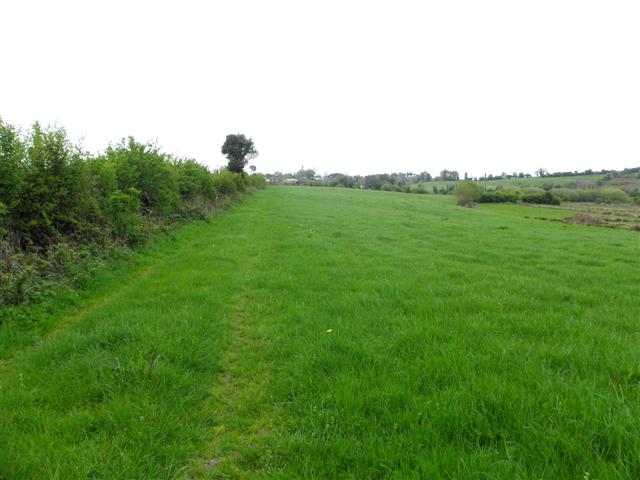
Bofealan Townland (geograph 1853979)
Bofealan () is a townland in the civil parish of Templeport, County Cavan, Ireland. It lies in the Roman Catholic parish of Templeport and barony of Tullyhaw. Geography Bofealan is bounded on the north by Moher and Mullanacre Lower townlands in Tomregan parish and Clontycarnaghan townland, on the west by Urhannagh townland, on the east by Drumane townland and on the south by Killynaff townland. It includes a subdivision called Ballyness (Irish derived place name either Béal Átha an Easa, meaning ''Entrance to the Ford of the Waterfall'' or Baile an Easa, meaning 'Town of the Waterfall'). Bofealan's chief geographical features are the Crooked River (Ireland) and a disused mill race and pond. Bofealan is traversed by rural lanes. The townland covers 78 statute acres. History In medieval times the McGovern barony of Tullyhaw was divided into economic taxation areas called ballibetoes, from the Irish ''Baile Biataigh'' (Anglicized as 'Ballybetagh'), meaning 'A Provisione ... [...More Info...] [...Related Items...] OR: [Wikipedia] [Google] [Baidu] |
Drumane
Drumane () is a townland in the civil parish of Templeport, County Cavan, Ireland. It lies in the Roman Catholic parish of Templeport and barony of Tullyhaw. Geography Drumane is bounded on the north by Mullanacre Lower townland in Tomregan parish, on the west by Bofealan townland, on the south by Killynaff and Lecharrownahone townlands and on the east by Carrowmore, County Cavan townland in Tomregan parish. Its main geographical features are the Crooked River (Ireland), a small wood and a gravel pit. Dromane is traversed by a minor road and rural lanes. The townland covers 147 statute acres. History The 1609 Baronial Map depicts the townland as ''Drommeane''. The 1652 Commonwealth Survey spells the name as ''Dromeane''. The 1665 Down Survey map depicts it as ''Dromane''. William Petty's 1685 map depicts it as ''Dromean''. In the Plantation of Ulster by grant dated 4 June 1611, King James VI and I granted, along with other lands, one poll of ''Dromeane to Donill Backagh McS ... [...More Info...] [...Related Items...] OR: [Wikipedia] [Google] [Baidu] |
Killynaff
Killynaff () is a townland in the civil parish of Templeport, County Cavan, Ireland. It lies in the Roman Catholic parish of Templeport and barony of Tullyhaw. Geography Killynaff is bounded on the north by Urhannagh, Bofealan and Drumane townlands, on the west by Cavanaquill and Crossmakelagher townlands and on the southeast by Lecharrownahone townland. Its chief geographical features are cow pastures. Killynaff is traversed by a minor road and rural lanes. The townland covers 133 statute acres. History In medieval times the McGovern barony of Tullyhaw was divided into economic taxation areas called ballibetoes, from the Irish ''Baile Biataigh'' (Anglicized as 'Ballybetagh'), meaning 'A Provisioner's Town or Settlement'. The original purpose was to enable the farmer, who controlled the baile, to provide hospitality for those who needed it, such as poor people and travellers. The ballybetagh was further divided into townlands farmed by individual families who paid a tribute o ... [...More Info...] [...Related Items...] OR: [Wikipedia] [Google] [Baidu] |
Templeport
Templeport () is a civil parish in the barony of Tullyhaw, County Cavan, Ireland. The chief towns in the parish are Bawnboy and Ballymagauran. The large Roman Catholic parish of Templeport containing 42,172 statute acres was split up in the 18th & 19th centuries into three new parishes, Templeport, Corlough and Glangevlin. Etymology The name of Templeport parish derives from the old townland of Templeport (which is now shortened to Port) which is the anglicisation of the Gaelic 'Teampall An Phoirt' ("The Church of the Port or Bank or Landing-Place"). The church referred to is the old church on St. Mogue's Island in the middle of Port Lake. This church fell into disuse in medieval times and a new church was built on the opposite shore of the lake. It was forfeited to Queen Elizabeth in 1590 and started use as a Protestant church in about 1610. It is very unlikely that the island church ever served as the parish church because there was only one boat available and it would have ... [...More Info...] [...Related Items...] OR: [Wikipedia] [Google] [Baidu] |
Cor, Templeport
Cor () is a townland in the civil parish of Templeport, County Cavan, Ireland. It lies in the Roman Catholic parish of Templeport and barony of Tullyhaw. Geography Cor is bounded on the north by Kilsallagh and Keenagh, Templeport townlands, on the west by Port, Templeport townland, on the south by Cloneary townland and on the east by Lissanover townland. Its chief geographical features are a stream, a plantation, a spring well and a stone quarry. Cor is traversed by minor roads and rural lanes. The townland covers 153 statute acres. History In medieval times the McGovern barony of Tullyhaw was divided into economic taxation areas called ballibetoes, from the Irish ''Baile Biataigh'' (Anglicized as 'Ballybetagh'), meaning 'A Provisioner's Town or Settlement'. The original purpose was to enable the farmer, who controlled the baile, to provide hospitality for those who needed it, such as poor people and travellers. The ballybetagh was further divided into townlands farmed by indi ... [...More Info...] [...Related Items...] OR: [Wikipedia] [Google] [Baidu] |
Moher
Moher is a townland in the Parish of Tomregan, Barony of Tullyhaw, County Cavan, Ireland. Etymology The townland name is an anglicisation of the Gaelic placename "Mothar" which means 'A cluster of trees'. In the 17th century it formed part of Carrowmore townland. Geography It is bounded on the north by Sralahan townland, on the east by Mullanacre Lower townland, on the south by Bofealan townland and on the west by Clontycarnaghan townland. Its chief geographical features are the Crooked River (Ireland) and Slieve Rushen mountain, on whose southern slope it lies, reaching an altitude of 600 feet above sea-level. The townland is traversed by the N87 road (Ireland), the Bawnboy Road and other minor lanes. The townland covers an area of 218 statute acres. History It formed part of the Manor of Calva which was granted to Walter Talbot in 1610 as part of the Plantation of Ulster and descended with the rest of the Ballyconnell estate. George Montgomery the estate owner died in 1841 ... [...More Info...] [...Related Items...] OR: [Wikipedia] [Google] [Baidu] |
Mullanacre Lower
Mullanacre Lower is a townland in the Parish of Tomregan, Barony of Tullyhaw, County Cavan, Ireland. Etymology The townland name is an anglicisation of the Gaelic placename "Mullagh an Acre" which means 'The Acre of the Summit'. In the 17th century it formed part of Carrowmore, County Cavan townland. The earliest surviving spelling dates from 1761: ''Mullaneacre''. Geography It is bounded on the north by Mullanacre Upper townland, on the east by Carrowmore, County Cavan townland, on the south by Drumane & Bofealan townlands and on the west by Moher townland. Its chief geographical features are the Crooked River (Ireland) and Slieve Rushen mountain, on whose southern slope it lies, reaching an altitude of over above sea-level. The townland is traversed by the N87 road (Ireland), Carrowmore Lane and other minor lanes. The townland covers 315 statute acres, including of water. History The townland formed part of the Manor of Calva which was granted to Walter Talbot in 1610 a ... [...More Info...] [...Related Items...] OR: [Wikipedia] [Google] [Baidu] |
Clontycarnaghan
Clontycarnaghan () is a townland in the civil parishes in Ireland, civil parish of Templeport, County Cavan, Republic of Ireland, Ireland. It lies in the Roman Catholic parish of Templeport and barony of Tullyhaw. Geography Clontycarnaghan is bounded on the north by Mullanacre Upper townland in Tomregan parish, on the west by Corneen and Munlough North townlands, on the south by Urhannagh and Bofealan townlands and on the east by Sralahan and Moher townlands in Tomregan parish. Its chief geographical features are Slieve Rushen mountain on whose southern slope it lies, the Crooked River (Ireland), waterfalls, mountain bogs, forestry plantations, spring wells and dug wells. It forms part of the Slieve Rushen Bog Natural Heritage Are Clontycarnaghan is traversed by the national secondary N87 road (Ireland), minor roads and rural lanes. The townland covers 371 statute acres. History In medieval times the McGovern barony of Tullyhaw was divided into economic taxation areas called ... [...More Info...] [...Related Items...] OR: [Wikipedia] [Google] [Baidu] |
Urhannagh
Urhannagh () is a townland in the civil parish of Templeport, County Cavan, Ireland. It lies in the Roman Catholic parish of Templeport and barony of Tullyhaw. Geography Urhannagh is bounded on the north by Clontycarnaghan townland, on the west by Munlough North townland, on the east by Bofealan townland and on the south by Cavanaquill and Killynaff townlands. Its chief geographical features are a small stream and cow pastures. Urhannagh is traversed by rural lanes. The townland covers 68 statute acres. History In medieval times the McGovern barony of Tullyhaw was divided into economic taxation areas called ballibetoes, from the Irish ''Baile Biataigh'' (Anglicized as ''Ballybetagh''), meaning 'A Provisioner's Town or Settlement'. The original purpose was to enable the farmer, who controlled the baile, to provide hospitality for those who needed it, such as poor people and travellers. The ballybetagh was further divided into townlands farmed by individual families who paid a ... [...More Info...] [...Related Items...] OR: [Wikipedia] [Google] [Baidu] |
Tullygarvey
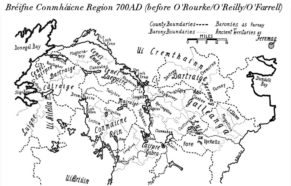
Tullygarvey ( ga, Teallach Ghairbhíth) is one of eight Baronies in the County of Cavan. The area has been in constant occupation since pre-4000 BC. The Barony of Tullygarvey consists of the parishes of Kill and Drung and parts of Annagh, Drumgoon and Laragh. Tullygarvey derives its name from the Irish meaning "Gairbhéith's household", Gairbhéith was a member of the Uí Briúin dynasty of Connacht. He was an ancestor of the O'Reilly clan and lived c.860 AD. He was not connected to the McGarvey clan of Donegal. It is located in the northeast of County Cavan, along the Annagh River. History In 1579, East Breifne, then part of Connacht, was made a shire. The shire was named Cavan after the area's main town. The administration remained in the control of the local Irish dynasty and subject to the Brehon and Canon Law. In 1584, John Perrot formed the shire into a county in Ulster. . Settlements *Cootehill Cootehill (; ) is a market town and townland in County Cavan, I ... [...More Info...] [...Related Items...] OR: [Wikipedia] [Google] [Baidu] |
King James VI And I
James VI and I (James Charles Stuart; 19 June 1566 – 27 March 1625) was King of Scotland as James VI from 24 July 1567 and King of England and Ireland as James I from the union of the Scottish and English crowns on 24 March 1603 until his death in 1625. The kingdoms of Scotland and England were individual sovereign states, with their own parliaments, judiciaries, and laws, though both were ruled by James in personal union. James was the son of Mary, Queen of Scots, and a great-great-grandson of Henry VII, King of England and Lord of Ireland, and thus a potential successor to all three thrones. He succeeded to the Scottish throne at the age of thirteen months, after his mother was compelled to abdicate in his favour. Four different regents governed during his minority, which ended officially in 1578, though he did not gain full control of his government until 1583. In 1603, he succeeded Elizabeth I, the last Tudor monarch of England and Ireland, who died childless. He c ... [...More Info...] [...Related Items...] OR: [Wikipedia] [Google] [Baidu] |
Tomás Mac Maghnus Mág Samhradháin
Tomás mac Maghnus Mág Samhradháin (anglicised Thomas McGovern) was lineage head of the McGoverns and Baron or Lord of Tullyhaw barony, County Cavan from 1512 until his death in 1532. Ancestry His ancestry was Tomás son of Maghnus (d. 1497) son of Tomás Óg (d. 1494) son of Tomás na Fésóige (d. 1458) son of Fearghal (d. 1393) son of Tomás (d. 1343) son of Brian ‘Breaghach’ Mág Samhradháin (d. 1298).M.V. Duignan (1934), "The Ui Briúin Bréifni genealogies", pp. 90–137, in JRSAI Vol. LXIV He was the eldest son and his younger brother Uaithne Mág Samhradháin was also a chief of the clan from 1540. Career Tomás was the leader of a dissident sept within the McGovern clan, which led to conflict with the reigning McGovern chief, Cathal Mág Samhradháin, the First. The Annals of the Four Masters for 1512 state- ''Philip, the son of Turlough Maguire, with his sons and the sons of Thomas, son of Manus Magauran, made an incursion into Teallach-Eachdhach (Tullyhaw) ... [...More Info...] [...Related Items...] OR: [Wikipedia] [Google] [Baidu] |
.jpg)


