|
Bodstedter Bodden
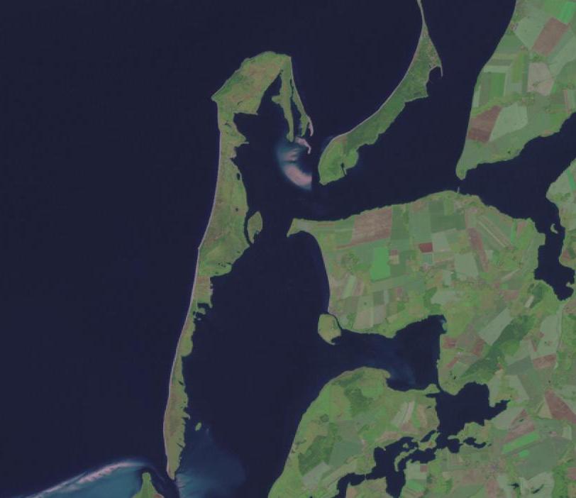
The Bodstedter Bodden is a lagoon, of the type known as a ''bodden'', that is part of the Darss-Zingst Bodden Chain and the Western Pomerania Lagoon Area National Park in northeastern Germany. It lies south of the peninsula of Fischland-Darß-Zingst on the coast of Mecklenburg-Vorpommern. The heavily indented, reed fringed shoreline forms a picturesque landscape with the result that the villages near the shore are popular tourist destinations. The western boundary of the bodden with the Koppelstrom forms the so-called ''Borner Bülten'' ('' Bulte'' i.e. small swampy, islands of reed). The Koppelstrom is the transition to another lagoon, the Saaler Bodden. To the east the Bodstedter Bodden is separated from the Barther Bodden and Zingster Strom by the Meiningen Narrows. To the south of the ''bodden'' is the lake of ''Redensee'' and the village of Fuhlendorf. To the northeast, the Prerower Strom, a former estuary, empties into the ''bodden''. The deepest point of the ''bodden'' ... [...More Info...] [...Related Items...] OR: [Wikipedia] [Google] [Baidu] |
Darss-Zingst Bodden Chain
The Darss-Zingst Bodden ChainMüller, Felix et al. (2010). ''Long-Term Ecological Research: Between Theory and Application'', ''Coastal Lagoons - Darss-Zingst Bodden Chain'', Sect. 12.3.3, Springer, Heidelberg, London, New York, p. 173. (german: Darß-Zingster Boddenkette) is a waterbody on the Baltic Sea coast northeast of Rostock in Germany. It consists of a string of several lagoons or ''bodden'' arranged in an east-west direction that are separated from the open sea by the Fischland-Darß-Zingst peninsula. The surface area of these lagoons is 197 km² and the average water depth is only about two metres. The individual lagoons of the Darss-Zingst Bodden Chain are the: * Saaler Bodden * Bodstedter Bodden * Barther Bodden and * Grabow (listed from west to east; not mentioned here are several smaller stretches of interlinking water). The salt content of the water rises from west to east, because only at the eastern end of the bodden chain is there a link to the Baltic Sea via ... [...More Info...] [...Related Items...] OR: [Wikipedia] [Google] [Baidu] |
Bodstedter Bodden
The Bodstedter Bodden is a lagoon, of the type known as a ''bodden'', that is part of the Darss-Zingst Bodden Chain and the Western Pomerania Lagoon Area National Park in northeastern Germany. It lies south of the peninsula of Fischland-Darß-Zingst on the coast of Mecklenburg-Vorpommern. The heavily indented, reed fringed shoreline forms a picturesque landscape with the result that the villages near the shore are popular tourist destinations. The western boundary of the bodden with the Koppelstrom forms the so-called ''Borner Bülten'' ('' Bulte'' i.e. small swampy, islands of reed). The Koppelstrom is the transition to another lagoon, the Saaler Bodden. To the east the Bodstedter Bodden is separated from the Barther Bodden and Zingster Strom by the Meiningen Narrows. To the south of the ''bodden'' is the lake of ''Redensee'' and the village of Fuhlendorf. To the northeast, the Prerower Strom, a former estuary, empties into the ''bodden''. The deepest point of the ''bodden'' ... [...More Info...] [...Related Items...] OR: [Wikipedia] [Google] [Baidu] |
Bodden
Bodden are briny bodies of water often forming lagoons, along the southwestern shores of the Baltic Sea, primarily in Germany's state of Mecklenburg-Vorpommern. These lagoons can be found especially around the island of Rügen, Usedom and the Fischland-Darss-Zingst peninsula. Some of them are protected reserves, forming the Western Pomerania Lagoon Area National Park. They have a distinctive geological origin and are enclosed by peninsulae, spits and islands, leaving only narrow connections to adjacent bodden or the open sea. Freshwater inflow from the mainland and saltwater inflow from the open sea, which depends on wind direction and force as well as the proximity of the bodden to the sea, result in fluctuating salt gradients and distinctive ecosystems. During the Littorina Sea transgression, an island archipelago was formed by the carving of narrow glacial basins and channels resulting from meltwater. Bodden were formed in a comparatively short period between spits and ... [...More Info...] [...Related Items...] OR: [Wikipedia] [Google] [Baidu] |
Western Pomerania Lagoon Area National Park
The Western Pomerania Lagoon Area National Park at www.naturefund.de. Accessed on 27 June 2012. (''Nationalpark Vorpommersche Boddenlandschaft'') is Mecklenburg-Vorpommern's largest national park, situated at the coast of the Baltic Sea. It consists of several peninsulas, islands and lagoon shore areas in the Baltic Sea, belonging to the district of Vorpommern-Rügen. The national park includes: * the Darss, Darß peninsula * the western coast of the island of Rügen * the island of Hiddensee * the island of Ummanz * several tiny islets between the above places * the multiple lagoons in between the land masses The national park is characterised by very shallow water housing a unique coastal fauna. All portions of the national park are famous for being a resting place for tens of thousands of crane (b ... [...More Info...] [...Related Items...] OR: [Wikipedia] [Google] [Baidu] |
Fischland-Darß-Zingst
Fischland-Darß-Zingst or Fischland-Darss-Zingst at www.fischland-darss-zingst.net. Accessed on 18 Dec 2011. is a long in the coastal district of , in the German state of . The three parts of the peninsula, from west to ... [...More Info...] [...Related Items...] OR: [Wikipedia] [Google] [Baidu] |
Mecklenburg-Vorpommern
Mecklenburg-Vorpommern (MV; ; nds, Mäkelborg-Vörpommern), also known by its anglicized name Mecklenburg–Western Pomerania, is a state in the north-east of Germany. Of the country's sixteen states, Mecklenburg-Vorpommern ranks 14th in population; it covers an area of , making it the sixth largest German state in area; and it is 16th in population density. Schwerin is the state capital and Rostock is the largest city. Other major cities include Neubrandenburg, Stralsund, Greifswald, Wismar, and Güstrow. It was named after the 2 regions of Mecklenburg and Vorpommern (which means West Pomerania). The state was established in 1945 after World War II through the merger of the historic regions of Mecklenburg and the Prussian Western Pomerania by the Soviet military administration in Allied-occupied Germany. It became part of the German Democratic Republic in 1949, but was dissolved in 1952 during administrative reforms and its territory divided into the districts of R ... [...More Info...] [...Related Items...] OR: [Wikipedia] [Google] [Baidu] |
Phragmites
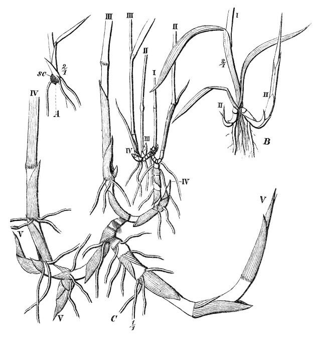
''Phragmites'' () is a genus of four species of large perennial reed grasses found in wetlands throughout temperate and tropical regions of the world. Taxonomy The World Checklist of Selected Plant Families, maintained by Kew Garden in London, accepts the following four species: * ''Phragmites australis'' ( Cav.) Trin. ex Steud. – cosmopolitan * ''Phragmites japonicus'' Steud. – Japan, Korea, Ryukyu Islands, Russian Far East * ''Phragmites karka'' ( Retz.) Trin. ex Steud. – tropical Africa, southern Asia, Australia, some Pacific Islands, invasive in New Zealand * ''Phragmites mauritianus'' Kunth – central + southern Africa, Madagascar, Mauritius The cosmopolitan common reed has the generally accepted botanical name ''Phragmites australis''. (Cav.) Trin. ex Steud. About 130 other synonyms have been proposed. Examples include ''Phragmites communis'' Trin., ''Arundo phragmites'' L., and ''Phragmites vulgaris'' (Lam.) Crép. (illegitimate name). Wildlife in reed beds ... [...More Info...] [...Related Items...] OR: [Wikipedia] [Google] [Baidu] |
Saaler Bodden
The Saaler Bodden forms the southwestern part of the Darss-Zingst Bodden Chain and lies east of the Fischland peninsula about 30 kilometres northeast of Rostock.''Die General Karte No. 1 - Schwerin-Rostock-Rügen'', 1:200,000 scale, Mairs Geographische Verlag/Falk Verlag, Ostfildern, 2008. Its average depth is around two metres, which restricts angling and the use of pleasure craft. It is a lagoon-like stretch of water known as a ''bodden'', which is typical of this part of the Baltic coastline. South of the Saaler Bodden is the town of Ribnitz-Damgarten, which is divided into two by the mouth of the 72 kilometre long Recknitz river. This southern part of the ''bodden'' is called the Lake Ribnitz (''Ribnitzer See''). Apart from the Recknitz near Damgarten, the other streams that empty into the Ribnitzer See are the ''Klosterbach'' near Ribnitz and ''Körkwitzer Bach'' and ''Fischergraben'' near Körkwitz. A stream called the ''Saaler Bach'' (in its lower reaches known as the ''Zi ... [...More Info...] [...Related Items...] OR: [Wikipedia] [Google] [Baidu] |
Barther Bodden
The Barther Bodden (German for ''Barth Lagoon'') is a ''bodden'' water between the Zingst peninsula and the mainland town of Barth. It is a brackish lagoon that is part of the Darss-Zingst Bodden Chain. Its largest inflow is the Barthe stream. Large parts of the Barther Bodden have a depth of less than 2 meters, so that shipping is very restricted. Today, it is limited almost exclusively to sport boats and pleasure cruisers. To the north is the Zingster Strom, the river-like section of the ''bodden'' south of Zingst. Here the bodden reaches its greatest depths of over six metres. To the northwest lie the well-known islands of Kirr and Barther Oie, both important breeding areas for gulls, terns, waterfowl and waders. These rise just a few centimetres above the water level of the bodden and are out of bounds to visitors. The Kirr is used as cattle pasture and, during the autumn migration Migration, migratory, or migrate may refer to: Human migration * Human migration, physi ... [...More Info...] [...Related Items...] OR: [Wikipedia] [Google] [Baidu] |
Zingster Strom
The Zingster Strom is a distinctive, river-like arm of the Barther Bodden lagoon, south of the Zingst peninsula on Germany's Baltic Sea coast. It lies between the island of Kirr and the Zingst and runs from east to west in a semi-circular arc, both ends being open to the south. It is less than one hundred metres wide in places and about three kilometres long. Unlike its rather shallow neighbouring waterbodies it is over six metres deep in places. At its northernmost point lies the village of Zingst Zingst ( Polabian ''Sgoni'') is the easternmost portion of the three-part Fischland-Darß-Zingst Peninsula, located in Mecklenburg-Vorpommern, Germany, between the cities of Rostock and Stralsund on the southern shore of the Baltic Sea. T ... with its harbour and a water fowl roosting area. Two smaller islands, Brunstwerder and Gänsebrink, are located in the Strom. The Strom used to have direct access to the Baltic via the ''Alte Stramminke'', a former inlet. {{Rügen-geo-s ... [...More Info...] [...Related Items...] OR: [Wikipedia] [Google] [Baidu] |


.png)


