|
Blanket Bay
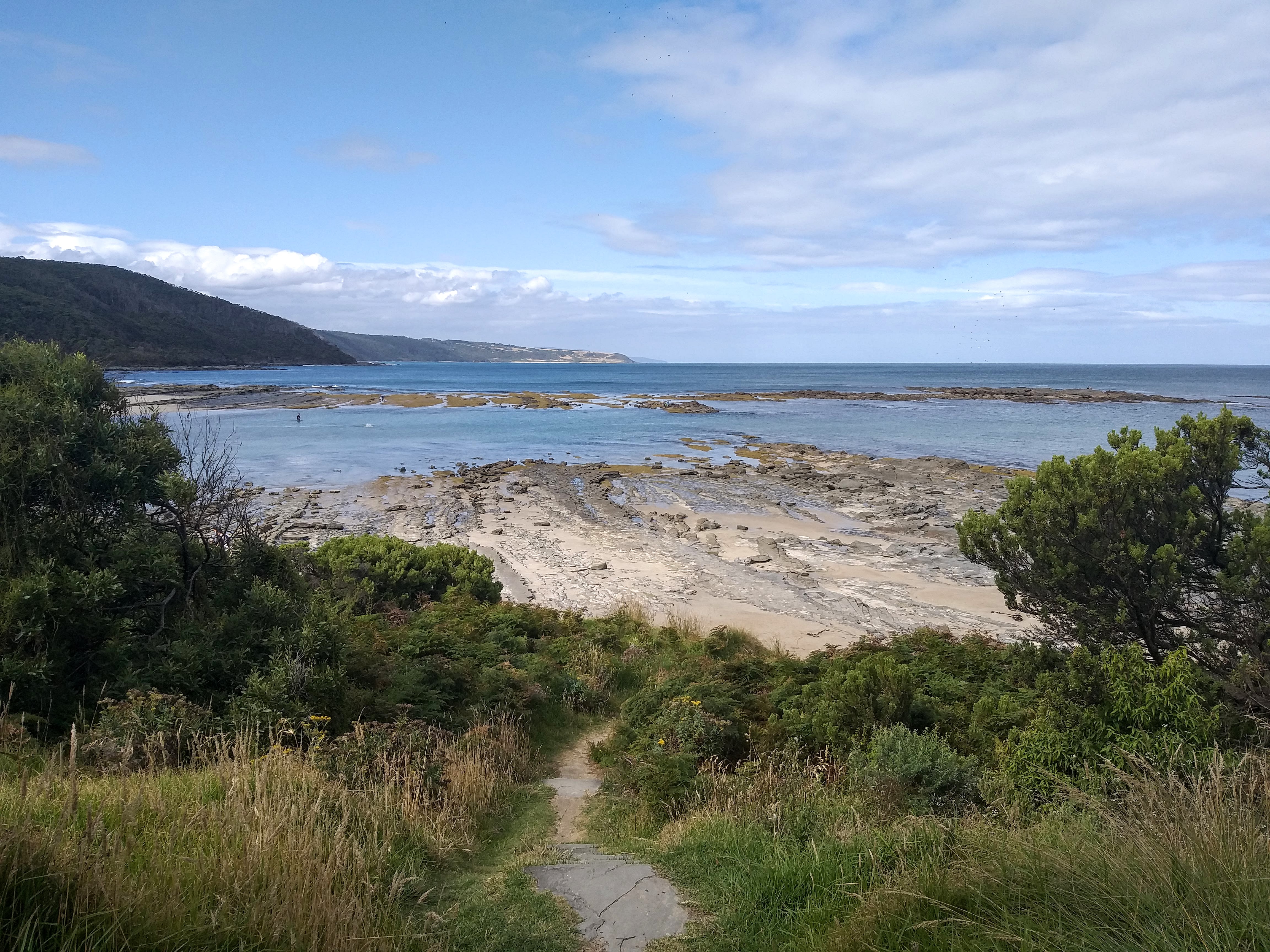
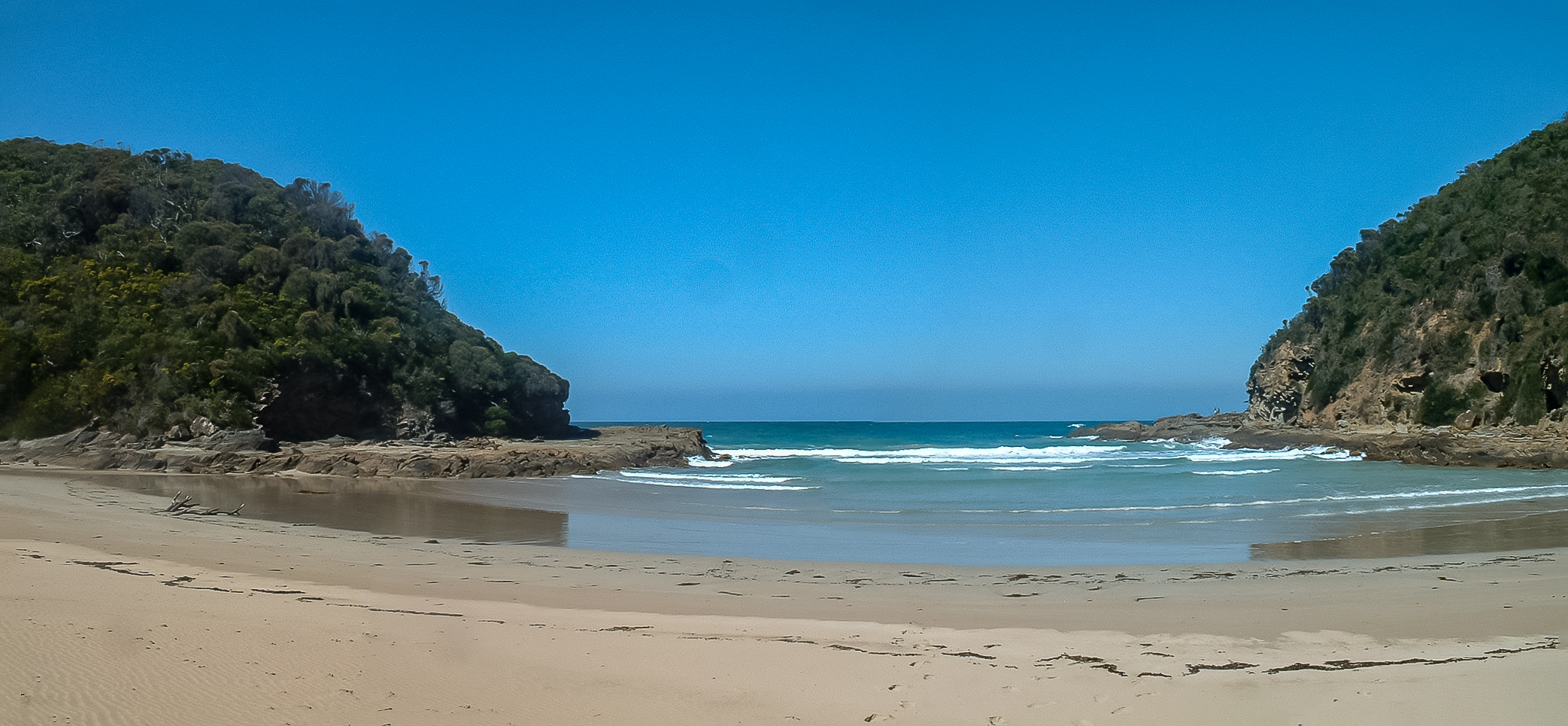
Blanket Bay is a small bay on the coast of Victoria, Australia. The foreshore is part of the Cape Otway National park. Location and features The bay's beach is protected by rock platforms and outer reefs. The bay is surrounded by steep sloping Manna Gum forests and rugged rock and reef coastline. The sandy beach being about 200 metres long. A creek flows into the beach The area adjacent to the bay is a camping ground and linked by hiking trails of the Great Ocean Walk. Remains of the 1880s jetty built for landing supplies can still be seen at low tide. History In 1846, a number of Gadubanud aboriginal people where massacred in a revenge expedition, after a member of an early colonial surveying party was killed. In 1877 a road gang was landed at the bay to construct a track to the Cape Otway lighthouse. Parker River was previously used to delivery provisions to the lighthouse but was deemed too treacherous. Blanket Bay was once a unloading point for stores arriving by sh ... [...More Info...] [...Related Items...] OR: [Wikipedia] [Google] [Baidu] |
Victoria (Australia)
Victoria is a state in southeastern Australia. It is the second-smallest state with a land area of , the second most populated state (after New South Wales) with a population of over 6.5 million, and the most densely populated state in Australia (28 per km2). Victoria is bordered by New South Wales to the north and South Australia to the west, and is bounded by the Bass Strait to the south (with the exception of a small land border with Tasmania located along Boundary Islet), the Great Australian Bight portion of the Southern Ocean to the southwest, and the Tasman Sea (a marginal sea of the South Pacific Ocean) to the southeast. The state encompasses a range of climates and geographical features from its temperate coastal and central regions to the Victorian Alps in the northeast and the semi-arid north-west. The majority of the Victorian population is concentrated in the central-south area surrounding Port Phillip Bay, and in particular within the metropolit ... [...More Info...] [...Related Items...] OR: [Wikipedia] [Google] [Baidu] |
Cape Otway
Cape Otway is a cape and a bounded locality of the Colac Otway Shire in southern Victoria, Australia on the Great Ocean Road; much of the area is enclosed in the Great Otway National Park. History Cape Otway was originally inhabited by the Gadubanud people; evidence of their campsites is contained in the middens throughout the region. The traditional Gadubanud name for the cape is ''Bangurac''. The cape was charted by the British when Lieutenant James Grant sailed through Bass Strait in in December 1800. Grant named it Cape Albany Otway after Captain William Albany Otway. This was later shortened to Cape Otway. The British started to colonise the region in 1837 when Joseph Gellibrand and George Hesse became lost in the Otways on an expedition. It was found that Hesse probably died of exposure, while Gellibrand was initially cared for by a local Aboriginal clan but later killed by members of another clan visiting from the Apollo Bay area. The ship ''Joanna'' was wrecked near t ... [...More Info...] [...Related Items...] OR: [Wikipedia] [Google] [Baidu] |
Blanket Bay
Blanket Bay is a small bay on the coast of Victoria, Australia. The foreshore is part of the Cape Otway National park. Location and features The bay's beach is protected by rock platforms and outer reefs. The bay is surrounded by steep sloping Manna Gum forests and rugged rock and reef coastline. The sandy beach being about 200 metres long. A creek flows into the beach The area adjacent to the bay is a camping ground and linked by hiking trails of the Great Ocean Walk. Remains of the 1880s jetty built for landing supplies can still be seen at low tide. History In 1846, a number of Gadubanud aboriginal people where massacred in a revenge expedition, after a member of an early colonial surveying party was killed. In 1877 a road gang was landed at the bay to construct a track to the Cape Otway lighthouse. Parker River was previously used to delivery provisions to the lighthouse but was deemed too treacherous. Blanket Bay was once a unloading point for stores arriving by sh ... [...More Info...] [...Related Items...] OR: [Wikipedia] [Google] [Baidu] |
Eucalyptus Viminalis
''Eucalyptus viminalis'', commonly known as the manna gum, white gum or ribbon gum, is a species of small to very tall tree that is Endemism, endemic to south-eastern Australia. It has smooth bark, sometimes with rough bark near the base, lance-shaped to curved adult leaves, flower buds in groups of three or seven, white flowers and cup-shaped or hemispherical fruit. Description ''Eucalyptus viminalis'' is a tree that typically grows to a height of , sometimes to , and forms a lignotuber. It has smooth, often powdery, white to pale brown bark that is shed in long ribbons, sometimes hanging on the upper branches, and sometimes with rough, fibrous bark on the lower trunk. Young plants and coppice regrowth have Sessility (botany), sessile, lance-shaped to curved or oblong leaves long, wide and arranged in opposite pairs. Adult leaves are arranged alternately, the same shade of green on both sides, lance-shaped to curved, long and wide, tapering to a Petiole (botany), petiole lon ... [...More Info...] [...Related Items...] OR: [Wikipedia] [Google] [Baidu] |
Great Ocean Walk
The Great Ocean Walk is a walking trail on Victoria's southwest coast in Australia, traversing several areas of historical and cultural significance. The track makes extensive usage of eco-friendly facilities; with Parks Victoria and tour guide operators attempting to raise environmental awareness. The trail meanders along high cliff tops and sandy beaches. Track The Great Ocean Walk is a walking track located 200 kilometres south-west of Melbourne. It stretches 104 kilometres from Apollo Bay to Glenample Homestead, located near The Twelve Apostles, Victoria. The walk passes through the Otway National Park, with Parks Victoria providing seven hike-in camp-sites spaced at intervals of 10 km to 15 km along the track. Guided tours are offered by several operators, with the walk estimated to take about eight days to complete. All walkers are required to register with Parks Victoria, and must book for use of camp-sites. The track hugs coastline which is not always ... [...More Info...] [...Related Items...] OR: [Wikipedia] [Google] [Baidu] |
Gadubanud
The Gadubanud (Katubanut), also known as the Pallidurgbarran, Yarro waetch or Cape Otway tribe ( Tindale), are an Aboriginal Australian people of the state of Victoria. Their territory encompasses the rainforest plateau and rugged coastline of Cape Otway. They were thought to have become extinct quickly following the onset of European colonisation, and little is known of them. However, some may have found refuge at the Wesleyan mission station at Birregurra, and later the Framlingham mission station, and some people still trace their descent from such a remnant. Today, by the principle of succession, the Gunditjmara are considered the traditional custodians of Gadubanud lands. Name "Gadubanud/Katubanut" appears to have meant "King Parrot language", and is considered to have been an exonym applied to the people by tribes to their west, perhaps with a pejorative colouring. Language Almost no linguistic material has been recorded for the Gadubanud language. A connection wi ... [...More Info...] [...Related Items...] OR: [Wikipedia] [Google] [Baidu] |
Parker River
The Parker River is a perennial river of the Corangamite catchment, located in the Otways region of the Australian state of Victoria. Location and features The Parker River rises in the Otway Ranges in southwest Victoria, near Parkers Spur and flows generally south through the Great Otway National Park before reaching its river mouth and emptying into Bass Strait, east of Cape Otway and the Cape Otway Lighthouse, near Point Franklin. From its highest point, the river descends over its course. Etymology In the Aboriginal Australian Gadubanud language The Kulinic languages form a branch of the Pama–Nyungan family in Victoria (Australia). They are: * Kulin (3+, e.g. Woiwurrung) *'' Kolakngat'' * Drual (2) Warrnambool is Kulinic and may be Drual, but is too poorly attested to be certain. ... the river is named ''Tjeerrang bundit'', meaning "twigs of spear tree". The river was given its current name by surveyor George Smythe after Amelia Parker, to whom he was late ... [...More Info...] [...Related Items...] OR: [Wikipedia] [Google] [Baidu] |
Geelong Advertiser
The ''Geelong Advertiser'' is a daily newspaper circulating in Geelong, Victoria, Australia, the Bellarine Peninsula, and surrounding areas. First published on 21 November 1840, the ''Geelong Advertiser'' is the oldest newspaper title in Victoria and the second-oldest in Australia. The newspaper is currently owned by News Corp. It was the Pacific Area Newspaper Publishers Association 2009 Newspaper of the Year (circulation 25,000 to 90,000). History The ''Geelong Advertiser'' was initially edited by James Harrison, a Scottish emigrant, who had arrived in Sydney in 1837 to set up a printing press for the English company Tegg & Co. Moving to Melbourne in 1839, he found employment with John Pascoe Fawkner, as a compositor, and later editor, of Fawkner's '' Port Phillip Patriot''. When Fawkner acquired a new press, Harrison offered him £30 for the original press, and started Geelong's first newspaper. The first edition of the ''Geelong Advertiser'', which originally appeared w ... [...More Info...] [...Related Items...] OR: [Wikipedia] [Google] [Baidu] |
Cape Otway Lighthouse
Cape Otway Lighthouse is a lighthouse on Cape Otway in southern Victoria, Australia. It is Victoria's oldest working lighthouse. During winter to spring, the lighthouse is a vantage point for land-based whale watching as migrating whales swim very close to shores. The government reserved the tip of the cape as the site for a lighthouse. Access to the site was difficult; it was eventually reached overland and construction of the Cape Otway Lightstation began in 1846 from stone quarried at the Parker River. The light was first lit in 1848 using a first order Fresnel lens; it was the second lighthouse completed on mainland Australia and it remains the oldest surviving lighthouse in mainland Australia. It was decommissioned in January 1994 after being the longest continuous operating light on the Australian mainland. At the keeper's cottages of Apollo Bay, accommodation is available in two double studios or in the head keeper's cottage that will sleep groups ranging from two to six ... [...More Info...] [...Related Items...] OR: [Wikipedia] [Google] [Baidu] |
The Advertiser (Adelaide)
''The Advertiser'' is a daily tabloid format newspaper based in the city of Adelaide, South Australia. First published as a broadsheet named ''The South Australian Advertiser'' on 12 July 1858,''The South Australian Advertiser'', published 1858–1889 National Library of Australia, digital newspaper library. it is currently a tabloid printed from Monday to Saturday. ''The Advertiser'' came under the ownership of in the 1950s, and the full ownership of in 1987. It is a publication of Advertiser Newspapers Pty Ltd (ADV), ... [...More Info...] [...Related Items...] OR: [Wikipedia] [Google] [Baidu] |
Williamstown, Victoria
Williamstown is a suburb in Melbourne, Victoria, Australia, south-west of Melbourne's Central Business District, located within the City of Hobsons Bay local government area. Williamstown recorded a population of 14,407 at the 2021 census. History Indigenous history Indigenous Australians occupied the area long before maritime activities shaped the modern historical development of Williamstown. The Yalukit-willam clan of the Kulin nation were the first people to call Hobsons Bay home. They roamed the thin coastal strip from Werribee to Williamstown/Hobsons Bay. The Yalukit-willam were one clan in a language group known as the Bunurong, which included six clans along the coast from the Werribee River, across the Mornington Peninsula, Western Port Bay to Wilsons Promontory. The Yalukit-willam referred to the Williamstown area as "koort-boork-boork", a term meaning "clump of she-oaks", literally "She-oak, She-oak, many." The head of the Yalikut-willam tribe at the time of the ... [...More Info...] [...Related Items...] OR: [Wikipedia] [Google] [Baidu] |
Apollo Bay
Apollo Bay is a coastal town in southwestern Victoria, Australia. It is situated on the eastern side of Cape Otway, along the edge of the Barham River and on the Great Ocean Road, in the Colac Otway Shire. The town had a population of 1,790 at the . Its population swells throughout the bustling holiday seasons and is considered a major tourist destination in Victoria. It is host to the annual Apollo Bay Seafood Festival, Winter Wild and the Great Ocean Road Running Festival. Off season, Apollo Bay is home to families and retirees alike. In winter to spring, southern right whales come to the area mainly to breed, to bear their calves, and to raise them in the warmer, calm waters of South Australia during their migration season. Less frequently, humpback whales can be seen off the coast. History Apollo Bay is part of the traditional lands of the Gadubanud, or King Parrot people, of the Cape Otway coast. By the early 19th century, the area was being frequented by sealers and wha ... [...More Info...] [...Related Items...] OR: [Wikipedia] [Google] [Baidu] |


.jpg)


