|
Bladen Lakes State Forest
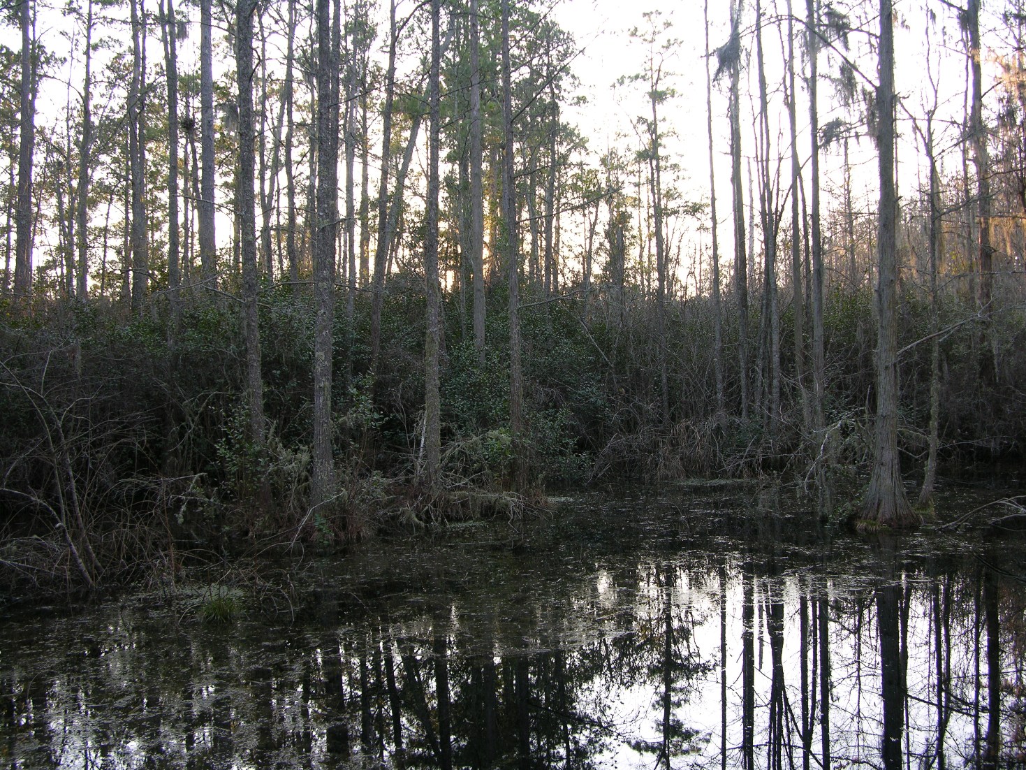
Bladen Lakes State Forest (BLSF) is a North Carolina state forest near Elizabethtown, North Carolina, USA. It is managed by the North Carolina Forest Service. Covering about , it is the largest state owned forest in North Carolina. Bladen Lakes comprises three parcels of land and has a total of eight compartments. Adjoining the forest are Turnbull Creek Educational State Forest, Jones Lake State Park and Singletary Lake State Park. The vast majority of the forest is in the Game Lands Program, which is administered by the North Carolina Wildlife Resources Commission. There are several safety zones where hunting is prohibited or restricted (archery zones, hunting areas for disabled persons and still hunting only areas). BLSF is a working forest, which means it is actively managed and creates its own income. Yearly revenues are generated through timber sales, pine straw sales and cooking of charcoal. It is an active partner in the Forest Stewardship Program contributing signific ... [...More Info...] [...Related Items...] OR: [Wikipedia] [Google] [Baidu] |
Bladen County, North Carolina
Bladen County () , from the North Carolina Collection's website at the . Retrieved 2013-02-08. is a located in the of . As of the [...More Info...] [...Related Items...] OR: [Wikipedia] [Google] [Baidu] |
Carolina Bay
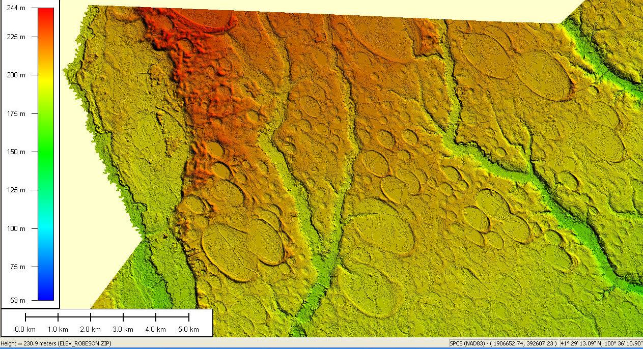
Carolina bays are elliptical to circular depressions concentrated along the Atlantic seaboard within coastal New York, New Jersey, Delaware, Maryland, Virginia, North Carolina, South Carolina, Georgia, and north Florida.Kaczorowski, R. T. (1977) ''The Carolina Bays: a Comparison with Modern Oriented Lakes'' Technical Report no. 13-CRD, Coastal research Division, Department of Geology, University of South Carolina, Columbia. In Maryland, they are called Maryland basins. Within the Delmarva Peninsula, they and other coastal ponds are also called Delmarva bays.Coleman, D. (2001''Delmarva Bays: Natural Enigmas.'' , Annapolis. Maryland. The name "Carolina bay" is sometimes attributed to the writings of the English explorer [...More Info...] [...Related Items...] OR: [Wikipedia] [Google] [Baidu] |
North Carolina Forest Service
The North Carolina Forest Service, formerly known as the North Carolina Division of Forest Resources is a North Carolina state government agency responsible for providing land management assistance to landowners. The agency's primary responsibility is wildland fire control on all state and privately owned land in North Carolina, United States. The Service was a Division of the N.C. Department of Environment and Natural Resources until July 2011 and is now part of the North Carolina Department of Agriculture and Consumer Services. History 1800s-1910s * 1891 - The North Carolina Geographic Survey is authorized by the state legislature. Joseph Austin Holmes, professor of Botany and Geology at N.C. State College is appointed State Geologist. This marked the first geological survey in the nation authorized by public funds. W.W. Ashe, a student at the University of North Carolina is appointed part-time Assistant in Forestry for the state Geologic Survey. Conducting timber investigat ... [...More Info...] [...Related Items...] OR: [Wikipedia] [Google] [Baidu] |
List Of North Carolina State Forests
The State of North Carolina has a group of twelve protected areas known as State Forests which are managed by the North Carolina Forest Service, an agency of the North Carolina Department of Agriculture and Consumer Services. The seven of the state forests are known as ''State Educational Forests'', and they are primarily used to educate the public about the forest environment, forestry and forest management. One state forest, DuPont, was designated as a ''State Recreational Forest'' in recognition of its high recreational value and use. Most of the state forests provide recreational facilities for hiking and picnicking. North Carolina state forests See also * List of U.S. National Forests * List of North Carolina state parks Notes References External links * website for the NC Forest Service. {{DEFAULTSORT:List Of North Carolina State Forests * North Carolina North Carolina () is a state in the Southeastern region of the United States. The state is the ... [...More Info...] [...Related Items...] OR: [Wikipedia] [Google] [Baidu] |
Elizabethtown, North Carolina
Elizabethtown is a town in Bladen County, North Carolina, United States. The population was 3,583 at the 2010 census. It is the county seat of Bladen County. History Some hold Elizabethtown is named for Elizabeth, the wife of George Carteret, while others believe it was named for the love interest of a local landowner. In the 1970s Elizabethtown more than doubled its size through annexation, increasing from about 1400 square feet to 3700 square feet in area. The Mt. Horeb Presbyterian Church and Cemetery and Trinity Methodist Church are listed on the National Register of Historic Places. Geography Elizabethtown is located at (34.625691, −78.612270). According to the United States Census Bureau, the town has a total area of , of which is land and , or 0.73%, is water. Browns Creek, a tributary to the Cape Fear River, drains the south side of Elizabethtown. Demographics 2020 census As of the 2020 United States Census, there were 3,296 people, 1,482 households, and ... [...More Info...] [...Related Items...] OR: [Wikipedia] [Google] [Baidu] |
Turnbull Creek Educational State Forest
Turnbull Creek Educational State Forest (TCESF) is a North Carolina State Forest in Elizabethtown, North Carolina. It is the only educational state forest located in North Carolina's coastal plain. Jones Lake State Park is adjacent to the forest, and both are surrounded by Bladen Lakes State Forest. The forest's primary purpose is public education of forestry Forestry is the science and craft of creating, managing, planting, using, conserving and repairing forests, woodlands, and associated resources for human and environmental benefits. Forestry is practiced in plantations and natural stands. ... practices. References External links * North Carolina state forests Protected areas of Bladen County, North Carolina Education in Bladen County, North Carolina Open-air museums in North Carolina {{BladenCountyNC-geo-stub ... [...More Info...] [...Related Items...] OR: [Wikipedia] [Google] [Baidu] |
Jones Lake State Park
Jones Lake State Park is a North Carolina state park in Bladen County, North Carolina in the United States near Elizabethtown. It covers , including the Carolina bay lakes of Jones Lake and Salters Lake. Jones Lake State Park is north of Elizabethtown on North Carolina Highway 242 in North Carolina's Coastal Plain region. The park offers year-round recreation, including fishing, swimming, boating, hiking, picnicking and environmental and historical education programs. Geology Jones Lake is one of a series of Carolina Bay lakes that stretch from New Jersey to Florida along the Atlantic Coastal Plain. Recent work by the U.S. Geological Survey has interpreted the Carolina Bays as relict thermokarst lakes that formed several thousands of years ago when the climate was colder, drier, and windier. Thermokarst lakes develop by thawing of frozen ground (permafrost) and by subsequent modification by wind and water. Thus, this interpretation suggests that permafrost once extended as ... [...More Info...] [...Related Items...] OR: [Wikipedia] [Google] [Baidu] |
Singletary Lake State Park
Singletary Lake State Park is a North Carolina state park in Bladen County, North Carolina in the United States. Located near Elizabethtown, it covers , including Singletary Lake, one of the largest Carolina bays. Singletary Lake State Park is southeast of Elizabethtown on North Carolina Highway 53 in North Carolina's Coastal Plain region. It serves primarily as a group camp but is open on a limited basis for year-round recreation, including hiking, fishing and observing nature. Geology Singletary Lake is one of a series of Carolina bay lakes that stretch from New Jersey to Florida along the Atlantic Coastal Plain. Recent work by the U.S. Geological Survey has interpreted the Carolina Bays as relict thermokarst lakes that formed several thousands of years ago when the climate was colder, drier, and windier.Swezey, C.S. (2020) "Quaternary eolian dunes and sand sheets in inland locations of the Atlantic Coastal Plain Province", in Inland Dunes of North America (N. Lancaster and ... [...More Info...] [...Related Items...] OR: [Wikipedia] [Google] [Baidu] |
North Carolina Wildlife Resources Commission
The North Carolina Wildlife Resources Commission is a state government agency created by the General Assembly in 1947 to conserve and sustain North Carolina's fish and wildlife resources through research, scientific management, wise use, and public input. The Commission is the regulatory agency responsible for the enforcement of N.C. fishing, hunting, trapping and boating laws. Licenses and regulations Hunting, fishing, trapping and boating The agency issues licenses and permits for hunting, trapping, and fishing, as well as titles and registrations for boats 14 feet or longer and personal watercraft (jet skis) in the state. It employs law enforcement officers (commonly called game wardens) who enforce the rules and regulations associated with these activities. The agency also constructs public fishing areas (PFAs) (https://www.ncwildlife.org/Fishing/Where-to-Fish) and boating access areas (BAAs) (https://www.ncwildlife.org/Boating/Where-to-Boat) that provide parking spaces for ... [...More Info...] [...Related Items...] OR: [Wikipedia] [Google] [Baidu] |
Charcoal
Charcoal is a lightweight black carbon residue produced by strongly heating wood (or other animal and plant materials) in minimal oxygen to remove all water and volatile constituents. In the traditional version of this pyrolysis process, called charcoal burning, often by forming a charcoal kiln, the heat is supplied by burning part of the starting material itself, with a limited supply of oxygen. The material can also be heated in a closed retort. Modern "charcoal" briquettes used for outdoor cooking may contain many other additives, e.g. coal. This process happens naturally when combustion is incomplete, and is sometimes used in radiocarbon dating. It also happens inadvertently while burning wood, as in a fireplace or wood stove. The visible flame in these is due to combustion of the volatile gases exuded as the wood turns into charcoal. The soot and smoke commonly given off by wood fires result from incomplete combustion of those volatiles. Charcoal burns at a highe ... [...More Info...] [...Related Items...] OR: [Wikipedia] [Google] [Baidu] |
Carolina Bays
Carolina bays are elliptical to circular depressions concentrated along the Atlantic seaboard within coastal New York, New Jersey, Delaware, Maryland, Virginia, North Carolina, South Carolina, Georgia, and north Florida.Kaczorowski, R. T. (1977) ''The Carolina Bays: a Comparison with Modern Oriented Lakes'' Technical Report no. 13-CRD, Coastal research Division, Department of Geology, University of South Carolina, Columbia. In Maryland, they are called Maryland basins. Within the Delmarva Peninsula, they and other coastal ponds are also called Delmarva bays.Coleman, D. (2001''Delmarva Bays: Natural Enigmas.'' , Annapolis. Maryland. The name "Carolina bay" is sometimes attributed to the writings of the English explorer [...More Info...] [...Related Items...] OR: [Wikipedia] [Google] [Baidu] |
Pocosin
A pocosin is a type of palustrine wetland with deep, acidic, sandy, peat soils. Groundwater saturates the soil except during brief seasonal dry spells and during prolonged droughts. Pocosin soils are nutrient-deficient (oligotrophic), especially in phosphorus.Snyder, S. A. (1993)Pocosin. In: Fire Effects Information System, (Online) Fire Sciences Laboratory, United States Forest Service. Retrieved 2011-02-16. Pocosins occur in the southern portions of the Atlantic coastal plain of North America, spanning from southeastern Virginia, through North Carolina, and into South Carolina. The majority of pocosins are found in North Carolina. The Alligator River National Wildlife Refuge was created in 1984 to help preserve pocosin wetlands. Characteristics Pocosins occupy poorly drained higher ground between streams and floodplains. Seeps cause the inundation. There are often perched water tables underlying pocosins. Shrub vegetation is common in a pocosin ecosystem. Pocosins are someti ... [...More Info...] [...Related Items...] OR: [Wikipedia] [Google] [Baidu] |


