|
Blackburn Hundred
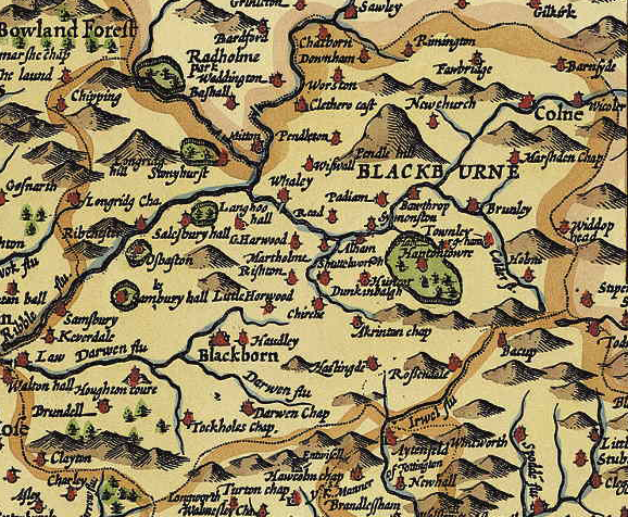
Blackburn Hundred (also known as Blackburnshire) is a historic sub-division of the county of Lancashire, in northern England. Its chief town was Blackburn, in the southwest of the hundred. It covered an area similar to modern East Lancashire, including the current districts of Ribble Valley (excluding the part north of the River Ribble and east of the Hodder, which was then in Yorkshire), Pendle (excluding West Craven, also in Yorkshire), Burnley, Rossendale, Hyndburn, Blackburn with Darwen, and South Ribble (east from Walton-le-dale and Lostock Hall). Much of the area is hilly, bordering on the Pennines, with Pendle Hill in the midst of it, and was historically sparsely populated. It included several important royal forests. In the 18th century several towns in the area became industrialized and densely populated, including Blackburn itself, and Burnley. Early history The shire probably originated as a county of the Kingdom of Northumbria, but was much fought over. In the D ... [...More Info...] [...Related Items...] OR: [Wikipedia] [Google] [Baidu] |
Blackburn
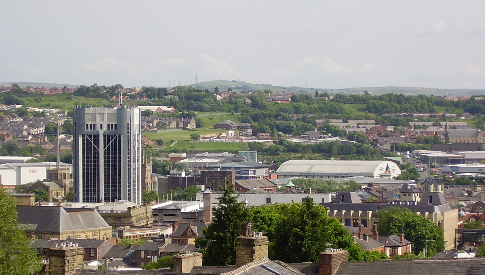
Blackburn () is an industrial town and the administrative centre of the Blackburn with Darwen borough in Lancashire, England. The town is north of the West Pennine Moors on the southern edge of the Ribble Valley, east of Preston and north-northwest of Manchester. Blackburn is the core centre of the wider unitary authority area along with the town of Darwen. It is one of the largest districts in Lancashire, with commuter links to neighbouring cities of Manchester, Salford, Preston, Lancaster, Liverpool, Bradford and Leeds. At the 2011 census, Blackburn had a population of 117,963, whilst the wider borough of Blackburn with Darwen had a population of 150,030. Blackburn had a population of 117,963 in 2011, with 30.8% being people of ethnic backgrounds other than white British. A former mill town, textiles have been produced in Blackburn since the middle of the 13th century, when wool was woven in people's houses in the domestic system. Flemish weavers who settled in t ... [...More Info...] [...Related Items...] OR: [Wikipedia] [Google] [Baidu] |
Borough Of Burnley
The Borough of Burnley () is a local government district with the borough status in Lancashire, England. It has an area of and a population of (), and is named after its largest town, Burnley. Other notable settlements include Padiham, Hapton, Worsthorne, Briercliffe and Cliviger. The borough is bounded by Hyndburn, Ribble Valley, Pendle, Rossendale – all in Lancashire – and the borough of Calderdale in West Yorkshire. It is governed by Burnley Borough Council, which is currently under no overall control following the 2019 local elections. History The district was formed on 1 April 1974, when the former county borough of Burnley merged with the urban district of Padiham and part of Burnley Rural District. The council is based at Burnley Town Hall. 1976 saw all of the district's councillors stand for re-election as all the borough's wards were abolished and replaced with 22 new ones with a total of 54 seats. Although the majority of the new wards elected ... [...More Info...] [...Related Items...] OR: [Wikipedia] [Google] [Baidu] |
Domesday Book
Domesday Book () – the Middle English spelling of "Doomsday Book" – is a manuscript record of the "Great Survey" of much of England and parts of Wales completed in 1086 by order of King William I, known as William the Conqueror. The manuscript was originally known by the Latin name ''Liber de Wintonia'', meaning "Book of Winchester", where it was originally kept in the royal treasury. The '' Anglo-Saxon Chronicle'' states that in 1085 the king sent his agents to survey every shire in England, to list his holdings and dues owed to him. Written in Medieval Latin, it was highly abbreviated and included some vernacular native terms without Latin equivalents. The survey's main purpose was to record the annual value of every piece of landed property to its lord, and the resources in land, manpower, and livestock from which the value derived. The name "Domesday Book" came into use in the 12th century. Richard FitzNeal wrote in the ''Dialogus de Scaccario'' ( 1179) that the book ... [...More Info...] [...Related Items...] OR: [Wikipedia] [Google] [Baidu] |
Anglo-Saxon Chronicle
The ''Anglo-Saxon Chronicle'' is a collection of annals in Old English, chronicling the history of the Anglo-Saxons. The original manuscript of the ''Chronicle'' was created late in the 9th century, probably in Wessex, during the reign of Alfred the Great (r. 871–899). Multiple copies were made of that one original and then distributed to monasteries across England, where they were independently updated. In one case, the ''Chronicle'' was still being actively updated in 1154. Nine manuscripts survive in whole or in part, though not all are of equal historical value and none of them is the original version. The oldest seems to have been started towards the end of Alfred's reign, while the most recent was written at Peterborough Abbey after a fire at that monastery in 1116. Almost all of the material in the ''Chronicle'' is in the form of annals, by year; the earliest are dated at 60 BC (the annals' date for Caesar's invasions of Britain), and historical material follows up t ... [...More Info...] [...Related Items...] OR: [Wikipedia] [Google] [Baidu] |
Kingdom Of Northumbria
la, Regnum Northanhymbrorum , conventional_long_name = Kingdom of Northumbria , common_name = Northumbria , status = State , status_text = Unified Anglian kingdom (before 876)North: Anglian kingdom (after 876)South: Danish kingdom (876–914)South: Norwegian kingdom (after 914) , life_span = 654–954 , flag_type = Oswald's Stripes, the provincial flag of Northumbria and red was previously purple , image_coat = , image_map = Map_of_the_Kingdom_of_Northumbria_around_700_AD.svg , image_map_size = 250 , image_map_caption = Northumbria around 700 AD , image_map2 = , image_map2_size = , image_map2_caption = , government_type = Monarchy , year_start = 653 , year_end = 954 , event_end = South is annexed by Kingdom of England , event1 = South is annexed by the Danelaw , date_even ... [...More Info...] [...Related Items...] OR: [Wikipedia] [Google] [Baidu] |
Shire
Shire is a traditional term for an administrative division of land in Great Britain and some other English-speaking countries such as Australia and New Zealand. It is generally synonymous with county. It was first used in Wessex from the beginning of Anglo-Saxon settlement, and spread to most of the rest of England in the tenth century. In some rural parts of Australia, a shire is a local government area; however, in Australia it is not synonymous with a "county", which is a lands administrative division. Etymology The word ''shire'' derives from the Old English , from the Proto-Germanic ( goh, sćira), denoting an 'official charge' a 'district under a governor', and a 'care'. In the UK, ''shire'' became synonymous with ''county'', an administrative term introduced to England through the Norman Conquest in the later part of the eleventh century. In contemporary British usage, the word ''counties'' also refers to shires, mainly in places such as Shire Hall. In regions with ... [...More Info...] [...Related Items...] OR: [Wikipedia] [Google] [Baidu] |
Royal Forests
A royal forest, occasionally known as a kingswood (), is an area of land with different definitions in England, Wales, Scotland and Ireland. The term ''forest'' in the ordinary modern understanding refers to an area of wooded land; however, the original medieval sense was closer to the modern idea of a "preserve" – i.e. land legally set aside for specific purposes such as royal hunting – with less emphasis on its composition. There are also differing and contextual interpretations in Continental Europe derived from the Carolingian and Merovingian legal systems. In Anglo-Saxon England, though the kings were great huntsmen, they never set aside areas declared to be "outside" (Latin ''foris'') the law of the land.H. R. Loyn, ''Anglo-Saxon England and the Norman Conquest'' 2nd ed. 1991:378-82. Historians find no evidence of the Anglo-Saxon monarchs (c. 500 to 1066) creating forests. However, under the Norman kings (after 1066), by royal prerogative forest law was widely applied. ... [...More Info...] [...Related Items...] OR: [Wikipedia] [Google] [Baidu] |
Pendle Hill
Pendle Hill is in the east of Lancashire, England, near the towns of Burnley, Nelson, Colne, Brierfield, Clitheroe and Padiham. Its summit is above mean sea level. It gives its name to the Borough of Pendle. It is an isolated hill in the Pennines, separated from the South Pennines to the east, the Bowland Fells to the northwest, and the West Pennine Moors to the south. It is included in a detached part of the Forest of Bowland Area of Outstanding Natural Beauty. History The name "Pendle Hill" combines the words for hill from three different languages (as does Bredon Hill in Worcestershire). In the 13th century it was called ''Pennul'' or ''Penhul'', apparently from the Cumbric ''pen'' and Old English ''hyll'', both meaning "hill". The modern English "hill" was appended later, after the original meaning of Pendle had become opaque. A Bronze Age burial site has been discovered at the summit of the hill. There is an ancient local legend that the Devil once jumped from Hameld ... [...More Info...] [...Related Items...] OR: [Wikipedia] [Google] [Baidu] |
Pennines
The Pennines (), also known as the Pennine Chain or Pennine Hills, are a range of uplands running between three regions of Northern England: North West England on the west, North East England and Yorkshire and the Humber on the east. Commonly described as the "backbone of England", the range stretches northwards from the Peak District at the southern end, through the South Pennines, Yorkshire Dales and North Pennines to the Tyne Gap, which separates the range from the Border Moors and Cheviot Hills across the Anglo-Scottish border, although some definitions include them. South of the Aire Gap is a western spur into east Lancashire, comprising the Rossendale Fells, West Pennine Moors and the Bowland Fells in North Lancashire. The Howgill Fells and Orton Fells in Cumbria are sometimes considered to be Pennine spurs to the west of the range. The Pennines are an important water catchment area with numerous reservoirs in the head streams of the river valleys. The North Pennin ... [...More Info...] [...Related Items...] OR: [Wikipedia] [Google] [Baidu] |
Lostock Hall
Lostock Hall is a suburban village within the South Ribble borough of Lancashire, England. It is located on the south side of the River Ribble, some south of Preston and north of Leyland. It is bordered on its southeastern side by the interchange for the M6, M61 and M65 motorways. At the time of the United Kingdom Census 2001, the central Lostock Hall area had a population of 3,948,Neighbourhood Statistics - Lostock Hall (Ward) URL accessed 17 November 2007. falling to 3,762 at the 2011 Census. Lostock Hall traces its origins to James de Lostock who in 1212 built Lostock's Hall in the then rural area of Cuerden Green in the |
South Ribble
South Ribble is a borough in the county of Lancashire, England. Its council is based in Leyland. The population, at the 2011 Census, was 109,057. Notable towns and villages include Walton le Dale, Bamber Bridge, Leyland and Penwortham. It is wedged geographically between the towns of Blackburn, Lytham St Annes and Chorley and the city of Preston. Overview The district was formed on 1 April 1974 under the Local Government Act 1972, from Leyland and Walton-le-Dale urban districts, along with part of Preston Rural District. The Parliamentary Constituency of South Ribble includes the West Lancashire communities of Rufford, Tarleton, Hesketh Bank and Meols. Other notable population areas within South Ribble are Penwortham, Longton, Hutton, Walton-le-Dale, Bamber Bridge, Lostock Hall, Moss Side, and part of Buckshaw Village. Council In the 2007 local elections, South Ribble Conservative party won a landslide victory, gaining 24 seats to hold 44 of 55 on the borough co ... [...More Info...] [...Related Items...] OR: [Wikipedia] [Google] [Baidu] |


