|
Black Lake (Montenegro)
Black Lake ( Montenegrin: ''Crno jezero'') is a lake in the Municipality of Žabljak in northern Montenegro.Rellie, Annalisa, & Rudolf Abraham. ''Montenegro''. Bucks, UK: Bradt Travel Guides, p. 256. It is a glacial lake, located on Mount Durmitor, at an elevation of 1,416 m. It is 3 km from the town of Žabljak. Geography Black Lake lies at the foot of Međed Peak and has an area of 0.515 square km. The lake consists of two smaller lakes: Big Lake (''Veliko jezero'') and Little Lake (''Malo jezero''). The lakes are connected by a narrow strait that dries up during the summer, creating two separate bodies of water. * Big Lake has an area of 0.338 square km, maximum depth of 24.5 m, maximum length of 855 m, and maximum width of 615 m. * Little Lake has an area of 0.177 square km, maximum depth of 49.1 m, maximum length of 605 m, and maximum width around 400 m. The maximum length of Black Lake is 1,155 m. Little Lake actually has a greater volume because it is deeper. Black La ... [...More Info...] [...Related Items...] OR: [Wikipedia] [Google] [Baidu] |
Žabljak
Žabljak ( Serbian / Montenegrin: Жабљак, ) is a small town in northern Montenegro. It has a population of 1,723. Žabljak is the seat of Žabljak Municipality (2011 population: 3,569). The town is in the centre of the Durmitor mountain region and with an altitude of 1,456 metres, it is the highest situated Balkan town. History The first Slav name of the place was ''Varezina voda'' (Варезина вода) possibly because of the strong source of drinkable water nearby, making a settlement possible. Later, the town was renamed ''Hanovi'' because it was where caravans rested. The modern name dates from 1870, when in a single day the building of a school, church and captain's home began. However, almost all the original buildings were destroyed during the Balkan Wars. All that has remained is the old church of Sv. Preobraženje (Holy Transfiguration), built in 1862 as a monument to a Montenegrin victory in the battle against the Ottoman Empire. After Žabljak was establi ... [...More Info...] [...Related Items...] OR: [Wikipedia] [Google] [Baidu] |
Montenegro
) , image_map = Europe-Montenegro.svg , map_caption = , image_map2 = , capital = Podgorica , coordinates = , largest_city = capital , official_languages = Montenegrin , languages2_type = Languages in official use , languages2 = , ethnic_groups = , ethnic_groups_year = 2011 , religion = , religion_year = 2011 , demonym = Montenegrin , government_type = Unitary parliamentary republic , leader_title1 = President , leader_name1 = Milo Đukanović , leader_title2 = Prime Minister , leader_name2 = Dritan Abazović (acting) , leader_title3 = Speaker , leader_name3 = Danijela Đurović , legislature = Skupština , sovereignty_type = Establishment history , established_event1 = Principality of Duklja , established_date1 ... [...More Info...] [...Related Items...] OR: [Wikipedia] [Google] [Baidu] |
Glacial Lake
A glacial lake is a body of water with origins from glacier activity. They are formed when a glacier erodes the land and then melts, filling the depression created by the glacier. Formation Near the end of the last glacial period, roughly 10,000 years ago, glaciers began to retreat. A retreating glacier often left behind large deposits of ice in hollows between drumlins or hills. As the ice age ended, these melted to create lakes. This is apparent in the Lake District in Northwestern England where post-glacial sediments are normally between 4 and 6 metres deep. These lakes are often surrounded by drumlins, along with other evidence of the glacier such as moraines, eskers and erosional features such as striations and chatter marks. These lakes are clearly visible in aerial photos of landforms in regions that were glaciated during the last ice age. The formation and characteristics of glacial lakes vary between location and can be classified into glacial erosion lake, ice-bloc ... [...More Info...] [...Related Items...] OR: [Wikipedia] [Google] [Baidu] |
Montenegrin Language
Montenegrin ( ; cnr, label=none, / ) is a normative variety of the Serbo-Croatian language mainly used by Montenegrins and is the official language of Montenegro. Montenegrin is based on the most widespread dialect of Serbo-Croatian, Shtokavian, more specifically on Eastern Herzegovinian, which is also the basis of Standard Croatian, Serbian, and Bosnian. Montenegro's language has historically and traditionally been called either Serbian or Montenegrin. The idea of a standardized Montenegrin standard language separate from Serbian appeared in the 1990s during the breakup of Yugoslavia, through proponents of Montenegrin independence from the State Union of Serbia and Montenegro. Montenegrin became the official language of Montenegro with the ratification of a new constitution on 22 October 2007. Language standardization In January 2008, the government of Montenegro formed the Board (Council) for Standardization of the Montenegrin Language, which aims to standardize the ... [...More Info...] [...Related Items...] OR: [Wikipedia] [Google] [Baidu] |
Lake
A lake is an area filled with water, localized in a basin, surrounded by land, and distinct from any river or other outlet that serves to feed or drain the lake. Lakes lie on land and are not part of the ocean, although, like the much larger oceans, they do form part of the Earth's water cycle. Lakes are distinct from lagoons, which are generally coastal parts of the ocean. Lakes are typically larger and deeper than ponds, which also lie on land, though there are no official or scientific definitions. Lakes can be contrasted with rivers or streams, which usually flow in a channel on land. Most lakes are fed and drained by rivers and streams. Natural lakes are generally found in mountainous areas, rift zones, and areas with ongoing glaciation. Other lakes are found in endorheic basins or along the courses of mature rivers, where a river channel has widened into a basin. Some parts of the world have many lakes formed by the chaotic drainage patterns left over from the la ... [...More Info...] [...Related Items...] OR: [Wikipedia] [Google] [Baidu] |
Durmitor
Durmitor ( Montenegrin: Дурмитор, or ) is a massif located in northwestern Montenegro. It is part of the Dinaric Alps. Its highest peak, Bobotov Kuk, reaches a height of . The massif is limited by the Tara River Canyon on the north, the Piva River Canyon on the west, and by the Komarnica River Canyon on the south. To the east, the Durmitor opens to a high plateau, called ''Jezerska površ'' (Plateau of Lakes). The Sinjavina mountain is located to the east of the ''Jezerska površ'' plateau. The Durmitor is for the most part located in the Žabljak municipality. The massif gives its name to the national park that comprises it. Durmitor National Park was founded in 1952, and designated as a World Heritage Site in 1980. Peaks The massif has 48 peaks above . Highest peaks are: * Bobotov kuk * Bezimeni vrh (Nameless Peak) * Šljeme * Istočni vrh Šljemena (East Peak of Sljeme) * Soa / Đevojka * Milošev tok * Bandijerna * Rbatina * Lučin vrh * Prutaš * Minin ... [...More Info...] [...Related Items...] OR: [Wikipedia] [Google] [Baidu] |
Hiking
Hiking is a long, vigorous walk, usually on trails or footpaths in the countryside. Walking for pleasure developed in Europe during the eighteenth century.AMATO, JOSEPH A. "Mind over Foot: Romantic Walking and Rambling." In ''On Foot: A History of Walking'', 101-24. NYU Press, 2004. Accessed March 1, 2021. http://www.jstor.org/stable/j.ctt9qg056.7. Religious pilgrimages have existed much longer but they involve walking long distances for a spiritual purpose associated with specific religions. "Hiking" is the preferred term in Canada and the United States; the term "walking" is used in these regions for shorter, particularly urban walks. In the United Kingdom and the Republic of Ireland, the word "walking" describes all forms of walking, whether it is a walk in the park or backpacking in the Alps. The word hiking is also often used in the UK, along with rambling , hillwalking, and fell walking (a term mostly used for hillwalking in northern England). The term bushwalking is end ... [...More Info...] [...Related Items...] OR: [Wikipedia] [Google] [Baidu] |
Montenegrin Cuisine
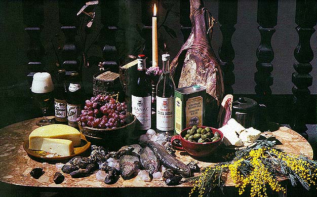
Montenegrin cuisine is a result of Montenegro's geographic position and its long history and tradition. Review The first major influences to Montenegrin cuisine came from the Levant and Turkey, largely via Serbia: sarma, musaka, pilav, pita, gibanica, burek, ćevapi, kebab, đuveč, and Turkish sweets such as baklava and tulumba. Hungarian cuisine influences stews and sataraš. Central European cuisine is evident in the prevalence of crêpes, doughnuts, jams, many types of biscuits and cakes, and various kinds of breads. Montenegrin cuisine also varies geographically; the cuisine in the coastal area differs from that of the northern highland region. The coastal area is traditionally a representative of Mediterranean cuisine, with seafood being a common dish. The traditional dishes of Montenegro's Adriatic coast, unlike its heartland, have a distinctively Italian influence as well. [...More Info...] [...Related Items...] OR: [Wikipedia] [Google] [Baidu] |
Lakes Of Montenegro
The following is a list of lakes in Montenegro. Montenegro Travel * Lake Bileća (Bilećko jezero) - Only partly in Montenegro, with most of the lake in . * (Biogradsko jezero) * Black Lake (Crno jezero) - Glacial lake near |


