|
Berlin-Pankow
Pankow () is a locality (''Ortsteil'') of Berlin in the district (''Bezirk'') of Pankow. Until 2001 it was an autonomous district with the localities of Karow, Niederschönhausen, Wilhelmsruh, Rosenthal, Blankenfelde, Buch and Französisch Buchholz. History The village of Pankow is named after the small Panke river, a tributary of the Spree. The settlement was first mentioned in a 1311 deed by the Margraves of Brandenburg, though the " Four Evangelists" fieldstone church had already been erected about 1230. In 1691 Elector Frederick III acquired Schönhausen Palace, in neighboring Niederschönhausen, from the heirs of General Joachim Ernst von Grumbkow, which promoted the development of the Pankow village. As Pankow grew, due to industrialization, in the 19th century, it became a suburb – and popular day-trip destination – of Berlin. It was finally incorporated into the city by the Greater Berlin Act of 1920. In the East German period, from 1949 to 199 ... [...More Info...] [...Related Items...] OR: [Wikipedia] [Google] [Baidu] |
Berlin-Pankow (electoral District)
Berlin-Pankow is an electoral constituency (German: ''Wahlkreis'') represented in the Bundestag. It elects one member via first-past-the-post voting. Under the current constituency numbering system, it is designated as constituency 76. It is located in northern Berlin, comprising the Pankow borough. Berlin-Pankow was created for the 2002 German federal election, 2002 federal election. Since 2021, it has been represented by Stefan Gelbhaar of the Alliance 90/The Greens. Geography Berlin-Pankow is located in northern Berlin Berlin ( , ) is the capital and List of cities in Germany by population, largest city of Germany by both area and population. Its 3.7 million inhabitants make it the European Union's List of cities in the European Union by population within ci .... As of the 2021 federal election, it comprises the Pankow borough excluding the area of Prenzlauer Berg east of Prenzlauer Allee. History Berlin-Pankow was created in 2002 and contained parts of the abolished ... [...More Info...] [...Related Items...] OR: [Wikipedia] [Google] [Baidu] |
Berlin-Pankow Station
Berlin-Pankow is a station on the Berlin–Szczecin railway, situated in Berlin's Pankow district. It is served by the S-Bahn lines , and and is the northern terminus of the U-Bahn line . Overview Pankow is a station on Berlin S-Bahn and Berlin U-Bahn networks. The station is served by the following services: Berlin S-Bahn The station opened on 15 October 1880, south of the former Pankow village. It soon was named ''Pankow-Schönhausen'' after the neighbouring Schönhausen Palace. The entrance building was rebuilt in 1911 with the establishment of the suburban railway toward Bernau, which would become the first line of the Berlin S-Bahn on 8 August 1924. The station was renamed ''Berlin-Pankow'' in 1954. With the construction of the marshalling yard Pankow the passenger station was likewise converted received in the course of the work a platform "after kind of the citizens of Berlin light rail stations". Until 1916, the suburban traffic was separated from the long-dista ... [...More Info...] [...Related Items...] OR: [Wikipedia] [Google] [Baidu] |
Pankow
Pankow () is the most populous and the second-largest borough by area of Berlin. In Berlin's 2001 administrative reform, it was merged with the former boroughs of Prenzlauer Berg and Weißensee; the resulting borough retained the name Pankow. Pankow was sometimes claimed by the Western Allies (United States, United Kingdom, and France) to be the capital of the German Democratic Republic (East Germany), while the German Democratic Republic itself considered East Berlin to be its capital. Overview The borough, named after the Panke river, covers the northeast of the city region, including the inner city locality of Prenzlauer Berg. It borders Mitte and Reinickendorf in the west, Friedrichshain-Kreuzberg in the south, and Lichtenberg in the east. Pankow is Berlin's largest borough by population and the second largest by area (after Treptow-Köpenick). Between 1945 and 1960, Schönhausen Palace and the nearby Majakowskiring street in the Niederschönhausen locality of Pankow was th ... [...More Info...] [...Related Items...] OR: [Wikipedia] [Google] [Baidu] |
Berlin-Pankow-Heinersdorf Station
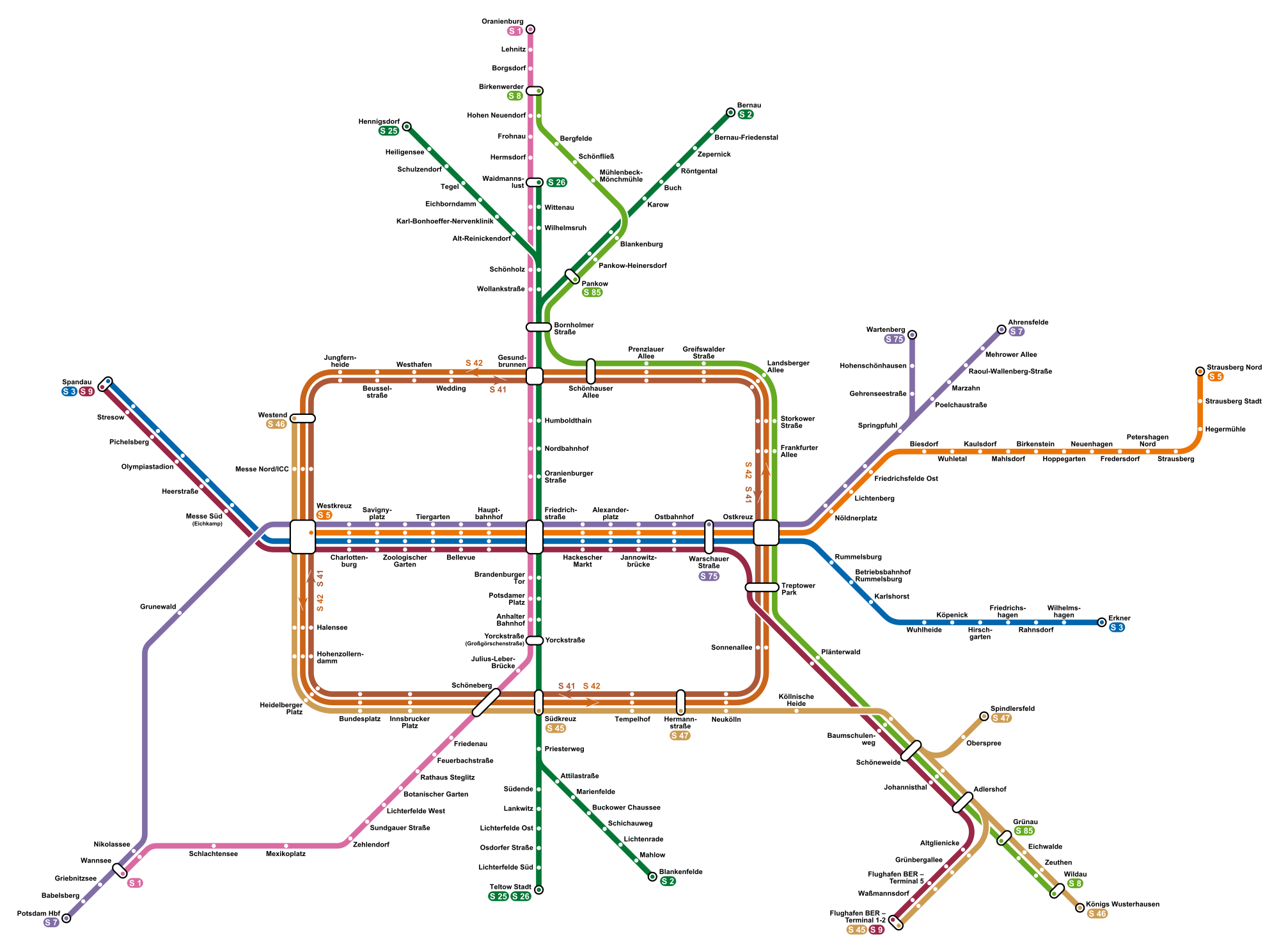
Pankow-Heinersdorf is a railway station in the Pankow district of Berlin. It is served by the S-Bahn lines and . It is also served by BVG tram route 50. It serves the Heinersdorf region to the north of the centre of Pankow Pankow () is the most populous and the second-largest borough by area of Berlin. In Berlin's 2001 administrative reform, it was merged with the former boroughs of Prenzlauer Berg and Weißensee; the resulting borough retained the name Pankow. .... History Pankow-Heinersdorf station was opened on 1 October 1893. The station was one of the first S-Bahn stations, as S-Bahn services started operated upon the electrification of the line in 1924. On 25 April 1945, the S-Bahn ceased operation as a result of the Soviet invasion of Berlin. Services resumed from Pankow-Heinersdorf on 11 June 1945. Services This station is served by the following services: * Berlin S-Bahn services ''Bernau – Karow – Pankow – Gesundbrunnen – Friedrichstraße – Pot ... [...More Info...] [...Related Items...] OR: [Wikipedia] [Google] [Baidu] |
Boroughs Of Berlin
Berlin is both a city and one of Germany’s federated states (city state). Since the 2001 administrative reform, it has been made up of twelve districts (german: Bezirke, ), each with its own administrative body. However, unlike the municipalities and counties of other German states, the Berlin districts are not territorial corporations of public law () with autonomous competencies and property, but simple administrative agencies of Berlin's state and city government, the City of Berlin forming a single municipality () since the Greater Berlin Act of 1920. Thus they cannot be equated to US or UK boroughs in the traditional meaning of the term. Each district possesses a district representatives' assembly () directly elected by proportional representation and an administrative body called district board (). The district board, comprising since October 2021 six (until then five) members - a district mayor () as head and five (earlier four) district councillors () - is elected by th ... [...More Info...] [...Related Items...] OR: [Wikipedia] [Google] [Baidu] |
Französisch Buchholz
Französisch Buchholz (), also known simply as Buchholz, is a German locality (''Ortsteil'') within the Berlin borough (''Bezirk'') of Pankow. History First mentioned in 1242 as ''Buckholtz'' in a document, it became the property of Frederick William I in 1670. In 1685, after the Edict of Potsdam, it was formed as a French colony (''Französische Kolonie''), a residence for French Huguenots. An autonomous municipality of Brandenburg, named ''Berlin-Buchholz'' after 1913, it was merged into Berlin in 1920 by the " Greater Berlin Act". From 1949 to 1990 it was part of East Berlin. Geography Located in the northern suburbs of the city, but totally surrounded by the territory of Berlin, Buchholz borders on Buch, Karow, Blankenburg, Pankow, Niederschönhausen, Rosenthal and Blankenfelde. In the north of the quarter is situated the natural reserve "'' Karower Teiche''", part of the Barnim Nature Park. [...More Info...] [...Related Items...] OR: [Wikipedia] [Google] [Baidu] |
Heinersdorf
Heinersdorf () is a locality in the borough of Pankow in Berlin, Germany. It is located close to the centre of Pankow. History Heinersdorf was first mentioned in a 1319 document when it was sold by Margrave Waldemar of Brandenburg to the Hospital of the Holy Ghost in Berlin. After that it changed owners several times. In 1920 it was incorporated into Greater Berlin and belonged to the former ''Pankow'' borough, until it merged with Karow, Blankenburg and Weissensee in 1985. These localities belonged to Pankow again after Berlin's 2001 administrative reform. The foundations of the fieldstone church were laid around 1300. The church features two stained glass windows from 1946 by Charles Crodel. Another landmark is the Heinersdorf water tower, which was erected in 1910. Originally part of a planned town hall that was never built, it later served as a Flak tower and as a listening station of the Red Army. Since 1991 the building has been abandoned. Heinerdorf was often in t ... [...More Info...] [...Related Items...] OR: [Wikipedia] [Google] [Baidu] |
Berlin S-Bahn
The Berlin S-Bahn () is a rapid transit railway system in and around Berlin, the capital city of Germany. It has been in operation under this name since December 1930, having been previously called the special tariff area ''Berliner Stadt-, Ring- und Vorortbahnen'' (Berlin city, orbital, and suburban railways). It complements the Berlin U-Bahn and is the link to many outer-Berlin areas, such as Berlin Brandenburg Airport. As such, the Berlin S-Bahn blends elements of a commuter rail service and a rapid transit system. In its first decades of operation, the trains were steam-drawn; even after the electrification of large parts of the network, a number of lines remained under steam. Today, the term ''S-Bahn'' is used in Berlin only for those lines and trains with third-rail electrical power transmission and the special Berlin S-Bahn loading gauge. The third unique technical feature of the Berlin S-Bahn, the , is being phased out and replaced by a communications-based train control ... [...More Info...] [...Related Items...] OR: [Wikipedia] [Google] [Baidu] |
Wilhelmsruh
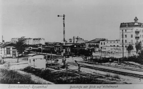
Wilhelmsruh () is a German locality (''Ortsteil'') within the borough (''Bezirk'') of Pankow, Berlin. It is the city's smallest locality, after Halensee and Hansaviertel. History In the locality, originally part of Rosenthal, it was built a country house named ''Nordend'' which received occasionally the designation name ''Rosenthal II''. In 1892 the settlement received the name of ''Colonie Wilhelmsruh''. As part of Nordend municipality (now a zone of Rosenthal), it merged into Berlin in 1920 with the " Greater Berlin Act". During the " Cold War" it was part of East Berlin bordering with the western sector, and it was crossed by the Berlin Wall from 1961 to 1989. Geography Wilhelmsruh is located in the northern suburb of Berlin, in a corner of Pankow district surrounded by Rosenthal, Niederschönhausen, Reinickendorf and Märkisches Viertel (both in Reinickendorf district). Its western corner is close to Wittenau but it doesn't borders with this locality. In its territ ... [...More Info...] [...Related Items...] OR: [Wikipedia] [Google] [Baidu] |
Industrialization
Industrialisation ( alternatively spelled industrialization) is the period of social and economic change that transforms a human group from an agrarian society into an industrial society. This involves an extensive re-organisation of an economy for the purpose of manufacturing. Historically industrialization is associated with increase of polluting industries heavily dependent on fossil fuels. With the increasing focus on sustainable development and green industrial policy practices, industrialization increasingly includes technological leapfrogging, with direct investment in more advanced, cleaner technologies. The reorganization of the economy has many unintended consequences both economically and socially. As industrial workers' incomes rise, markets for consumer goods and services of all kinds tend to expand and provide a further stimulus to industrial investment and economic growth. Moreover, family structures tend to shift as extended families tend to no longer live ... [...More Info...] [...Related Items...] OR: [Wikipedia] [Google] [Baidu] |
West Berlin
West Berlin (german: Berlin (West) or , ) was a political enclave which comprised the western part of Berlin during the years of the Cold War. Although West Berlin was de jure not part of West Germany, lacked any sovereignty, and was under military occupation until German reunification in 1990, the territory was claimed by the West Germany, Federal Republic of Germany (FRG) which was heavily disputed by the Soviet Union and other Eastern Bloc countries. However, West Berlin de facto aligned itself politically with the FRG on 23 May 1949, was directly or indirectly represented in its federal institutions, and most of its residents were citizens of the FRG. West Berlin was formally controlled by the Western Allies and entirely surrounded by the Soviet Union, Soviet-controlled East Berlin and East Germany. West Berlin had great symbolic significance during the Cold War, as it was widely considered by westerners an "island of free world, freedom" and America's most loyal counterpa ... [...More Info...] [...Related Items...] OR: [Wikipedia] [Google] [Baidu] |
Berlin Wall
The Berlin Wall (german: Berliner Mauer, ) was a guarded concrete barrier that encircled West Berlin from 1961 to 1989, separating it from East Berlin and East Germany (GDR). Construction of the Berlin Wall was commenced by the government of the GDR on 13 August 1961. It included guard towers placed along large concrete walls, accompanied by a wide area (later known as the "death strip") that contained anti-vehicle trenches, beds of nails and other defenses. The Eastern Bloc portrayed the Wall as protecting its population from fascist elements conspiring to prevent the "will of the people" from building a socialist state in the GDR. The authorities officially referred to the Berlin Wall as the ''Anti-Fascist Protection Rampart'' (german: Antifaschistischer Schutzwall, ). The West Berlin city government sometimes referred to it as the "Wall of Shame", a term coined by mayor Willy Brandt in reference to the Wall's restriction on freedom of movement. Along with the separat ... [...More Info...] [...Related Items...] OR: [Wikipedia] [Google] [Baidu] |


.png)