|
Bellaheady
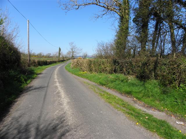
Bellaheady (Irish derived place name, either Béal Átha Héide meaning 'The Entrance to the Ford of Éadach' or Béal Átha an Fheadha meaning 'The Entrance to the Ford of the Wood'. Also called Rossbressal = Ros Breasail = Breasal’s Wood ) is a townland in the civil parish of Templeport, barony of Tullyhunco, County Cavan, Ireland. Geography Bellaheady is bounded on the west by Corran, County Cavan and Killycluggin townlands, on the east by Killarah townland, on the south by Toberlyan Duffin townland and on the north by Crossmakelagher and Tonyrevan townlands. Its chief geographical features are the Shannon-Erne Waterway, small streams, forestry plantations, quarries, dug wells and spring wells. Bellaheady is traversed by the R205 road (Ireland), minor public roads, rural lanes and the disused Cavan and Leitrim Railway. The townland covers 220 acres, including 10 acres of water. History Until the 1650s, Bellaheady was paired with the townland of Killarah, the lands being ... [...More Info...] [...Related Items...] OR: [Wikipedia] [Google] [Baidu] |
Killarah
Killarah (Irish derived place name either Coill an Rátha meaning 'The Wood of the Fort' or Coill Leath Ráth = 'The Wood of the Half-Fort' or Coill Áth Ráth meaning 'The Wood of the Ford of the Rath') is a townland in the civil parish of Kildallan, barony of Tullyhunco, County Cavan, Ireland. Geography Killarah is bounded on the west by Bellaheady, Coologe and Toberlyan Duffin townlands, on the east by Agharaskilly, Clontygrigny and Fartrin townlands, on the south by Callaghs townland and on the north by Crossmakelagher and Cormeen townlands. Its chief geographical features are Bellaheady Mountain which rises to 328 feet, Lough Andoul (Loch an Diabhail = The Devil’s Lake), the Shannon-Erne Waterway, small streams, forestry plantations, sand pits, gravel pits and dug wells. Killarah is traversed by minor public roads and rural lanes. The townland covers 688 acres. History Until the 1650s Killarah was paired with the townland of Bellaheady. Locals and the Ordnance Survey st ... [...More Info...] [...Related Items...] OR: [Wikipedia] [Google] [Baidu] |
Tonyrevan
Tonyrevan () is a townland in the civil parish of Templeport, County Cavan, Ireland. It lies in the Roman Catholic parish of Templeport and barony of Tullyhaw. Geography Tonyrevan is bounded on the west by Tonyhallagh and Killycluggin townlands, on the east by Crossmakelagher townland and on the south by Bellaheady townland in Kildallan parish. Tonyrevan's chief geographical features are a wood, a spring well, a dug well and a stone quarry. Tonyrevan is traversed by the national secondary R205 road (Ireland), rural lanes and the disused Cavan and Leitrim Railway. The townland covers 55 statute acres. History In medieval times the McGovern tuath of Tullyhaw was divided into economic taxation areas called ballibetoes, from the Irish Baile Biataigh (Anglicized as 'Ballybetagh'), meaning 'A Provisioner's Town or Settlement'. The original purpose was to enable the farmer, who controlled the baile, to provide hospitality for those who needed it, such as poor people and travellers. T ... [...More Info...] [...Related Items...] OR: [Wikipedia] [Google] [Baidu] |
Cavan And Leitrim Railway
The Cavan & Leitrim Railway was a narrow gauge railway in the counties of Leitrim and Cavan in northwest Ireland, which ran from 1887 until 1959. Unusually for Ireland, this narrow gauge line survived on coal traffic, from the mine at Arigna, although the original main line was constructed principally for traffic in cattle. It outlived most of the other Irish narrow-gauge lines, giving a further lease of life to some of their redundant engines. Early years Perhaps it was the brainchild of the Earl of Kingston of Kilronan Castle, Ballyfarnon, to bring prosperity to this part of Ireland. In September 1883, a public meeting in Ballinamore declared that a light railway and tramway would open up the coal and iron districts of Arigna and Lough Allen. The Cavan, Leitrim & Roscommon Light Railway & Tramway Company was set up with a guaranteed capital of £202,000 in 40,400 shares of £5 each. Chairman of the board was the Rt.Hon. The Earl of Kingston D.L., Kilronan Castle. Later ... [...More Info...] [...Related Items...] OR: [Wikipedia] [Google] [Baidu] |
Burren (townland)
Burren is a townland in the civil parish of Templeport, County Cavan, Ireland. It lies in the Roman Catholic parish of Templeport and barony of Tullyhaw. Geography Burren is bounded on the north by Derrycassan and Coologe townlands, on the west by Killydrum and Derryniggan townlands in County Leitrim, on the south by Raleagh townland in Kildallan parish and Lugnagon townland in County Leitrim and on the east by Kiltynaskellan and Doogary townlands in Kildallan parish. Its chief geographical features are Derrycassan Lake, the Shannon–Erne Waterway and several stone quarries. Burren is traversed by a public road (which was made in 1913 by Father Peter Brady) and several rural lanes. The townland covers 944 statute acres. History In medieval times the McGovern tuath of Tullyhaw was divided into economic taxation areas called ballibetoes, from the Irish Baile Biataigh (Anglicized as 'Ballybetagh'), meaning 'A Provisioner's Town or Settlement'. The original purpose was to ena ... [...More Info...] [...Related Items...] OR: [Wikipedia] [Google] [Baidu] |
Corran, County Cavan
Corran () is a townland in the civil parish of Templeport, County Cavan, Ireland. It lies in the Roman Catholic parish of Templeport and the barony of Tullyhaw. Geography Corran is bound on the north by Killycluggin townland, on the west by Kilnavert and Derrycassan townlands, on the south by Toberlyan and Toberlyan Duffin townlands, and the east by Bellaheady townland in Kildallan Parish. Corran can be entered using the regional R205 road, several minor roads, rural and disused lanes, and the Cavan and Leitrim Railway. The townland covers 146 statute acres. History In medieval times the McGovern tuath of Tullyhaw was divided into economic taxation areas called ballibetoes, from the Irish ''Baile Biataigh'' (Anglicized as 'Ballybetagh'), meaning 'A Provisioner's Town or Settlement'. The original purpose was to enable the farmer, who controlled the baile, to provide hospitality for those who needed it, such as poor people and travellers. The ballybetagh was further divided ... [...More Info...] [...Related Items...] OR: [Wikipedia] [Google] [Baidu] |
Killycluggin
Killycluggin () is a townland in the civil parish of Templeport, County Cavan, Ireland. It lies in the Roman Catholic parish area of Templeport and the barony of Tullyhaw. Geography Killycluggin is bounded on the north by Tonyhallagh townland, on the west by Lissanover townland, on the east by Tonyrevan townland and on the south by Bellaheady townland in Kildallan parish and by Kilnavert and Corran, County Cavan townlands. Killycluggin's chief geographical features are a stream, a stone quarry and a gravel pit. Killycluggin is traversed by the R205 road (Ireland), minor roads, rural lanes and the disused Cavan and Leitrim Railway. The townland covers 76 statute acres. History In medieval times the McGovern tuath of Tullyhaw was divided into economic taxation areas called ballibetoes, from the Irish ''Baile Biataigh'' (Anglicized as 'Ballybetagh'), meaning 'A Provisioner's Town or Settlement'. The original purpose was to enable the farmer, who controlled the baile, to provide ... [...More Info...] [...Related Items...] OR: [Wikipedia] [Google] [Baidu] |
Toberlyan Duffin
Toberlyan Duffin (Toberlyan = Irish derived place name usually given as Tobar Laighin, meaning either 'St Leynie's Well' or "The Well of the Spear" but probably more correctly either Tobar Lann, meaning the 'Well of the Church', or Tobar Linn, meaning the 'Well of the Pool' or Tobar Loin, meaning the 'Well of the High Wet Mountain Flat'. Duffin is usually given as meaning 'belonging to the Duffin family' but the earliest spelling is Dufferagh which probably means Dubh Rath meaning 'The Black Fort' (referring to the ringfort still in the townland) is a townland in the civil parish of Templeport, County Cavan, Ireland. It lies in the Roman Catholic parish of Templeport and barony of Tullyhaw. Geography Toberlyan is bounded on the north by Corran townland and Bellaheady townland in Kildallan parish, on the west by Toberlyan townland, on the south by Coologe townland and on the east by Killarah townland in Kildallan parish. Its chief geographical features are the Shannon-Erne Waterwa ... [...More Info...] [...Related Items...] OR: [Wikipedia] [Google] [Baidu] |
Crossmakelagher
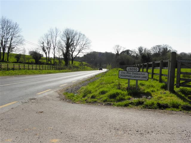
Crossmakelagher, also written Crossmakellagher or Crossmakellegher () is a townland in the civil parish of Templeport, County Cavan, Ireland. It lies in the Roman Catholic parish of Templeport and barony of Tullyhaw. The local people abbreviate it as 'Cross'. Geography Crossmakelagher is bounded on the north by Cavanaquill and Killynaff townlands, on the west by Tonyhallagh and Tonyrevan townlands, on the south by Bellaheady and Killarah townlands in Kildallan parish and on the east by Cormeen townland in Kildallan parish and Lecharrownahone townland. Its chief geographical features are the Shannon-Erne Waterway, a small plantation, a pond, a quarry, a spring well and several dug wells. Crossmakelagher is traversed by the regional R205 road, minor roads and rural lanes and the disused Cavan and Leitrim Railway. The townland covers 197 statute acres. History In medieval times the McGovern barony of Tullyhaw was divided into economic taxation areas called ballibetoes, from the ... [...More Info...] [...Related Items...] OR: [Wikipedia] [Google] [Baidu] |
Charles I Of England
Charles I (19 November 1600 – 30 January 1649) was King of England, Scotland, and Ireland from 27 March 1625 until Execution of Charles I, his execution in 1649. He was born into the House of Stuart as the second son of King James VI of Scotland, but after his father inherited the English throne in 1603, he moved to England, where he spent much of the rest of his life. He became heir apparent to the kingdoms of England, Scotland, and Ireland in 1612 upon the death of his elder brother, Henry Frederick, Prince of Wales. An unsuccessful and unpopular attempt to marry him to the Spanish Habsburg princess Maria Anna of Spain, Maria Anna culminated in an eight-month visit to Spain in 1623 that demonstrated the futility of the marriage negotiation. Two years later, he married the House of Bourbon, Bourbon princess Henrietta Maria of France. After his 1625 succession, Charles quarrelled with the Parliament of England, English Parliament, which sought to curb his royal prerogati ... [...More Info...] [...Related Items...] OR: [Wikipedia] [Google] [Baidu] |
Irish Rebellion Of 1641
The Irish Rebellion of 1641 ( ga, Éirí Amach 1641) was an uprising by Irish Catholics in the Kingdom of Ireland, who wanted an end to anti-Catholic discrimination, greater Irish self-governance, and to partially or fully reverse the plantations of Ireland. They also wanted to prevent a possible invasion or takeover by anti-Catholic English Parliamentarians and Scottish Covenanters, who were defying the king, Charles I. It began as an attempted ''coup d'état'' by Catholic gentry and military officers, who tried to seize control of the English administration in Ireland. However, it developed into a widespread rebellion and ethnic conflict with English and Scottish Protestant settlers, leading to Scottish military intervention. The rebels eventually founded the Irish Catholic Confederacy. Led by Felim O'Neill, the rebellion began on 23 October and although they failed to seize Dublin Castle, within days the rebels occupied most of the northern province of Ulster. O'Neill i ... [...More Info...] [...Related Items...] OR: [Wikipedia] [Google] [Baidu] |
Charles II Of England
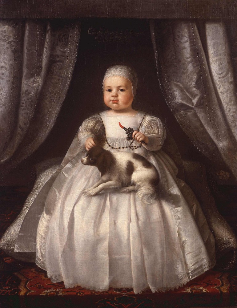
Charles II (29 May 1630 – 6 February 1685) was King of Scotland from 1649 until 1651, and King of England, Scotland and Ireland from the 1660 Restoration of the monarchy until his death in 1685. Charles II was the eldest surviving child of Charles I of England, Scotland and Ireland and Henrietta Maria of France. After Charles I's execution at Whitehall on 30 January 1649, at the climax of the English Civil War, the Parliament of Scotland proclaimed Charles II king on 5 February 1649. But England entered the period known as the English Interregnum or the English Commonwealth, and the country was a de facto republic led by Oliver Cromwell. Cromwell defeated Charles II at the Battle of Worcester on 3 September 1651, and Charles fled to mainland Europe. Cromwell became virtual dictator of England, Scotland and Ireland. Charles spent the next nine years in exile in France, the Dutch Republic and the Spanish Netherlands. The political crisis that followed Cromwell's death in 1 ... [...More Info...] [...Related Items...] OR: [Wikipedia] [Google] [Baidu] |
Sir Tristram Beresford, 1st Baronet
Sir Tristram Beresford, 1st Baronet (died 15 January 1673) was an Irish soldier and politician. He was the ancestor of the Marquesses of Waterford, the Barons Decies and the Beresford baronets, of William Beresford, 1st Viscount Beresford and Charles Beresford, 1st Baron Beresford. He was born the eldest son of Tristram Beresford, who had originated from Kent and settled in Ireland, and his wife Susannah Brooke. Beresford became manager of the Corporation of London's Londonderry Plantation and entered the Irish House of Commons in 1634 as the member for County Londonderry. He then represented the counties of Londonderry, Donegal and Tyrone from 1656 until 1658 in the Second Protectorate Parliament at Westminster. After the Restoration of 1660 he finally stood successfully for Londonderry in the Irish Parliament of 1661, holding the seat for the next five years. He was knighted in 1664 and was created a Baronet, of Coleraine in the County of Londonderry, on 5 May of the followin ... [...More Info...] [...Related Items...] OR: [Wikipedia] [Google] [Baidu] |
.jpg)
.jpg)


