|
Bear River (Nova Scotia)
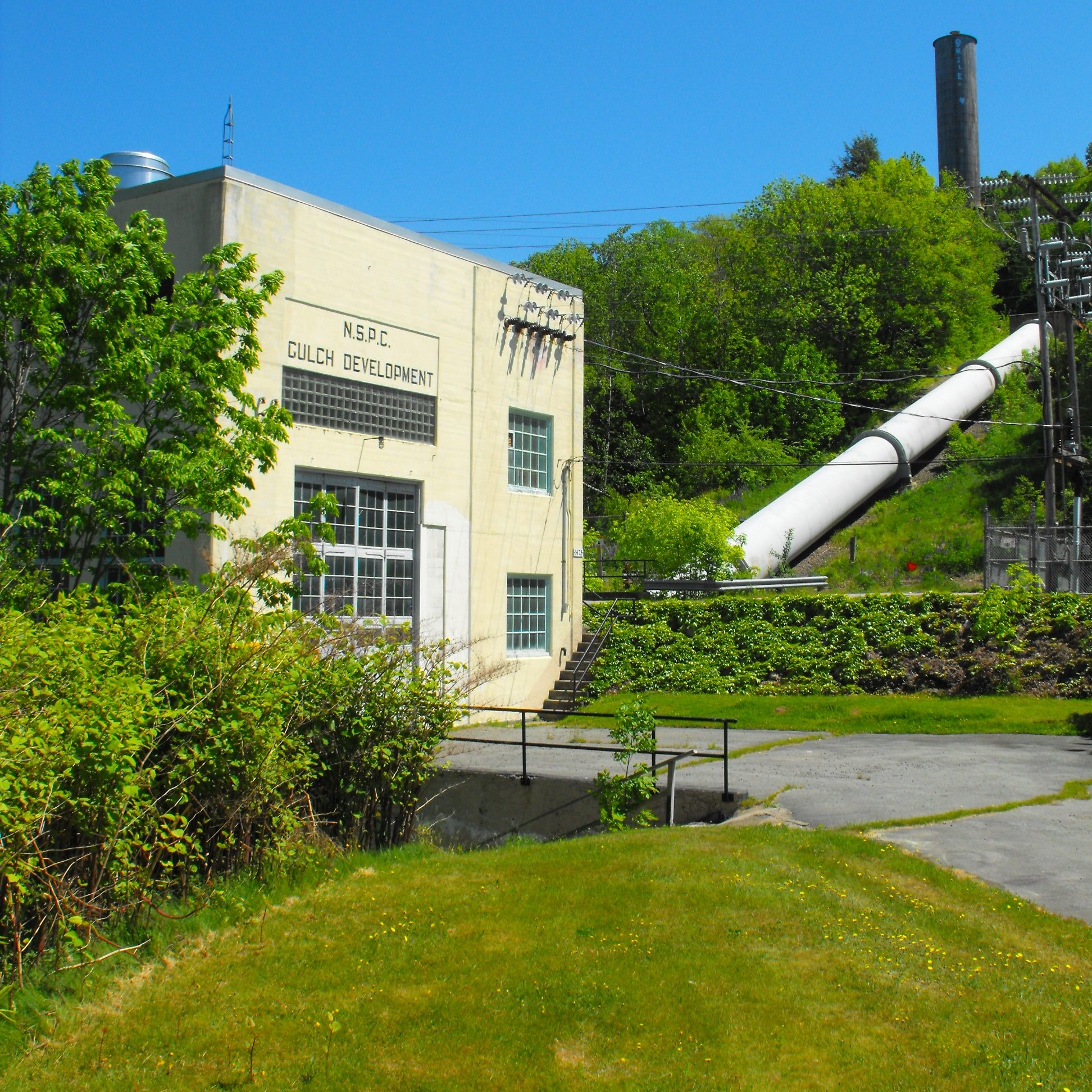
__NOTOC__ The Bear River is a minor river in western Nova Scotia, Canada. Flowing from south to north, it is long from its headwaters to its discharge into the Annapolis Basin, some east of Digby. The river is tidal for the last of its length. The village of Bear River (which today calls itself "The Tidal Village") is situated near the head of the tide where shipbuilding took place in the nineteenth century. The river lies within an area long-occupied by native Mi'kmaq people, embodied today by members of the Bear River First Nation who still reside on the river. The native name for the river is L'sitkuk, (pronounced "elsetkook"). The area was settled by European settlers at nearby Port Royal at the start of the seventeenth century. Samuel de Champlain called it Rivière St. Antoine (St. Anthony's River) on his first map, but the name did not survive. In 1609 it appeared as Rivière Hébert (probably for Louis Hébert) on Lescarbot's map and the name held. It was altered fo ... [...More Info...] [...Related Items...] OR: [Wikipedia] [Google] [Baidu] |
Canada
Canada is a country in North America. Its ten provinces and three territories extend from the Atlantic Ocean to the Pacific Ocean and northward into the Arctic Ocean, covering over , making it the world's second-largest country by total area. Its southern and western border with the United States, stretching , is the world's longest binational land border. Canada's capital is Ottawa, and its three largest metropolitan areas are Toronto, Montreal, and Vancouver. Indigenous peoples have continuously inhabited what is now Canada for thousands of years. Beginning in the 16th century, British and French expeditions explored and later settled along the Atlantic coast. As a consequence of various armed conflicts, France ceded nearly all of its colonies in North America in 1763. In 1867, with the union of three British North American colonies through Confederation, Canada was formed as a federal dominion of four provinces. This began an accretion of provinces an ... [...More Info...] [...Related Items...] OR: [Wikipedia] [Google] [Baidu] |
Landforms Of Annapolis County, Nova Scotia
A landform is a natural or anthropogenic land feature on the solid surface of the Earth or other planetary body. Landforms together make up a given terrain, and their arrangement in the landscape is known as topography. Landforms include hills, mountains, canyons, and valleys, as well as shoreline features such as bays, peninsulas, and seas, including submerged features such as mid-ocean ridges, volcanoes, and the great ocean basins. Physical characteristics Landforms are categorized by characteristic physical attributes such as elevation, slope, orientation, stratification, rock exposure and soil type. Gross physical features or landforms include intuitive elements such as berms, mounds, hills, ridges, cliffs, valleys, rivers, peninsulas, volcanoes, and numerous other structural and size-scaled (e.g. ponds vs. lakes, hills vs. mountains) elements including various kinds of inland and oceanic waterbodies and sub-surface features. Mountains, hills, plateaux, and plains are the fou ... [...More Info...] [...Related Items...] OR: [Wikipedia] [Google] [Baidu] |
List Of Rivers Of Nova Scotia
Nova Scotia's rivers all flow into the Atlantic Ocean through four unique watersheds: the Gulf of Maine, the Northumberland Strait, the Gulf of Saint Lawrence and into the Atlantic Ocean itself. Gulf of Maine The Gulf of Maine system includes the Bay of Fundy, which includes the Cumberland and Minas Basins. In Nova Scotia, the system occupies the shores from Fort Lawrence to Cape St. Mary (44°05′N). Bay of Fundy The Bay of Fundy coastline in Nova Scotia begins at Fort Lawrence and circles Cape Chignecto eastward to Truro. It then follows west along the Annapolis Valley as far as Brier Island on the Digby Neck. Within the Bay of Fundy are two basins: Chignecto Bay which begins at Fort Lawrence and ends at Cape Chignecto, and the Minas Basin that encompasses everything east of Ramshead Point (near Diligent River) and Cape Split. *Apple River (Note: westernmost river on the north coast of the Bay of Fundy) *Fox River *Ramshead River *Diligent River (Note: easternmost river o ... [...More Info...] [...Related Items...] OR: [Wikipedia] [Google] [Baidu] |
Nova Scotia Highway 101
Highway 101 is an east-west highway in Nova Scotia that runs from Bedford to Yarmouth. The highway follows a route along the southern coast of the Bay of Fundy through the Annapolis Valley, the largest agricultural district in the province. Between its western terminus at Yarmouth to Weymouth, the highway is 2-lane controlled access. Between Weymouth and Digby, the highway reverts to a 2-lane local road. From Digby to Grand Pre, the highway is 2-lane controlled access. From the Gaspereau River crossing near Grand Pre to 3 km west of Exit 6 ( Falmouth) the highway is a 4-lane freeway. Heading east the highway is 2-lane controlled access until Exit 5 ( Trunk 14). From Three Mile Plains to its eastern terminus at Bedford, the highway is a 4-lane freeway. Some of the 2-lane controlled access sections of the highway are 3 or 4 lanes, with the addition of passing lanes. One section of the 4-lane freeway near Hantsport is a short 5-lane (3 lanes westbound) section for ... [...More Info...] [...Related Items...] OR: [Wikipedia] [Google] [Baidu] |
Bay Of Fundy
The Bay of Fundy (french: Baie de Fundy) is a bay between the Canadian provinces of New Brunswick and Nova Scotia, with a small portion touching the U.S. state of Maine. It is an arm of the Gulf of Maine. Its extremely high tidal range is the highest in the world. The name is likely a corruption of the French word , meaning 'split'. Hydrology Tides The tidal range in the Bay of Fundy is about ; the average tidal range worldwide is only . Some tides are higher than others, depending on the position of the moon, the sun, and atmospheric conditions. Tides are semidiurnal, meaning they have two highs and two lows each day, with about six hours and 13 minutes between each high and low tide. Because of tidal resonance in the funnel-shaped bay, the tides that flow through the channel are very powerful. In one 12-hour tidal cycle, about 100 billion tons (110 billion short tons) of water flows in and out of the bay, which is twice as much as the combined total flow of all the rive ... [...More Info...] [...Related Items...] OR: [Wikipedia] [Google] [Baidu] |
Digby Gut
The Digby Gut is a narrow channel connecting the Bay of Fundy with the Annapolis Basin. The town of Digby, Nova Scotia is located on the inner portion of the western side of the Gut. The eastern entrance is marked by the Point Prim Lighthouse. Strong tidal currents, numerous rocky ledges, frequent fogs and unpredictable winds make it a dangerous passage requiring a pilot or local knowledge. Tide flows create 5 knot tidal currents and create numerous whirlpools and eddies. The gut is about a half nautical mile in width and bordered by high rocky cliffs. It marks a break in the North Mountain ridge along the Annapolis Valley and is the eastern end of Digby Neck. Digby Gut had its origins as the northern terminus of the ancient Bear River, part of which is now a drowned river valley. Digby Gut is overlooked by the Digby Pines Resort and has been used daily for many years by Digby- Saint John ferries such as the SS ''Princess Helene'' and MV ''Princess of Acadia''. The famous poe ... [...More Info...] [...Related Items...] OR: [Wikipedia] [Google] [Baidu] |
Drowned River Valley
A ria (; gl, ría) is a coastal inlet formed by the partial submergence of an unglaciated river valley. It is a drowned river valley that remains open to the sea. Definitions Typically rias have a dendritic, treelike outline although they can be straight and without significant branches. This pattern is inherited from the dendritic drainage pattern of the flooded river valley. The drowning of river valleys along a stretch of coast and formation of rias results in an extremely irregular and indented coastline. Often, there are naturally occurring islands, which are summits of partly submerged, pre-existing hill peaks. (Islands may also be artificial, such as those constructed for the Chesapeake Bay Bridge-Tunnel.) A ria coast is a coastline having several parallel rias separated by prominent ridges, extending a distance inland.Goudie, A. (2004) ''Encyclopedia of Geomorphology.'' Routledge. London, England.Bird, E.C.F. (2008) ''Coastal Geomorphology: An Introduction'', 2nd ed ... [...More Info...] [...Related Items...] OR: [Wikipedia] [Google] [Baidu] |
Louis Hébert
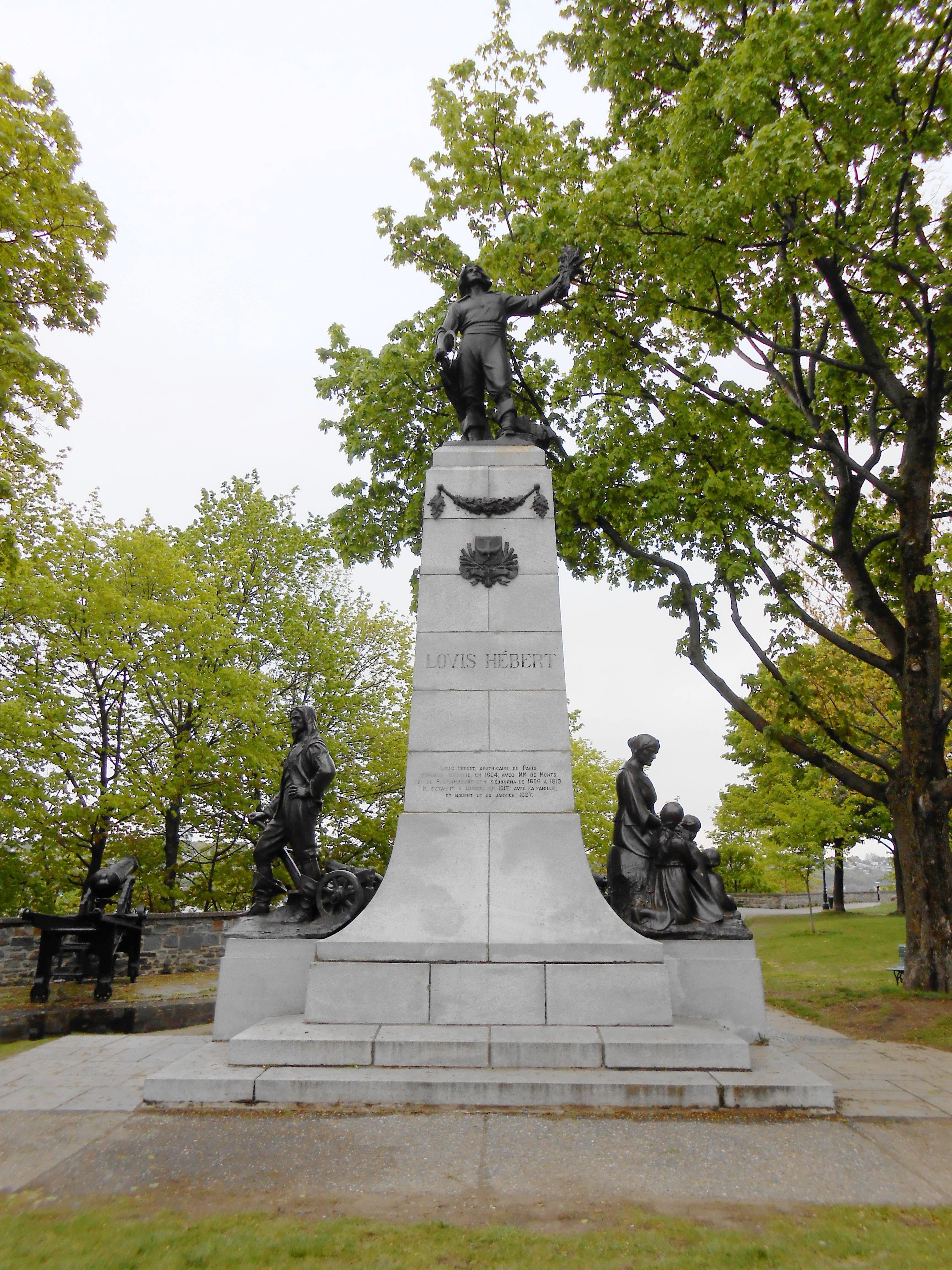
Louis Hébert (c. 1575 – 25 January 1627) is widely considered the first European apothecary in the region that would later become Canada, as well as the first European to farm in said region. He was born around 1575 at 129 de la rue Saint-Honoré in Paris to Nicolas Hébert and Jacqueline Pajot. He married Marie Rollet on 19 February 1601 at the Church of Saint-Sulpice, Paris. In 1606, he accompanied his cousin-in-law, Jean de Biencourt de Poutrincourt et de Saint-Just, to Acadia, along with Samuel Champlain. He lived at Port-Royal (now Annapolis, in southern Nova Scotia) from 1606 to 1607 and from 1611 to 1613 when Port-Royal was destroyed by the English deputy governor of Virginia Samuel Argall. In 1617, with his wife, Marie Rollet, and their three children– Guillaume, aged three; Guillaumette, aged nine; and Anne, aged 14 – he left Paris forever to live in Quebec City. He died there 10 years later because of an injury that occurred when he fell on a patch of ice. ... [...More Info...] [...Related Items...] OR: [Wikipedia] [Google] [Baidu] |
Provinces And Territories Of Canada
Within the geographical areas of Canada, the ten provinces and three territories are sub-national administrative divisions under the jurisdiction of the Canadian Constitution. In the 1867 Canadian Confederation, three provinces of British North America—New Brunswick, Nova Scotia, and the Province of Canada (which upon Confederation was divided into Ontario and Quebec)—united to form a federation, becoming a fully independent country over the next century. Over its history, Canada's international borders have changed several times as it has added territories and provinces, making it the world's second-largest country by area. The major difference between a Canadian province and a territory is that provinces receive their power and authority from the ''Constitution Act, 1867'' (formerly called the ''British North America Act, 1867''), whereas territorial governments are creatures of statute with powers delegated to them by the Parliament of Canada. The powers flowing from t ... [...More Info...] [...Related Items...] OR: [Wikipedia] [Google] [Baidu] |
Port Royal, Annapolis County, Nova Scotia
Port Royal is a toponym for a rural intersection on the north bank of the Annapolis Basin about from the town of Annapolis Royal in Annapolis County, Nova Scotia, Canada. It has no legal status in local government. It is the site of the Port-Royal National Historic Site, a replica of an Acadian The Acadians (french: Acadiens , ) are an ethnic group descended from the French who settled in the New France colony of Acadia during the 17th and 18th centuries. Most Acadians live in the region of Acadia, as it is the region where the de ... settlement that existed from 1605 until its destruction by the English in 1613. References {{Coord, 44, 43, 00, N, 65, 36, 13, W, region:CA-NS_type:city, display=title Communities in Annapolis County, Nova Scotia Populated places established in 1605 1605 establishments in New France Military forts in Acadia Military forts in Nova Scotia ... [...More Info...] [...Related Items...] OR: [Wikipedia] [Google] [Baidu] |

.jpg)

_V2.jpg)
