|
Bay Of Arrows
Golfo de Las Flechas or Bay of Arrows refers to a bay on the northeastern side of the island of Hispaniola in the present day Dominican Republic where there was a small skirmish between Christopher Columbus’ crew and the Cigüayos that lived there during Columbus' first voyage. It lies around 69 degrees west and 19 degrees north. The Bay of Arrows underwent a name change after being discovered by Christopher Columbus in January 1493. There is a current debate surrounding its location where some argue it is the present-day Samaná Bay while others claim it is the present-day Bay of Rincón. Background On his first voyage, Christopher Columbus had mostly amicable encounters with the Taínos, one of the indigenous people of the Caribbean islands. He sailed along the islands' coast, entering into capes and harbors to look at the scenery, hoping to find cities and large groups of population to trade with. Ultimately, what he expected was to reach the outer limits of the Chinese empir ... [...More Info...] [...Related Items...] OR: [Wikipedia] [Google] [Baidu] |
Dominican Republic
The Dominican Republic ( ; es, República Dominicana, ) is a country located on the island of Hispaniola in the Greater Antilles archipelago of the Caribbean region. It occupies the eastern five-eighths of the island, which it shares with Haiti, making Hispaniola one of only two Caribbean islands, along with Saint Martin, that is shared by two sovereign states. The Dominican Republic is the second-largest nation in the Antilles by area (after Cuba) at , and third-largest by population, with approximately 10.7 million people (2022 est.), down from 10.8 million in 2020, of whom approximately 3.3 million live in the metropolitan area of Santo Domingo, the capital city. The official language of the country is Spanish. The native Taíno people had inhabited Hispaniola before the arrival of Europeans, dividing it into five chiefdoms. They had constructed an advanced farming and hunting society, and were in the process of becoming an organized civilization. The Taínos also in ... [...More Info...] [...Related Items...] OR: [Wikipedia] [Google] [Baidu] |
Christopher Columbus
Christopher Columbus * lij, Cristoffa C(or)ombo * es, link=no, Cristóbal Colón * pt, Cristóvão Colombo * ca, Cristòfor (or ) * la, Christophorus Columbus. (; born between 25 August and 31 October 1451, died 20 May 1506) was an Italian explorer and navigator who completed Voyages of Christopher Columbus, four voyages across the Atlantic Ocean sponsored by the Catholic Monarchs of Spain, opening the way for the widespread European Age of Discovery, exploration and colonization of the Americas. His expeditions were the first known European contact with the Caribbean, Central America, and South America. The name ''Christopher Columbus'' is the anglicisation of the Latin . Scholars generally agree that Columbus was born in the Republic of Genoa and spoke a dialect of Ligurian (Romance language), Ligurian as his first language. He went to sea at a young age and travelled widely, as far north as the British Isles and as far south as what is now Ghana. He married Port ... [...More Info...] [...Related Items...] OR: [Wikipedia] [Google] [Baidu] |
Cigüayos
The Ciguayos (Spanish: Ciguayos) were a group of indigenous people who inhabited the Samaná Peninsula and its adjoining regions in the present-day Dominican Republic. The Ciguayos appear to have predated the agricultural Taíno who inhabited much of the island. Ciguayo was spoken on the northeastern coast of the Magua region from Nagua southward to at least the Yuna River, and throughout all of the Samana Peninsula. Since the moment of contact early Spanish writers perceived them as a threat and portrayed them flaunting long hair and brandishing bows with poisoned arrows. Their archery tradition, however, is linked to the Kalinago, or Island Caribs. Their legacy has spawned folktales, and since the 19th century, their memory has been at the center of the Dominican indigenist movement. Origins They were considered a separate ethnic people that inhabited the Peninsula of Samaná and part of the northern coast toward Nagua in what today is the Dominican Republic, and, by m ... [...More Info...] [...Related Items...] OR: [Wikipedia] [Google] [Baidu] |
Samaná Bay
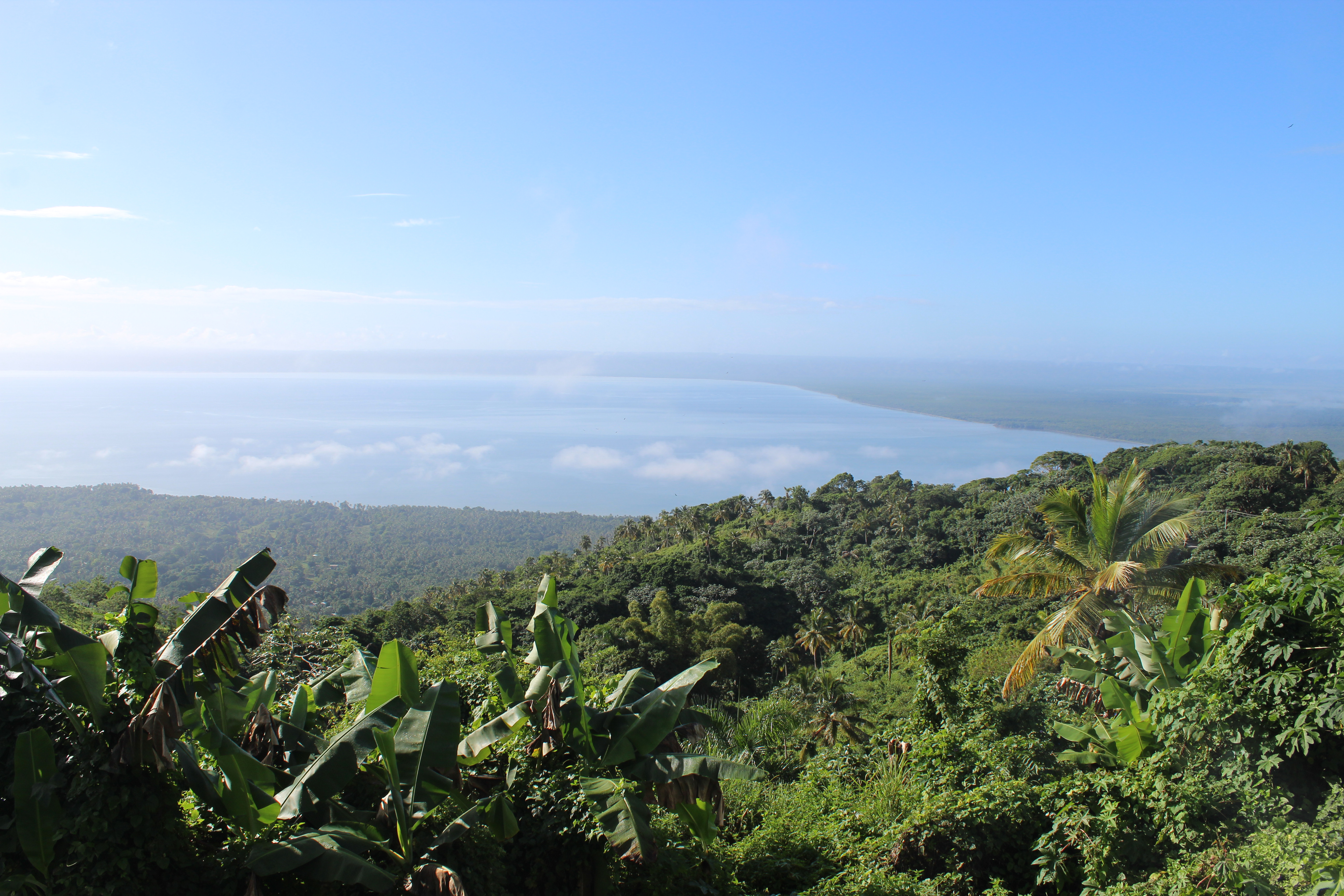
Samaná Bay is a bay in the eastern Dominican Republic. The Yuna River flows into Samaná Bay, and it is located south of the town of Samaná and the Samaná Peninsula. Wildlife Among its features are protected islands that serve as nesting sites for pelicans and frigatebirds, caves with Taíno pictographs and petroglyphs, and mangrove-lined river tributaries. It is a significant breeding site for the humpback whale in the Caribbean; the breeding season attracts many whale-watchers. Geography Samaná Bay lies along the boundary between the North American Plate and the Caribbean plate. Two named fault lines run the length of Samaná Bay. These fault lines form the western terminal of the nineteen-degree fault, that runs north of Puerto Rico and most of Hispaniola to form the northern boundary of the Caribbean plate. As such, the area is prone to earthquakes. File:Carr. al Hotel Antiguo Cayacoa, Samaná 32000, Dominican Republic - panoramio.jpg File:Samana-Laslovarga (113).jpg Fil ... [...More Info...] [...Related Items...] OR: [Wikipedia] [Google] [Baidu] |
Bay Of Rincón
Rincón Bay is V-shape bayin the northeasternmost in the Samaná Peninsula in the Dominican Republic. The road to playa Rincon has been since paved all the way to the beach for easy access by car. The road right on the beach is a sand road to go up and down the beach but cars can travel with common sense. The site is known for the indigenous Cigüayos who in this place were the first to resist Christopher Columbus' men with violence. For this reason, the admiral gave it the name of the Bay of Arrows. It is located north of the town of Santa Bárbara de Samaná. It is gated from the Antilles Current bCabo CabrónanCabo Samaná The resort town of Las Galeras sits on the eastern side of the bay. See also Scottish Bay Scottish Bay ( es, Bahía Escocesa) is a large bay in the Dominican Republic, stretching 70 kilometres across the northeast coast from Cabrera to Cabo Cabrón. The coast of the bay is entirely within two provinces, María Trinidad Sánchez Mar� ... References ... [...More Info...] [...Related Items...] OR: [Wikipedia] [Google] [Baidu] |
Caribbean Islands
Almost all of the Caribbean islands are in the Caribbean Sea, with only a few in inland lakes. The largest island is Cuba. Other sizable islands include Hispaniola, Jamaica, Puerto Rico and Trinidad and Tobago. Some of the smaller islands are referred to as a ''rock'' or ''reef.'' ''Islands are listed in alphabetical order by country of ownership and/or those with full independence and autonomy. Islands with coordinates can be seen on the map linked to the right.'' Antigua and Barbuda There are 54 islands in Antigua and Barbuda. There are three main islands, the two populated islands (Antigua and Barbuda) and Redonda. There are 51 off-shore islands. The islands of the country of Antigua and Barbuda include: *Antigua, , * Northeast Marine Management Area ** Prickly Pear Island ** Great Bird Island ** Galley Island Major ** Galley Island Minor ** Jenny Island ** Exchange Island ** Rabbit Island ** Lobster Island ** Long Island ** Maiden Island ** Rat Island ** Little ... [...More Info...] [...Related Items...] OR: [Wikipedia] [Google] [Baidu] |
Ming Dynasty
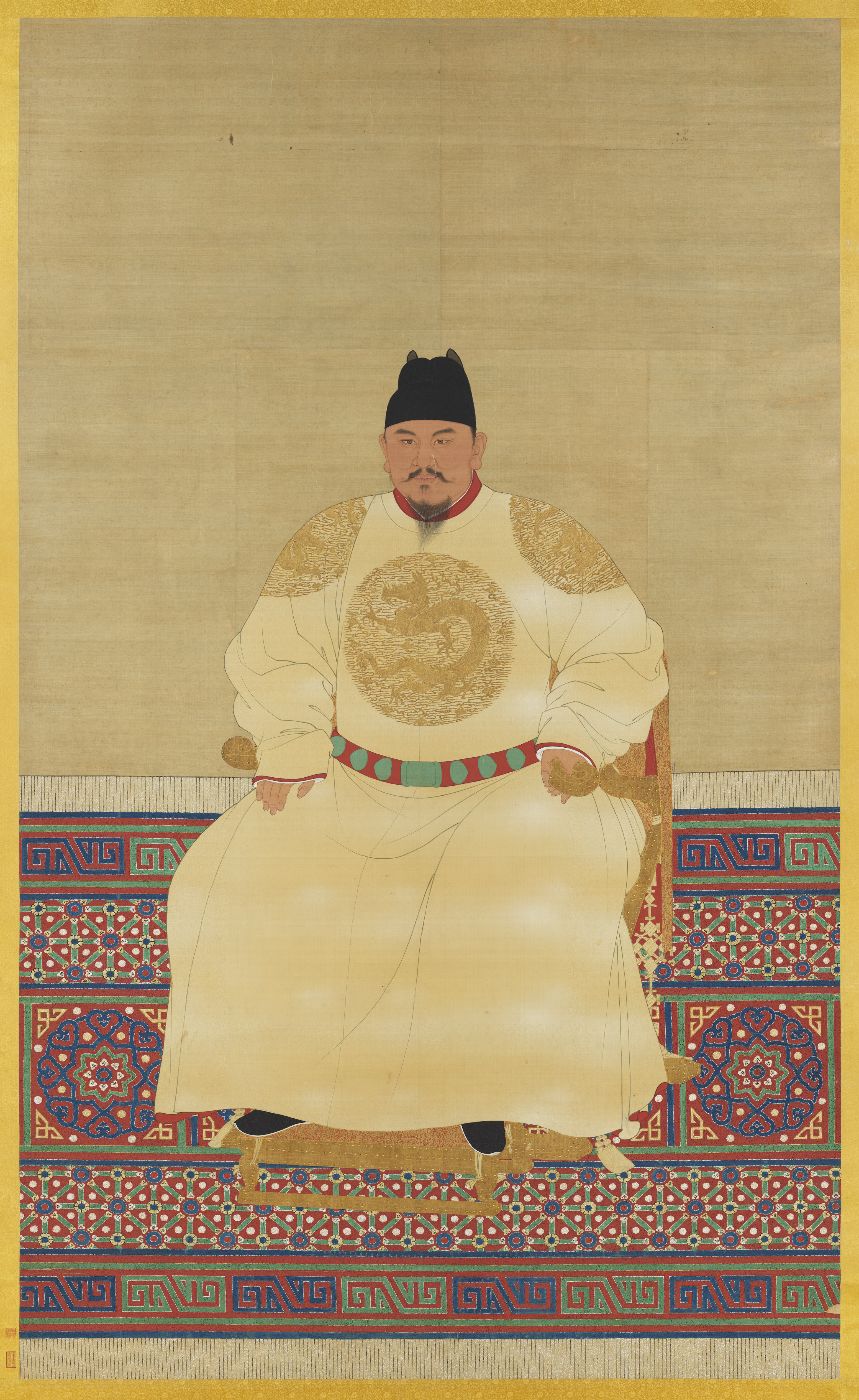
The Ming dynasty (), officially the Great Ming, was an Dynasties in Chinese history, imperial dynasty of China, ruling from 1368 to 1644 following the collapse of the Mongol Empire, Mongol-led Yuan dynasty. The Ming dynasty was the last orthodox dynasty of China ruled by the Han Chinese, Han people, the majority ethnic group in China. Although the primary capital of Beijing fell in 1644 to a rebellion led by Li Zicheng (who established the short-lived Shun dynasty), numerous rump state, rump regimes ruled by remnants of the House of Zhu, Ming imperial family—collectively called the Southern Ming—survived until 1662. The Ming dynasty's founder, the Hongwu Emperor (r. 1368–1398), attempted to create a society of self-sufficient rural communities ordered in a rigid, immobile system that would guarantee and support a permanent class of soldiers for his dynasty: the empire's standing army exceeded one million troops and the naval history of China, navy's dockyards in Nanjin ... [...More Info...] [...Related Items...] OR: [Wikipedia] [Google] [Baidu] |
Santa María (ship)
''La Santa María'' (), alternatively ''La Gallega'', was the largest of the three Spanish ships used by Christopher Columbus in his first voyage across the Atlantic Ocean in 1492, the others being the ''Niña'' and the '' Pinta''. Her master and owner was Juan de la Cosa, a man from Santoña, Cantabria, operating in south Spanish waters. Requisitioned by order of Queen Isabella and by contract with Christopher Columbus, whom de la Cosa knew previously, the ''Santa María'' became Columbus's flagship on the voyage as long as it was afloat. Having gone aground on Christmas Day, 1492, on the shores of Haiti, through inexperience of the helmsman, it was partially dismantled to obtain timbers for Fort Navidad, "Christmas Fort," placed in a native Taíno village. The fort was the first Spanish settlement in the New World, which Columbus had claimed for Spain. He thus regarded the wreck as providential. The hull remained where it was, the subject of much modern wreck-hunting with ... [...More Info...] [...Related Items...] OR: [Wikipedia] [Google] [Baidu] |
Samaná Peninsula
The Samaná Península is a peninsula in Dominican Republic situated in the province of Samaná. The Samaná Peninsula is connected to the rest of the state by the isthmus of Samaná; to its south is Samaná Bay. The peninsula contains many beaches, especially in the city of Santa Bárbara de Samaná. It contains three rivers. Transportation The main roads are the DR-5 and the Samaná Highway, which leads from the peninsula to Santo Domingo. The peninsula also contains the Samaná El Catey International Airport Samaná El Catey International Airport , also called Aeropuerto Internacional Presidente Juan Bosch (AISA), is an international airport that opened on 6 November 2006, serving the province of Samaná in the Dominican Republic. The airport is .... The peninsula also hosts agriculture and tourism. Gallery File:Cabo Samaná.jpg, Cabo Samaná, at the eastern end of the peninsula File:Playa Morón (14503906939).jpg, El Limon area of Samana, Dominican Republic See al ... [...More Info...] [...Related Items...] OR: [Wikipedia] [Google] [Baidu] |
Island Caribs
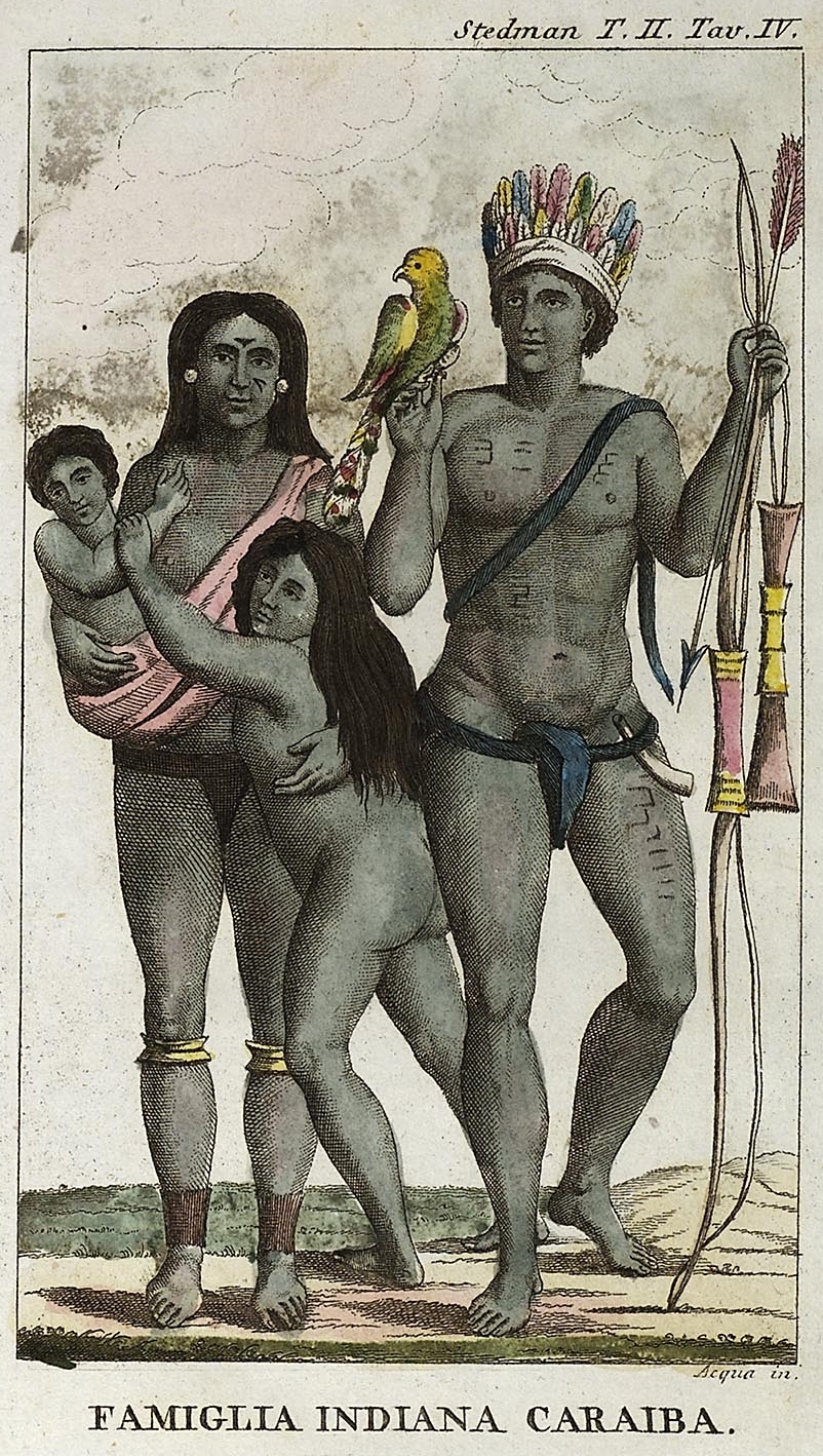
The Kalinago, also known as the Island Caribs or simply Caribs, are an indigenous people of the Lesser Antilles in the Caribbean. They may have been related to the Mainland Caribs (Kalina) of South America, but they spoke an unrelated language known as Island Carib. They also spoke a pidgin language associated with the Mainland Caribs. At the time of Spanish contact, the Kalinago were one of the dominant groups in the Caribbean, which owes its name to them. They lived throughout northeastern South America, Trinidad and Tobago, Barbados, the Windward Islands, Dominica, and possibly the southern Leeward Islands. Historically, it was thought their ancestors were mainland peoples who had conquered the islands from their previous inhabitants, the Igneri. However, linguistic and archaeological evidence contradicts the notion of a mass emigration and conquest; the Kalinago language appears not to have been Cariban, but like that of their neighbors, the Taíno. Irving Rouse and o ... [...More Info...] [...Related Items...] OR: [Wikipedia] [Google] [Baidu] |
Cacique
A ''cacique'' (Latin American ; ; feminine form: ''cacica'') was a tribal chieftain of the Taíno people, the indigenous inhabitants at European contact of the Bahamas, the Greater Antilles, and the northern Lesser Antilles. The term is a Spanish transliteration of the Taíno word ''kasike''. Cacique was initially translated as "king" or "prince" for the Spanish. In the colonial era the conquistadors and the administrators who followed them used the word generically, to refer to any leader of practically any indigenous group they encountered in the Western Hemisphere. In Hispanic and Lusophone countries, the term also has come to mean a political boss, similar to ''caudillo,'' exercising power in a system of ''caciquismo''. Spanish colonial-era caciques The Taíno word ''kasike'' descends from the Taíno word ''kassiquan'', which means "to keep house". In 1555 the word first entered the English language, defined as "prince". In Taíno culture, the ''kasike'' rank was her ... [...More Info...] [...Related Items...] OR: [Wikipedia] [Google] [Baidu] |


