|
Barwick In Elmet And Scholes
Barwick in Elmet and Scholes is a civil parish in the City of Leeds metropolitan borough in West Yorkshire, England. According to the 2001 census it had a population of 5,120, decreasing to 4,902 at the 2011 Census. The parish includes Barwick-in-Elmet and Scholes, situated in the north-eastern part of the borough. The parish council usually meets monthly.Barwick in Elmet and Scholes Parish CouncilParish Council meetings accessed 17 September 2022 See also *Listed buildings in Barwick in Elmet and Scholes Barwick in Elmet and Scholes is a civil parish in the metropolitan borough of the City of Leeds, West Yorkshire, England. It contains 23 Listed building#England and Wales, listed buildings that are recorded in the National Heritage List for Engla ... References Civil parishes in West Yorkshire {{WestYorkshire-geo-stub ... [...More Info...] [...Related Items...] OR: [Wikipedia] [Google] [Baidu] |
City Of Leeds
The City of Leeds is a city and metropolitan borough in West Yorkshire, England. The metropolitan borough includes the administrative centre of Leeds and the towns of Farsley, Garforth, Guiseley, Horsforth, Morley, Otley, Pudsey, Rothwell, Wetherby and Yeadon. It has a population of (), making it technically the second largest city in England by population behind Birmingham, since London is not a single local government entity. It is governed by Leeds City Council. The current city boundaries were set on 1 April 1974 by the provisions of the Local Government Act 1972, as part a reform of local government in England. The city is a merger of eleven former local government districts; the unitary City and County Borough of Leeds combined with the municipal boroughs of Morley and Pudsey, the urban districts of Aireborough, Garforth, Horsforth, Otley and Rothwell, and parts of the rural districts of Tadcaster, Wharfedale and Wetherby from the West Riding of Yorkshire. ... [...More Info...] [...Related Items...] OR: [Wikipedia] [Google] [Baidu] |
West Yorkshire
West Yorkshire is a metropolitan and ceremonial county in the Yorkshire and Humber Region of England. It is an inland and upland county having eastward-draining valleys while taking in the moors of the Pennines. West Yorkshire came into existence as a metropolitan county in 1974 after the reorganisation of the Local Government Act 1972 which saw it formed from a large part of the West Riding of Yorkshire. The county had a recorded population of 2.3 million in the 2011 Census making it the fourth-largest by population in England. The largest towns are Huddersfield, Castleford, Batley, Bingley, Pontefract, Halifax, Brighouse, Keighley, Pudsey, Morley and Dewsbury. The three cities of West Yorkshire are Bradford, Leeds and Wakefield. West Yorkshire consists of five metropolitan boroughs (City of Bradford, Calderdale, Kirklees, City of Leeds and City of Wakefield); it is bordered by the counties of Derbyshire to the south, Greater Manchester to the south-west, Lancash ... [...More Info...] [...Related Items...] OR: [Wikipedia] [Google] [Baidu] |
Elmet And Rothwell (UK Parliament Constituency)
Elmet and Rothwell is a constituency in West Yorkshire represented in the House of Commons of the UK Parliament since its creation in 2010 by Alec Shelbrooke, a Conservative. In the 2017 general election, Elmet and Rothwell recorded the largest turnout of any seat in West or South Yorkshire, with almost 60,000 electors casting a vote. There is no town of Elmet: the name refers to an ancient Celtic kingdom in the area. The name is however referenced by local villages Barwick-in-Elmet and Scholes-in-Elmet, and also Sherburn in Elmet which is nearby but outside the constituency. History Following its review of parliamentary boundaries in West Yorkshire, the Boundary Commission for England created this constituency for the 2010 election which principally contains the three towns of Garforth, Rothwell and Wetherby. Constituency profile Situated to the east of Leeds is the seat of Elmet and Rothwell in West Yorkshire. The constituency is named after the town of Rothwell and ... [...More Info...] [...Related Items...] OR: [Wikipedia] [Google] [Baidu] |
United Kingdom Census 2011
A Census in the United Kingdom, census of the population of the United Kingdom is taken every ten years. The 2011 census was held in all countries of the UK on 27 March 2011. It was the first UK census which could be completed online via the Internet. The Office for National Statistics (ONS) is responsible for the census in England and Wales, the General Register Office for Scotland (GROS) is responsible for the census in Scotland, and the Northern Ireland Statistics and Research Agency (NISRA) is responsible for the census in Northern Ireland. The Office for National Statistics is the executive office of the UK Statistics Authority, a non-ministerial department formed in 2008 and which reports directly to Parliament. ONS is the UK Government's single largest statistical producer of independent statistics on the UK's economy and society, used to assist the planning and allocation of resources, policy-making and decision-making. ONS designs, manages and runs the census in England an ... [...More Info...] [...Related Items...] OR: [Wikipedia] [Google] [Baidu] |
Civil Parish
In England, a civil parish is a type of administrative parish used for local government. It is a territorial designation which is the lowest tier of local government below districts and counties, or their combined form, the unitary authority. Civil parishes can trace their origin to the ancient system of ecclesiastical parishes, which historically played a role in both secular and religious administration. Civil and religious parishes were formally differentiated in the 19th century and are now entirely separate. Civil parishes in their modern form came into being through the Local Government Act 1894, which established elected parish councils to take on the secular functions of the parish vestry. A civil parish can range in size from a sparsely populated rural area with fewer than a hundred inhabitants, to a large town with a population in the tens of thousands. This scope is similar to that of municipalities in Continental Europe, such as the communes of France. However, ... [...More Info...] [...Related Items...] OR: [Wikipedia] [Google] [Baidu] |
Metropolitan Borough
A metropolitan borough (or metropolitan district) is a type of local government district in England. Created in 1974 by the Local Government Act 1972, metropolitan boroughs are defined in English law as metropolitan districts within metropolitan counties. All of the metropolitan districts have been granted or regranted royal charters giving them borough status (and in some cases, they also have city status).Local Government Act 1972, Schedule I, Part I, Metropolitan Counties and Metropolitan Districts Metropolitan boroughs have been effectively unitary authority areas since the abolition of metropolitan county councils by the Local Government Act 1985.Local Government Act 1985 c.51 Metropolitan boroughs pool much of their authority in joint boards and other arrangements that cover whole metropolitan counties, such as city regions or combined authorities, with most of the latter having a metro mayor. History London metropolitan boroughs (1900–1965) The term "metropolitan boro ... [...More Info...] [...Related Items...] OR: [Wikipedia] [Google] [Baidu] |
England
England is a country that is part of the United Kingdom. It shares land borders with Wales to its west and Scotland to its north. The Irish Sea lies northwest and the Celtic Sea to the southwest. It is separated from continental Europe by the North Sea to the east and the English Channel to the south. The country covers five-eighths of the island of Great Britain, which lies in the North Atlantic, and includes over 100 smaller islands, such as the Isles of Scilly and the Isle of Wight. The area now called England was first inhabited by modern humans during the Upper Paleolithic period, but takes its name from the Angles, a Germanic tribe deriving its name from the Anglia peninsula, who settled during the 5th and 6th centuries. England became a unified state in the 10th century and has had a significant cultural and legal impact on the wider world since the Age of Discovery, which began during the 15th century. The English language, the Anglican Church, and Engli ... [...More Info...] [...Related Items...] OR: [Wikipedia] [Google] [Baidu] |
Barwick-in-Elmet
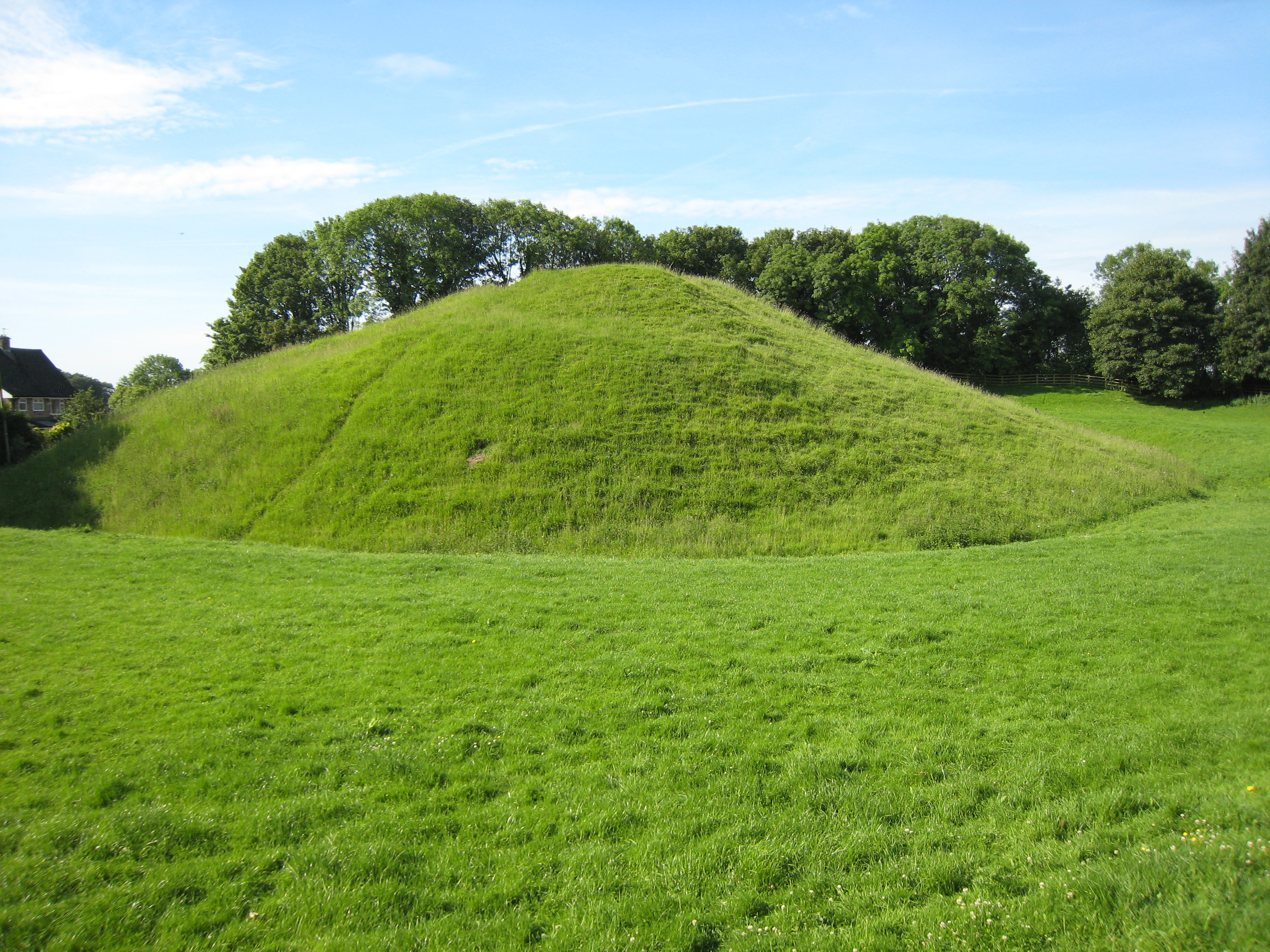
Barwick-in-Elmet (pronounced ''Barrick-in-Elmet'') is a village in West Yorkshire, east of Leeds city centre. It is one of only three places in the area to be explicitly associated with the ancient Romano-British kingdom of Elmet, the others being Scholes-in-Elmet and Sherburn-in-Elmet. The village is part of the civil parish of Barwick in Elmet and Scholes and sits in the Harewood ward of Leeds City Council. Etymology The name ''Barwick'' comes from the Old English words ''bere'' ('barley') and ''wīc'' ('settlement, specialised farm'), thus meaning 'a barley farm' or 'an outlying grange or part on an estate reserved for the lord's use, producing barley'. The name is first attested in the Domesday Book of 1086 as ''Bereuuith'' and ''Bereuuit''. The appellation 'in Elmet' serves to distinguish the settlement from the various others of the same name. The first attested appellation of this kind for Barwick-in-Elmet is in fact the Latin ''Berewyke juxta Abberford'' ('Barwick-b ... [...More Info...] [...Related Items...] OR: [Wikipedia] [Google] [Baidu] |
Scholes, Leeds
Scholes-in-Elmet is a village in Leeds, West Yorkshire, England. Its name is a plural of Old Norse ''skáli'' meaning "temporary shed". It is sometimes known as Scholes-in-Elmet to distinguish it from the villages of the same name in the Holme Valley and Cleckheaton, also by analogy with the neighbouring village of Barwick-in-Elmet and Sherburn in Elmet. The village is part of the civil parish of Barwick in Elmet and Scholes, sits in the Harewood ward of Leeds City Council and Elmet and Rothwell parliamentary constituency. In 2011, the population of Scholes was 2,266. History In the 1800s, Colonel Frederick Trench-Gascoigne (of Parlington Hall, Aberford) owned and rented out a large number of houses, mines, woodlands and farming land in the areas of Scholes, Swarcliffe, Barnbow, Garforth, Barwick-in-Elmet, Cross Gates, and Whinmoor. * * In the mid-1880s, a previous occupant of the Seacroft windmill, Isaac Chippindale, started the Scholes Brick and Tile Works on Wood Lane, o ... [...More Info...] [...Related Items...] OR: [Wikipedia] [Google] [Baidu] |
Listed Buildings In Barwick In Elmet And Scholes
Barwick in Elmet and Scholes is a civil parish in the metropolitan borough of the City of Leeds, West Yorkshire, England. It contains 23 Listed building#England and Wales, listed buildings that are recorded in the National Heritage List for England. Of these, three are listed at Grade I, the highest of the three grades, four are at Grade II*, the middle grade, and the others are at Grade II, the lowest grade. The parish contains the villages of Barwick-in-Elmet, Potterton, West Yorkshire, Potterton and Scholes, Leeds, Scholes, and the surrounding countryside. Part of Bramham Park is in the parish, and in the grounds are listed buildings. The largest house in the parish is Potterton Hall, which is listed together with associated structures. The other listed buildings include a England in the Middle Ages, medieval cross base surmounted by a war memorial, a church and its former rectory, other houses, farmhouses and farm buildings, a road bridge, and a milestone. __NOTO ... [...More Info...] [...Related Items...] OR: [Wikipedia] [Google] [Baidu] |


