|
Bangaru Thirumalai Nayak
Bangaru Thirumalai Nayak, also known as Bangaru Tirumalai and Vangaru Thirumala (as per European Records and notes), was a member of Madurai Nayak royal family and Governor/Commander of the Madurai Nayak King Vijaya Ranga Chokkanatha (1704–1731). His son, a young boy was adopted and crowned to the Madurai Throne, with the queen Meenakshi as queen regent, when the Madurai king died without heir. Strife between Bangaru Thirumalai and queen Meenakshi would later erupt into many battles leading to the downfall of the dynasty. Later, through marriage alliances with the Sinhalese royalty, relatives of Bangaru Thirumala came to rule the Kandy kingdom in Sri Lanka. They ruled till 1815 when the last king, Sri Vikrama Rajasinha was deposed and taken captive by the British. He was exiled to Vellore Fort from Kandy. Family origins Bangaru Tirumala was a member of royal family of Madurai Nayaks and a Governor/Commander of the Madurai Country in charge of Madurai and Tirunelveli regions. ... [...More Info...] [...Related Items...] OR: [Wikipedia] [Google] [Baidu] |
Dindigul Fort
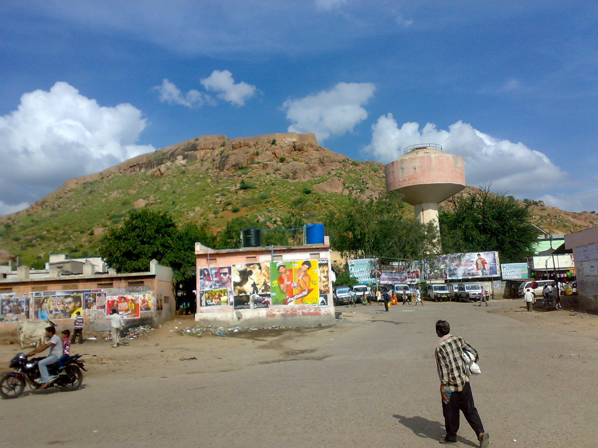
The Dindigul Fort or Dindigul Malai Kottai and Abirami amman Kalaheswarar Temple was built in 16th-century by Madurai Nayakar Dynasty situated in the town of Dindigul in the state of Tamil Nadu in India. The fort was built by the Madurai Nayakar king Muthu Krishnappa Nayakar in 1605. In the 18th century the fort passed on to Kingdom of Mysore (Mysore Wodeyars). Later it was occupied by Hyder Ali and Tipu Sultan the fort was of strategic importance. In 1799 it went to the control of the British East India Company during the Polygar Wars. There is an abandoned temple on its peak apart from few cannons sealed with balls inside. In modern times, the fort is maintained by the Archaeological Survey of India and is open to tourists. Etymology Dindigul city derives its name from a portmanteau of ''Thindu'' a Tamil word which means a ledge or a headrest attached to ground and ''kal'' another Tamil word which means Rock. Appar, the Saiva poet visited the city and noted it in his wor ... [...More Info...] [...Related Items...] OR: [Wikipedia] [Google] [Baidu] |
Gooty
Gooty ( ) is a town in Anantapur district of the Indian state of Andhra Pradesh. It is the headquarters of Gooty mandal in Anantapur revenue division. The town is renowned for the Gooty hill fort. Geography Gooty is located at , at a distance of 52 km from Anantapur. It has an average elevation of 345 metres (1131 feet). Earlier, Gooty was under the Vijayanagara Empire, later they abandoned Gooty Fort, Maratas took over fort they ruled through sandoor Gorpades till British left India. History Eight inscriptions have been found on the rocks close to the Narasimha temple located within the fort premises. These inscriptions are seriously damaged, but appear to be from the reign of the Western Chalukya king Vikramaditya VI (r. c. 1076–1126 CE). The earliest of the existing fortifications and other structures can be dated to the late Chalukya period. The fort later came under the control of the Vijayanagara Empire. During the reign of Venkata II (r. c. ... [...More Info...] [...Related Items...] OR: [Wikipedia] [Google] [Baidu] |
Tanjore
Thanjavur (), also Tanjore, Pletcher 2010, p. 195 is a city in the Indian state of Tamil Nadu. Thanjavur is the 11th biggest city in Tamil Nadu. Thanjavur is an important center of South Indian religion, art, and architecture. Most of the Great Living Chola Temples, which are UNESCO World Heritage Monuments, are located in and around Thanjavur. The foremost among these, the Brihadeeswara Temple, is located in the centre of the city. Thanjavur is also home to Tanjore painting, a painting style unique to the region. Thanjavur is the headquarters of the Thanjavur District. The city is an important agricultural centre located in the Kaveri Delta and is known as the ''Rice bowl of Tamil Nadu''. Thanjavur is administered by a municipal corporation covering an area of and had a population of 290,720 in 2011. Roadways are the major means of transportation, while the city also has rail connectivity. The nearest airport is Tiruchirapalli International Airport, located away from ... [...More Info...] [...Related Items...] OR: [Wikipedia] [Google] [Baidu] |
Carnatic Wars
The Carnatic Wars were a series of military conflicts in the middle of the 18th century in India's coastal Carnatic region, a dependency of Hyderabad State, India. Three Carnatic Wars were fought between 1744 and 1763. The conflicts involved numerous nominally independent rulers and their vassals, struggles for succession and territory; and included a diplomatic and military struggle between the French East India Company and the British East India Company. They were mainly fought within the territories of Mughal India with the assistance of various fragmented polities loyal to the "Great Moghul". As a result of these military contests, the British East India Company established its dominance among the European trading companies within India. The French company was pushed to a corner and was confined primarily to Pondichéry. The East India Company's dominance eventually led to control by the British Company over most of India and eventually to the establishment of the British ... [...More Info...] [...Related Items...] OR: [Wikipedia] [Google] [Baidu] |
Nawab Of Arcot
The Carnatic Sultanate was a kingdom in South India between about 1690 and 1855, and was under the legal purview of the Nizam of Hyderabad, until their demise. They initially had their capital at Arcot in the present-day Indian state of Tamil Nadu. Their rule is an important period in the history of the Carnatic and Coromandel Coast regions, in which the Mughal Empire gave way to the rising influence of the Maratha Empire, and later the emergence of the British Raj. Borders The old province known as the Carnatic, in which Madras (Chennai) was situated, extended from the Krishna river to the Kaveri river, and was bounded on the West by Mysore kingdom and Dindigul, (which formed part of the Sultanate of Mysore). The Northern portion was known as the ' Mughal Carnatic', the Southern the 'Maratha Carnatic' with the Maratha fortresses of Gingee and Ranjankudi. Carnatic thus was the name commonly given to the region of Southern India that stretches from the East Godavari of An ... [...More Info...] [...Related Items...] OR: [Wikipedia] [Google] [Baidu] |
Bombay
Mumbai (, ; also known as Bombay — the official name until 1995) is the capital city of the Indian state of Maharashtra and the ''de facto'' financial centre of India. According to the United Nations, as of 2018, Mumbai is the second-most populous city in India after Delhi and the eighth-most populous city in the world with a population of roughly 20 million (2 crore). As per the Indian government population census of 2011, Mumbai was the most populous city in India with an estimated city proper population of 12.5 million (1.25 crore) living under the Brihanmumbai Municipal Corporation. Mumbai is the centre of the Mumbai Metropolitan Region, the sixth most populous metropolitan area in the world with a population of over 23 million (2.3 crore). Mumbai lies on the Konkan coast on the west coast of India and has a deep natural harbour. In 2008, Mumbai was named an alpha world city. It has the highest number of millionaires and billionaires among all cities in ... [...More Info...] [...Related Items...] OR: [Wikipedia] [Google] [Baidu] |
Marathas
The Marathi people ( Marathi: मराठी लोक) or Marathis are an Indo-Aryan ethnolinguistic group who are indigenous to Maharashtra in western India. They natively speak Marathi, an Indo-Aryan language. Maharashtra was formed as a Marathi-speaking state of India in 1960, as part of a nationwide linguistic reorganization of the Indian states. The term "Maratha" is generally used by historians to refer to all Marathi-speaking peoples, irrespective of their caste; however, now it may refer to a Maharashtrian caste known as the Maratha. The Marathi community came into political prominence in the 17th century, when the Maratha Empire was established under Chhatrapati Shivaji; the Marathas are credited to a large extent for ending Mughal rule over India. History Ancient to medieval period During the ancient period, around 230 BC, Maharashtra came under the rule of the Satavahana dynasty, which ruled the region for 400 years.India Today: An Encyclopedia of Life in th ... [...More Info...] [...Related Items...] OR: [Wikipedia] [Google] [Baidu] |
Tanjore Nayaks
The Thanjavur Nayak kingdom or Thanjavur Nayak dynasty were the rulers of Thanjavur in the 15th and 17th centuries. The Nayaks of the Balija social group, were originally appointed as provincial governors by the Vijayanagara Emperor in the 15th century, who divided the territory into Nayak kingdoms which were Madurai, Tanjore, Gingee and Kalahasthi. In the mid 15th century they became an independent kingdom, although they continued their alliance with the Vijayanagara Empire. The Thanjavur Nayaks were notable for their patronage of literature and the arts. A translation from '' Raghunathabhyudayam (p. 284)'', says this about Timma Nayak the father of Sevappa Nayak, the founder of the Tanjore Nayak in line: ''In the sathria caste born from the feet of Vishnu was born a king called Timma Nayak''.''Nayaks of Tanjore'', by V. Vriddhagirisan, p.26 The ''Mannaru'' (Vishnu) of the Mannargudi temple was their ''kula daivam'' (family deity). Origins of Nayak rule With the demise of th ... [...More Info...] [...Related Items...] OR: [Wikipedia] [Google] [Baidu] |
France
France (), officially the French Republic ( ), is a country primarily located in Western Europe. It also comprises of overseas regions and territories in the Americas and the Atlantic, Pacific and Indian Oceans. Its metropolitan area extends from the Rhine to the Atlantic Ocean and from the Mediterranean Sea to the English Channel and the North Sea; overseas territories include French Guiana in South America, Saint Pierre and Miquelon in the North Atlantic, the French West Indies, and many islands in Oceania and the Indian Ocean. Due to its several coastal territories, France has the largest exclusive economic zone in the world. France borders Belgium, Luxembourg, Germany, Switzerland, Monaco, Italy, Andorra, and Spain in continental Europe, as well as the Netherlands, Suriname, and Brazil in the Americas via its overseas territories in French Guiana and Saint Martin. Its eighteen integral regions (five of which are overseas) span a combined area of and contain clos ... [...More Info...] [...Related Items...] OR: [Wikipedia] [Google] [Baidu] |


