|
Bagarmossen
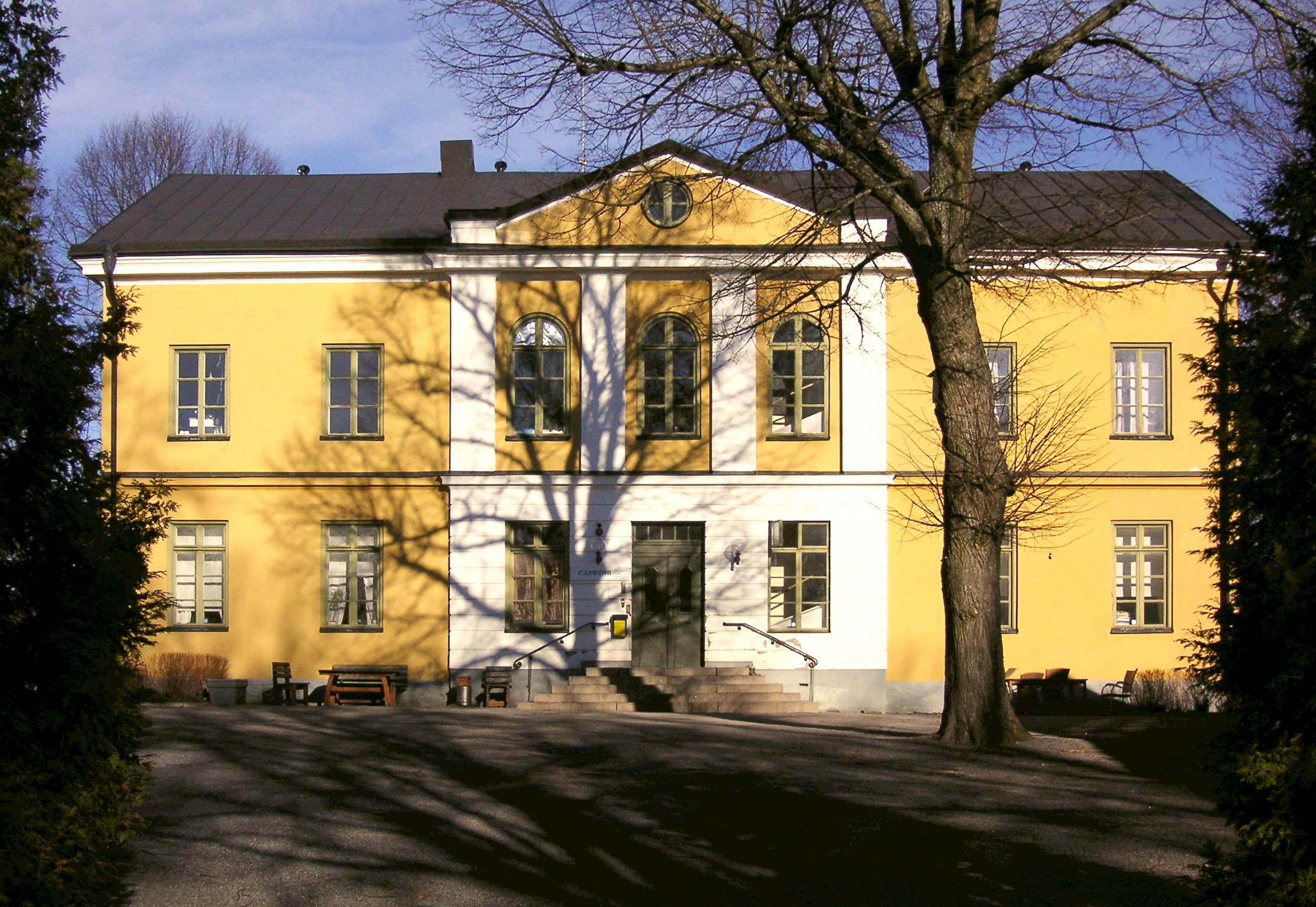
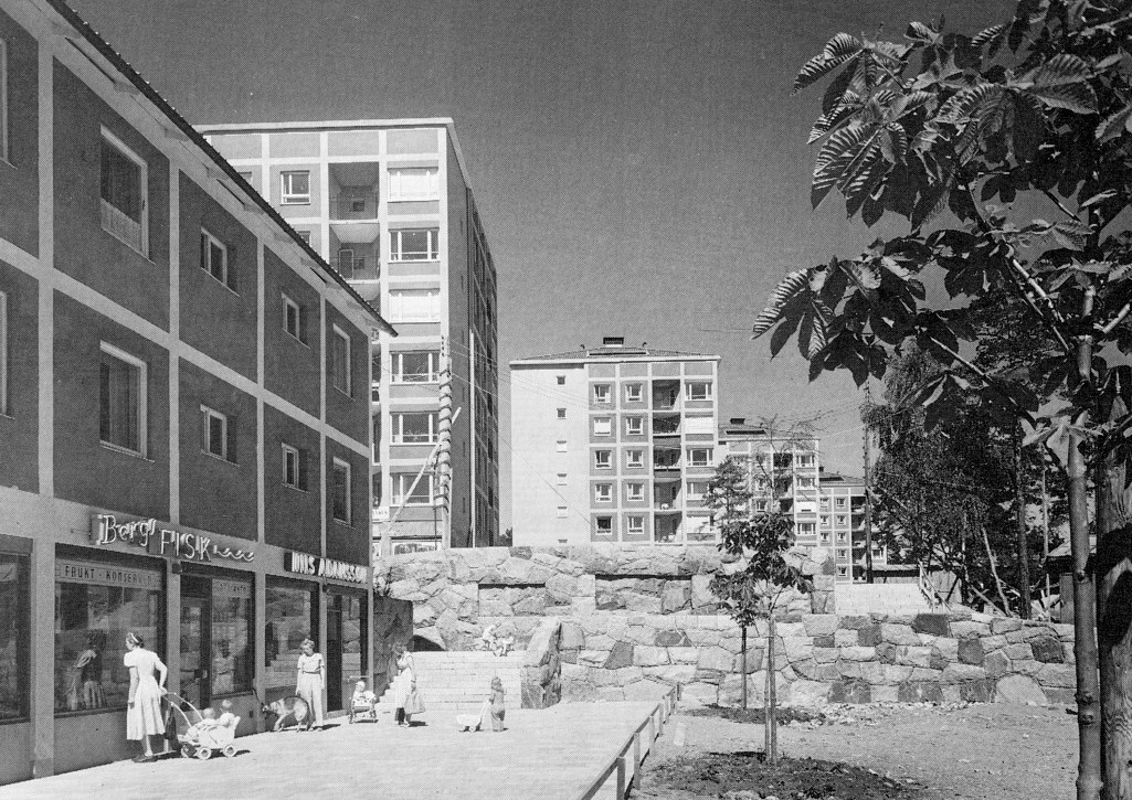
Bagarmossen is a district within Skarpnäck borough of Stockholm, Sweden. Bagarmossen had 10 914 inhabitants as of December 31, 2009. Geography and transportation Bagarmossen is located southeast of central Stockholm, neighbouring the Skarpnäcks gård district to the south and west, Kärrtorp to the northwest, and the nature reserve Nackareservatet in Nacka Municipality to the east. Bagarmossen is served by the Bagarmossen metro station, which is located along the green line 17. When the station opened in 1958, it was a surface station and the terminus of line 17. When line 17 was extended to Skarpnäck in 1994, this included a new underground station in Bagarmossen, replacing the old surface one. Bagarmossen is also the terminus of the 161 bus line to Gröndal. Architecture Bagarmossen was built mostly during the 1950s, and remains a relatively well-preserved '50s suburb. The apartment buildings along Byälvsvägen were built in the early 1970s as a part of the mil ... [...More Info...] [...Related Items...] OR: [Wikipedia] [Google] [Baidu] |
Bagarmossen Centrum 2
Bagarmossen is a district within Skarpnäck borough of Stockholm, Sweden. Bagarmossen had 10 914 inhabitants as of December 31, 2009. Geography and transportation Bagarmossen is located southeast of central Stockholm, neighbouring the Skarpnäcks gård district to the south and west, Kärrtorp to the northwest, and the nature reserve Nackareservatet in Nacka Municipality to the east. Bagarmossen is served by the Bagarmossen metro station, which is located along the green line 17. When the station opened in 1958, it was a surface station and the terminus of line 17. When line 17 was extended to Skarpnäck in 1994, this included a new underground station in Bagarmossen, replacing the old surface one. Bagarmossen is also the terminus of the 161 bus line to Gröndal. Architecture Bagarmossen was built mostly during the 1950s, and remains a relatively well-preserved '50s suburb. The apartment buildings along Byälvsvägen were built in the early 1970s as a part of the milli ... [...More Info...] [...Related Items...] OR: [Wikipedia] [Google] [Baidu] |
Bagarmossen Metro Station
Bagarmossen metro station is on the green line of the Stockholm metro, located in Bagarmossen, Söderort in the south of Stockholm. The surface station was opened on 18 November 1958 as the southern terminus of the extension from Hammarbyhöjden Hammarbyhöjden is a city district in Stockholm, Sweden. The district is split across two boroughs: Most of it is located in Skarpnäck borough, the subdistrict Blåsut is located in the Enskede-Årsta-Vantör borough. As of December 31, 2007 .... On 15 August 1994, the line was extended further to Skarpnäck. The current station is below ground level and was opened on 15 August 1994 as the extension to Skarpnäck was taken into service and Bagarmossen no longer served as a terminus. The old surface-level station with the same name was in use between 18 November 1958 and 8 July 1994. After the surface level station closed, a number of residential buildings were constructed on the site of the station and its approaches. Reference ... [...More Info...] [...Related Items...] OR: [Wikipedia] [Google] [Baidu] |
Skarpnäcksfältet
Skarpnäcksfältet ( en, The Skarpnäck Field) is a subdistrict of Skarpnäcks Gård in the Skarpnäck borough of Stockholm, Sweden. Skarpnäcksfältet was built in the 1980s, and has 8,734 inhabitants as of December 31, 2009. History Archaeological findings, such as a hill fort and stone circles near Flatensjön, indicate that Skarpnäcksfältet and nearby areas were populated by vikings as early as the 10th century. Skarpa by Skarpa, a cottage of the Årsta property, was first mentioned in the will of Duke Valdemar in 1318, where it was listed as one of his donations to Uppsala domkyrka. Skarpa derives from the word ''skarp'' ( en, sharp), and is believed to have indicated the soil quality, which was heavy loam. It is believed that the small village of Skarpa by, with the Skarpa cottage, also consisted of three homesteads dating as far back as the 13th century. According to a document from 1432, Skarpa was sold by the Archdiocese of Uppsala to Hans Kröpelin, th ... [...More Info...] [...Related Items...] OR: [Wikipedia] [Google] [Baidu] |
Kärrtorp
Kärrtorp is a district ( sv, stadsdel) in the Skarpnäck borough of Stockholm, Sweden,. Kärrtorp has 4,296 inhabitants as of December 31, 2009. Geography Kärrtorp is a small district located in the southeast of Stockholm. Kärrtorp neighbours Bagarmossen, Skarpnäcks gård (subdistrict Pungpinan), Enskededalen, Gamla Enskede in the Enskede-Årsta-Vantör borough, Hammarbyhöjden, Björkhagen, and the nature reserve Nackareservatet in Nacka municipality. Transportation Kärrtorp is served by the elevated Kärrtorp metro station, which was opened in 1958 and is located along the green line 17. Kärrtorp is the terminus of the 163 bus line to Bredäng, and the 180 line to Orhem via Skarpnäcks gård. The north-south Nynäsvägen motorway is reachable within a few minutes from Kärrtorp. Nynäsvägen goes north towards Södra Länken and the city centre, and south towards the outer suburbs and eventually Nynäshamn. History The first development plan of Kärrto ... [...More Info...] [...Related Items...] OR: [Wikipedia] [Google] [Baidu] |
Line 17 (Stockholm Metro)
The Green line ( sv, Gröna linjen) is the oldest of the three Stockholm metro lines. The long line comprises a single line north of the city centre, splitting into three branches south of the city centre. The first section of the line opened as a metro in 1950, although some parts of the line date back to the 1930s and were originally used by the Stockholm tramway. History Before the metro The first section of what is now the Green line opened as a metro in 1950, but several sections of the line use infrastructure that was originally built for, or used by, the Stockholm tramway. These include: * Between Globen and Stureby, the line uses tracks that were created for use by route 19 of the tramway in 1930. These tracks required rebuilding, with the removal of level crossings, before metro trains could use them. * Between Slussen and Skanstull, the line uses the , a tunnel originally built for use by routes 8 and 19 of the tramway in 1933. The tunnel stations required rebuilding ... [...More Info...] [...Related Items...] OR: [Wikipedia] [Google] [Baidu] |
Million Programme
The Million Programme ( sv, Miljonprogrammet) was an ambitious public housing program implemented in Sweden between 1965 and 1974 by the governing Swedish Social Democratic Party to ensure the availability of affordable, high quality housing to all Swedish citizens. The program sought to construct one million new housing dwellings over a ten-year period, which it accomplished. As part of its intention to modernize Swedish housing, it also demolished many older buildings that national and local governments considered obsolescent, unhealthy or derelict. At the time, the intention to build one million new homes in a nation with a population of eight million made the Million Programme the most ambitious building programme in the world. In contrast to the social housing proposals of many other developed countries, which is targeted at those with low incomes, the Million Programme was a universal program intended to provide housing to Swedish people at a variety of income levels. ... [...More Info...] [...Related Items...] OR: [Wikipedia] [Google] [Baidu] |
Nacka Municipality
Nacka Municipality (''Nacka kommun'') is a municipality in Stockholm County in east-central Sweden. Its seat is located at Nacka. The municipality is situated just east of the capital Stockholm and the western parts are considered a suburban part of the city of Stockholm. The present municipality was created in 1971 when the ''City of Nacka'' (itself instituted in 1949) was amalgamated with ''Saltsjöbaden'' (itself detached from "old" Nacka in 1909) and ''Boo''. Geography The municipality is situated in two historical provinces (''landskap''), Uppland and Södermanland, but in one administrative county (''län''), Stockholm County. The western densely built-up area of Nacka Municipality is a contiguous part of the city of Stockholm. About 50,000 of the municipality's total population live there. There are also some more localities in the municipality. The larger ones are: Boo, Fisksätra, Saltsjöbaden, Skuru and Älta. History The area has been populated since the ... [...More Info...] [...Related Items...] OR: [Wikipedia] [Google] [Baidu] |
Lawn
A lawn is an area of soil-covered land planted with grasses and other durable plants such as clover which are maintained at a short height with a lawnmower (or sometimes grazing animals) and used for aesthetic and recreational purposes. Lawns are usually composed only of grass species, subject to weed and pest control, maintained in a green color (e.g., by watering), and are regularly mowed to ensure an acceptable length. Lawns are used around houses, apartments, commercial buildings and offices. Many city parks also have large lawn areas. In recreational contexts, the specialised names turf, pitch, field or green may be used, depending on the sport and the continent. The term "lawn", referring to a managed grass space, dates to at least than the 16th century. With suburban expansion, the lawn has become culturally ingrained in some areas of the world as part of the desired household aesthetic.Robbins, PaulLawn People: How Grasses, Weeds, and Chemicals Make Us Who We Are P ... [...More Info...] [...Related Items...] OR: [Wikipedia] [Google] [Baidu] |
Spruce
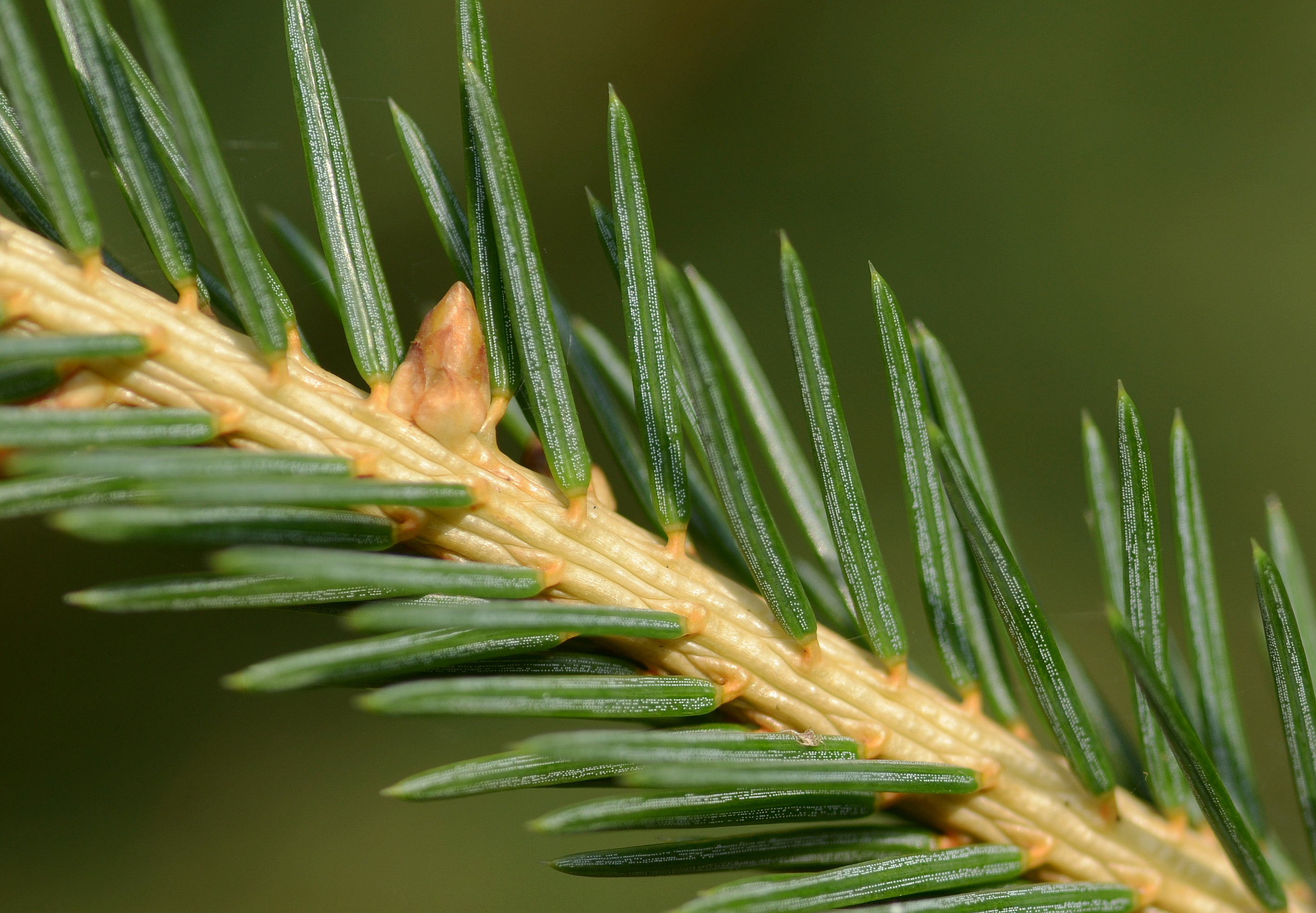
A spruce is a tree of the genus ''Picea'' (), a genus of about 35 species of coniferous evergreen trees in the family Pinaceae, found in the northern temperate and boreal (taiga) regions of the Earth. ''Picea'' is the sole genus in the subfamily Piceoideae. Spruces are large trees, from about 20 to 60 m (about 60–200 ft) tall when mature, and have whorled branches and conical form. They can be distinguished from other members of the pine family by their needles (leaves), which are four-sided and attached singly to small persistent peg-like structures (pulvini or sterigmata) on the branches, and by their cones (without any protruding bracts), which hang downwards after they are pollinated. The needles are shed when 4–10 years old, leaving the branches rough with the retained pegs. In other similar genera, the branches are fairly smooth. Spruce are used as food plants by the larvae of some Lepidoptera (moth and butterfly) species, such as the eastern spruce budwo ... [...More Info...] [...Related Items...] OR: [Wikipedia] [Google] [Baidu] |
Pine
A pine is any conifer tree or shrub in the genus ''Pinus'' () of the family Pinaceae. ''Pinus'' is the sole genus in the subfamily Pinoideae. The World Flora Online created by the Royal Botanic Gardens, Kew and Missouri Botanical Garden accepts 187 species names of pines as current, together with more synonyms. The American Conifer Society (ACS) and the Royal Horticultural Society accept 121 species. Pines are commonly found in the Northern Hemisphere. ''Pine'' may also refer to the lumber derived from pine trees; it is one of the more extensively used types of lumber. The pine family is the largest conifer family and there are currently 818 named cultivars (or trinomials) recognized by the ACS. Description Pine trees are evergreen, coniferous resinous trees (or, rarely, shrubs) growing tall, with the majority of species reaching tall. The smallest are Siberian dwarf pine and Potosi pinyon, and the tallest is an tall ponderosa pine located in southern Oregon's Rogue Riv ... [...More Info...] [...Related Items...] OR: [Wikipedia] [Google] [Baidu] |
Courtyard
A courtyard or court is a circumscribed area, often surrounded by a building or complex, that is open to the sky. Courtyards are common elements in both Western and Eastern building patterns and have been used by both ancient and contemporary architects as a typical and traditional building feature. Such spaces in inns and public buildings were often the primary meeting places for some purposes, leading to the other meanings of court. Both of the words ''court'' and ''yard'' derive from the same root, meaning an enclosed space. See yard and garden for the relation of this set of words. In universities courtyards are often known as quadrangles. Historic use Courtyards—private open spaces surrounded by walls or buildings—have been in use in residential architecture for almost as long as people have lived in constructed dwellings. The courtyard house makes its first appearance ca. 6400–6000 BC (calibrated), in the Neolithic Yarmukian site at Sha'ar HaGolan, in ... [...More Info...] [...Related Items...] OR: [Wikipedia] [Google] [Baidu] |


.jpg)