|
BR-277
BR-277 is a federal highway of Brazil, across the state of Paraná, between the town of Paranaguá and Foz do Iguaçu. Economic importance The highway has high economic importance for Brazil and even for Paraguay, as it connects the Brazil-Paraguay border with Port of Paranaguá. On the border there is intense trade between the two countries; there is great tourism in the Foz do Iguaçu area due to the border trade and mainly because of the Iguaçu Falls. In Paraná, there is a large production of soy, corn, chicken, milk, cellulose and fish, among other products (which are exported in Paranaguá), and Paraguay uses the port to carry out part of its exports. Duplications The highway is duplicated in the 140 km between the Port of Paranaguá, Curitiba and the junction with the BR-376. BR-277, as well as BRs 369 and 376, which form a triangle within the state of Paraná, were granted to private companies in 1997, at the beginning of the era of road concessions in Brazil. Th ... [...More Info...] [...Related Items...] OR: [Wikipedia] [Google] [Baidu] |
Curitiba
Curitiba () is the capital and largest city in the state of Paraná (state), Paraná in Brazil. The city's population was 1,948,626 , making it the List of cities in Brazil by population, eighth most populous city in Brazil and the largest in Brazil's South Region, Brazil, South Region. The Curitiba Metropolitan area comprises 26 Municipalities of Brazil, municipalities with a total population of over 3.2 million (Brazilian Institute of Geography and Statistics, IBGE estimate in 2010), making it the seventh most populous metropolitan area in the country. The city sits on a plateau at Above mean sea level, above sea level. It is located west of the seaport of Paranaguá and is served by the Afonso Pena International Airport, Afonso Pena International and Bacacheri Airport, Bacacheri airports. Curitiba is an important cultural, political, and economic center in Latin America and hosts the Federal University of Paraná, established in 1912. In the 1700s, Curitiba's favorabl ... [...More Info...] [...Related Items...] OR: [Wikipedia] [Google] [Baidu] |
Foz Do Iguaçu
Foz do Iguaçu (''Iguazu River Mouth'') () is the Brazilian city on the border of Iguaçu Falls. The city is the 7th largest in the state of Paraná. The city's population is approximately 258,000. It is approximately 650 km (400 mi) west of the capital of the state, Curitiba, being the westernmost city in that state. The inhabitants of the city are known as ''iguaçuenses''. The Iguaçu Falls located on the border of Argentina and Brazil and consisting of approximately 257 individual waterfalls over were chosen as one of the "'' New Natural Seven Wonders of the World''." The city is characterized by tourism and cultural diversity. There are about 80 nationalities, being the most representative from Italy, Portugal, Lebanon, China, Paraguay and Argentina. Foz do Iguaçu is integrated into a tri-national region, bordering the Argentine city of Puerto Iguazú and the Paraguayan city of Ciudad del Este. The city's economy is based on tourism, with emphasis on trade and se ... [...More Info...] [...Related Items...] OR: [Wikipedia] [Google] [Baidu] |
Paraná (state)
Paraná () is one of the 26 states of Brazil, in the south of the country, bordered on the north by São Paulo state, on the east by the Atlantic Ocean, on the south by Santa Catarina state and the province of Misiones, Argentina, and on the west by Mato Grosso do Sul and Paraguay, with the Paraná River as its western boundary line. It is subdivided into 399 municipalities, and its capital is the city of Curitiba. Other major cities are Londrina, Maringá, Ponta Grossa, Cascavel, São José dos Pinhais and Foz do Iguaçu. The state is home to 5.4% of the Brazilian population and has 6.2% of the Brazilian GDP. Crossed by the Tropic of Capricorn, Paraná has what is left of the araucaria forest, one of the most important subtropical forests in the world. At the border with Argentina is the National Park of Iguaçu, considered by UNESCO as a World Heritage Site. At only from there, at the border with Paraguay, the largest dam in the world was built, the Hidroelétrica de Itaipu ... [...More Info...] [...Related Items...] OR: [Wikipedia] [Google] [Baidu] |
Port Of Paranaguá
The Port of Paranaguá is one of the main ports of Brazil and Latin America. It's located in the city of Paranaguá, in the Brazilian state of Paraná (state), Paraná. It's the second largest port of Brazil in tonnage and the third in container shipping. It's a main exporting port of agricultural products in Brazil, especially soybeans and soybean meal. Data The port was established in 1872, as a private-owned wharf. In 1917 the State of Paraná took control of its concession, and began the works to expand the port. The new port opened in 1935. In 1947, a state organism, Administração dos Portos de Paranaguá (APP) was founded for overseeing its operation. In 1971, the APP started to manage also the port of Antonina becoming APPA (Administração dos Portos de Paranaguá e Antonina). The land access system to the port is made up of BR-277, PR-401, PR-411, PR-410 and PR-412. Rail access is through the Sul-Atlântico S/A railway, Red Sur, of the former Regional Superintendenc ... [...More Info...] [...Related Items...] OR: [Wikipedia] [Google] [Baidu] |
Ponta Grossa
Ponta Grossa () is a municipality in the state of Paraná, southern Brazil. The estimated population is 355,336 according to official data from the Brazilian Institute of Geography and Statistics and it is the 4th most populous city in Paraná (76th in Brazil). It is also the largest city close to Greater Curitiba region, so within a radius of 186 miles (300 km) of Ponta Grossa. It is also known as ''Princesa dos Campos'' (in English: ''Princess of the Fields'') and ''Capital Cívica do Paraná'' (in English: ''Civic Capital of Paraná''). The city is connected to the ''Caminho das Tropas'' (in English: ''Path of the Troops''), being one of the network of routes used by drovers (''tropeiros'') in the middle of a high hill inside a grassy vegetation. The city is considered of average size, located around a central hill, while most of its growth occurred in the second half of the twentieth century with the weakening of the primary economy. Ponta Grossa is one of the larg ... [...More Info...] [...Related Items...] OR: [Wikipedia] [Google] [Baidu] |
Paranaguá
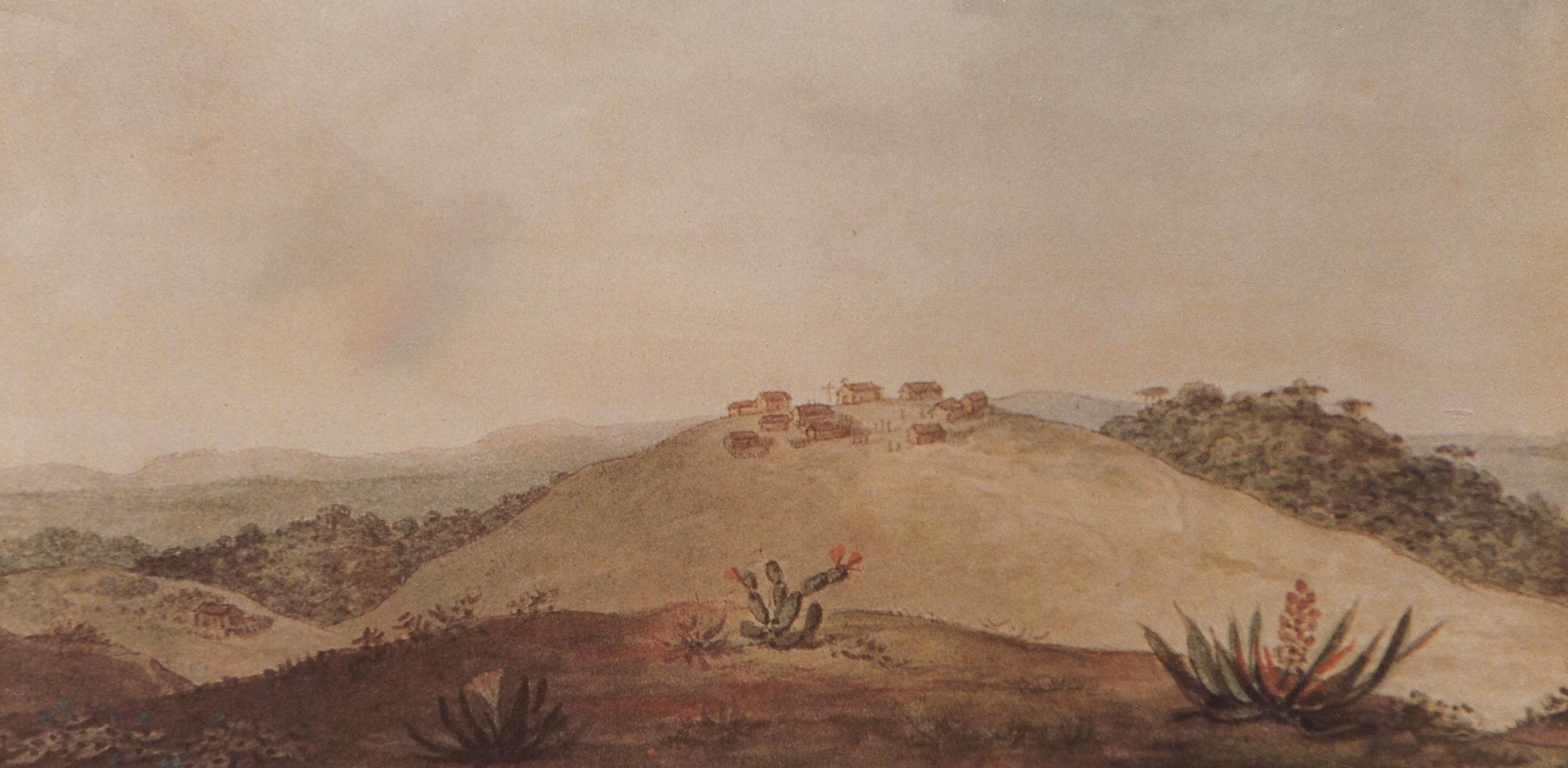
Paranaguá (''Great Round Sea'', in Tupi) is a city in the state of Paraná in Brazil. Founded in 1648, it is Paraná's oldest city. It is known for the Port of Paranaguá, which serves as both the sea link for Curitiba, to the west and the capital of Paraná, and as one of the largest ports of Brazil. As of 2020, the city has an estimated population of 156,174 and a population density of 169.92 persons per km², making it the tenth most populated city in the state of Paraná. The total area of the city is . Conservation The municipality contains 4% of the Guaratuba Environmental Protection Area, created in 1992. It holds 17% of the Bom Jesus Biological Reserve, a strictly protected conservation unit established in 2012. The municipality contains the Ilha do Mel State Park and the Ilha do Mel Ecological Station on the Ilha do Mel (Honey Island) at the mouth of Paranaguá Bay. History Early settlement Paranaguá was home to a ''sambaqui'', or midden culture, for several ... [...More Info...] [...Related Items...] OR: [Wikipedia] [Google] [Baidu] |
Ratinho Júnior
Carlos Roberto Massa Júnior (born 19 April 1981), best known as Ratinho Júnior, is a Brazilian politician and the son of television host and former politician Ratinho. Ratinho Júnior is the current governor of the state of Paraná, having won the 2018 election. References 1981 births Living people People from Jandaia do Sul Brazilian Socialist Party politicians Social Christian Party (Brazil) politicians Social Democratic Party (Brazil, 2011) politicians Cidadania politicians Members of the Chamber of Deputies (Brazil) from Paraná Governors of Paraná (state) {{Brazil-politician-stub ... [...More Info...] [...Related Items...] OR: [Wikipedia] [Google] [Baidu] |
Balsa Nova
Balsa Nova is a municipality in the state of Paraná in the Southern Region of Brazil. It has a population of 13,092 and covers . Balsa Nova borders the municipalities of Araucária, Campo Largo, Contenda, Lapa, Palmeira and Porto Amazonas, all in the east of the state of Paraná. History Balsa Nova was settled by Carajó people, an Atlantic coast-based subgroup of the Guaraní people, prior to the arrival of the Portuguese. The Carajó used the present-day area of Balsa Nova along the Iguaçu as an outpost. The area served as a crossing ground for cattle drovers moving livestock and goods to the south of Brazil. The Sierra of São Luiz do Purunã provided an open area for cattle. The first settlement in the area dates to 1702, and the Capela Nossa Senhora do Carmo, later known as the Capela de Nossa Senhora da Conceição do Tamunduá, was built in 1709. The area was referred to variously as Rodeio, Rodeiozinho, or Rodeio Grande; all are references to cattle farming. Th ... [...More Info...] [...Related Items...] OR: [Wikipedia] [Google] [Baidu] |
Santa Terezinha De Itaipu
Santa Terezinha de Itaipu is a municipality in the state of Paraná in the Southern Region of Brazil. According to the IBGE Santa Teresinha de Itaipu has approximately 24,000 inhabitants. The municipality contains part of the Santa Maria Ecological Corridor, created in 2001. See also *List of municipalities in Paraná This is a list of the municipalities in the state of Paraná (PR), located in the South Region of Brazil. Paraná is divided into 399 municipalities, which are grouped into 39 microregions, which are grouped into 10 mesoregions. See also * ... References Municipalities in Paraná {{ParanáBR-geo-stub ... [...More Info...] [...Related Items...] OR: [Wikipedia] [Google] [Baidu] |
Medianeira
Medianeira is a municipality A municipality is usually a single administrative division having corporate status and powers of self-government or jurisdiction as granted by national and regional laws to which it is subordinate. The term ''municipality'' may also mean the go ... in the state of Paraná in Brazil. In 2020 it had 46,574 inhabitants. The agriculture-industrial sector is the base of the city's economy. References External links City website Medianeira {{ParanáBR-geo-stub ... [...More Info...] [...Related Items...] OR: [Wikipedia] [Google] [Baidu] |
Cascavel
Cascavel is a municipality in the state of Paraná in Brazil. It is the fifth most populous city in the state with 332,333 residents, according to IBGE, a government agency. The distance to Curitiba, the state capital, is 491 kilometers by freeway. Relatively new and with a privileged topography, Cascavel's development was planned, which gives it wide streets and well distributed neighborhoods. With an area of 2,100,831 km2, it is considered a strategic hub of Mercosul. The city is on a plateau 781 meters above sea level. It is 504 km west of the state capital of Curitiba and 605 km west of the sea port of Paranaguá, 140 km from the three borders (Paraguay, Argentina and Brazil) at 24° 58' South, 53° 26' West. Toponymy The name of the city means rattlesnake in Portuguese; it arises from a variation of the classical Latin "caccabus", meaning "bubbling water boiling". According to legend, a group of settlers camped one night in the region and they we ... [...More Info...] [...Related Items...] OR: [Wikipedia] [Google] [Baidu] |
Laranjeiras Do Sul
Laranjeiras do Sul is a municipality in the state of Paraná in the Southern Region of Brazil. It was once the territorial capital of Iguaçu. See also *List of municipalities in Paraná This is a list of the municipalities in the state of Paraná (PR), located in the South Region of Brazil. Paraná is divided into 399 municipalities, which are grouped into 39 microregions, which are grouped into 10 mesoregions. See also * ... References News from Laranjeiras do Sul Municipalities in Paraná {{ParanáBR-geo-stub ... [...More Info...] [...Related Items...] OR: [Wikipedia] [Google] [Baidu] |


