|
Börtlingen
Börtlingen is a municipality in the district of Göppingen in Baden-Württemberg in southern Germany. Geography Börtlingen belongs to the marginal zone of the metropolitan region of Stuttgart. Geographical location Börtlingen is located in the Schurwald in 334-498 meters above sea level, in a straight line about 6 km north of the county town Göppingen. Municipality arrangement To Börtlingen belongs the village Börtlingen, the two Weiler Breech and Zell, the courts Ödweiler and Schweizerhof and the house Schneiderhof and the proofs of former village Oedweiler. Population development The development between 1837 and 2010. Source: Statistical Office Baden-Württemberg Stuttgart Economy and Infrastructure Transportation Börtlingen is accessible via the B 297 and the county road K 1408 from Lorch and Göppingen. Local roads lead to Zachersmühle and Oberwälden and about the Kaisersträßle to Adelberg and Oberberken. There is also a bus service to and from G ... [...More Info...] [...Related Items...] OR: [Wikipedia] [Google] [Baidu] |
Adelberg
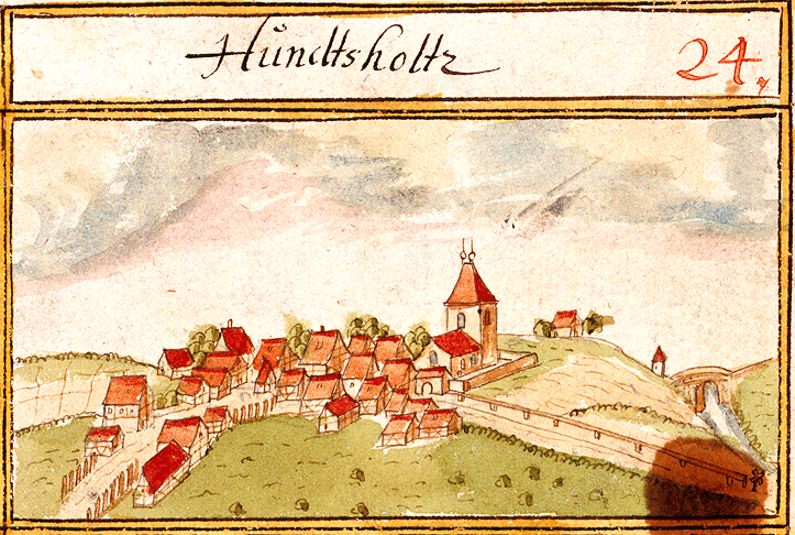
Adelberg is a municipality in the district of Göppingen in Baden-Württemberg in southern Germany. Geography Adelberg lies in the Schurwald forest, at an altitude of around 334 to 473m. Climate The annual rainfall of 1045mm is within the top quarter of values recorded in Germany, with lower values registered in 87% of the country's weather stations. The driest month is February, while the most rainfall comes in June, with almost double the rainfall of February. Variability of precipitation is extremely strong, and only 18% of weather stations record higher seasonal variations. Local subdivisions The municipality of Adelberg is made up of the village of Adelberg, the neighbouring hamlet of Adelberg Abbey, and the houses, Herrenmühle, Mittelmühle und Zachersmühle. In 1971, the hamlet of Nassach was transferred to the municipality of Uhingen. History The site on which Adelberg now stands was originally occupied by the village of Hundsholz (''Dogwood''), which is the source of ... [...More Info...] [...Related Items...] OR: [Wikipedia] [Google] [Baidu] |
Göppingen (district)
Göppingen is a ''Landkreis'' (district) in the middle of Baden-Württemberg, Germany. Neighboring districts are Rems-Murr, Ostalbkreis, Heidenheim, Alb-Donau, Reutlingen and Esslingen. History In 1817, Württemberg was divided into four kreise (districts), the southeastern one of which was named Donaukreis. The four kreise were in turn divided into oberämter. In Donaukreis, the most northern of these oberämter were Göppingen and, to its east, Geislingen. In 1938, the four kreise were abolished, and Geislingen was merged with Göppingen. During the communal reform of 1973 the district was not changed much, only a few municipalities from the districts Schwäbisch Gmünd and Ulm were added. The district is sometimes called ''Stauferkreis'', because the Staufen family had their roots in this area. However, when that family had no heir anymore, the land became part of Württemberg in the 14th century. Partnerships In 1990 a partnership with the district Löbau (now merged in ... [...More Info...] [...Related Items...] OR: [Wikipedia] [Google] [Baidu] |
Schurwald
The Schurwald is a wooded mountain range in Baden-Württemberg, southern Germany, which at its highest point is 513.2 m above sea level. It is one of the most important Recreation areas for the Stuttgart area. Over the centuries, the vast forests of the mountain range supplied the surrounding towns and villages with wood for fuel and building material, and thus acquired the name "Schurwald", which comes from the German word, ''Schur'', which can mean a shearing or clearcutting. Geography The Schurwald begins to the east of Stuttgart and runs eastwards to the foothills of the Swabian Alb, passing through the districts of Esslingen, Göppingen and Rems-Murr-Kreis. It is bordered to the south by valleys of the Neckar and Fils rivers, and to the north by the valley of the Rems. At the eastern end of the Schurwald, which is crossed by numerous streams, is the Herrenbach Reservoir. Geology Geologically, the Schurwald is a dissected cuesta, formed by headward erosion. It contains ... [...More Info...] [...Related Items...] OR: [Wikipedia] [Google] [Baidu] |
Lorch (Württemberg)
Lorch is a small town in the Ostalbkreis district, in Baden-Württemberg, Germany, by the river Rems, 8 kilometers west of Schwäbisch Gmünd. It is a part of the Ostwürttemberg region. Geography Lorch lies in a valley of the river Rems, a tributary of the river Neckar, with Schwäbisch Gmünd to its east, Schorndorf to its west, the Swabian-Franconian Forest to its north and the Swabian Alps to its south. Lorch is part of the Swabian-Franconian Forest Nature Park and is located at the Limes hiking route (HW 6) of the Swabian Alp Association. In addition to Schwäbisch Gmünd, the town also borders the municipality of Alfdorf to the north, the municipalities of Wäschenbeuren and Börtlingen to the south as well as the municipality of Plüderhausen to the west. Lorch, with the formerly independent municipality of Waldhausen, encompasses 35 hamlets, villages and farms in addition to Lorch itself. In accordance with the borders drawn at the 31st of December 1971, Lor ... [...More Info...] [...Related Items...] OR: [Wikipedia] [Google] [Baidu] |
Rechberghausen
Rechberghausen is a town in the district of Göppingen in Baden-Württemberg in southern Germany. Geography Geographical location The community lies in on the foothills of the central Swabian Jura and on the edge of the eastern Schurwald. The height is DE-NN. Neighbouring communities In the northwest the municipality borders to Börtlingen, in the northeast to Birenbach. Eastern and south-eastern neighbour is the county seat Göppingen, with its Bartenbach district, the western neighbour is the community Wangen (Göppingen). All are located in the district of Göppingen. History The place was first mentioned in 1245. He was then the Dukes of Teck Duke of Teck is a title which was created twice in Germanic lands. It was first borne from 1187 to 1439 by the head of a cadet line of the German ducal House of Zähringen, known as the "first House of Teck". The ''caput'' of his territory was T ... after the local castle had previously probably heard the Lords of Rechberghau ... [...More Info...] [...Related Items...] OR: [Wikipedia] [Google] [Baidu] |
Municipalities Of Germany
MunicipalitiesCountry Compendium. A companion to the English Style Guide European Commission, May 2021, pages 58–59. (german: Gemeinden, singular ) are the lowest level of official territorial division in . This can be the second, third, fourth or fifth level of territorial division, depending on the status of the municipality and the '' Land'' (federal state) it is part of. The city-states Berlin and Hamburg are second-l ... [...More Info...] [...Related Items...] OR: [Wikipedia] [Google] [Baidu] |
Baden-Württemberg
Baden-Württemberg (; ), commonly shortened to BW or BaWü, is a German state () in Southwest Germany, east of the Rhine, which forms the southern part of Germany's western border with France. With more than 11.07 million inhabitants across a total area of nearly , it is the third-largest German state by both area (behind Bavaria and Lower Saxony) and population (behind North Rhine-Westphalia and Bavaria). As a federated state, Baden-Württemberg is a partly-sovereign parliamentary republic. The largest city in Baden-Württemberg is the state capital of Stuttgart, followed by Mannheim and Karlsruhe. Other major cities are Freiburg im Breisgau, Heidelberg, Heilbronn, Pforzheim, Reutlingen, Tübingen, and Ulm. What is now Baden-Württemberg was formerly the historical territories of Baden, Prussian Hohenzollern, and Württemberg. Baden-Württemberg became a state of West Germany in April 1952 by the merger of Württemberg-Baden, South Baden, and Württemberg-Hohe ... [...More Info...] [...Related Items...] OR: [Wikipedia] [Google] [Baidu] |
Germany
Germany, officially the Federal Republic of Germany (FRG),, is a country in Central Europe. It is the most populous member state of the European Union. Germany lies between the Baltic and North Sea to the north and the Alps to the south. Its 16 constituent states have a total population of over 84 million in an area of . It borders Denmark to the north, Poland and Czechia to the east, Austria and Switzerland to the south, and France, Luxembourg, Belgium, and the Netherlands to the west. The nation's capital and most populous city is Berlin and its main financial centre is Frankfurt; the largest urban area is the Ruhr. Settlement in what is now Germany began in the Lower Paleolithic, with various tribes inhabiting it from the Neolithic onward, chiefly the Celts. Various Germanic tribes have inhabited the northern parts of modern Germany since classical antiquity. A region named Germania was documented before AD 100. In 962, the Kingdom of Germany formed the ... [...More Info...] [...Related Items...] OR: [Wikipedia] [Google] [Baidu] |
Johanneskirche History
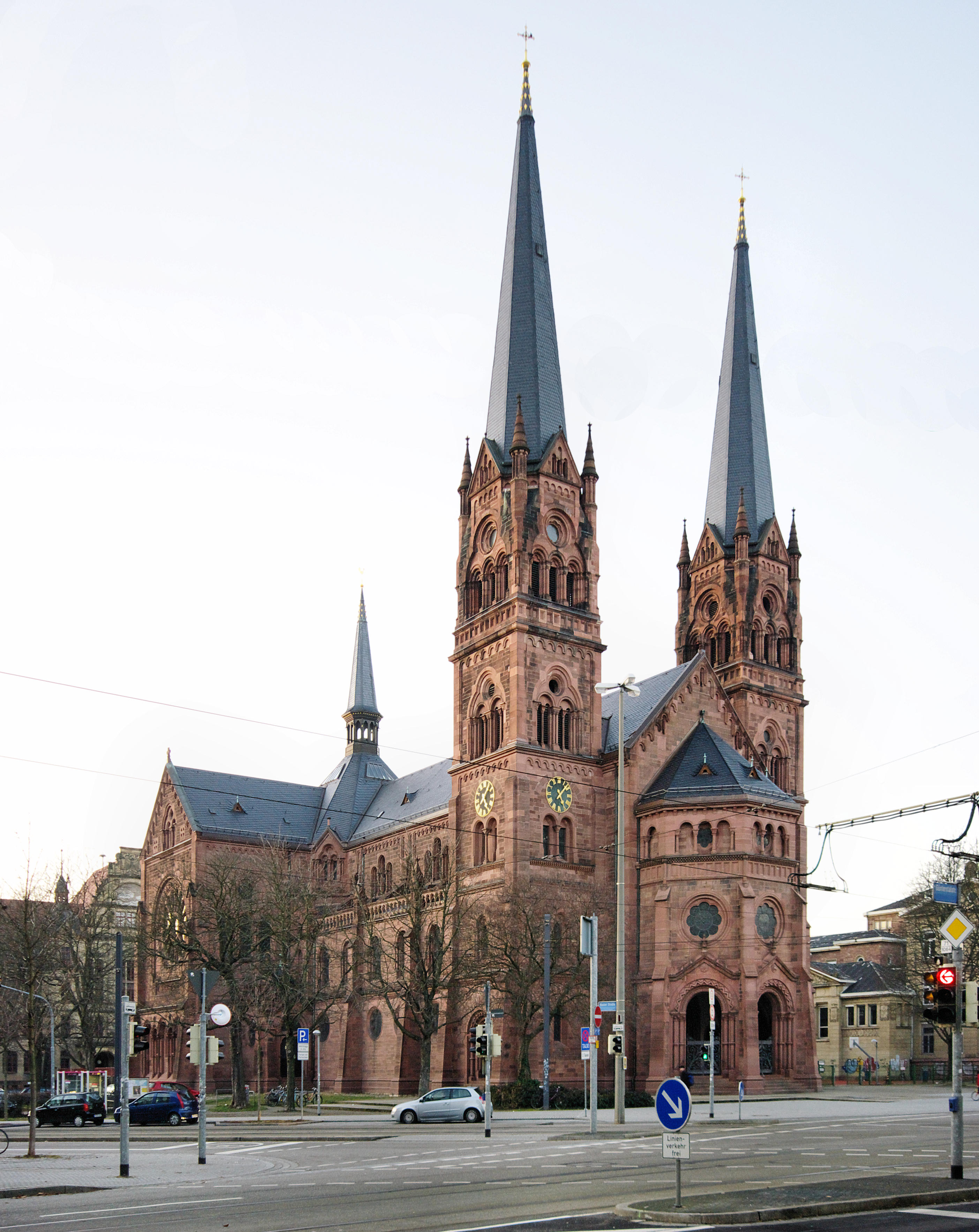
The Johanneskirche (Church of St. John) is a catholic church located in Freiburg im Breisgau. It was first opened in 1899 and is currently located in the Wiehre district. Around the church, further historic buildings were built. On the western side is the presbytery of the community next to a vocational school and to the north is the Lessingschule. At the same time as the Johanneskirche was being completed, the Protestant Christians built their own church near to Johanneskirche, the Christuskirche. History After the Wiehre district had joined with Freiburg in 1825, a large construction project took place. The population rapidly grew within a few decades. Since the Church of St. Cyriakus and Perpetua was only designed for less than 200 people, the church was no longer adequate for the rising population figures. This led to a decision being made to build a new church in 1889. The client was the domain directorate, subordinated to the Ministry of Finance of the Grand Duchy of Baden. ... [...More Info...] [...Related Items...] OR: [Wikipedia] [Google] [Baidu] |
Barn And Well In Börtlingen, Württemberg
A barn is an agricultural building usually on farms and used for various purposes. In North America, a barn refers to structures that house livestock, including cattle and horses, as well as equipment and fodder, and often grain.Allen G. Noble, ''Traditional Buildings: A Global Survey of Structural Forms and Cultural Functions'' (New York: Tauris, 2007), 30. As a result, the term barn is often qualified e.g. tobacco barn, dairy barn, cow house, sheep barn, potato barn. In the British Isles, the term barn is restricted mainly to storage structures for unthreshed cereals and fodder, the terms byre or shippon being applied to cow shelters, whereas horses are kept in buildings known as stables. In mainland Europe, however, barns were often part of integrated structures known as byre-dwellings (or housebarns in US literature). In addition, barns may be used for equipment storage, as a covered workplace, and for activities such as threshing. Etymology The word ''barn'' comes fr ... [...More Info...] [...Related Items...] OR: [Wikipedia] [Google] [Baidu] |
Schwäbisch Gmünd
Schwäbisch Gmünd (, until 1934: Gmünd; Swabian: ''Gmẽẽd'' or ''Gmend'') is a city in the eastern part of the German state of Baden-Württemberg. With a population of around 60,000, the city is the second largest in the Ostalb district and the whole East Württemberg region after Aalen. The city is a ''Große Kreisstadt'' since 1956, i.e. a chief city under district administration; it was the administrative capital of its own rural district until the local government reorganisation on 1 January 1973. There are some institutions of higher education in the city, most notably the Pädagogische Hochschule Schwäbisch Gmünd (University of Education Schwäbisch Gmünd) and the Landesgymnasium für Hochbegabte (State Highschool for gifted children). Schwäbisch Gmünd was a self-ruling free imperial city from the 13th century until its annexation to Württemberg in 1802. Geography Schwäbisch Gmünd is situated within the northern foothills of the Swabian Jura Mountains ... [...More Info...] [...Related Items...] OR: [Wikipedia] [Google] [Baidu] |


