|
Byres Road
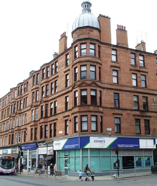
Byres Road is a street in Hillhead, Glasgow, Scotland. It is the central artery of the city's West End. Location and history Byres Road is a mixed commercial, shopping and upmarket residential area consisting largely of traditional sandstone tenements with retail premises on the ground floor and three floors of residential flats above. Its proximity to the University of Glasgow has meant that the surrounding West End of Glasgow has a large student population. Murals painted by the notable Glasgow artist Alasdair Gray adorn the Ubiquitous Chip, the Oxfam Bookshop, and the Oran Mor bars. Stretching from Great Western Road at the Botanic Gardens in the north to Dumbarton Road at Partick Cross in the south, the road originally ran through a relatively rural area called the Byres of Partick (also known as Bishop's Byres). The oldest pub in the area is the 17th century Curler's, originally sited beside a pond used for curling and, legend has it, given a seven-day licence by K ... [...More Info...] [...Related Items...] OR: [Wikipedia] [Google] [Baidu] |
Glasgow City Council
Glasgow City Council is the local government authority for the City of Glasgow, Scotland. It was created in 1996 under the Local Government etc. (Scotland) Act 1994, largely with the boundaries of the post-1975 City of Glasgow district of the Strathclyde region. History The early city, a sub-regional capital of the old Lanarkshire county, was run by the old "Glasgow Town Council" based at the Tollbooth, Glasgow Cross. In 1895, the Town Council became "The Corporation of the City of Glasgow" ("Glasgow Corporation" or "City Corporation"), around the same time as its headquarters moved to the newly built Glasgow City Chambers in George Square. It retained this title until local government re-organisation in 1975, when it became the " City of Glasgow District Council", a second-tier body under Strathclyde Regional Council which was also headquartered in Glasgow. Created under the Local Government (Scotland) Act 1973, it included ''the former county of the city of Glasgow an ... [...More Info...] [...Related Items...] OR: [Wikipedia] [Google] [Baidu] |
Oxfam
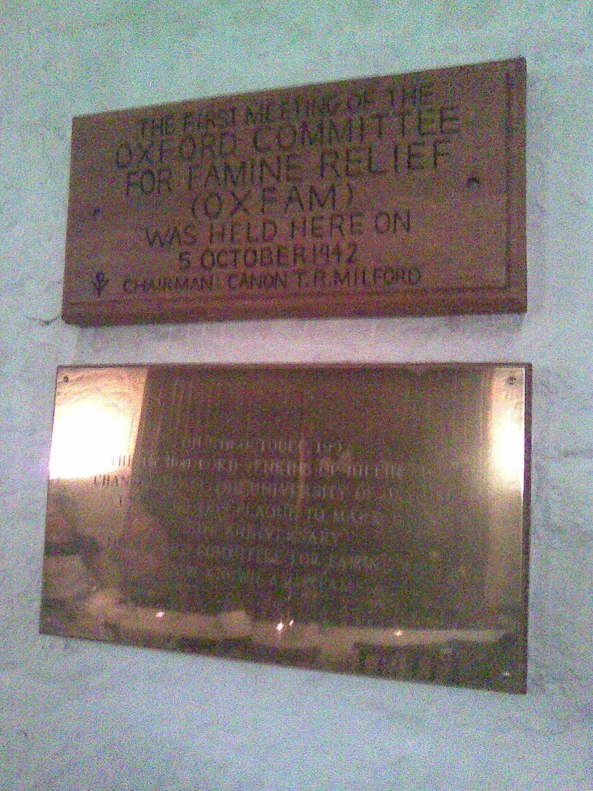
Oxfam is a British-founded confederation of 21 independent charitable organizations focusing on the alleviation of global poverty, founded in 1942 and led by Oxfam International. History Founded at 17 Broad Street, Oxford, as the Oxford Committee for Famine Relief by a group of Quakers, social activists, and Oxford academics in 1942 and registered in accordance with UK law in 1943, the original committee was a group of concerned citizens, including Henry Gillett (a prominent local Quaker), Theodore Richard Milford, Gilbert Murray and his wife Mary, Cecil Jackson-Cole, and Alan Pim. The committee met in the Old Library of University Church of St Mary the Virgin, Oxford, for the first time in 1942, and its aim was to help starving citizens of occupied Greece, a famine caused by the Axis occupation of Greece and Allied naval blockades and to persuade the British government to allow food relief through the blockade. The Oxford committee was one of several local committees ... [...More Info...] [...Related Items...] OR: [Wikipedia] [Google] [Baidu] |
Charles II Of England
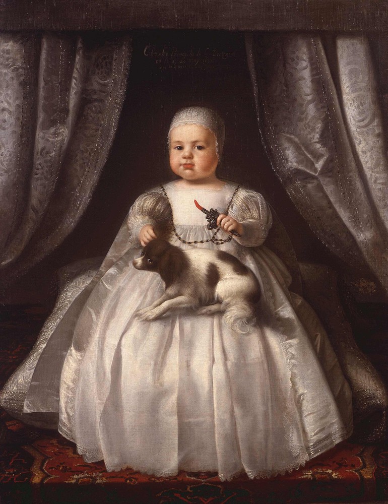
Charles II (29 May 1630 – 6 February 1685) was King of Scotland from 1649 until 1651, and King of England, Scotland and Ireland from the 1660 Restoration of the monarchy until his death in 1685. Charles II was the eldest surviving child of Charles I of England, Scotland and Ireland and Henrietta Maria of France. After Charles I's execution at Whitehall on 30 January 1649, at the climax of the English Civil War, the Parliament of Scotland proclaimed Charles II king on 5 February 1649. But England entered the period known as the English Interregnum or the English Commonwealth, and the country was a de facto republic led by Oliver Cromwell. Cromwell defeated Charles II at the Battle of Worcester on 3 September 1651, and Charles fled to mainland Europe. Cromwell became virtual dictator of England, Scotland and Ireland. Charles spent the next nine years in exile in France, the Dutch Republic and the Spanish Netherlands. The political crisis that followed Cromwell's death i ... [...More Info...] [...Related Items...] OR: [Wikipedia] [Google] [Baidu] |
Curling
Curling is a sport in which players slide stones on a sheet of ice toward a target area which is segmented into four concentric circles. It is related to bowls, boules, and shuffleboard. Two teams, each with four players, take turns sliding heavy, polished granite stones, also called ''rocks'', across the ice ''curling sheet'' toward the ''house'', a circular target marked on the ice. Each team has eight stones, with each player throwing two. The purpose is to accumulate the highest score for a ''game''; points are scored for the stones resting closest to the centre of the house at the conclusion of each ''end'', which is completed when both teams have thrown all of their stones once. A game usually consists of eight or ten ends. The player can induce a curved path, described as ''curl'', by causing the stone to slowly rotate as it slides. The path of the rock may be further influenced by two sweepers with brooms or brushes, who accompany it as it slides down the sheet and ... [...More Info...] [...Related Items...] OR: [Wikipedia] [Google] [Baidu] |
Curlers Tavern
The Curlers Rest, formerly the Curlers Tavern, is the oldest drinking establishment on Byres Road, Glasgow, Scotland. A tavern is said to have been situated at this site since the 17th century, when this part of the city was still countryside. The rural connection is today only remembered in the name Byres Road, from the lands known as the Byres of Partick. The present pub is housed in an 18th-century two-story cottage-type building and derives its name from the large pond, which could be found nearby. Every winter curlers came to play on the ice. Furthermore, the Partick Curling Curling is a sport in which players slide stones on a sheet of ice toward a target area which is segmented into four concentric circles. It is related to bowls, boules, and shuffleboard. Two teams, each with four players, take turns slidi ... Club (established in 1842) had its pond here in 1848. There is also a legend associated with the pub which claims that King Charles II came riding on ... [...More Info...] [...Related Items...] OR: [Wikipedia] [Google] [Baidu] |
Partick
Partick ( sco, Pairtick, Scottish Gaelic: ''Partaig'') is an area of Glasgow on the north bank of the River Clyde, just across from Govan. To the west lies Whiteinch, to the east Yorkhill and Kelvingrove Park (across the River Kelvin), and to the north Broomhill, Hyndland, Dowanhill, Hillhead, areas which form part of the West End of Glasgow. Partick was a Police burgh from 1852 until 1912 when it was incorporated into the city.Second City of The Empire: 1830s to 1914 from theglasgowstory.com. Retrieved 22 December 2011. Partick is the area of the city most connected with the Highlands, and several Gaelic agencies, such as the Gaelic Books Council ( |
Byre
A stable is a building in which livestock, especially horses, are kept. It most commonly means a building that is divided into separate stalls for individual animals and livestock. There are many different types of stables in use today; the American-style barn, for instance, is a large barn with a door at each end and individual stalls inside or free-standing stables with top and bottom-opening doors. The term "stable" is also used to describe a group of animals kept by one owner, regardless of housing or location. The exterior design of a stable can vary widely, based on climate, building materials, historical period and cultural styles of architecture. A wide range of building materials can be used, including masonry (bricks or stone), wood and steel. Stables also range widely in size, from a small building housing one or two animals to facilities at agricultural shows or race tracks that can house hundreds of animals. History The stable is typically historically the ... [...More Info...] [...Related Items...] OR: [Wikipedia] [Google] [Baidu] |
Partick Cross
Partick Cross is a major road junction in Partick, in the west end of the city of Glasgow, Scotland. The junction is the meeting point of Dumbarton Road, Byres Road, Partick Bridge Street and Coopers Well Street. History Riots took place on the centenary of Daniel O'Connell's birth on 6 August 1875. The Irish immigrants decided to celebrate with a march and the locals rose up in protest. The centre of what was said to be a major civil disturbance was at Partick Cross. Thirty locals had to be sworn in as special constables including Rachel Hamilton and they drove the rioters back. Description Near to the Cross are some of the city's best known tourist destinations including: *The Kelvingrove Art Gallery and Museum *Kelvingrove Park *The University of Glasgow , image = UofG Coat of Arms.png , image_size = 150px , caption = Coat of arms Flag , latin_name = Universitas Glasguensis , motto = l ... [...More Info...] [...Related Items...] OR: [Wikipedia] [Google] [Baidu] |
Glasgow Botanic Gardens
Glasgow Botanic Gardens is a botanical garden located in the West End of Glasgow, Scotland. It features several glasshouses, the most notable of which is the Kibble Palace. The Gardens has a wide variety of temperate and tropical flora, a herb garden, a chronological bed with plants arranged according to their introduction to Scotland, the UK's national collection of tree ferns, and a world rose garden officially opened in 2003 by Princess Tomohito of Mikasa. The River Kelvin runs along the north side of the Gardens and continues through Kelvingrove Park, the Kelvin walkway providing an uninterrupted walking route between the two green spaces. The Botanic Gardens was awarded a Green Flag Award in 2011. History In 1817 about 8 acres (32,000 m2) of land were laid out at Sandyford, near Sauchiehall Street, Glasgow, and run by the Royal Botanic Institution of Glasgow (founded by Thomas Hopkirk of Dalbeth and Prof James Jeffray Professor of Botany at Glasgow University), ... [...More Info...] [...Related Items...] OR: [Wikipedia] [Google] [Baidu] |
A82 Road
The A82 is a major road in Scotland that runs from Glasgow to Inverness via Fort William. It is one of the principal north-south routes in Scotland and is mostly a trunk road managed by Transport Scotland, who view it as an important link from the Central Belt to the Scottish Highlands and beyond. The road passes close to numerous landmarks, including; Loch Lomond, Rannoch Moor, Glen Coe, the Ballachulish Bridge, Ben Nevis, the Commando Memorial, Loch Ness, and Urquhart Castle. The route is derived in several places from the military roads constructed through the Highlands by General George Wade and Major William Caulfeild in the 18th century, along with later roads constructed by Thomas Telford in the 19th. The modern route is based on that designed by Telford, but with a number of improvements primarily dating from the 1920s and 30s. These include a diversion across Rannoch Moor, and another around Loch Leven which was subsequently replaced by the Ballachulish Bridg ... [...More Info...] [...Related Items...] OR: [Wikipedia] [Google] [Baidu] |
Òran Mór
Òran Mór (Scottish Gaelic: "great melody of life" or "big song") is a theatre, restaurant, entertainment and music venue in Glasgow. From 1862 until 1978 the building was the Kelvinside Parish Church (Botanic Gardens) before becoming redundant and then converted into an entertainment venue in 2004. History The building was founded as the Kelvinside Free Church, as a parish church of the Free Church of Scotland. The foundation stone was laid on 4 September 1862, and the church was built in the Neo-Gothic style, on designs by J. J. Stevenson. A spire was built in an Italian Gothic Pyramid style. After the Free Church of Scotland joined the United Presbyterian Church in 1900 to form the United Free Church of Scotland, the church was renamed the Kelvinside United Free Church. The name was once more changed when the United Free Church of Scotland merged into the Church of Scotland, becoming Kelvinside Parish Church in 1929. Between 1929 and 1978, the church served as a Pa ... [...More Info...] [...Related Items...] OR: [Wikipedia] [Google] [Baidu] |
Ashton Lane
Ashton Lane is a cobbled backstreet in the West End of Glasgow. It is connected to Byres Road by a short linking lane beside Hillhead subway station and is noted for its bars, restaurants and a licensed cinema. Overview The Lane was not always the focus of West End cafe society. By the early 1970s, it was a run-down area of small residential and empty commercial properties. However, in 1976, the cost to renew the lease on the cramped property in Ruthven Lane that housed the Ubiquitous Chip restaurant forced the owner to look for new premises. 'The Chip', as it is locally known, moved to its current location in a derelict property that had been the stables for a funeral undertaker. The move was a gamble for the owner, Ronnie Clydesdale, since the Lane was a backwater to the thriving Byres Rd but in 1977 the Glasgow Subway closed for a major refurbishment. This forced several small businesses to relocate from Byres Rd and the then-famous Grosvenor Cafe followed The Chip into As ... [...More Info...] [...Related Items...] OR: [Wikipedia] [Google] [Baidu] |


.jpg)


