|
Byblos District
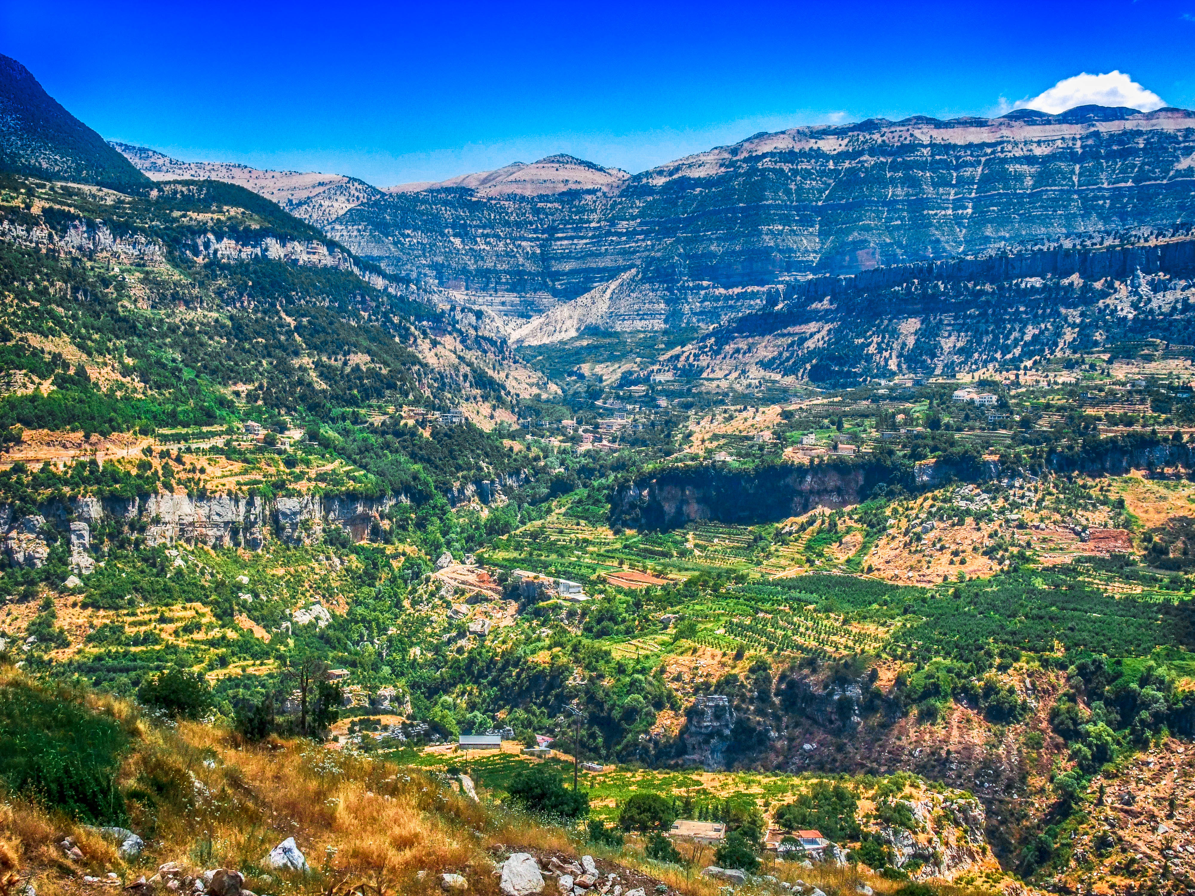
Byblos District ( ar, قضاء جبيل; transliteration: ''Qadaa' Jbeil''), also called the Jbeil District (''Jbeil'' is Lebanese Arabic for "Byblos"; standard Arabic ''Jubail''), is a district (''qadaa'') of the Keserwan-Jbeil Governorate of Lebanon. It is located to the northeast of Lebanon's capital Beirut. The capital is Byblos. The rivers of al-Madfoun and Nahr Ibrahim form the district's natural northern and southern borders respectively, with the Mediterranean Sea bordering it from the west and Mount Lebanon from the east, separating it from the adjacent district of Baalbek in the Beqaa Valley. Demographics The district's population is predominantly Maronite Catholic, followed by a Shia Muslim minority community. The largest towns of the district are predominantly inhabited by Maronites; they are Byblos, Qartaba, Aqoura and Amsheet. Most Shia Muslims live in the valley of the Ibrahim River, particularly in the villages of Almat, Ras Osta, Hjoula, Bichtlida, Lassa, ... [...More Info...] [...Related Items...] OR: [Wikipedia] [Google] [Baidu] |
Governorates Of Lebanon
Lebanon is divided into nine governorates (''muhafazah''). Each governorate is headed by a governor (''muhafiz''): All of the governorates except for Beirut Governorate, Beirut and Akkar Governorate, Akkar are divided into districts of Lebanon, districts, which are further subdivided into list of municipalities of Lebanon, municipalities. The newest governorate is Keserwan-Jbeil, which was gazetted on 7 September 2017 but whose first governor, Pauline Deeb, was not appointed until 2020. Implementation of the next most recently created governorates, Akkar and Baalbek-Hermel, also remains ongoing since the appointment of their first governors in 2014. See also * Politics of Lebanon References External links Governorates of Lebanon, Administrative divisions in Asia, Lebanon 1 First-level administrative divisions by country, Governorates, Lebanon Lists of subdivisions of Lebanon, Governorates Subdivisions of Lebanon {{Lebanon-geo-stub ... [...More Info...] [...Related Items...] OR: [Wikipedia] [Google] [Baidu] |
Aqoura
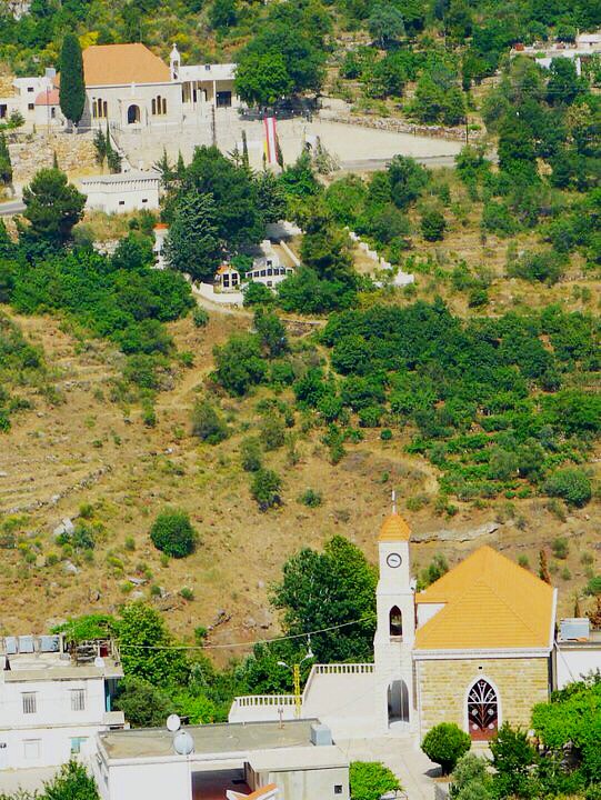
Aqoura ( ar, عاقورة, also spelled ''Aaqoura'', "Akoura") is a mountainous village in the Byblos District of Keserwan-Jbeil Governorate, Lebanon. It is 68 kilometers north of Beirut. Aqoura has an average elevation of 1,600 meters above sea level and a total land area of around 10.5 square kilometers . Aqoura's inhabitants are Maronite Catholics. By area, Aaqoura is the largest village belonging to its citizens (not emirate lands) in Lebanon. By voting, it is the third largest town in the Byblos District, along with the district capital Byblos and Qartaba. Maronite The Maronites ( ar, الموارنة; syr, ܡܖ̈ܘܢܝܐ) are a Christian ethnoreligious group native to the Eastern Mediterranean and Levant region of the Middle East, whose members traditionally belong to the Maronite Church, with the larges ...s emerged from Aaqoura in the fourth century when Saint Maroun's disciple Ibrahim El Korchy started preaching and converting pagans to the Christian faith ... [...More Info...] [...Related Items...] OR: [Wikipedia] [Google] [Baidu] |
Laqlouq
Laqlouq ( ar, لقلوق), also spelled ''Laklouk'' and also known as ′Arab Laqlouq ( ar, عرب القلوق) is a small mountainous village in mountainous area in the Byblos District of Keserwan-Jbeil Governorate, Lebanon. It is located 69 kilometers northeast of Beirut. Laqlouq has an average elevation of 1,780 meters above sea level and a total land area of 210 hectares. Most of the inhabitants are Sunni Muslims, in contrast to the majority of Byblos District's population, which is largely Maronite Christian with a significant Shia Muslim minority.Laqlouq ''Localiban''. Localiban. 2007-04-28. History Laqlouq was founded in the 18th century by s who are known today as ''′Arab al-Laqlouq''.[...More Info...] [...Related Items...] OR: [Wikipedia] [Google] [Baidu] |
Saint Charbel
Charbel Makhlouf, O.L.M. ( ar, شربل مخلوف, May 8, 1828 – December 24, 1898), born Youssef Antoun Makhlouf and venerated as Saint Charbel, was a Maronite monk and priest from Lebanon. During his life, he obtained a wide reputation for holiness, and for his ability to unite Christians and Muslims. He is venerated as a saint by the Catholic Church. He is known among Lebanese Christians as the "Miracle Monk of Lebanon" because of the favours received through his intercession, especially after prayers are said at his tomb in the Monastery of Saint Maron in Annaya, Lebanon. Life Early life Youssef Antoun Makhlouf was born on May 8, 1828, one of five children, in the mountain village of Bekaa Kafra, the highest by elevation in Lebanon. His father, Antoun Zaarour Makhlouf, was a mule driver who died in August 1831 while returning from ''corvée'' for the Turkish army, leaving his wife Brigitta (''née'' Chidiac) a widow to care for their children. She remarried a man who w ... [...More Info...] [...Related Items...] OR: [Wikipedia] [Google] [Baidu] |
Greek Orthodox Church Of Antioch
The Greek Orthodox Patriarchate of Antioch ( el, Ελληνορθόδοξο Πατριαρχείο Αντιοχείας), also known as the Antiochian Orthodox Church and legally as the Greek Orthodox Patriarchate of Antioch and All the East ( ar, بطريركيّة أنطاكية وسائر المشرق للروم الأرثوذكس, translit=Baṭriyarkiyyat ʾAnṭākiya wa-Sāʾir al-Mašriq li-r-Rūm al-ʾUrṯūḏuks, lit=Patriarchate of Antioch and All the East for the Orthodox Rūm), is an autocephalous Greek Orthodox church within the wider communion of Eastern Orthodox Christianity. Headed by the Greek Orthodox patriarch of Antioch, it considers itself the successor to the Christian community founded in Antioch by the Apostles Peter and Paul. Background The seat of the patriarchate was formerly Antioch, in what is now Turkey. However, in the 14th century, it was moved to Damascus, modern-day Syria. Its traditional territory includes Syria, Lebanon, Iraq, Ku ... [...More Info...] [...Related Items...] OR: [Wikipedia] [Google] [Baidu] |
Berbara
Berbara ( ar, البربارة, also spelled ''al-Barbara'') is a municipality in the Byblos District of Keserwan-Jbeil Governorate, Lebanon. It is located along the Mediterranean coast, 48 kilometers north of Beirut. Berbara has an average elevation of 200 meters above sea level and a total land area of 314 hectares. Its inhabitants are predominantly Maronite and Greek Orthodox The term Greek Orthodox Church (Greek: Ἑλληνορθόδοξη Ἐκκλησία, ''Ellinorthódoxi Ekklisía'', ) has two meanings. The broader meaning designates "the entire body of Orthodox (Chalcedonian) Christianity, sometimes also call ... Christians. References Populated places in Byblos District Eastern Orthodox Christian communities in Lebanon Maronite Christian communities in Lebanon {{Lebanon-geo-stub ... [...More Info...] [...Related Items...] OR: [Wikipedia] [Google] [Baidu] |
Jeddayel
Jeddayel ( ar, جدايل; also spelled ''Geddayel'' or ''Jadayel'') is a town in the Byblos District of the Keserwan-Jbeil Governorate, Lebanon. It is located 4 km north of Byblos. Its inhabitants are predominantly Greek Orthodox and Maronite Christians. Its population is about 1,500. Demographics Jeddayel is located in a predominantly Christian Greek Orthodox area know locally as “Qornet Al Rom”, containing seven Christian Greek Orthodox towns: Mounsef, AlRihani, Jeddayel, Barbara, Chikhane, Gharzouz, and Hosrayel. Churches There exist three churches in Jeddayel, because the martyr Dometius of Persia is the patron saint of a large part of the population. Two churches, a Maronite and another Greek Orthodox, are named 'Mar Doumit'. The third church is in honour of ''Notre Dame''. Events and festivals 'Mar Doumit feast day', and 'Summer goodbye' are yearly feasted in Jeddayel. Both events end by an open village dinner. Also, Christmas is widely celebrated in Jeddayel ... [...More Info...] [...Related Items...] OR: [Wikipedia] [Google] [Baidu] |
Mounsef
Mounsef ( ar, المنصف, also spelled ''al-Mounsif'') is a municipality in the Byblos District of Keserwan-Jbeil Governorate, Lebanon. It located off the Mediterranean coast and is 47 kilometers north of Beirut. Mounsef has an average elevation of 220 meters above sea level and a total land area of 341 hectares. Its inhabitants are predominantly Greek Orthodox Christian The term Greek Orthodox Church (Greek: Ἑλληνορθόδοξη Ἐκκλησία, ''Ellinorthódoxi Ekklisía'', ) has two meanings. The broader meaning designates "the entire body of Orthodox (Chalcedonian) Christianity, sometimes also call ...s. References Populated places in Byblos District Eastern Orthodox Christian communities in Lebanon {{Lebanon-geo-stub ... [...More Info...] [...Related Items...] OR: [Wikipedia] [Google] [Baidu] |
Greek Orthodox Christianity In Lebanon
Lebanese Greek Orthodox Christians (Arabic: المسيحية الأرثوذكسية الرومية في لبنان) refers to Lebanese people who are adherents of the Greek Orthodox Church of Antioch in Lebanon, which is an autocephalous Greek Orthodox Church within the wider communion of Eastern Orthodox Christianity, and is the second-largest Christian denomination in Lebanon after the Maronite Christians. Lebanese Greek Orthodox Christians are believed to constitute about 8% of the total population of Lebanon.Lebanon – International Religious Freedom Report 2010 U.S. Department of State. Retrieved on 14 February 2010.< ... [...More Info...] [...Related Items...] OR: [Wikipedia] [Google] [Baidu] |
Mazraat Es-Siyad
Mazraat es-Siyad (also transliterated ''Mazraet es-Siyed''; ar, مزرعة السياد ) is a mountainous village in the highlands of the Byblos District in the Keserwan-Jbeil Governorate, Lebanon. The town is away from Beirut, and stands at an elevation of above sea level. Etymology/History ''Mazraat es-Siyad'' translates as "grange of the masters" in Arabic. It is named after the Shia siyyad (masters) of the al-Husseini family, whose ancestor, Sayyed Hussein al-Husseini was the first person to reside in the area after he restored an ancient monastery. The monastery was bestowed to him by Sheikh Nawfal Ibrahim al-Khoury during the Mamluk era (13th–15th centuries). Geography Mazraat es-Siyyad is located in the Byblos District in the Mount Lebanon Governorate. It is 58 kilometers north of the capital Beirut. It spans an area of and stands at an altitude of above sea level. The municipal area of Mazraat es-Siyad includes the hamlets of Abboud, Mazraat er- Rmeileh, Shar ... [...More Info...] [...Related Items...] OR: [Wikipedia] [Google] [Baidu] |
Lassa, Lebanon
Lassa ( ar, لاسا) is a municipality in the Byblos District of Keserwan-Jbeil Governorate, Lebanon. It is 90 kilometers north of Beirut. Lassa has an average elevation of 1,130 meters above sea level and a total land area of 739 hectares. The village contains one public school, which enrolled 15 students in 2008. Its inhabitants are predominantly Shia Muslims and a persecuted maronite minority Lassa was the seat of the Shia Muslim houses of Moqdad & Hamadeh, which exercised control over large swaths of Mount Lebanon in the 17th and 18th centuries, including the districts of Jubbay al-Mnaytra, Bilad Jubayl (Byblos), Bilad al-Batrun and Jubbat Bsharray. Lassa was burnt by the Ottomans many times in reprisal for the Hamadeh lords' failure to remit tax incomes. In the late 18th century, the Hamadeh Hamadeh ( ar, حمادة) or Hamadé or Hamada is a common Arabic surname. Hamadeh may refer to: * Ali Hamadeh (born 1974), American tennis player of Lebanese origin * Anas Hamadeh (bo ... [...More Info...] [...Related Items...] OR: [Wikipedia] [Google] [Baidu] |
Fidar
Fidar ( ar, فيدار), municipality in the Byblos District of Keserwan-Jbeil Governorate, Lebanon. It is 61 kilometers north of Beirut. Fdar has an average elevation of 100 meters above sea level and a total land area of 390 hectare The hectare (; SI symbol: ha) is a non-SI metric unit of area equal to a square with 100- metre sides (1 hm2), or 10,000 m2, and is primarily used in the measurement of land. There are 100 hectares in one square kilometre. An acre is ...s. As of 2008, the village contained one public school with 206 students enrolled. Nassib Zgheib is the president of the municipality since 2019. This small village is also known for his 800-year-old church (kniset saïdet el doueir). References Populated places in Byblos District {{Lebanon-geo-stub ... [...More Info...] [...Related Items...] OR: [Wikipedia] [Google] [Baidu] |

.png)

.jpg)


