|
Busby, Scotland
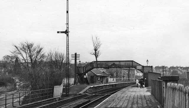
Busby is a village in East Renfrewshire, Scotland. Busby is in the same urban area as Glasgow, although it is administratively separate. It lies on the White Cart Water south of Glasgow City Centre and northwest of the outskirts of East Kilbride. It directly adjoins the town of Clarkston, with which the village is closely associated. History As a settlement, Busby dates back at least 700 years. Historically, the village was called Bushby. Its modern origins may be dated to several significant changes in the 1780s. The first big change was in the landscape. Until the 1780s Busby village consisted of a scatter of cottages along a track leading from Carmunnock to Mearns. This route forded the River Cart near Newford. This original village or fermtoun was in the area of the present Busby railway station. For centuries the occupants had worked the surrounding land from this central settlement. However, by the 1780s the landowner was in process of sweeping away the old fermtoun. ... [...More Info...] [...Related Items...] OR: [Wikipedia] [Google] [Baidu] |
Renfrewshire (historic)
Renfrewshire or the County of Renfrew is a historic county, registration county and lieutenancy area in the west central Lowlands of Scotland. It contains the local government council areas of Inverclyde, Renfrewshire and East Renfrewshire, as well as parts of Glasgow and is occasionally named Greater Renfrewshire to distinguish the county from the modern council area. The county borders the city of Glasgow and Lanarkshire to the east and Ayrshire to the south and west. The Firth of Clyde forms its northern boundary, with Dunbartonshire and Argyllshire on the opposing banks. Renfrewshire's early history is marked by ancient British and Roman settlement. Renfrewshire can trace its origin to the feudal lands at Strathgryfe granted to Walter Fitzalan, the first High Steward of Scotland. Robert III of Scotland, a descendant of Fitzalan, established the shire of Renfrew-based out of the Royal burgh of Renfrew, the site of the House of Stuart's castle and Renfrewshire's cou ... [...More Info...] [...Related Items...] OR: [Wikipedia] [Google] [Baidu] |
Lanarkshire
Lanarkshire, also called the County of Lanark ( gd, Siorrachd Lannraig; sco, Lanrikshire), is a historic county, lieutenancy area and registration county in the central Lowlands of Scotland. Lanarkshire is the most populous county in Scotland, as it contains most of Glasgow and the surrounding conurbation. In earlier times it had considerably greater boundaries, including neighbouring Renfrewshire until 1402. Lanarkshire is bounded to the north by the counties of Stirlingshire and Dunbartonshire (this boundary is split into two sections owing to Dunbartonshire's Cumbernauld exclave), to the northeast by West Lothian and Mid Lothian, to the east by Peeblesshire, to the south by Dumfriesshire, and to the west by Ayrshire and Renfrewshire. Administrative history Lanarkshire was historically divided between two administrative areas. In the mid-18th century it was divided again into three wards: the upper, middle and lower wards with their administrative centres at Lanar ... [...More Info...] [...Related Items...] OR: [Wikipedia] [Google] [Baidu] |
Populated Places Established In The 13th Century
Population typically refers to the number of people in a single area, whether it be a city or town, region, country, continent, or the world. Governments typically quantify the size of the resident population within their jurisdiction using a census, a process of collecting, analysing, compiling, and publishing data regarding a population. Perspectives of various disciplines Social sciences In sociology and population geography, population refers to a group of human beings with some predefined criterion in common, such as location, race, ethnicity, nationality, or religion. Demography is a social science which entails the statistical study of populations. Ecology In ecology, a population is a group of organisms of the same species who inhabit the same particular geographical area and are capable of interbreeding. The area of a sexual population is the area where inter-breeding is possible between any pair within the area and more probable than cross-breeding with ... [...More Info...] [...Related Items...] OR: [Wikipedia] [Google] [Baidu] |
E-book
An ebook (short for electronic book), also known as an e-book or eBook, is a book publication made available in digital form, consisting of text, images, or both, readable on the flat-panel display of computers or other electronic devices. Although sometimes defined as "an electronic version of a printed book", some e-books exist without a printed equivalent. E-books can be read on dedicated e-reader devices, but also on any computer device that features a controllable viewing screen, including desktop computers, laptops, tablets and smartphones. In the 2000s, there was a trend of print and e-book sales moving to the Internet, where readers buy traditional paper books and e-books on websites using e-commerce systems. With print books, readers are increasingly browsing through images of the covers of books on publisher or bookstore websites and selecting and ordering titles online; the paper books are then delivered to the reader by mail or another delivery service. With e-bo ... [...More Info...] [...Related Items...] OR: [Wikipedia] [Google] [Baidu] |
Gazetteer For Scotland
The ''Gazetteer for Scotland'' is a gazetteer covering the geography, history and people of Scotland. It was conceived in 1995 by Bruce Gittings of the University of Edinburgh and David Munro of the Royal Scottish Geographical Society, and contains 25,870 entries as of July 2019. It claims to be "the largest dedicated Scottish resource created for the web". The Gazetteer for Scotland provides a carefully researched and editorially validated resource widely used by students, researchers, tourists and family historians with interests in Scotland. Following on from a strong Scottish tradition of geographical publishing, the ''Gazetteer for Scotland'' is the first comprehensive gazetteer to be produced for the country since Francis Groome's '' Ordnance Gazetteer of Scotland'' (1882-6) (the text of which is incorporated into relevant entries). The aim is not to produce a travel guide, of which there are many, but to write a substantive and thoroughly edited description of the ... [...More Info...] [...Related Items...] OR: [Wikipedia] [Google] [Baidu] |
Thomas Donohoe
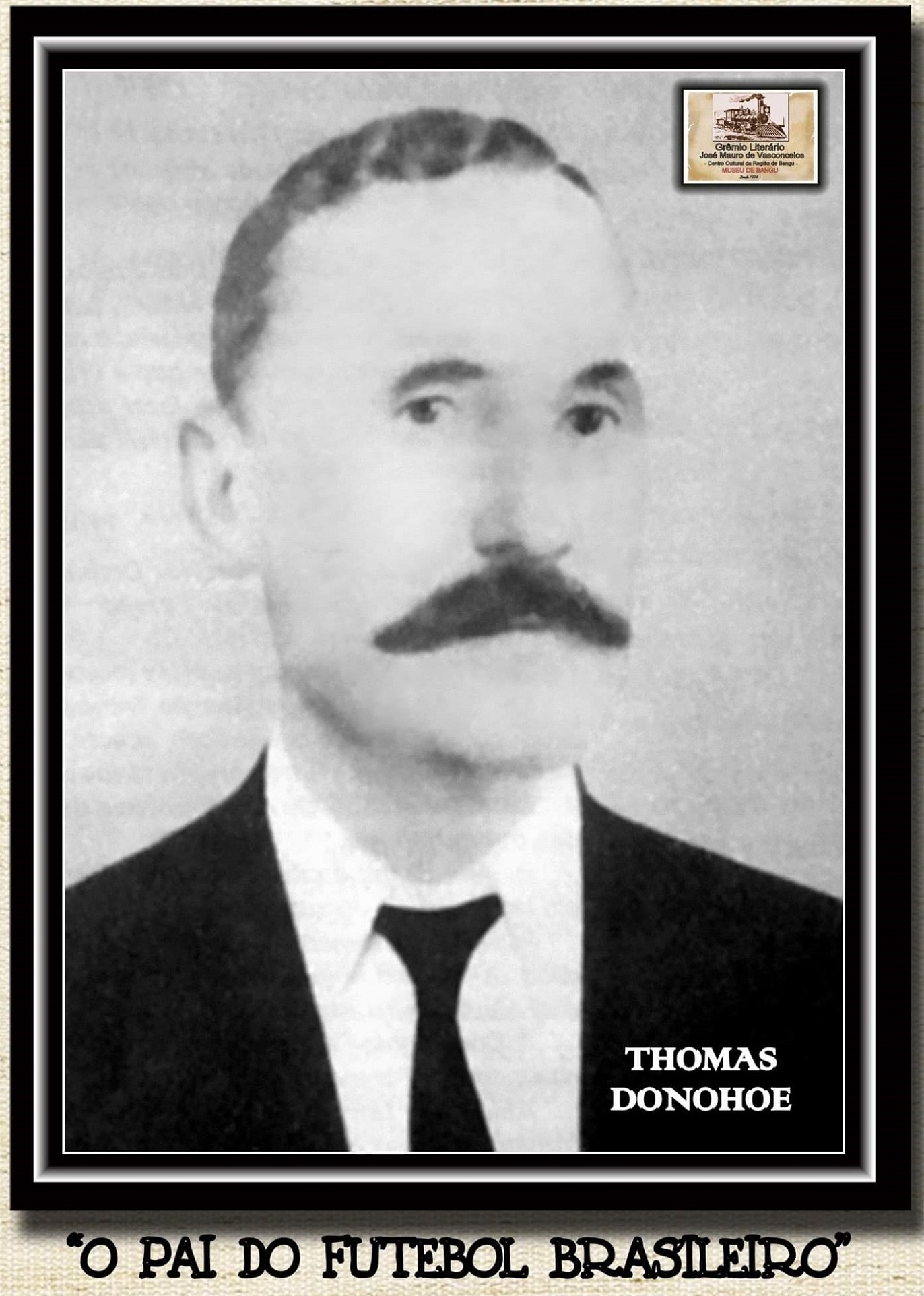
Thomas Donohoe was a master dyer in the calico printing industry. Thomas emigrated to Brazil in 1894.UK And Ireland Outward Passenger List 1890 - 1960 Journey From Southampton To Rio de Janeiro, May 1894. He organized football matches in Bangu (now a suburb of ) that year with fellow employees of the textile company [...More Info...] [...Related Items...] OR: [Wikipedia] [Google] [Baidu] |
Busby Railway Station 1954897 9a85c608
Busby may refer to: Clothing *Busby (military headdress), a kind of military headdress, made of fur, derived from that traditionally worn by Hussars. Places * Busby, Alberta, a hamlet in Canada *Busby, East Renfrewshire, a village in Scotland * Busby Hall, a country house in North Yorkshire, England * Great Busby, a village in North Yorkshire, England * Little Busby, a civil parish in North Yorkshire, England Australia * Busby, New South Wales, a suburb of Sydney * Busby Islet, South Australia United States * Busby, Arkansas, an unincorporated community *Busby, Kansas, an unincorporated community *Busby, Montana, a census-designated place People Surname * Adam Busby (born 1948), Scottish terrorist *Alan T. Busby (1895–1992), American educator *Alexander Busby (politician) (1808–1873), English-born Australian politician *Allen Busby (1900–1988), American politician *Brian Busby (born 1962), Canadian literary historian and anthologist *Buzz Busby (1933–2003), stage name ... [...More Info...] [...Related Items...] OR: [Wikipedia] [Google] [Baidu] |
Paisley, Renfrewshire
Paisley ( ; sco, Paisley, gd, Pàislig ) is a large town situated in the west central Lowlands of Scotland. Located north of the Gleniffer Braes, the town borders the city of Glasgow to the east, and straddles the banks of the White Cart Water, a tributary of the River Clyde. Paisley serves as the administrative centre for the Renfrewshire council area, and is the largest town in the historic county of the same name. It is often cited as "Scotland's largest town" and is the fifth largest settlement in the country, although it does not have city status. The town became prominent in the 12th century, with the establishment of Paisley Abbey, an important religious hub which formerly had control over other local churches. By the 19th century, Paisley was a centre of the weaving industry, giving its name to the Paisley shawl and the Paisley pattern. The town's associations with political radicalism were highlighted by its involvement in the Radical War of 1820, with s ... [...More Info...] [...Related Items...] OR: [Wikipedia] [Google] [Baidu] |
Bleachfield
A bleachfield or bleaching green was an open area used for spreading cloth on the ground to be purified and whitened by the action of the sunlight. Bleaching fields were usually found in and around mill towns in Great Britain and were an integral part of textile manufacture during the Industrial Revolution. When cloth-making was still a home-based occupation, the bleachfields could be found on Scottish crofts and English farm fields. Just as wool needed fulling and flax needed retting, so did the semi-finished fabrics need space and time outdoors to bleach. In the 18th century there were many linen bleachfields in Scotland, particularly in Perthshire, Renfrewshire in the Scottish Lowlands, and the outskirts of Glasgow. By the 1760s, linen manufacture became a major industry in Scotland, second only to agriculture. For instance, in 1782 alone, Perthshire produced 1.7 million yards of linen, worth £81,000 (£ as of ). Bleachfields were also common in northern England; for insta ... [...More Info...] [...Related Items...] OR: [Wikipedia] [Google] [Baidu] |
Renfrewshire
Renfrewshire () ( sco, Renfrewshire; gd, Siorrachd Rinn Friù) is one of the 32 council areas of Scotland. Located in the west central Lowlands, it is one of three council areas contained within the boundaries of the historic county of Renfrewshire, the others being East Renfrewshire to the east and Inverclyde to the west. It also shares borders with Glasgow, North Ayrshire and West Dunbartonshire, and lies on the southern bank of the River Clyde. The term Renfrewshire may also be used to refer to the historic county, also known as the County of Renfrew or Greater Renfrewshire, with origins in the 16th century. The larger Renfrewshire, containing Renfrewshire, Inverclyde and East Renfrewshire, remains in use as a registration county and lieutenancy area as well as a joint valuation board area for electoral registration and local tax valuation purposes. The town of Paisley is the area's main settlement and centre of local government and contains the historic coun ... [...More Info...] [...Related Items...] OR: [Wikipedia] [Google] [Baidu] |
River Cart
The River Cart ( sco, River Cairt) is a tributary of the River Clyde, Scotland, which it joins from the west roughly midway between the towns of Erskine and Renfrew and opposite the town of Clydebank. The River Cart itself is very short, being formed from the confluence of the Black Cart Water (from the west) and the White Cart Water (from the south east) and is only long. The River Cart and its tributary the White Cart Water were navigable as far as the Seedhill Craigs at Paisley; and, as with the River Clyde, various improvements were made to this river navigation. In 1840 the Forth and Cart Canal was opened, linking the Forth and Clyde Canal, at Whitecrook near Clydebank, to the River Clyde, opposite the mouth of the River Cart. The aim was to provide a direct link between Paisley, Port Dundas, Edinburgh, and the Firth of Forth.Lindsay, Jean (1968). ''The Canals of Scotland''. Newton Abbott: David & Charles Black Cart Water The Black Cart Water ( sco, Black Cairt ... [...More Info...] [...Related Items...] OR: [Wikipedia] [Google] [Baidu] |
Cotton Mill
A cotton mill is a building that houses spinning (textiles), spinning or weaving machinery for the production of yarn or cloth from cotton, an important product during the Industrial Revolution in the development of the factory system. Although some were driven by animal power, most early mills were built in rural areas at fast-flowing rivers and streams using water wheels for power. The development of viable Watt steam engine, steam engines by Boulton and Watt from 1781 led to the growth of larger, steam-powered mills allowing them to be concentrated in urban mill towns, like Manchester, which with neighbouring Salford, Greater Manchester, Salford had more than 50 mills by 1802. The mechanisation of the spinning process in the early factories was instrumental in the growth of the machine tool industry, enabling the construction of larger cotton mills. Joint stock company, Limited companies were developed to construct mills, and the trading floors of the Manchester Royal Excha ... [...More Info...] [...Related Items...] OR: [Wikipedia] [Google] [Baidu] |


.jpg)


