|
Burnt Wagons, California
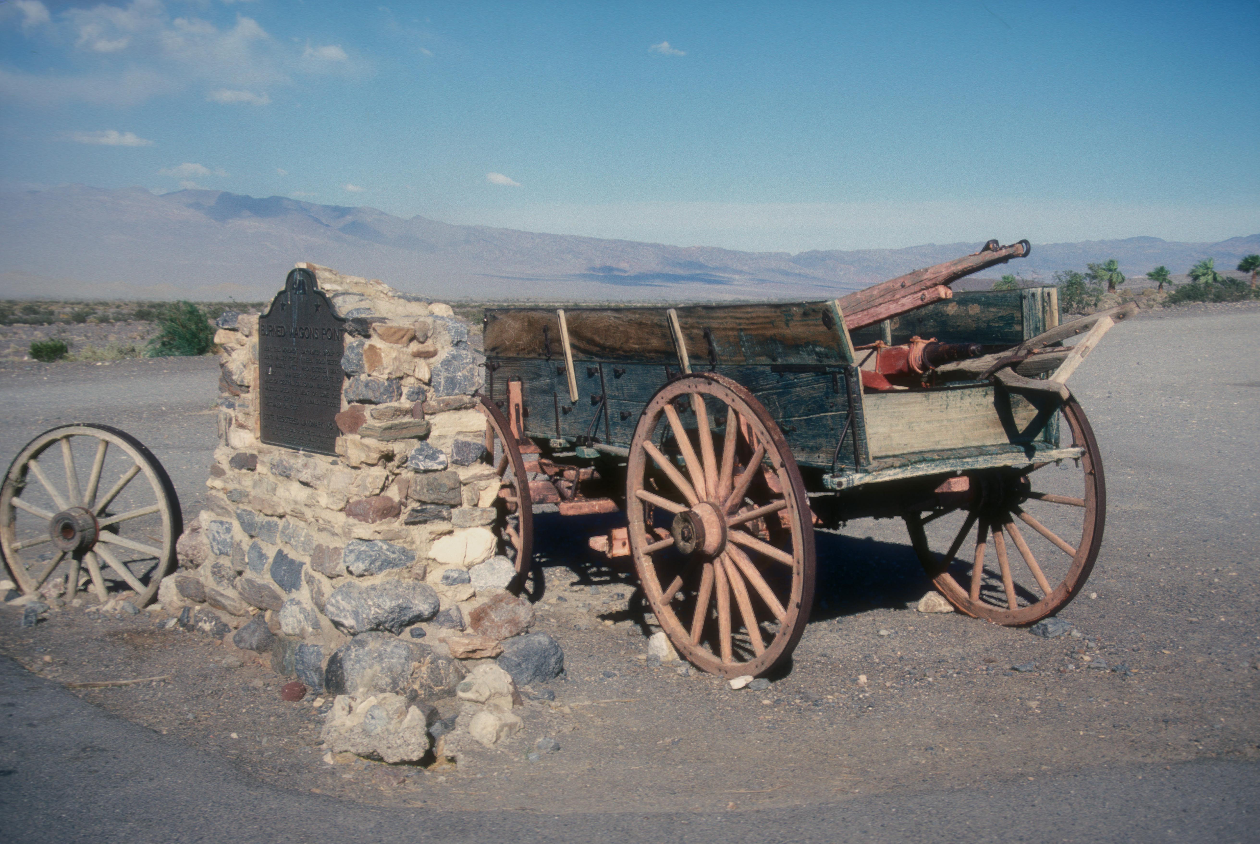
Burnt Wagons is a former settlement in Inyo County, California, near Stovepipe Wells. It was located in Death Valley northwest of Death Valley Junction. The name recalls the emigrants of 1849 who abandoned and burnt their wagons at the site. The site is now registered as California Historical Landmark #441. The monument's plaque reads: Near this monument, the Jayhawker group of Death Valley Forty-Niners, gold seekers from Middle West, who entered Death Valley in 1849 seeking short route to the mines of central California, burned their wagons, dried the meat of some oxen and, with surviving animals, struggled westward on foot. See also * California Historical Landmarks in Inyo County *History of California through 1899 Human history in California began when indigenous Americans first arrived some 13,000 years ago. Coastal exploration by the Spanish began in the 16th century, with further European settlement along the coast and in the inland valleys following ... Referen ... [...More Info...] [...Related Items...] OR: [Wikipedia] [Google] [Baidu] |
United States
The United States of America (U.S.A. or USA), commonly known as the United States (U.S. or US) or America, is a country primarily located in North America. It consists of 50 states, a federal district, five major unincorporated territories, nine Minor Outlying Islands, and 326 Indian reservations. The United States is also in free association with three Pacific Island sovereign states: the Federated States of Micronesia, the Marshall Islands, and the Republic of Palau. It is the world's third-largest country by both land and total area. It shares land borders with Canada to its north and with Mexico to its south and has maritime borders with the Bahamas, Cuba, Russia, and other nations. With a population of over 333 million, it is the most populous country in the Americas and the third most populous in the world. The national capital of the United States is Washington, D.C. and its most populous city and principal financial center is New York City. Paleo-Americ ... [...More Info...] [...Related Items...] OR: [Wikipedia] [Google] [Baidu] |
California
California is a U.S. state, state in the Western United States, located along the West Coast of the United States, Pacific Coast. With nearly 39.2million residents across a total area of approximately , it is the List of states and territories of the United States by population, most populous U.S. state and the List of U.S. states and territories by area, 3rd largest by area. It is also the most populated Administrative division, subnational entity in North America and the 34th most populous in the world. The Greater Los Angeles area and the San Francisco Bay Area are the nation's second and fifth most populous Statistical area (United States), urban regions respectively, with the former having more than 18.7million residents and the latter having over 9.6million. Sacramento, California, Sacramento is the state's capital, while Los Angeles is the List of largest California cities by population, most populous city in the state and the List of United States cities by population, ... [...More Info...] [...Related Items...] OR: [Wikipedia] [Google] [Baidu] |
Inyo County, California
Inyo County () is a county in the eastern central part of the U.S. state of California, located between the Sierra Nevada and the state of Nevada. In the 2020 census, the population was 19,016. The county seat is Independence. Inyo County is on the east side of the Sierra Nevada and southeast of Yosemite National Park in Central California. It contains the Owens River Valley; it is flanked to the west by the Sierra Nevada and to the east by the White Mountains and the Inyo Mountains. With an area of 10,192 square miles (26,397 km2), Inyo County is the second-largest county by area in California, after San Bernardino County. Almost one-half of that area is within Death Valley National Park. However, with a population density of 1.8 people per square mile, it also has the second-lowest population density in California, after Alpine County. History Present-day Inyo county has been the historic homeland for thousands of years of the Mono, Timbisha, Kawaiisu, and Nort ... [...More Info...] [...Related Items...] OR: [Wikipedia] [Google] [Baidu] |
Stovepipe Wells, California
Stovepipe Wells is a way-station in the northern part of Death Valley, in unincorporated Inyo County, California. Geography and names Stovepipe Wells is located at and is US Geological Survey (USGS) feature ID 235564. It is entirely inside Death Valley National Park and along State Route 190 (SR 190) at less than above sea level. West on SR 190 is Towne Pass at about above sea level. Eventually, the road meets Panamint Valley Road at Panamint Junction in the Panamint Valley. East on SR 190 the road leads to Furnace Creek and Death Valley Junction. Variant names listed for the Inyo County location by USGS include Stove Pipe Wells Hotel and Stovepipe Wells Hotel. The US Postal Service ZIP Code is 92328, and the locale name is spelled ''Stove Pipe Wells'' in some postal renditions. It is commonly referred to as Stovepipe Wells Village. Climate According to the Köppen Climate Classification system, Stovepipe Wells has a hot desert climate, abbreviated "BWh" on climate maps. ... [...More Info...] [...Related Items...] OR: [Wikipedia] [Google] [Baidu] |
Death Valley
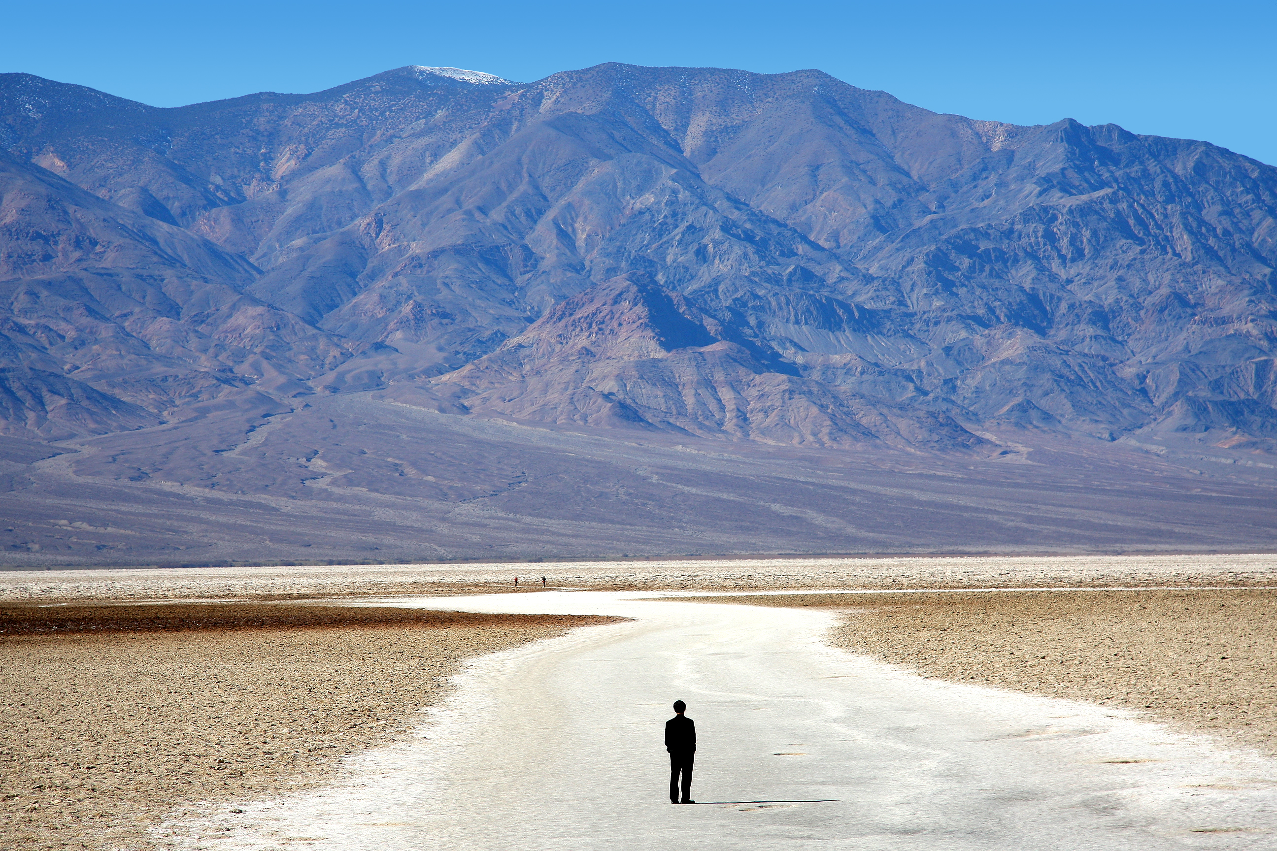
Death Valley is a desert valley in Eastern California, in the northern Mojave Desert, bordering the Great Basin Desert. During summer, it is the Highest temperature recorded on Earth, hottest place on Earth. Death Valley's Badwater Basin is the point of lowest elevation in North America, at below sea level. It is east-southeast of Mount Whitney — the highest point in the contiguous United States, with an elevation of 14,505 feet (4,421 m). On the afternoon of July10, 1913, the National Weather Service, United States Weather Bureau recorded a high temperature of 134 °F (56.7 °C) at Furnace Creek, California, Furnace Creek in Death Valley, which stands as the Highest temperature recorded on Earth, highest ambient air temperature ever recorded on the surface of the Earth. This reading, however, and several others taken in that period are disputed by some modern experts. Lying mostly in Inyo County, California, near the border of California and Nevada, in the Great ... [...More Info...] [...Related Items...] OR: [Wikipedia] [Google] [Baidu] |
Death Valley Junction, California
Death Valley Junction, more commonly known as Amargosa (Spanish for "Bitter"), is a tiny Mojave Desert unincorporated community in Inyo County, California, at the intersection of SR 190 and SR 127, in the Amargosa Valley and just east of Death Valley National Park. The zip code is 92328, the elevation is , and the population is fewer than four people. Death Valley Junction is home to the Amargosa Opera House and Hotel, where resident Marta Becket staged dance and mime shows from the late 1960s until her last show in February 2012. Becket died in 2017. The hotel is still operating next to the opera house, but beyond these maintained areas, the town is in a state of disrepair. There is no gas station, and only one restaurant, the Amargosa Cafe. The town is owned by the non-profit Amargosa Opera House Inc. which runs the Opera House, Hotel, and cafe The community's location, east-southeast of Furnace Creek, on the east side of Death Valley is south of Nevada's Amargosa Valle ... [...More Info...] [...Related Items...] OR: [Wikipedia] [Google] [Baidu] |
Death Valley '49ers
The Death Valley '49ers were a group of pioneers from the Eastern United States that endured a long and difficult journey during the late 1840s California Gold Rush to prospect in the Sutter's Fort area of the Central Valley and Sierra Nevada in California. Their route from Utah went through the Great Basin Desert in Nevada, and Death Valley and the Mojave Desert in Southern California, in attempting to reach the Gold Country. Journey to California The Gold Rush On January 24, 1848, James W. Marshall and his crew found gold at Sutter's Mill in Coloma, California. This discovery would lure tens of thousands of people from the United States and foreign nations. People packed their belongings and began to travel by covered wagon to what they hoped would be new and better life. Since the first great influx of these pioneers began in 1849, they are generally referred to as 49ers. However, the Donner Party pioneers had provided a sobering lesson after mis-scheduling the overland ... [...More Info...] [...Related Items...] OR: [Wikipedia] [Google] [Baidu] |
California Historical Landmark
A California Historical Landmark (CHL) is a building, structure, site, or place in California that has been determined to have statewide historical landmark significance. Criteria Historical significance is determined by meeting at least one of these criteria: # The first, last, only, or most significant of its type in the state or within a large geographic region (Northern California, Northern, Central California, Central, or Southern California); # Associated with an individual or group having a profound influence on the history of California; or # An outstanding example of a period, style, architectural movement or construction; or is the best surviving work in a region of a pioneer architect, designer, or master builder. Other designations California Historical Landmarks numbered 770 and higher are automatically listed in the California Register of Historical Resources. A site, building, feature, or event that is of local (city or county) significance may be designated as a ... [...More Info...] [...Related Items...] OR: [Wikipedia] [Google] [Baidu] |
California Historical Landmarks In Inyo County
This list includes properties and districts listed on the California Historical Landmark listing in Inyo County, California. Click the "Map of all coordinates" link to the right to view a Google map of all properties and districts with latitude and longitude coordinates in the table below. References See also *List of California Historical Landmarks *National Register of Historic Places listings in Inyo County, California __NOTOC__ This is a list of the National Register of Historic Places listings in Inyo County, California. This is intended to be a complete list of the properties and districts on the National Register of Historic Places in Inyo County, Californ ... {{DEFAULTSORT:California Historical Landmarks * . *List of California Historical Landmarks History of the Mojave Desert region History of Southern California Protected areas of Inyo County, California ... [...More Info...] [...Related Items...] OR: [Wikipedia] [Google] [Baidu] |
History Of California Through 1899
Human history in California began when indigenous Americans first arrived some 13,000 years ago. Coastal exploration by the Spanish began in the 16th century, with further European settlement along the coast and in the inland valleys following in the 18th century. California was part of New Spain until that kingdom dissolved in 1821, becoming part of Mexico until the Mexican–American War (1846–1848), when it was ceded to the United States under the terms of the 1848 Treaty of Guadalupe Hidalgo. The same year, the California Gold Rush began, triggering intensified U.S. westward expansion. California joined the Union as a free state via the Compromise of 1850. By the end of the 19th century, California was still largely rural and agricultural, with a population of about 1.4 million. Pre-Columbian history (~13,000 BC-1530 AD) The most commonly accepted model of migration to the New World is that people from Asia crossed the Bering land bridge to the Americas some 16,500 y ... [...More Info...] [...Related Items...] OR: [Wikipedia] [Google] [Baidu] |
Former Settlements In Inyo County, California
A former is an object, such as a template, gauge or cutting die, which is used to form something such as a boat's hull. Typically, a former gives shape to a structure that may have complex curvature. A former may become an integral part of the finished structure, as in an aircraft fuselage, or it may be removable, being using in the construction process and then discarded or re-used. Aircraft formers Formers are used in the construction of aircraft fuselage, of which a typical fuselage has a series from the nose to the empennage, typically perpendicular to the longitudinal axis of the aircraft. The primary purpose of formers is to establish the shape of the fuselage and reduce the column length of stringers to prevent instability. Formers are typically attached to longerons, which support the skin of the aircraft. The "former-and-longeron" technique (also called stations and stringers) was adopted from boat construction, and was typical of light aircraft built until the ... [...More Info...] [...Related Items...] OR: [Wikipedia] [Google] [Baidu] |
Populated Places In The Mojave Desert
Population typically refers to the number of people in a single area, whether it be a city or town, region, country, continent, or the world. Governments typically quantify the size of the resident population within their jurisdiction using a census, a process of collecting, analysing, compiling, and publishing data regarding a population. Perspectives of various disciplines Social sciences In sociology and population geography, population refers to a group of human beings with some predefined criterion in common, such as location, race, ethnicity, nationality, or religion. Demography is a social science which entails the statistical study of populations. Ecology In ecology, a population is a group of organisms of the same species who inhabit the same particular geographical area and are capable of interbreeding. The area of a sexual population is the area where inter-breeding is possible between any pair within the area and more probable than cross-breeding with ind ... [...More Info...] [...Related Items...] OR: [Wikipedia] [Google] [Baidu] |


