|
Bundesstraße 96a
The Bundesstraße 96a (B96a) is a federal highway in Germany. It begins in Mahlow south of Berlin on the B96 and ends north of Berlin in Birkenwerder, again on the B96. In the GDR it replaced the route of today's B96 running through West Berlin. In the GDR it was called F 96 and after German reunification it was renamed B96a. The B96 leads from the south near Mahlow to the north towards the city center of Berlin on former West Berlin territory. For this reason, a new route was designated in the GDR, which starts at Mahlow and turns east towards Schönefeld, from there it crosses the Adlergestell in the former East Berlin district of Treptow and crosses the Spree on the Elsenbrücke bridge. In the former district of Friedrichshain, the route runs along Stralauer Allee, Warschauer Straße and today's Petersburger Straße, in the former district of Prenzlauer Berg along today's Danziger Straße and then northwards along Schönhauser Allee. Through the district of Pankow it leads ... [...More Info...] [...Related Items...] OR: [Wikipedia] [Google] [Baidu] |
Blankenfelde-Mahlow
Blankenfelde-Mahlow is a municipality in the Teltow-Fläming district of Brandenburg, Germany. It is situated approximately south of Berlin. History The municipality shared its borders with the former West Berlin, and so during the period 1961-1990 it was separated. Blankenfelde Blankenfelde was first mentioned in documents in 1375. However, a substantial part of this district, the so-called Gagfah settlement, did not develop until the 1930s, after the Süd-Berlin Bodenaktiengesellschaft had acquired and parceled out the area. As a result, the population increased significantly - from 766 inhabitants in 1930 to 6228 inhabitants in 1939. Mahlow Mahlow was first mentioned in documents in 1287. After the place had received a station in 1875, the immigration of wealthy Berliners. Its constituency is under Teltow from 1945 until its dissolution in 1952. As early as 1950, the community Glasow was merged with the community Mahlow. The construction of the Berlin Wall from 13 August ... [...More Info...] [...Related Items...] OR: [Wikipedia] [Google] [Baidu] |
Bundesautobahn 117
is an autobahn in Germany. The road that would become the A 117 was opened on 6 October 1962 as the A 113, intended as a connection from the A 10- A 13 junction in Schönefeld to the Berlin neighborhood of Adlershof. This road's path was similar to all of the A 117's present-day route, then the A 113's route south to the beginning of the A 13. Soon after reunification, a junction was built along the A 113 at Waltersdorf (present-day A 117 junction 2). In 1997, construction began in Neukölln on a new section of autobahn, which was to begin at the A 100 and connect the inner city to Adlershof and the already-existing section of the A 113. The new section was completed in 2008 and received the A 113 designation. The stub that was left, from Waltersdorf into Treptow, was renumbered A 117. During construction of the A 113 extension, a new three-way interchange had to be built at the point where the extension me ... [...More Info...] [...Related Items...] OR: [Wikipedia] [Google] [Baidu] |
Selchow (Schönefeld)
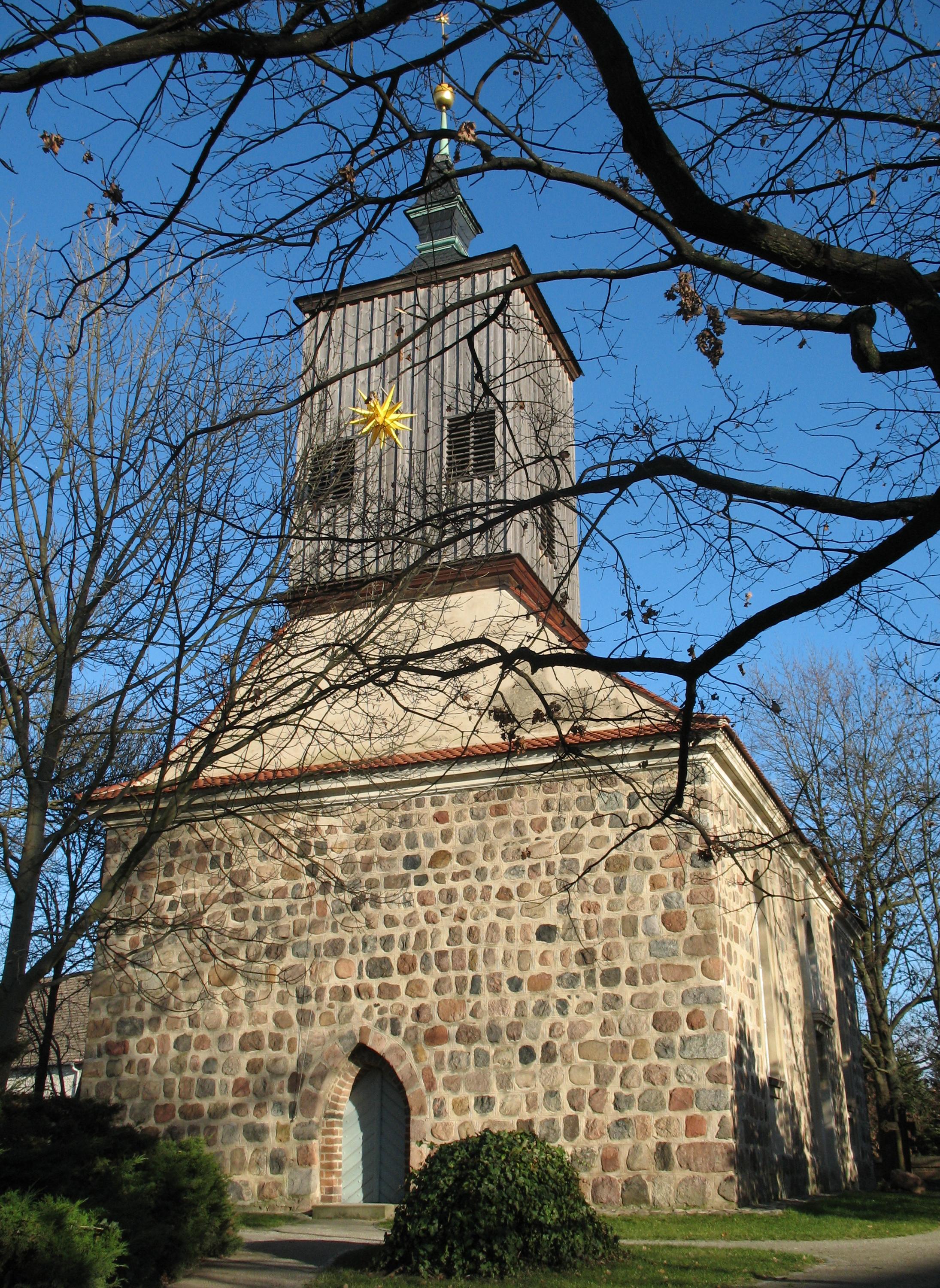
The small village of Selchow is one of the six districts of the municipality of Schönefeld in the district of Dahme-Spreewald south of Berlin, Germany. It borders in its east and south directly on the Berlin Brandenburg Airport (BER) and lies between its southern and the end of the northern runway. Geographical classification Selchow borders clockwise on the following villages (starting in the north): Waßmannsdorf, Schönefeld, Groß-Kienitz, Glasow, Mahlow and Großziethen. Traffic The Bundesstraße 96a runs through ''Selchow'', as well as the ''Landesstraße 75''. The Bundesstraße 96 is connected to the west via the country road. The nearest freeway junction is the ''Schönefeld-Süd'' junction of the Bundesautobahn 113. The village is connected to Waßmannsdorf station via the bus line 742. Places of interest *The village church of ''Selchow'' is a Romanesque fieldstone church from the first half of the 13th century. The windows were partly enlarged around 1700; the ... [...More Info...] [...Related Items...] OR: [Wikipedia] [Google] [Baidu] |
Glasow (Blankenfelde-Mahlow)
Glasow is an inhabited part of the Mahlow district of the municipality of Blankenfelde-Mahlow in the district of Teltow-Fläming in the state of Brandenburg, Germany. Geographical position This part of the commune is situated in the southeast of the Gemarkung. To the north lies the Mahlow district. This is followed clockwise by the Schönefeld district Selchow and the districts Groß Kienitz, Dahlewitz and Blankenfelde (each to Blankenfelde-Mahlow). Most of the district is built on and extends along the historical axis ''Alt Mahlow'', which runs in a north–south direction through the former street village. In the center of the village there is a village green. In the south, the country road 75 branches off as ''Selchower Weg'' in an easterly direction and connects to the Bundesstraße 96, which also runs in a north–south direction. To the west, the ''Glasowbach'' flows past the village. Economy and Infrastructure Economy In the place numerous crafts enterprises are active, un ... [...More Info...] [...Related Items...] OR: [Wikipedia] [Google] [Baidu] |
1980s
File:1980s replacement montage02.PNG, 420px, From left, clockwise: The first Space Shuttle, ''Columbia'', lifts off in 1981; US president Ronald Reagan and Soviet leader Mikhail Gorbachev ease tensions between the two superpowers, leading to the end of the Cold War; The fall of the Berlin Wall in 1989 is considered to be one of the most momentous events of the 1980s; In 1981, the IBM Personal Computer is released; In 1985, the Live Aid concert is held in order to fund relief efforts for the famine in Ethiopia during the time Mengistu Haile Mariam ruled the country; Pollution and ecological problems persisted when the Soviet Union and much of the world is filled with radioactive debris from the 1986 Chernobyl disaster, and in 1984, when thousands of people perished in Bhopal during a gas leak from a pesticide plant ; The Iran–Iraq War leads to over one million dead and $1 trillion spent, while another war between the Soviets and Afghans leaves over 2 million dead. rect 2 3 199 ... [...More Info...] [...Related Items...] OR: [Wikipedia] [Google] [Baidu] |
Waßmannsdorf
Waßmannsdorf is a village and a civil parish (''Ortsteil'') of the German town of Schönefeld, located in the district of Dahme-Spreewald in Brandenburg. As of 2007 its population was of around 1,000. History First mentioned in 1350 as ''Wasmanstorp'', the village was an autonomous municipality until 2003, when it merged into Schönefeld. From 1961 to 1989 its municipal borders with West Berlin were crossed by the Berlin Wall. Geography Waßmannsdorf is located in the southeastern suburb of Berlin, near the districts of Tempelhof-Schöneberg, Neukölln and Treptow-Köpenick; and bordering with the quarter of Rudow. The nearest places are Großziethen, Selchow, Schönefeld and Blankenfelde-Mahlow. The village is 20 km far from Königs Wusterhausen, 28 from Ludwigsfelde and 34 from Potsdam. Transport Waßmannsdorf is situated close to the runway of the new Berlin Brandenburg Airport. Crossed by the Berlin outer ring, it is served by a new railway station on the ''S-Bahn'' ... [...More Info...] [...Related Items...] OR: [Wikipedia] [Google] [Baidu] |
Berlin Outer Ring
The Berlin outer ring (german: Berliner Außenring, BAR) is a long double track electrified railway, originally built by the German Democratic Republic to bypass West Berlin in preparation for the building of the Berlin Wall during the division of Germany. It was developed by East Germany for economic, transport policy, and military reasons between 1951 and 1961 and included parts of some older lines (Outer Freight Ring, Jüterbog–Nauen railway, and Michendorf–Großbeeren railway). Without the completion of the outer ring it would not have been possible to build the Berlin Wall, sealing off West Berlin, without disrupting East Germany’s transport links. The Potsdam-Schönefeld Expressway was built for similar reasons. The term ''Outer ring'' is used to distinguish the line from the Ring line of inner Berlin. Route Starting at the Anhalt line in the south, the outer ring runs from Genshagener Heide to Schönefeld Airport, Grünau Cross, Wuhlheide, Schönfließ, Go ... [...More Info...] [...Related Items...] OR: [Wikipedia] [Google] [Baidu] |
Pankow
Pankow () is the most populous and the second-largest borough by area of Berlin. In Berlin's 2001 administrative reform, it was merged with the former boroughs of Prenzlauer Berg and Weißensee; the resulting borough retained the name Pankow. Pankow was sometimes claimed by the Western Allies (United States, United Kingdom, and France) to be the capital of the German Democratic Republic (East Germany), while the German Democratic Republic itself considered East Berlin to be its capital. Overview The borough, named after the Panke river, covers the northeast of the city region, including the inner city locality of Prenzlauer Berg. It borders Mitte and Reinickendorf in the west, Friedrichshain-Kreuzberg in the south, and Lichtenberg in the east. Pankow is Berlin's largest borough by population and the second largest by area (after Treptow-Köpenick). Between 1945 and 1960, Schönhausen Palace and the nearby Majakowskiring street in the Niederschönhausen locality of Pankow was th ... [...More Info...] [...Related Items...] OR: [Wikipedia] [Google] [Baidu] |
Schönhauser Allee
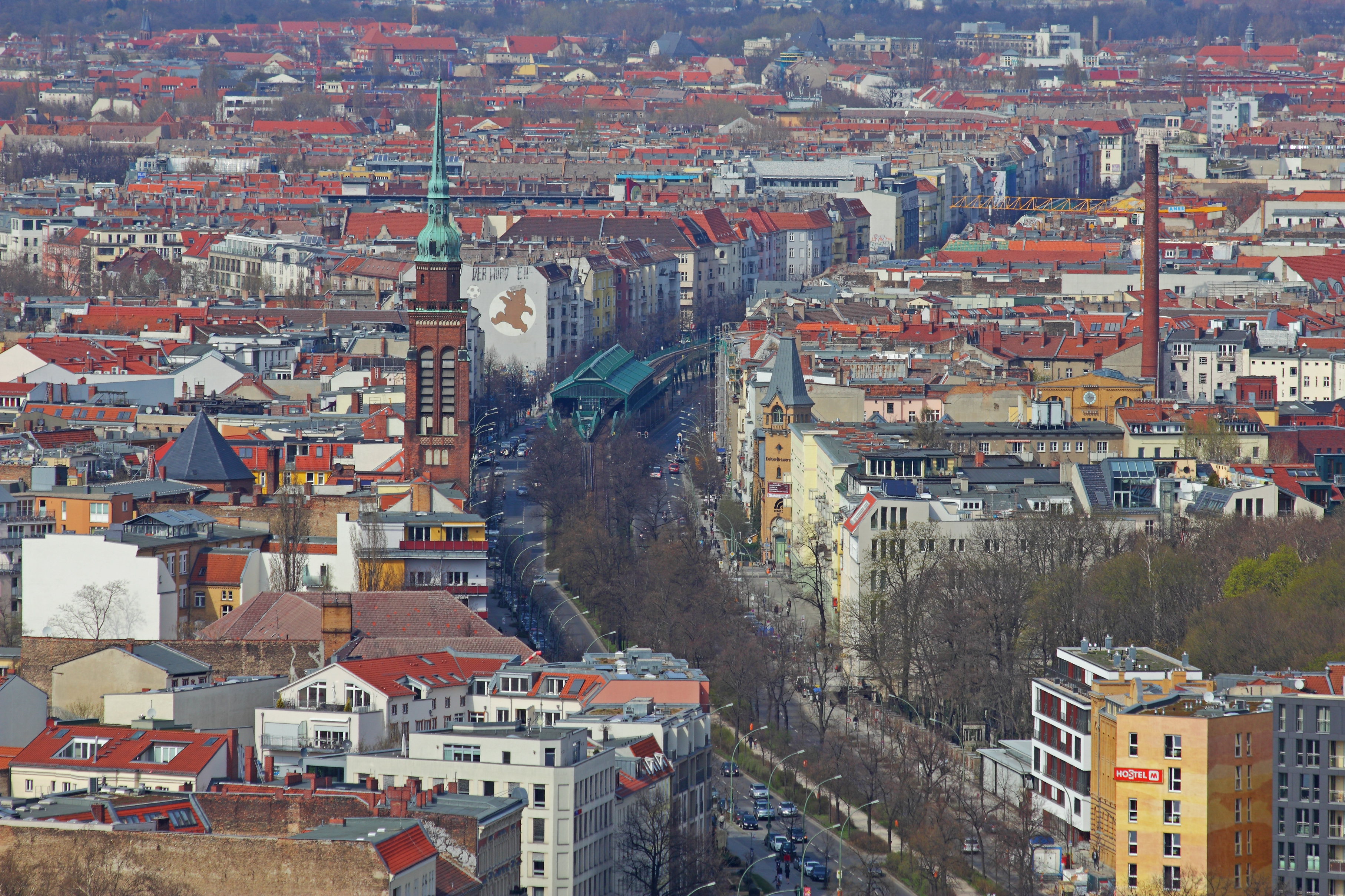
Schönhauser Allee in Berlin is one of the most important streets of the Prenzlauer Berg district. Schönhauser Allee begins at Rosa-Luxemburg-Platz in the south and ends at Schonensche Straße in the north. Many of the side streets of Schönhauser Allee are named after Scandinavian cities as Bornholmer Straße and Kopenhagener Straße. The street was named after the Schönhausen Palace in Pankow. The Berlin U-Bahn line U2 follows the boulevard on an elevated railway An elevated railway or elevated train (also known as an el train for short) is a rapid transit railway with the tracks above street level on a viaduct or other elevated structure (usually constructed from steel, cast iron, concrete, or bricks .... References Pankow Shopping districts and streets in Germany Streets in Berlin {{Germany-road-stub ... [...More Info...] [...Related Items...] OR: [Wikipedia] [Google] [Baidu] |
Danziger Straße
Danziger, being related to Danzig (Gdańsk, Poland), may refer to: Danzig/Gdansk, Poland * Danziger bay, southeastern bay of the Baltic Sea * ''Danziger Deutsch'', Danzig German, Northeastern German dialects spoken in Gdańsk, Poland * ''Danziger Kreuz'', Danzig Cross, a Nazi decoration of the Free City of Danzig * Danziger Willkür, an official set of records of the laws of Danzig People with the surname *Adolphe Danziger De Castro (1859–1959), Jewish scholar, journalist, lawyer *Aharon Danziger (fl. 1976–1984), Israeli paralympic volleyball player *Allen Danziger (born 1942), American actor *Avraham Danziger (1748—1820), rabbi, posek and codifier *Cory Danziger, American actor, political activist *Fred Danziger (1906–1948), American football player * Harry Danziger (born 1938), American rabbi * Jazzy Danziger (born 1984), American poet and editor *Jeff Danziger (born 1943), syndicated political cartoonist and author * Joan Danziger (born 1934), American sculptor * Kur ... [...More Info...] [...Related Items...] OR: [Wikipedia] [Google] [Baidu] |


