|
Bund Tunnel
The Bund Tunnel () is a sub-surface road and road tunnel in the city of Shanghai, China. The tunnel connects the districts of Hongkou to the north and Huangpu to the south. In the south, the tunnel begins on a stretch of South Zhongshan Road, which runs along the western bank of the Huangpu River, on the east side of the old Chinese city. It follows South Zhongshan Road and No. 2 East Zhongshan Road, crosses Yan'an Road, a major east-west artery (with a major exit to and from Yan'an Road), then follows East No. 1 Zhongshan Road through the Bund. At the northern end of the Bund, where the surface road joins the historic Garden Bridge to cross Suzhou Creek, the tunnel also crosses Suzhou Creek under the bridge. On the northern bank of Suzhou Creek, the tunnel briefly follows Daming Road, with another major exit leading east onto Changzhi Road, while the main tunnel veers west and joins Wusong Road. Construction on the tunnel began in 2007. The southern section of the tunnel is a ... [...More Info...] [...Related Items...] OR: [Wikipedia] [Google] [Baidu] |
The Bund (Shanghai)
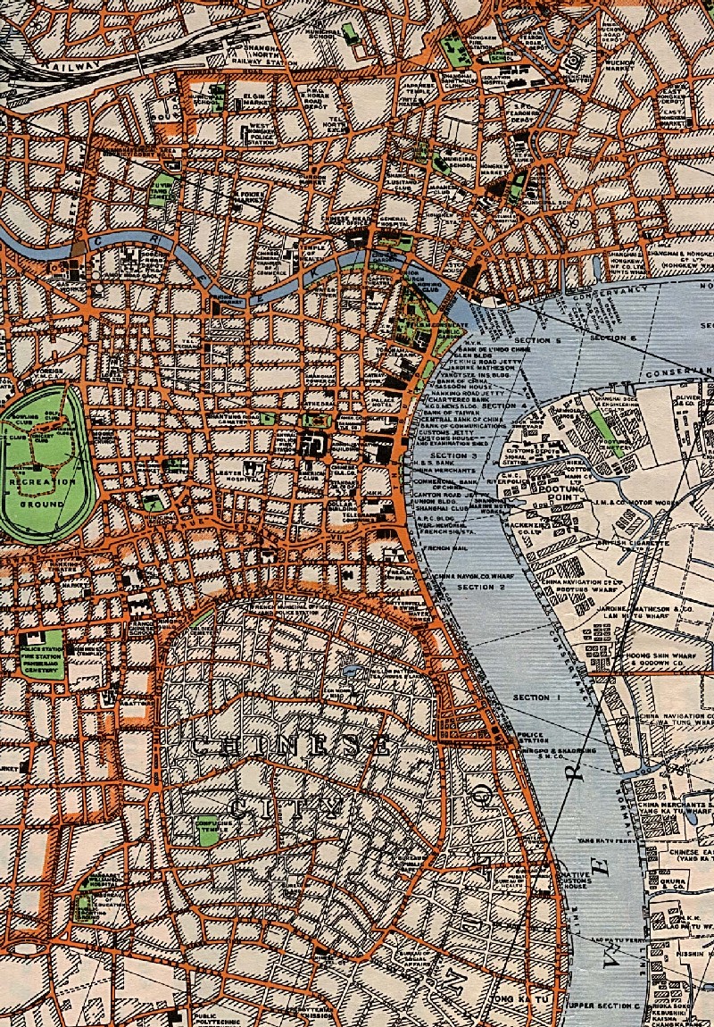
The Bund or Waitan (, Shanghainese romanization: ''Nga3thae1'', , ) is a waterfront area and a protected historical district in central Shanghai. The area centers on a section of Zhongshan Road (East Zhongshan Road No.1) within the former Shanghai International Settlement, which runs along the western bank of the Huangpu River in the eastern part of Huangpu District. The area along the river faces the modern skyscrapers of Lujiazui in the Pudong District. The Bund usually refers to the buildings and wharves on this section of the road, as well as some adjacent areas. From the 1860s to the 1930s, it was the rich and powerful center of the foreign establishment in Shanghai, operating as a legally protected treaty port. Name The term "bund" was borrowed into English from Hindustani and originally referred to a dyke or embankment. Within the Chinese treaty ports, it was applied specifically to an embanked quay which ran along the shore. The Chinese name for the Bund is unrelated ... [...More Info...] [...Related Items...] OR: [Wikipedia] [Google] [Baidu] |
Suzhou Creek
Suzhou Creek (or Soochow Creek), also called the Wusong (Woosung) River, is a river that passes through the Shanghai city center. It is named after the neighboring city of Suzhou (Soochow), Jiangsu, the predominant settlement in this area prior to the rise of Shanghai as a metropolis. One of the principal outlets of Lake Tai in Wujiang District of Suzhou, Suzhou Creek is long, of which 54 km are within the administrative region of Shanghai and 24 km within the city's highly urbanized parts. It flows into the Huangpu River at the northern end of the Bund in Huangpu District. History The river was originally called "Song Jiang" ("Pine River"). When the former Huating Fu (Prefecture) was renamed Songjiang Fu in 1278, the river's name was changed to "Wusong River". The mouth of the river was known in the 4th or 5th century of Jin as (, , lit "Harpoon Ditch"), at which time it was the main conduit into the ocean;Shanghai Municipal Government."申","沪"的由来 ("Or ... [...More Info...] [...Related Items...] OR: [Wikipedia] [Google] [Baidu] |
Transport In Shanghai
Shanghai has an extensive public transport system, largely based on buses, trolley buses, taxis, and a rapidly expanding metro system. Shanghai has invested heavily in public transportation before and after the 2010 World Expo, including the construction of the Hongqiao transportation hub of high-speed rail, air, metro and bus routes. Public transport is the major mode of transport in Shanghai as limitations on car purchases were introduced in 1994 in order to limit the growth of automobile traffic and alleviate congestion. New private cars cannot be driven without a license plate, which are sold in monthly license plate auctions which is only accessible for locally registered residents and those who have paid social insurance or individual income taxes for over three years. Around 9,500 license plates are auctioned each month, and the average price is about () in 2019. Shanghai (population of 25 million) has over four million cars on the road, the fifth-largest number of any Chi ... [...More Info...] [...Related Items...] OR: [Wikipedia] [Google] [Baidu] |
Yan'an Elevated Road
Yan'an Elevated Road () is an elevated expressway in the city of Shanghai, China. It runs along Yan'an Road in its entirety, continuing from the east terminus of G50 Shanghai-Chongqing Expressway at Huqingping Interchange (close to Hongqiao International Airport) to just beyond the old building of Shanghai Natural History Museum, at which point it ends and rejoins Yan'an Road on the surface. Traffic is then partly directed underground to the Bund Tunnel (completed 2010). Motorists continuing east can cross the Huangpu River using the East Yan'an Road Tunnel to Pudong. The maximum speed on the expressway is 80 km/h. Construction on the first portion of the elevated roadway, from the Inner Ring Road to Hongqiao Airport, began on 28 November 1995 and was completed on 2 December 1996. The expressway originally stretched down the whole length of Yan'an Road, ending with a left-turning ramp onto the surface road of the Bund. In 2008, to improve cityscape in the historic area ... [...More Info...] [...Related Items...] OR: [Wikipedia] [Google] [Baidu] |
General Post Office Building, Shanghai
The General Post Office Building () is the head post office of Shanghai, China. Built in 1924, the four-storey building is located at 395 Tiandong Road, at the north end of the Sichuan Road Bridge, on the banks of the Suzhou Creek. History In the early years of the Republic of China (ROC), Shanghai was the center of China's postal network. In 1914, China joined the Universal Postal Union, and Shanghai was designated as the exchange for international mail. By the early 1920s, the previous premises of the postal administration was no longer adequate, and land was acquired on the north bank of Suzhou Creek for the construction of a new headquarters building. The building was situated within the Shanghai International Settlement, midway between the central business district and the Shanghai North Railway Station. Built from 1922 to 1924 and designed by Stewardson & Spence,Warr, Anne: ''Shanghai Architecture'', The Watermark Press, 2007, the building is in Classical style. Its two m ... [...More Info...] [...Related Items...] OR: [Wikipedia] [Google] [Baidu] |
Wenhui Bao
''Wenhui Bao'' (), anglicized as the ''Wenhui Daily'',Shanghai Municipal Government"Press Group Celebrates" 26 July 2008. Accessed 18 Dec 2014. is a Chinese daily newspaper published by the Shanghai United Media Group. History ''Wenhui Bao'' was founded in Shanghai on January 25, 1938 by leftist-leaning intellectuals centered on writer and journalist Ke Ling. Over the next decade, it was closed down twice for its political leanings. In early 1956, ''Wenhui Bao'' was forced to relocate to Beijing and was renamed '' Jiaoshibao'' (Teacher's News). After the start of the Hundred Flowers Campaign, however, the paper was allowed to resume publication under its original name, beginning on 1 October 1956. Under its editor-in-chief Xu Zhucheng, ''Wenhui Bao'' became one of the most outspoken newspapers of the Hundred Flowers period, but was attacked by Mao Zedong in July 1957 and punished. In the 1960s, ''Wenhui Bao'' became an outlet for Mao Zedong's editorials, and in late 1965 it w ... [...More Info...] [...Related Items...] OR: [Wikipedia] [Google] [Baidu] |
Tunnelling Shield
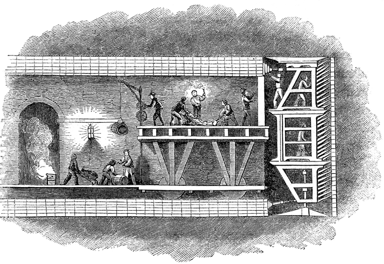
A tunnelling shield is a protective structure used during the excavation of large, man-made tunnels. When excavating through ground that is soft, liquid, or otherwise unstable, there is a potential health and safety hazard to workers and the project itself from falling materials or a cave-in. A tunnelling shield can be used as a temporary support structure. It is usually in place for the short-term from when the tunnel section is excavated until it can be lined with a permanent support structure. The permanent structure may be made up of, depending on the period, bricks, concrete, cast iron, or steel. Although modern shields are commonly cylindrical, the first "shield", designed by Marc Isambard Brunel, was actually a large, rectangular, scaffold-like iron structure with three levels and twelve sections per level, with a solid load-bearing top surface. The structure protected the men from cave-ins as they laboured within it, digging the tunnel out in front of the shield. History ... [...More Info...] [...Related Items...] OR: [Wikipedia] [Google] [Baidu] |
Cut And Cover
A tunnel is an underground passageway, dug through surrounding soil, earth or rock, and enclosed except for the entrance and exit, commonly at each end. A Pipeline transport, pipeline is not a tunnel, though some recent tunnels have used immersed tube construction techniques rather than traditional tunnel boring methods. A tunnel may be for foot or vehicular road traffic, for rail transport, rail traffic, or for a canal. The central portions of a rapid transit network are usually in the tunnel. Some tunnels are used as sanitary sewer, sewers or aqueduct (watercourse), aqueducts to supply water for consumption or for hydroelectric stations. Utility tunnels are used for routing steam, chilled water, electrical power or telecommunication cables, as well as connecting buildings for convenient passage of people and equipment. Secret tunnels are built for military purposes, or by civilians for smuggling of weapons, contraband, or people. Special tunnels, such as wildlife crossi ... [...More Info...] [...Related Items...] OR: [Wikipedia] [Google] [Baidu] |
Waibaidu Bridge
The Waibaidu Bridge (), called the Garden Bridge in English, is the first all-steel bridge,"The Preservation and Renovation of Waibaidu Bridge,"''WHITR-AP (Shanghai) NEWSLETTER'' 9 (March 2009):4.; http://whitr-ap.org/download/Newsletter%209.pdf and the only surviving example of a camelback truss bridge, in China. The present bridge is the fourth Western-designed bridge built at its location since 1856, in the downstream of the estuary of the Suzhou Creek, near its confluence with the Huangpu River, adjacent to the Bund in central Shanghai. It connects the Huangpu and Hongkou districts and was opened on 20 January 1908. With its rich history and unique design the Waibaidu Bridge is one of the symbols of Shanghai. Its modern and industrial image may be regarded as the city's landmark bridge. On 15 February 1994 the Shanghai Municipal Government declared the bridge an example of Heritage Architecture, and one of the outstanding structures in Shanghai. In an ever-changing metropolis, t ... [...More Info...] [...Related Items...] OR: [Wikipedia] [Google] [Baidu] |
Huangpu District, Shanghai
Huangpu District (), makes up the eastern part of Shanghai's traditional urban core and is today the most central of Shanghai's 16 districts. Huangpu district is the seat of municipal government, includes key attractions such as The Bund and the Old City God Temple, as well as popular shopping districts such as Nanjing Road, Huaihai Road and Xintiandi. The Huangpu District is one of the most densely populated urban districts in the world. Location The Huangpu District is located in central Shanghai, People's Republic of China on the left bank (i.e., west or north bank) of Huangpu River, after which the district is named. It is opposite to Pudong and is bounded by Suzhou Creek to the north. Today's Huangpu District is sometimes referred to as "new Huangpu" to distinguish it from the pre-merger Huangpu District which existed before 2000. In 2000, the pre-merger Huangpu and Nanshi districts were combined to form a new district, also called Huangpu. In June 2011, the existing Huan ... [...More Info...] [...Related Items...] OR: [Wikipedia] [Google] [Baidu] |
Yan'an Road
Yan'an Road (; Shanghainese: Yi'ue Lu) is a road in Shanghai, a major east–west thoroughfare through the centre of the city. The modern Yan'an Road is in three sections, reflecting three connected streets which existed pre-1945: Avenue Edward VII, Avenue Foch and the Great Western Road. The streets were joined together under a common name by the Republic of China (1912–1949), Republic of China government in 1945, then renamed in the early 1950s after the Chinese Communist Party took over Shanghai. The road is named after Yan'an, the Communist base during the Chinese Civil War. East Yan'an Road East Yan'an Road stretches from the southern end of the Bund (Shanghai), the Bund in the east to Xizang Road (near People's Square and the customary centre of urban Shanghai) in the west. Yan'an Road East follows the course of an ancient canal, the West Yangjing Bang (the East Yangjing Bang was on the east side of the Huangpu River; the two were more closely connected when the Huangpu ... [...More Info...] [...Related Items...] OR: [Wikipedia] [Google] [Baidu] |
Old City Of Shanghai
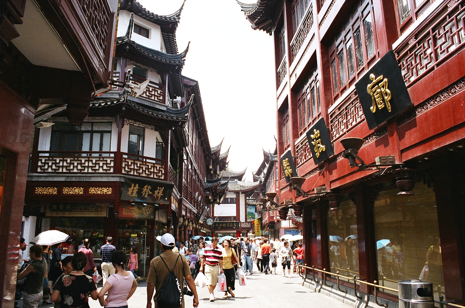
The Old City of Shanghai (; Shanghainese: ''Zånhae Lo Zenshian''), also formerly known as the Chinese city, is the traditional urban core of Shanghai. Its boundary was formerly defined by a defensive wall. The Old City was the county seat for the old county of Shanghai. With the advent of foreign concessions in Shanghai, the Old City became just one part of Shanghai's urban core but continued for decades to be the seat of the Chinese authority in Shanghai. Notable features include the City God Temple which is located in the center of the Old City and is connected to the Yuyuan Garden. With the exception of two short sections, the walls were demolished in 1912, and a broad circular avenue built over the former wall and moat: the southern half was named the "Zhonghua Road" and the northern half the "Minguo Road" (together making up "''Zhonghua Minguo''", or "Republic of China" in Chinese). (The northern half was renamed "Renmin Road" ("People's Road") in 1950 by the new Communist ... [...More Info...] [...Related Items...] OR: [Wikipedia] [Google] [Baidu] |


