|
Bum La
The Bum La Pass is a border pass between China's Tsona County in Tibet and India's Tawang district in Arunachal Pradesh. It is 37 km away from the town of Tawang in India's Tawang district and 43 km from the town of Tsona Dzong in China’s Tsona County. The pass currently serves as a trading point between Arunachal Pradesh and Tibet.Indo-China Border Trade Department of Trade & Commerce, Government of Arunachal Pradesh, retrieved 13 July 2020. It is also an agreed Border Personnel Meeting point for the security forces of China and India. Location An old traders road went from |
Tsona County
Tsona County () or Cona County () is a county in Shannan prefecture in southern part of Tibet region of China. The county lies immediately to the north of the McMahon Line agreed as the mutual border between British India and Tibet in 1914. Chine has not accepted the 1914 border delineation, but treats it as the Line of Actual Control (LAC). The Tsona County also borders Bhutan on its southwest. Geography Two main south-flowing rivers Nyamjang Chu and Tsona Chu flow through the county and enter India's Tawang district, where they join the Tawang Chu river. Between Nyamjang Chu and Tsona Chu lies an undulating plateau, with streams flowing west to east, often after collecting into lakes. Napa Yutso Lake and Nyapa Tso are two such large lakes. In addition, the Tsona County also contains the basins of the east-flowing rivers that form the Subansiri River. Loro Karpo Chu (the "white Loro river") in the north leads to the Jorra township. Loro Nakpo Chu (the "black Loro river") l ... [...More Info...] [...Related Items...] OR: [Wikipedia] [Google] [Baidu] |
Lake Shungtser At Tawang-3
A lake is an area filled with water, localized in a basin, surrounded by land, and distinct from any river or other outlet that serves to feed or drain the lake. Lakes lie on land and are not part of the ocean, although, like the much larger oceans, they do form part of the Earth's water cycle. Lakes are distinct from lagoons, which are generally coastal parts of the ocean. Lakes are typically larger and deeper than ponds, which also lie on land, though there are no official or scientific definitions. Lakes can be contrasted with rivers or streams, which usually flow in a channel on land. Most lakes are fed and drained by rivers and streams. Natural lakes are generally found in mountainous areas, rift zones, and areas with ongoing glaciation. Other lakes are found in endorheic basins or along the courses of mature rivers, where a river channel has widened into a basin. Some parts of the world have many lakes formed by the chaotic drainage patterns left over from the last ice ... [...More Info...] [...Related Items...] OR: [Wikipedia] [Google] [Baidu] |
Mountain Passes Of India
A mountain is an elevated portion of the Earth's crust, generally with steep sides that show significant exposed bedrock. Although definitions vary, a mountain may differ from a plateau in having a limited summit area, and is usually higher than a hill, typically rising at least 300 metres (1,000 feet) above the surrounding land. A few mountains are isolated summits, but most occur in mountain ranges. Mountains are formed through tectonic forces, erosion, or volcanism, which act on time scales of up to tens of millions of years. Once mountain building ceases, mountains are slowly leveled through the action of weathering, through slumping and other forms of mass wasting, as well as through erosion by rivers and glaciers. High elevations on mountains produce colder climates than at sea level at similar latitude. These colder climates strongly affect the ecosystems of mountains: different elevations have different plants and animals. Because of the less hospitable terrain ... [...More Info...] [...Related Items...] OR: [Wikipedia] [Google] [Baidu] |
Mountain Passes Of China
A mountain is an elevated portion of the Earth's crust, generally with steep sides that show significant exposed bedrock. Although definitions vary, a mountain may differ from a plateau in having a limited summit area, and is usually higher than a hill, typically rising at least 300 metres (1,000 feet) above the surrounding land. A few mountains are isolated summits, but most occur in mountain ranges. Mountains are formed through tectonic forces, erosion, or volcanism, which act on time scales of up to tens of millions of years. Once mountain building ceases, mountains are slowly leveled through the action of weathering, through slumping and other forms of mass wasting, as well as through erosion by rivers and glaciers. High elevations on mountains produce colder climates than at sea level at similar latitude. These colder climates strongly affect the ecosystems of mountains: different elevations have different plants and animals. Because of the less hospitable terrain and ... [...More Info...] [...Related Items...] OR: [Wikipedia] [Google] [Baidu] |
Mountain Passes Of Tibet
A mountain is an elevated portion of the Earth's crust, generally with steep sides that show significant exposed bedrock. Although definitions vary, a mountain may differ from a plateau in having a limited summit area, and is usually higher than a hill, typically rising at least 300 metres (1,000 feet) above the surrounding land. A few mountains are isolated summits, but most occur in mountain ranges. Mountains are formed through tectonic forces, erosion, or volcanism, which act on time scales of up to tens of millions of years. Once mountain building ceases, mountains are slowly leveled through the action of weathering, through slumping and other forms of mass wasting, as well as through erosion by rivers and glaciers. High elevations on mountains produce colder climates than at sea level at similar latitude. These colder climates strongly affect the ecosystems of mountains: different elevations have different plants and animals. Because of the less hospitable terrain ... [...More Info...] [...Related Items...] OR: [Wikipedia] [Google] [Baidu] |
Mountain Passes Of Arunachal Pradesh
A mountain is an elevated portion of the Earth's crust, generally with steep sides that show significant exposed bedrock. Although definitions vary, a mountain may differ from a plateau in having a limited summit area, and is usually higher than a hill, typically rising at least 300 metres (1,000 feet) above the surrounding land. A few mountains are isolated summits, but most occur in mountain ranges. Mountains are formed through tectonic forces, erosion, or volcanism, which act on time scales of up to tens of millions of years. Once mountain building ceases, mountains are slowly leveled through the action of weathering, through slumping and other forms of mass wasting, as well as through erosion by rivers and glaciers. High elevations on mountains produce colder climates than at sea level at similar latitude. These colder climates strongly affect the ecosystems of mountains: different elevations have different plants and animals. Because of the less hospitable terrain ... [...More Info...] [...Related Items...] OR: [Wikipedia] [Google] [Baidu] |
2022 Yangtse Clash
The Yangtse clash of 9 December 2022 occurred at night between the troops of the Indian Army and the Chinese People's Liberation Army (PLA) along their mutually contested Line of Actual Control (LAC) in the Yangtse region of Tawang in the Indian state of Arunachal Pradesh. Violent clashes ensued after the two armies confronted each other with nail-studded clubs and other melee weapons near positions on a border ridgeline in close vicinity of the revered Buddhist site of Chumi Gyatse Falls. The border incident marked the most serious clash between the two armies along their undemarcated frontier since the Galwan Valley clash in June 2020, which had led to the deaths of 20 Indian soldiers and an unknown number of dead on the Chinese side. Independent researchers using satellite imagery found evidence of Chinese troops, numbering about 300 according to reports, from a newly constructed border village moving up towards two Indian outposts at about elevation. This provoked a clash ... [...More Info...] [...Related Items...] OR: [Wikipedia] [Google] [Baidu] |
Tawang Monastery
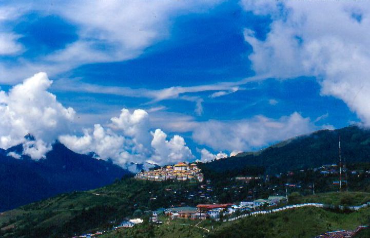
Tawang Monastery, located in Tawang city of Tawang district in the Indian state of Arunachal Pradesh, is the largest monastery in India. It is situated in the valley of the Tawang Chu, near the small town of the same name in the northwestern part of Arunachal Pradesh, in close proximity to the Chinese and Bhutanese border. Tawang Monastery is known in Tibetan as Gaden Namgyal Lhatse, which translates to "the divine paradise of complete victory." It was founded by Merak Lama Lodre Gyatso in 1680–1681 in accordance with the wishes of the 5th Dalai Lama, Ngawang Lobsang Gyatso. It belongs to the Gelug school of Vajrayana Buddhism and had a religious association with Drepung Monastery of Lhasa, which continued during the period of British rule. The monastery is three stories high. It is enclosed by a long compound wall. Within the complex there are 65 residential buildings. The library of the monastery has valuable old scriptures, mainly Kangyur and Tengyur. Etymology The ful ... [...More Info...] [...Related Items...] OR: [Wikipedia] [Google] [Baidu] |
Chumi Gyatse Falls
Chumi Gyatse Falls (), called Domtsang and Dongzhang waterfalls in Tibetan and Chinese languages respectively, are a collection of waterfalls in the Tawang district in Arunachal Pradesh, India, close to the border with the Tibet region of China. According to the local Buddhist tradition, the 108 holly water falls which originate from in-between the mountains symbolise the blessings of Guru Padmasambhava. The Chumi Gyatse Falls are close to the Line of Actual Control, the de facto border between China and India, just 250 metres away according to one account. Geography The Chumi Gyatse Falls are in an area called Yangtse where the Tsona Chu river flows from Tibet into India's Tawang district. They are along the cliff face of a high plateau ("Yangtse plateau") formed by an east–west mountain range, whose watershed serves as the India–China border as per the McMahon Line. A few hundred meters to the north, lies Domtsang () or Dongzhang () (), a Buddhist meditation site associa ... [...More Info...] [...Related Items...] OR: [Wikipedia] [Google] [Baidu] |
Tawang District
Tawang district (Pron:/tɑ:ˈwæŋ or təˈwæŋ/) is the smallest of the 26 administrative districts of Arunachal Pradesh state in northeastern India. With a population of 49,977, it is the eighth least populous district in the country (out of 707). History Tawang is inhabited by the Monpa people. From 500 BC to 600 AD a kingdom known as Lhomon or Monyul ruled the area. The Monyul kingdom was later absorbed into the control of neighbouring Bhutan and Tibet. Tawang Monastery was founded by the Merak Lama Lodre Gyatso in 1681 in accordance with the wishes of the 5th Dalai Lama, Ngawang Lobsang Gyatso, and has an interesting legend surrounding its name, which means "Chosen by Horse". The sixth Dalai Lama, Tsangyang Gyatso, was born in Tawang. Tawang was historically part of Tibet. The 1914 Simla Accord defined the McMahon Line as the new boundary between British India and Tibet. By this treaty, Tibet relinquished several hundred square miles of its territory, including Ta ... [...More Info...] [...Related Items...] OR: [Wikipedia] [Google] [Baidu] |
India Chinese Meeting @ Tawang Border
India, officially the Republic of India (Hindi: ), is a country in South Asia. It is the seventh-largest country by area, the second-most populous country, and the most populous democracy in the world. Bounded by the Indian Ocean on the south, the Arabian Sea on the southwest, and the Bay of Bengal on the southeast, it shares land borders with Pakistan to the west; China, Nepal, and Bhutan to the north; and Bangladesh and Myanmar to the east. In the Indian Ocean, India is in the vicinity of Sri Lanka and the Maldives; its Andaman and Nicobar Islands share a maritime border with Thailand, Myanmar, and Indonesia. Modern humans arrived on the Indian subcontinent from Africa no later than 55,000 years ago., "Y-Chromosome and Mt-DNA data support the colonization of South Asia by modern humans originating in Africa. ... Coalescence dates for most non-European populations average to between 73–55 ka.", "Modern human beings—''Homo sapiens''—originated in Africa. Then, interm ... [...More Info...] [...Related Items...] OR: [Wikipedia] [Google] [Baidu] |


