|
Buffalo Narrows
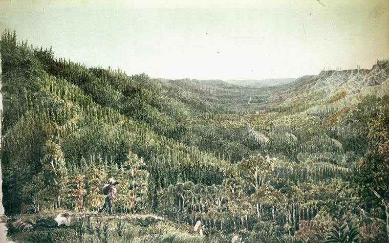
Buffalo Narrows is a northern village in Saskatchewan, Canada. It is a community of 1,110 people. Located at the "Narrows" between Peter Pond Lake and Churchill Lake, tourism and resource extraction (logging, fishing) are its main economic activities. History Buffalo Narrows or ''Détroit du Boeuf'' as it was called in French was founded in the early 20th century as trapping, mink ranching and fishing settlement by Scandinavian traders. The community developed around an earlier Dene settlement. John Macoun, who was travelling the fur trade route from Methye Portage to Lac Île-à-la-Crosse visited the "Narrows" in September 1875. He described his visit to this old community in the following lines: "After sunrise, a headwind sprang up with which we battled all day and reached the "Narrows," that connect Buffalo and Clearwater lakes, before dark. "Chipewyan House" is situated at the eastern end of the "Narrows," and at the head of Clearwater Lake. Here the Chipewyans hav ... [...More Info...] [...Related Items...] OR: [Wikipedia] [Google] [Baidu] |
Northern Village (Saskatchewan)
Northern village may refer to: * Northern village (Quebec), a municipal status type in Quebec, Canada * Northern village (Saskatchewan), a municipal status type in Saskatchewan, Canada {{Geodis ... [...More Info...] [...Related Items...] OR: [Wikipedia] [Google] [Baidu] |
Peter Pond Lake
Peter Pond Lake is a glacial lake in Saskatchewan, Canada. It is located in northwestern Saskatchewan in the Boreal Forest and Canadian Shield within the Churchill River drainage basin. It was on the fur trade route to the Methye Portage which connected eastern Canada to the MacKenzie River area. The lake is a long oval tending to the northwest. A peninsula which almost reaches the west shore divides it into Big Peter Pond (the northern two thirds) and Little Peter Pond. On the east side of Little Peter Pond a narrow isthmus separates it from Churchill Lake, the two forming a broad "V". The La Loche River, which drains Lac La Loche comes in from the north while the Dillon River, with the village of Dillon at its mouth, comes in from the west. The lake drains into Churchill Lake through the Kisis Channel at Buffalo Narrows, Saskatchewan. Originally called Big and Little Buffalo Lakes, it was renamed after Peter Pond in 1931. It is on Highway 155 which passes through Buffalo N ... [...More Info...] [...Related Items...] OR: [Wikipedia] [Google] [Baidu] |
Métis
The Métis ( ; Canadian ) are Indigenous peoples of the Americas, Indigenous peoples who inhabit Canada's three Canadian Prairies, Prairie Provinces, as well as parts of British Columbia, the Northwest Territories, and the Northern United States. They have a shared history and culture which derives from specific mixed European (primarily French) and Indigenous peoples of the Americas, Indigenous ancestry which became a distinct culture through ethnogenesis by the mid-18th century, during the early years of the North American fur trade. In Canada, the Métis, with a population of 624,220 as of 2021, are one of three major groups of Indigenous peoples in Canada, Indigenous peoples that were legally recognized in the Constitution Act of 1982, the other two groups being the First Nations in Canada, First Nations and Inuit. Smaller communities who self-identify as Métis exist in Canada and the United States, such as the Little Shell Tribe of Chippewa Indians of Montana. The United ... [...More Info...] [...Related Items...] OR: [Wikipedia] [Google] [Baidu] |
Buffalo Narrows Murders
On the night of January 30, 1969, in Buffalo Narrows Frederick Moses McCallum, 19, broke the door to the Pederson's family home with a long-handled fire axe killing seven people and wounding one. Events Frederick Moses McCallum, 19, broke the door to the Pederson's family home and with a long-handled fire axe killed seven people and wounded one. In the home, he killed the father, mother, family friend, two sons, two daughters, and wounded one son. All the bodies of family members lay in bed and the body of a family friend lay in the living room. After the killings, McCallum called a local priest and told him about the killings. The priest called the police. When police detained McCallum he was sitting in the kitchen and sipping tea. The wounded son after the murders was in a coma for several months. In court, a psychiatrist said McCallum had signs of schizophrenia. McCallum was initially found unfit for criminal responsibility and sent to a psychiatric hospital in Ontario. In ... [...More Info...] [...Related Items...] OR: [Wikipedia] [Google] [Baidu] |
La Loche River (Saskatchewan)
The La Loche River is a small river in north-west Saskatchewan. The distance from its source at the south east end of Lac La Loche to its mouth at the north end of Peter Pond Lake is 56 km. The river is bridged by Highway 956 about 5 kilometres from its source. The Kimowin River flows in from the west. History Two kilometres from the mouth of the La Loche River lies the old site of Bull's House () . Bull's House was an outpost of the Hudson's Bay Company during the fur trade. This hamlet may have begun as a North West Company post in 1795. A century later in 1895 according to Father Penard of the La Loche mission there were six families living there. In 1906 only 12 people remained. Oxen and horses used for hauling freight at Methye Portage were sometimes wintered there. During periods of high water that flooded fields at Bull's House hay was cut a few miles away at Hay Point () on the east side of Peter Pond Lake for the animals. It was also called the ''Riviere La ... [...More Info...] [...Related Items...] OR: [Wikipedia] [Google] [Baidu] |
Dillon, Saskatchewan
Dillon is an unincorporated community in the taiga, boreal forest of northern Saskatchewan, Canada. It is located on the western shore of Peter Pond Lake at the mouth of the Dillon River. The community is the administrative headquarters of the Buffalo River Dene Nation and is accessed by Saskatchewan Highway 925, Highway 925 from Saskatchewan Highway 155, Highway 155. History The North West Company had a post near Dillon in 1790. It was called ''Lac des Boeufs Post'' (Buffalo Lake Post). The Hudson's Bay Company had a post nearby in 1791. In 1819–1820 Sir John Franklin noted the position of the North West Company Post on Buffalo Lake (Peter Pond Lake) where Buffalo River (Dillon River) is located. (see map) The first post office opened under the name of Buffalo River in 1926 and closed in 1929. In 1954 the post office was re-opened under the name of Dillon. Name changes In 1932 the name of the community was officially changed from Buffalo River to Dillon, the name of th ... [...More Info...] [...Related Items...] OR: [Wikipedia] [Google] [Baidu] |
Hudson's Bay Company
The Hudson's Bay Company (HBC; french: Compagnie de la Baie d'Hudson) is a Canadian retail business group. A fur trading business for much of its existence, HBC now owns and operates retail stores in Canada. The company's namesake business division is Hudson's Bay, commonly referred to as The Bay ( in French). After incorporation by English royal charter in 1670, the company functioned as the ''de facto'' government in parts of North America for nearly 200 years until the HBC sold the land it owned (the entire Hudson Bay drainage basin, known as Rupert's Land) to Canada in 1869 as part of the Deed of Surrender, authorized by the Rupert's Land Act 1868. At its peak, the company controlled the fur trade throughout much of the English- and later British-controlled North America. By the mid-19th century, the company evolved into a mercantile business selling a wide variety of products from furs to fine homeware in a small number of sales shops (as opposed to trading posts) ... [...More Info...] [...Related Items...] OR: [Wikipedia] [Google] [Baidu] |
Chipewyan People
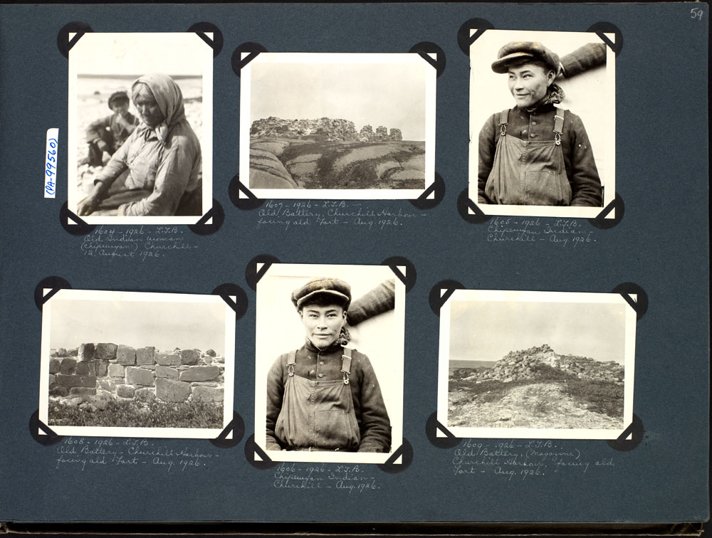
The Chipewyan ( , also called ''Denésoliné'' or ''Dënesųłı̨né'' or ''Dënë Sųłınë́'', meaning "the original/real people") are a Dene Indigenous Canadian people of the Athabaskan language family, whose ancestors are identified with the Taltheilei Shale archaeological tradition. They are part of the Northern Athabascan group of peoples, and come from what is now Western Canada. Terminology The term ''Chipewyan'' (ᒌᐘᔮᐣ) is a Cree exonym meaning ''pointed hides'', referring to the design of their parkas. The French-speaking missionaries to the northwest of the Red River Colony referred to the Chipewyan people as Montagnais in their documents written in French. Montagnais simply means "mountain people" or "highlanders" in French and has been applied to many unrelated nations across North America over time. For example the Neenolino Innu of northern Quebec are also called "Montagnais". Demographics Chipewyan peoples live in the region spanning the we ... [...More Info...] [...Related Items...] OR: [Wikipedia] [Google] [Baidu] |
Lac Île-à-la-Crosse
Lac Île-à-la-Crosse is a Y-shaped lake in North-Central Saskatchewan, Canada, on the Churchill River. At the centre of the Y is the town of Île-à-la-Crosse, the second oldest town in Saskatchewan. The Churchill exits the north-east arm and flows east to Hudson Bay through a series of lakes. The Churchill enters at the north-west arm called Aubichon Arm or Deep River. Upstream it leads north-west to Athabasca Country passing Churchill Lake, Peter Pond Lake, Lac La Loche and on to the Methye Portage leading to Lake Athabasca. The Beaver River comes from the south and west and enters on the east side. The headwaters of the Beaver are south-west between the upper Athabasca River and the upper North Saskatchewan River in the Lac la Biche area in Alberta. Lac Île-à-la-Crosse is reached from the south by Saskatchewan Highway 155 which follows the Beaver River. To the south-east is Lac la Plonge and to the south-west Canoe Lake. To the east are many lakes which are w ... [...More Info...] [...Related Items...] OR: [Wikipedia] [Google] [Baidu] |
Methye Portage
The Methye Portage or Portage La Loche in northwestern Saskatchewan was one of the most important portages in the old fur trade route across Canada. The portage connected the Mackenzie River basin to rivers that ran east to the Atlantic. It was reached by Peter Pond in 1778 and abandoned in 1883 when steamboats began running on the Athabasca River with links to the railroad. It ranks with Grand Portage as one of the two most important and difficult portages used during the fur trade era. 'Methye' is Cree and 'La Loche' is French for a fish that is called 'burbot' in English. Although 'Methye Portage' is often used the official name since 1957 is Portage La Loche. Both names are used in historical documents, books and journals. Alexander Mackenzie in his book "Voyages from Montreal" used both Portage la Loche and Mithy-Ouinigam Portage (in 1789–1793). History The Methye Portage had been in use by indigenous peoples as a trade route for generations. They introduced it to ... [...More Info...] [...Related Items...] OR: [Wikipedia] [Google] [Baidu] |
North American Fur Trade
The North American fur trade is the commercial trade in furs in North America. Various Indigenous peoples of the Americas traded furs with other tribes during the pre-Columbian era. Europeans started their participation in the North American fur trade from the initial period of their colonization of the Americas onward, extending the trade's reach to Europe. European merchants from France, England and the Dutch Republic established trading posts and forts in various regions of North America to conduct the trade with local Indigenous communities. The trade reached the peak of its economic importance in the 19th century, by which time it relied upon elaborately developed trade networks. The trade soon became one of the main economic drivers in North America, attracting competition amongst European nations which maintained trade interests in the Americas. The United States sought to remove the substantial British control over the North American fur trade during the first decades o ... [...More Info...] [...Related Items...] OR: [Wikipedia] [Google] [Baidu] |
John Macoun
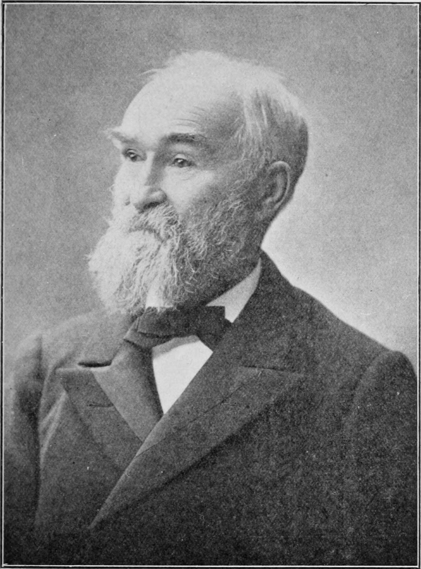
John Macoun (17 April 1831 – 18 June 1920) was an Irish-born Canadian naturalist. Early life Macoun was born in Magheralin, County Down, Ireland in 1831, the third child of James Macoun and Anne Jane Nevin. In 1850, the worsening economic situation in Ireland led his family to emigrate to Canada, where he settled in Seymour Township, Ontario and began farming. Unsatisfied as a farmer, he became a school teacher in 1856. It was during this time that he developed a nearly obsessive interest in botany. Although his formal education was slight, his knowledge and dedication to field work became sufficiently advanced that he gained the notice and respect of several professional botanists. By 1860 he was teaching school in Belleville, and had established correspondence with botanists such as Asa Gray, Sir William Jackson Hooker, George Lawson, and Louis-Ovide Brunet. This allowed him in 1868 to secure a faculty position as a Professor of Botany and Geology at Alber ... [...More Info...] [...Related Items...] OR: [Wikipedia] [Google] [Baidu] |
.jpg)

.jpg)


