|
Budharaja
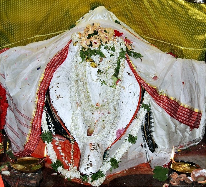
Budharaja is a small hillock in Sambalpur, Odisha, India India, officially the Republic of India (Hindi: ), is a country in South Asia. It is the seventh-largest country by area, the second-most populous country, and the most populous democracy in the world. Bounded by the Indian Ocean on the so .... There is a Shiva temple situated on the top of hill and middle of the sambalpur city. A concrete road goes to the temple from the base. The locality on the eastern side of the hillock is known as Budharaja due to its proximity to the hillock. Currently a Watch Tower is under construction to increase tourism. Gallery Image:sbp_view1.JPG, View of SBP from NH 6 [Baidu] |
Sambalpur
Sambalpur () is the fifth largest city in the Indian State of Odisha. It is located on the banks of river Mahanadi, with a population of 335,761 (as per 2011 census). Prehistoric settlements have been recorded there. It is the home of the Sambalpuri Saree. Overview The city contains many temples, historic buildings and parks. Educational institutes include Sambalpur University Sambalpur University is located in Burla town, of district Sambalpur, India, in the state of Odisha. Popularly known as Jyoti Vihar, it offers courses at the undergraduate and post-graduate levels. The governor of Odisha is the chancellor of ..., Veer Surendra Sai Institute of Medical Sciences and Research (VIMSAR), Veer Surendra Sai University of Technology (VSSUT), Gangadhar Meher University, Indian Institute of Management Sambalpur and Odisha State Open University (OSOU). Hirakud Dam, the longest earthen dam in the world and the largest artificial lake of Asia, is at Sambalpur. After the inde ... [...More Info...] [...Related Items...] OR: [Wikipedia] [Google] [Baidu] |
Odisha
Odisha (English: , ), formerly Orissa ( the official name until 2011), is an Indian state located in Eastern India. It is the 8th largest state by area, and the 11th largest by population. The state has the third largest population of Scheduled Tribes in India. It neighbours the states of Jharkhand and West Bengal to the north, Chhattisgarh to the west, and Andhra Pradesh to the south. Odisha has a coastline of along the Bay of Bengal in Indian Ocean. The region is also known as Utkala and is also mentioned in India's national anthem, " Jana Gana Mana". The language of Odisha is Odia, which is one of the Classical Languages of India. The ancient kingdom of Kalinga, which was invaded by the Mauryan Emperor Ashoka (which was again won back from them by King Kharavela) in 261 BCE resulting in the Kalinga War, coincides with the borders of modern-day Odisha. The modern boundaries of Odisha were demarcated by the British Indian government when Orissa Province wa ... [...More Info...] [...Related Items...] OR: [Wikipedia] [Google] [Baidu] |
India
India, officially the Republic of India (Hindi: ), is a country in South Asia. It is the seventh-largest country by area, the second-most populous country, and the most populous democracy in the world. Bounded by the Indian Ocean on the south, the Arabian Sea on the southwest, and the Bay of Bengal on the southeast, it shares land borders with Pakistan to the west; China, Nepal, and Bhutan to the north; and Bangladesh and Myanmar to the east. In the Indian Ocean, India is in the vicinity of Sri Lanka and the Maldives; its Andaman and Nicobar Islands share a maritime border with Thailand, Myanmar, and Indonesia. Modern humans arrived on the Indian subcontinent from Africa no later than 55,000 years ago., "Y-Chromosome and Mt-DNA data support the colonization of South Asia by modern humans originating in Africa. ... Coalescence dates for most non-European populations average to between 73–55 ka.", "Modern human beings—''Homo sapiens''—originated in Africa. Then, int ... [...More Info...] [...Related Items...] OR: [Wikipedia] [Google] [Baidu] |
Geography Of Sambalpur
Sambalpur district lies between 20° 40’ N and 22° 11’ N latitude, 82° 39’ E and 85° 15’ E longitude with a total area of 6,702 km2. The district is surrounded by Deogarh district in the east, Bargarh and Jharsuguda districts in the west, Sundergarh district in the north and Subarnpur and Angul districts in the South. Sambalpur is the district headquarters. The district has three distinctive physiographic units such as, Hilly Terrain of Bamra and Kuchinda in the north, plateau and ridges of Rairakhol in the south-east and valley and plains of Sambalpur Sub-division in the south east. Sambalpur district experiences extreme type of climate with 66 rainy days and 153 centimeters rainfall on an average per annum. Most of the rainfall is confined to the months from June to October visited by south west monsoon. Mercury rises up to 47° Celsius during May with intolerable heat wave and falls as low as 11.8° Celsius during December with extreme cold. The rainfall is hig ... [...More Info...] [...Related Items...] OR: [Wikipedia] [Google] [Baidu] |

