|
Brown County, Wisconsin
Brown County is a county in the U.S. state of Wisconsin. As of the 2020 census, the population was 268,740, making it the fourth-most populous county in Wisconsin. The county seat is Green Bay, making it one of three Wisconsin counties on Lake Michigan not to have a county seat with the same name. Brown County is part of the Green Bay, WI Metropolitan Statistical Area. History Brown County is one of Wisconsin's two original counties, along with Crawford County. It originally spanned the entire eastern half of the state when formed by the Michigan Territorial legislature in 1818. It was named for Major General Jacob Brown, a military leader during the War of 1812. Several towns along the Fox River vied for the position of county seat in Brown County's early years. The first county seat was located at Menomoneeville (now a part of Allouez) in 1824. In 1837, a public referendum relocated the county seat to De Pere. The location was put up for the popular vote again in 185 ... [...More Info...] [...Related Items...] OR: [Wikipedia] [Google] [Baidu] |
Brown County Courthouse (Wisconsin)
The Brown County Courthouse located in Green Bay, Wisconsin. It was added to the National Register of Historic Places for its artistic and architectural significance in 1976. The courthouse is a waypoint on the Packers Heritage Trail The Packers Heritage Trail is a self-guided walking tour that traverses locations relating to the history of the Green Bay Packers. 22 of the sites have bronze commemorative plaques. 21 sites are located within a two-mile radius of downtown Green .... History The courthouse was designed by Charles E. Bell and completed in 1908. The original cost was $318,797.67. In 1992, it underwent renovations costing $10 million. References Courthouses on the National Register of Historic Places in Wisconsin County courthouses in Wisconsin Buildings and structures in Green Bay, Wisconsin Beaux-Arts architecture in Wisconsin Government buildings completed in 1908 National Register of Historic Places in Brown County, Wisconsin 1908 establishments in Wis ... [...More Info...] [...Related Items...] OR: [Wikipedia] [Google] [Baidu] |
I-41
Interstate 41 (I-41) is a north–south Interstate Highway connecting the interchange of I-94 and U.S. Route 41 (US 41), located south of the Wisconsin–Illinois border at the end of the Tri-State Tollway in metropolitan Chicago, to an interchange with I-43 in metropolitan Green Bay, Wisconsin. The designation travels concurrently with US 41, I-894, US 45, I-43, and sections of I-94 in Wisconsin and Illinois. The route was officially added to the Interstate Highway System on April 7, 2015, and connects Milwaukee and Green Bay with the Fox Cities. Route description I-41 begins at the I-94/US 41 interchange in Russell, Illinois, located south of the Wisconsin–Illinois border at the end of the Tri-State Tollway. The highway continues north concurrently with I-94 as part of the North-South Freeway to the Mitchell Interchange in Milwaukee, turns west to run concurrently with I-894 and I-43 as the Airport Freeway to the Hale Interchan ... [...More Info...] [...Related Items...] OR: [Wikipedia] [Google] [Baidu] |
Highway 57 (Wisconsin)
Wisconsin Highway 57 (often called Highway 57, STH-57 or WIS 57) is a state highway in Wisconsin, United States. It runs from its southern terminus at Wisconsin Highway 59 in Milwaukee to its northern terminus at Wisconsin Highway 42 in Sister Bay. Much of WIS 57 parallels Interstate 43 (I-43) and WIS 42, particularly from Saukville to its northern terminus in Sister Bay. The highway is concurrent with I-43 for in Ozaukee County. Like most Wisconsin state highways, WIS 57 is maintained by the Wisconsin Department of Transportation (WisDOT). WIS 57 serves as a major highway in eastern Wisconsin, and it was originally designed to connect the major cities of Milwaukee and Green Bay as well as several other large cities along its corridor. The state of Wisconsin proposed that the WIS 57 route become an Interstate Highway corridor when the Interstate Highway System was planned in the 1950s; the state's plan was rejected in favor of the current rou ... [...More Info...] [...Related Items...] OR: [Wikipedia] [Google] [Baidu] |
Highway 54 (Wisconsin)
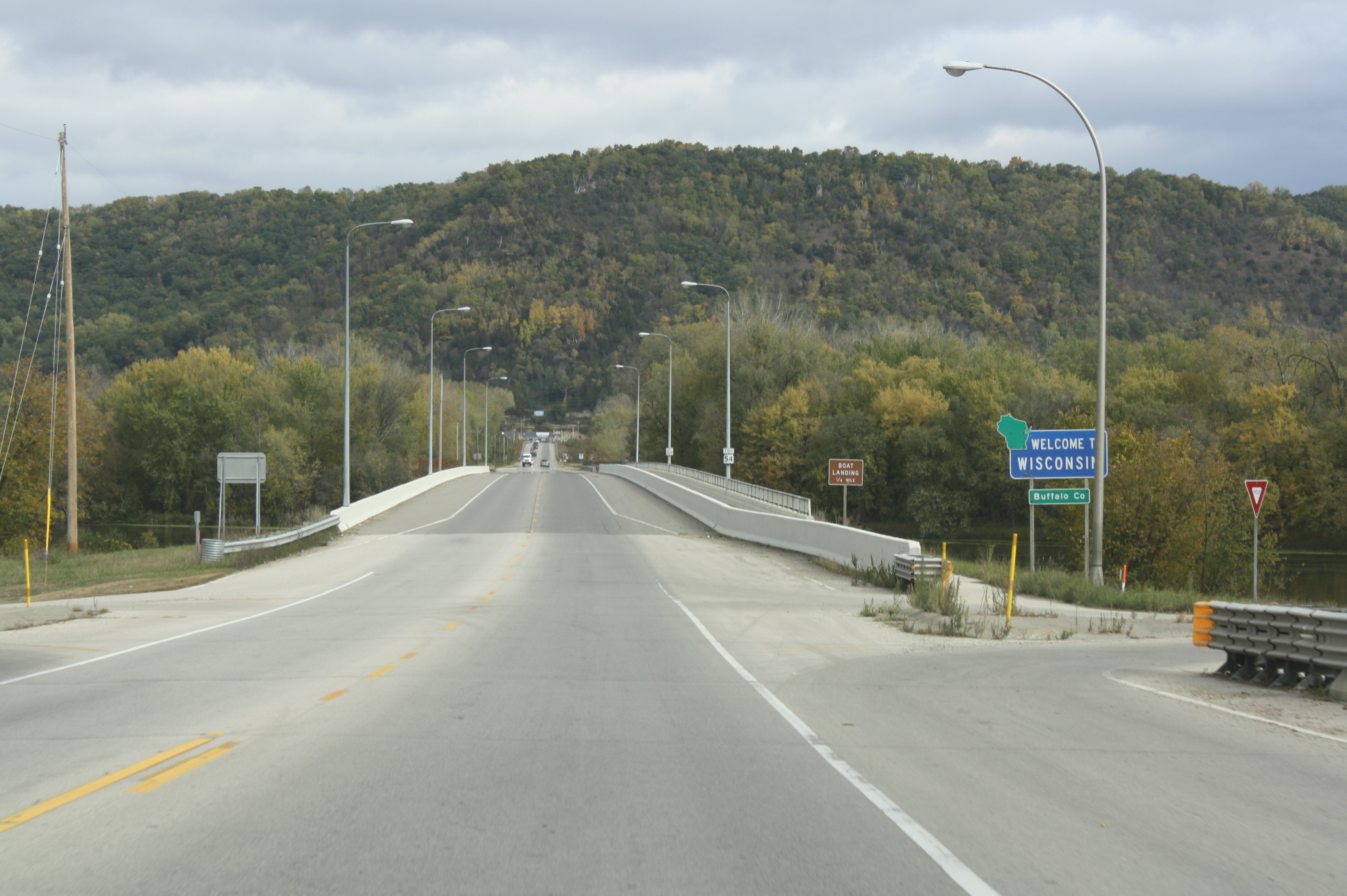
State Trunk Highway 54 (often called Highway 54, STH-54 or WIS 54) is a Wisconsin state highway running east–west across central Wisconsin. It is in length. Route description Minnesota state line to Plover WIS 54 begins at the western terminus. It crosses through the Minnesota state line at Winona, Minnesota via the North Channel Bridge. At this bridge, MN 43 ends there. After crossing the bridge, it soon turns east via WIS 35/Great River Road. In Centerville, WIS 35, as well as the Great River Road, turn southward; leaves the concurrency. At the same junction, WIS 93 joins the concurrency eastward. Further east, they then start to run concurrently with US 53 in Galesville. However, as they travel eastward, WIS 54 turns northeast, leaving the concurrency. At Butman Corners, WIS 54 then turns east again. After leaving Butman Corners, it closely parallels the Black River just south of the route. Then, it meanders eastward towards ... [...More Info...] [...Related Items...] OR: [Wikipedia] [Google] [Baidu] |
Highway 32 (Wisconsin)
State Trunk Highway 32 (often called Highway 32, STH-32 or WIS 32) is a state highway in the U.S. state of Wisconsin that runs north–south in eastern Wisconsin. It runs from the Illinois border (at Illinois Route 137) north to the Michigan border ( concurrent with U.S. Highway 45). It is named the 32nd Division Memorial Highway after the U.S. 32nd Infantry Division, and the highway shields have red arrows—the division's logo—on either side of the number 32. The route of WIS 32 and the Red Arrow marking is set in state statute by the Wisconsin Legislature. Route description Illinois state line to Milwaukee At the Illinois state line, IL 137 ends while WIS 32 begins as a continuation of it. From then on, it intersects WIS 165, WIS 50 and WIS 158 in Kenosha, and WIS 11 in Racine. Then, as WIS 32 nearly reaches Racine, Sheridan Road ends and continues as Racine Street. Then, in downtown Racine, WIS 20 runs concurrently with WIS 32 ... [...More Info...] [...Related Items...] OR: [Wikipedia] [Google] [Baidu] |
WIS 32
State Trunk Highway 32 (often called Highway 32, STH-32 or WIS 32) is a state highway in the U.S. state of Wisconsin that runs north–south in eastern Wisconsin. It runs from the Illinois border (at Illinois Route 137) north to the Michigan border ( concurrent with U.S. Highway 45). It is named the 32nd Division Memorial Highway after the U.S. 32nd Infantry Division, and the highway shields have red arrows—the division's logo—on either side of the number 32. The route of WIS 32 and the Red Arrow marking is set in state statute by the Wisconsin Legislature. Route description Illinois state line to Milwaukee At the Illinois state line, IL 137 ends while WIS 32 begins as a continuation of it. From then on, it intersects WIS 165, WIS 50 and WIS 158 in Kenosha, and WIS 11 in Racine. Then, as WIS 32 nearly reaches Racine, Sheridan Road ends and continues as Racine Street. Then, in downtown Racine, WIS 20 runs concurrently with WIS 32 ... [...More Info...] [...Related Items...] OR: [Wikipedia] [Google] [Baidu] |
Highway 29 (Wisconsin)
State Trunk Highway 29 (often called Highway 29, STH-29 or WIS 29) is a state highway running east–west across central Wisconsin. It is a major east–west corridor connecting the Twin Cities and the Chippewa Valley with Wausau and Green Bay. A multi-year project to upgrade the corridor to a four-lane freeway or expressway from Elk Mound to Green Bay was completed in 2005. The expansion served to improve safety on the route, which was over capacity as a two-lane road. The remainder of WIS 29 is two-lane surface road or urban multi-lane road. Route description Prescott to Elk Mound WIS 29 begins at its western terminus at U.S. Highway 10 (US 10), on the north side of Prescott. From this point, WIS 29 follows WIS 35 northeast to River Falls, passing the University of Wisconsin–River Falls campus. At the junction with WIS 65, WIS 35 turns northbound with WIS 65 while WIS 29 continues east. WIS ... [...More Info...] [...Related Items...] OR: [Wikipedia] [Google] [Baidu] |
US 141
US Highway 141 (US 141) is a north–south United States Numbered Highway in the states of Wisconsin and Michigan. The highway runs north-northwesterly from an interchange with Interstate 43 (I-43) in Bellevue, Wisconsin, near Green Bay, to a junction with US 41/ M-28 near Covington, Michigan. In between, it follows city streets in Green Bay and has a concurrent section with US 41 in Wisconsin. North of Green Bay, US 141 is either a freeway or an expressway into rural northern Wisconsin before downgrading to an undivided highway. In Michigan, US 141 is an undivided highway that runs through rural woodlands. The highway has two segments in each state; after running through Wisconsin for about , it crosses into Michigan for approximately another . After that, it crosses back into Wisconsin for about before crossing the state line one last time. The northernmost Michigan section is about , making the overall length about . When the US Highway ... [...More Info...] [...Related Items...] OR: [Wikipedia] [Google] [Baidu] |
US 41
U.S. Route 41, also U.S. Highway 41 (US 41), is a major north–south United States Numbered Highway that runs from Miami, Florida, to the Upper Peninsula of Michigan. Until 1949, the part in southern Florida, from Naples to Miami, was US 94. The highway's southern terminus is in the Brickell neighborhood of Downtown Miami at an intersection with Brickell Avenue ( US 1), and its northern terminus is east of Copper Harbor, Michigan, at a modest cul-de-sac near Fort Wilkins Historic State Park at the tip of the Keweenaw Peninsula. US 41 closely parallels Interstate 75 (I-75) from Naples, Florida, all the way through Georgia to Chattanooga, Tennessee. Route description , - , FL , , - , GA , , - , TN , , - , KY , , - , IN , , - , IL , , - , WI , , - , MI , , - class="sortbottom" , Total , Florida In Florida, US 41 is paralleled by Interstate 75 all the way from Miami to Georgia (on the northern border), and I-75 has largely suppl ... [...More Info...] [...Related Items...] OR: [Wikipedia] [Google] [Baidu] |


