|
Brower's Spring
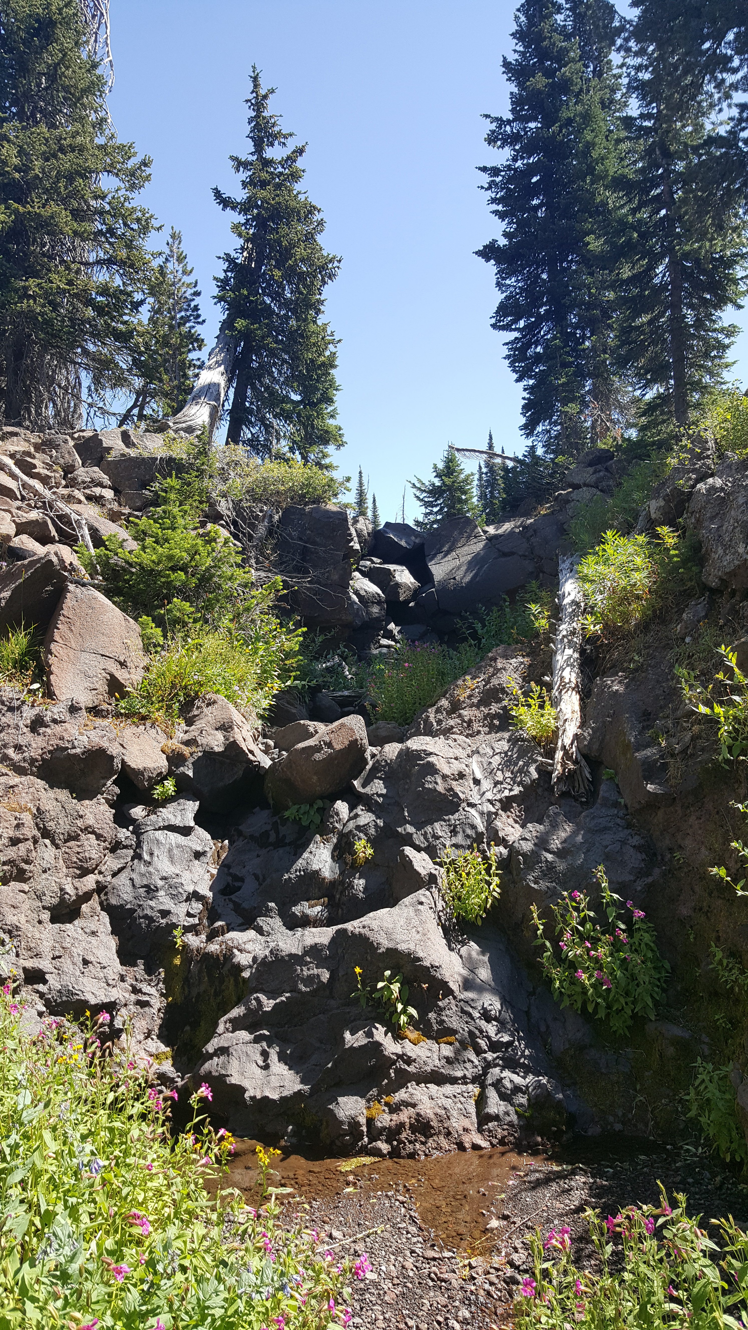
Brower's Spring is a spring in the Centennial Mountains of Beaverhead County, Montana that was marked by a surveyor in 1888 as the ultimate headwaters of the Missouri River and thus the fourth longest river in the world, the Mississippi-Missouri River. The spring is named for Jacob V. Brower who in 1896 declared it to be the source of the Missouri in his book published by the Pioneer Press titled ''The Missouri river and its utmost source''. He visited the site in 1895 and buried a copper plate upon which the name of the river and the date were engraved. The spring is further than the spot Meriwether Lewis reported in 1805 as the source of the river above Lemhi Pass on Trail Creek. Both sources are near the Continental Divide in Montana. It is upstream from where the name "Missouri River" is first used. Though the copper plate has not been located, the site of Brower's Spring is believed to be at about on the north fork of where Hell Roaring Creek divides near its so ... [...More Info...] [...Related Items...] OR: [Wikipedia] [Google] [Baidu] |
Beaverhead River
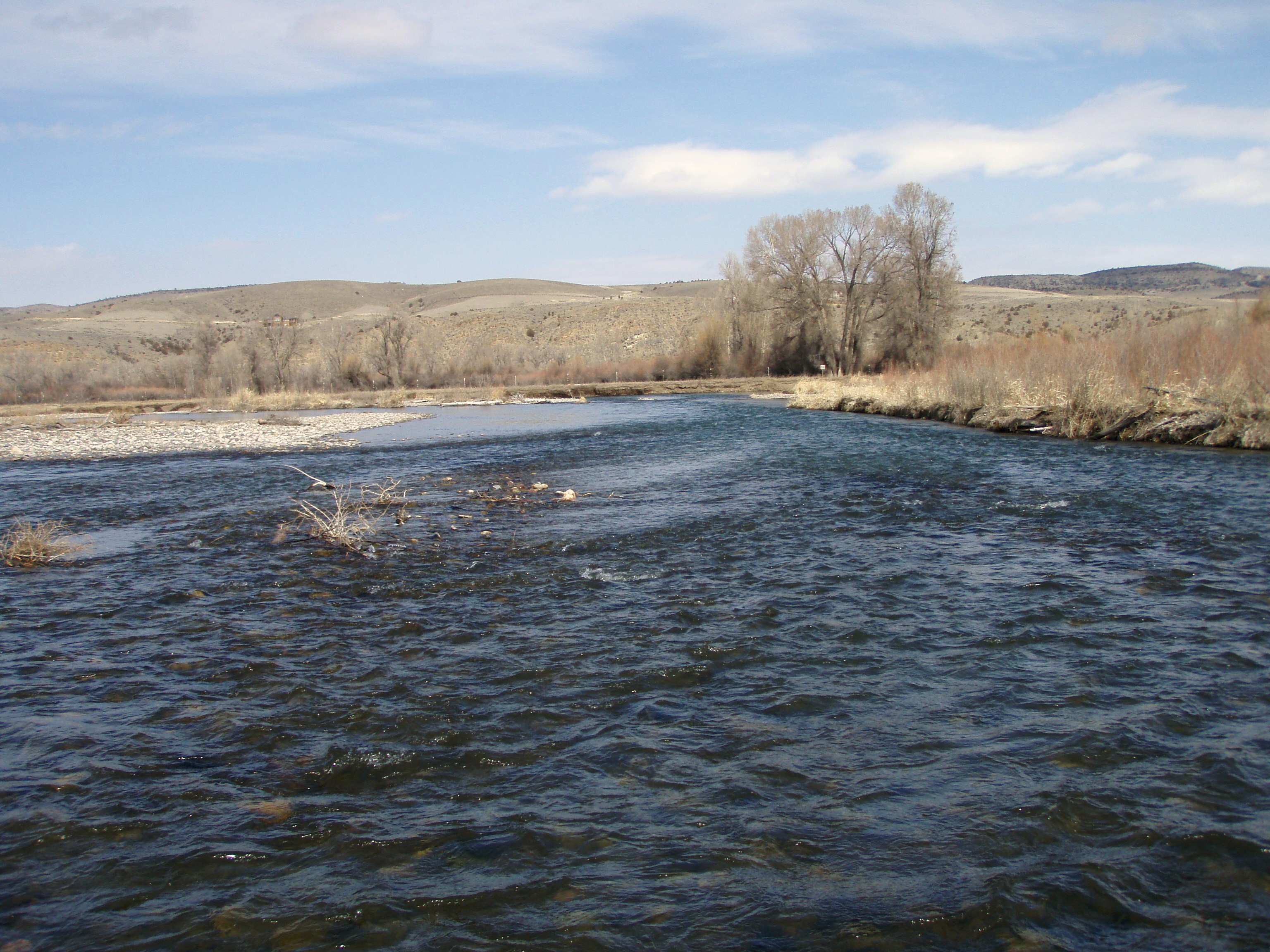
The Beaverhead River is an approximately tributary of the Jefferson River in southwest Montana (east of the Continental Divide). It drains an area of roughly . The river's original headwaters, formed by the confluence of the Red Rock River and Horse Prairie Creek, are now flooded under Clark Canyon Reservoir, which also floods the first of the river. The Beaverhead then flows through a broad valley northward to join the Big Hole River and form the Jefferson River. With the Red Rock River included in its length, the river stretches another , for a total length of , one of the more significant drainages of south-western Montana. The name of the Beaverhead originates from Beaverhead Rock on the middle river. This rock formation was recognized by Sacajawea when the Lewis and Clark Expedition passed the area in 1805. There were also many beavers in the area at the time, but the name does not originate from the animal. In 1805, Captain Meriwether Lewis traveled up the Jefferson ... [...More Info...] [...Related Items...] OR: [Wikipedia] [Google] [Baidu] |
Landforms Of Beaverhead County, Montana
A landform is a natural or anthropogenic land feature on the solid surface of the Earth or other planetary body. Landforms together make up a given terrain, and their arrangement in the landscape is known as topography. Landforms include hills, mountains, canyons, and valleys, as well as shoreline features such as bays, peninsulas, and seas, including submerged features such as mid-ocean ridges, volcanoes, and the great ocean basins. Physical characteristics Landforms are categorized by characteristic physical attributes such as elevation, slope, orientation, stratification, rock exposure and soil type. Gross physical features or landforms include intuitive elements such as berms, mounds, hills, ridges, cliffs, valleys, rivers, peninsulas, volcanoes, and numerous other structural and size-scaled (e.g. ponds vs. lakes, hills vs. mountains) elements including various kinds of inland and oceanic waterbodies and sub-surface features. Mountains, hills, plateaux, and plains are the fou ... [...More Info...] [...Related Items...] OR: [Wikipedia] [Google] [Baidu] |
USGS
The United States Geological Survey (USGS), formerly simply known as the Geological Survey, is a scientific agency of the United States government. The scientists of the USGS study the landscape of the United States, its natural resources, and the natural hazards that threaten it. The organization's work spans the disciplines of biology, geography, geology, and hydrology. The USGS is a fact-finding research organization with no regulatory responsibility. The agency was founded on March 3, 1879. The USGS is a bureau of the United States Department of the Interior; it is that department's sole scientific agency. The USGS employs approximately 8,670 people and is headquartered in Reston, Virginia. The USGS also has major offices near Lakewood, Colorado, at the Denver Federal Center, and Menlo Park, California. The current motto of the USGS, in use since August 1997, is "science for a changing world". The agency's previous slogan, adopted on the occasion of its hundredth anniv ... [...More Info...] [...Related Items...] OR: [Wikipedia] [Google] [Baidu] |
West Yellowstone, Montana
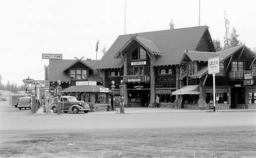
West Yellowstone is a town in Gallatin County, Montana, United States, adjacent to Yellowstone National Park. The population was 1,272 at the 2020 census. West Yellowstone is served by Yellowstone Airport. It is part of the Bozeman, MT Micropolitan Statistical Area. West Yellowstone offers lodging, gift shops, and other services to travelers visiting nearby Yellowstone National Park. History Founded in June 1908 when the Oregon Short Line Railroad was completed, the town's name changed several times until West Yellowstone was settled upon in 1920. Train service to West Yellowstone ended in 1960. The town was incorporated in 1966. Geography According to the United States Census Bureau, the town has a total area of , all land. Climate At almost 7,000 feet above sea level and almost exactly halfway between the equator and the North Pole, West Yellowstone experiences a subarctic climate (Köppen climate classification ''Dfc''), with cold — sometimes bitterly cold — winters a ... [...More Info...] [...Related Items...] OR: [Wikipedia] [Google] [Baidu] |
Sawtell Peak
Sawtell Peak, also spelled Sawtelle Peak is a mountain in the U.S. state of Idaho. It is located in the eastern portion of the Centennial Mountains. Sawtell Peak is located in the Caribou-Targhee National Forest roughly east of Idaho's border with Montana. The summit is located near Henrys Lake and Big Springs, headwaters of the Henrys Fork of the Snake River as well as Brower's Spring, headwaters of the Missouri River, both of which being located near the Continental Divide. It was named after Gilman Sawtell, who settled the Island Park area in 1868. There are two ridges, the north one being much less accessible. Sawtell Peak is the starting point of the easiest route to climb nearby Mount Jefferson. Geology Sawtell Peak is the easternmost peak in the Centennial Range, which run east to west, contrary to many other fault block ranges in the Basin and Range Province. This east to west structure is likely due to movement with the Yellowstone Hotspot. The mountain and surrou ... [...More Info...] [...Related Items...] OR: [Wikipedia] [Google] [Baidu] |
Mount Jefferson (Madison County, Montana)
Mount Jefferson is a mountain in the U.S. state of Montana, and is one of the many 10,000+ ft peaks in the Tobacco Root Mountains. The mountain is located in Beaverhead-Deerlodge National Forest. (There is also another Mount Jefferson in Montana, further south, on the Idaho/Montana border.) Hollowtop Mountain is an adjacent, taller peak less than .75 miles (1.2 km) to the north. Over the years, the two summits have had numerous names and elevations recorded on various maps. According to U.S. Geological Survey topographic maps, Mount Jefferson is , while Hollowtop Mountain to the north is . Nomenclature Nomenclature for Mount Jefferson has seen considerable change and confusion over the years. A.N. Winchell, in his 1914 report, ''Mining Districts of the Dillon Quadrangle'', referred to the highest peak in the Tobacco Roots as "Jefferson Peak, locally called Old Hollowtop." Since that time the more northerly, and higher, of two adjacent peaks has usually been called ... [...More Info...] [...Related Items...] OR: [Wikipedia] [Google] [Baidu] |
Three Forks, Montana
Three Forks is a city in Gallatin County, Montana, United States and is located within the watershed valley system of both the Missouri and Mississippi rivers drainage basins — and is historically considered the birthplace or start of the Missouri River. The population was 1,989 at the 2020 census. The city of Three Forks is named so because it lies geographically near the point, in nearby Missouri Headwaters State Park, where the Jefferson, Madison, and Gallatin Rivers converge to form the Missouri River — the longest single river in North America, as well as the major portion of the Missouri-Mississippi River System from the headwaters near Three Forks to its discharge into the Gulf of Mexico. Three Forks is part of the Bozeman, MT Micropolitan Statistical Area of approximately 100,000 people and located thirty miles west of Bozeman. History The three rivers, west to east, were named by Meriwether Lewis in late July 1805 for President Thomas Jefferson, Secretary ... [...More Info...] [...Related Items...] OR: [Wikipedia] [Google] [Baidu] |
Missouri River Headwaters State Park
Missouri Headwaters State Park is a public recreation area occupying at the site of the official start of the Missouri River. The park offers camping, hiking trails, hunting, and water-related activities. It is located on Trident Road northeast of Three Forks, Montana at an elevation of . The park includes the Three Forks of the Missouri National Historic Landmark, designated in 1960 because the site is one where the Lewis and Clark Expedition camped in 1805. Setting The bulk of Missouri Headwaters State Park is found on a peninsula flanked on the east by the Gallatin River and the west by the Missouri River and the Madison River. Small parts of the park are also located on the east bank of the Gallatin River, and an island in the Missouri just below the confluence of the Madison and Jefferson Rivers. The total park size is . The Jefferson River meets the Madison and Missouri roughly midway through the park's north-south extent. History The Lewis and Clark Expedition encamped ... [...More Info...] [...Related Items...] OR: [Wikipedia] [Google] [Baidu] |
Gallatin River
The Gallatin River is a tributary of the Missouri River, approximately 120 mi (193 km long), in the U.S. states of Wyoming and Montana. It is one of three rivers, along with the Jefferson River, Jefferson and Madison River, Madison, that converge near Three Forks, Montana, to form the Missouri. It originates in the northwest corner of Yellowstone National Park in northwestern Wyoming, in the Gallatin Range of the Rocky Mountains. It flows northwest through Gallatin National Forest, past Big Sky, Montana, and joins the Jefferson and Madison approximately 30 mi (48 km) northwest of Bozeman, Montana, Bozeman. U.S. Highway 191 follows the river from the Wyoming border to just outside Bozeman. The river was named in July 1805 by Meriwether Lewis at Three Forks. The eastern fork of the three, it was named for Albert Gallatin, the United States Secretary of the Treasury, U.S. Treasury Secretary from 1801–14. The western fork was named for President of the Unit ... [...More Info...] [...Related Items...] OR: [Wikipedia] [Google] [Baidu] |
Madison River
The Madison River is a headwater tributary of the Missouri River, approximately 183 miles (295 km) long, in Wyoming and Montana. Its confluence with the Jefferson and Gallatin rivers near Three Forks, Montana forms the Missouri River. The Madison rises in Teton County in northwestern Wyoming at the confluence of the Firehole and Gibbon rivers, a location in Yellowstone National Park called ''Madison Junction''. It first flows west, then north through the mountains of southwestern Montana to join the Jefferson and the Gallatin rivers at Three Forks. The Missouri River Headwaters State Park is located on the Madison at Three Forks. In its upper reaches in Gallatin County, Montana, the Hebgen Dam forms Hebgen Lake. In its middle reaches in Madison County, Montana, the Madison Dam forms Ennis Lake and provides hydroelectric power. In 1959, the 1959 Hebgen Lake earthquake formed Quake Lake just downstream from Hebgen Dam. Downstream from Ennis, the Madison flows through Bear ... [...More Info...] [...Related Items...] OR: [Wikipedia] [Google] [Baidu] |
Jefferson River
The Jefferson River is a tributary of the Missouri River, approximately long, in the U.S. state of Montana. The Jefferson River and the Madison River form the official beginning of the Missouri at Missouri Headwaters State Park near Three Forks. It is joined downstream (northeast) by the Gallatin. From broad valleys to a narrow canyon, the Jefferson River passes through a region of significant geological diversity, with some of the oldest and youngest rocks of North America and a diversity of igneous, metamorphic, and sedimentary formations. The region was only intermittently inhabited by Native Americans until relatively recent times, and no single tribe had exclusive use of the Jefferson River when the Lewis and Clark Expedition first ascended the river in 1805. Today, the Jefferson River retains much of its scenic beauty and wildlife diversity from the days of Lewis and Clark, yet is threatened by water use issues and encroaching development. The Jefferson is a segment ... [...More Info...] [...Related Items...] OR: [Wikipedia] [Google] [Baidu] |

.jpg)


