|
Broomhouse, Glasgow
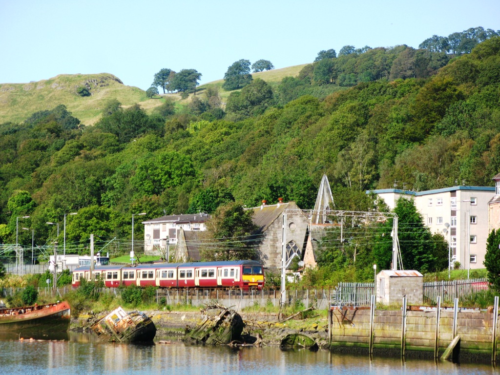
Broomhouse ( sco, Bruimhoose) is a residential area in Glasgow, Scotland. It is about east of the city centre. Historically a small mining village and later the site of the Glasgow Zoo, in the early 21st century it grew substantially as an affluent commuter suburb. Although close to Baillieston and within the Glasgow boundaries, the neighbourhood has a G71 postcode which has often led to it being associated with Uddingston, the main town for that district which is about to the south-east in the South Lanarkshire local authority area. Location Broomhouse is in the south-east of the Glasgow city area. It is bounded to the north by a railway line (historically part of the Rutherglen and Coatbridge Railway) which divides its territory with that of Bailleston, while to the south the M74 motorway separates it from Daldowie. A large quarry and landfill occupy the land to the west (some of which is in the process of being reclaimed as a community woodland). The North Calder Wate ... [...More Info...] [...Related Items...] OR: [Wikipedia] [Google] [Baidu] |
Politics Of Glasgow
The politics of Glasgow, Scotland's largest city by population, are expressed in the deliberations and decisions of Glasgow City Council, in elections to the council, the Scottish Parliament and the UK Parliament. Local government As one of the 32 unitary local government areas of Scotland, Glasgow City Council has a defined structure of governance, generally under the Local Government etc. (Scotland) Act 1994, controlling matters of local administration such as housing, planning, local transport, parks and local economic development and regeneration. For such purposes the city is currently (as of 2020, since 2017) divided into 23 wards, each returning either three or four councillors via single transferable vote, a proportional representation system. From 1995 until 2007, single members were elected from 79 small wards. Among other appointments, one of the councillors becomes its leader, and one other takes on the ceremonial and ambassadorial role of Lord Provost of Gla ... [...More Info...] [...Related Items...] OR: [Wikipedia] [Google] [Baidu] |
Forestry Commission
The Forestry Commission is a non-ministerial government department responsible for the management of publicly owned forests and the regulation of both public and private forestry in England. The Forestry Commission was previously also responsible for Forestry in Wales and Scotland. However, on 1 April 2013, Forestry Commission Wales merged with other agencies to become Natural Resources Wales, whilst two new bodies ( Forestry and Land Scotland and Scottish Forestry) were established in Scotland on 1 April 2019. The Forestry Commission was established in 1919 to expand Britain's forests and woodland, which had been severely depleted during the First World War. The Commission bought large amounts of agricultural land on behalf of the state, eventually becoming the largest manager of land in Britain. Today, the Forestry Commission is divided into three divisions: Forestry England, Forestry Commission and Forest Research. Over time the purpose of the Commission broadened to i ... [...More Info...] [...Related Items...] OR: [Wikipedia] [Google] [Baidu] |
North Clyde Line
The North Clyde Line (defined by Network Rail as the ''Glasgow North Electric Suburban'' line) is a suburban railway in West Central Scotland. The route is operated by ScotRail Trains. As a result of the incorporation of the Airdrie–Bathgate rail link and the Edinburgh–Bathgate line, this route has become the fourth rail link between Glasgow and Edinburgh. Route The North Clyde Line (known as Dunbartonshire - Glasgow, Cumbernauld and Falkirk Grahamston in timetables), electrified by British Rail in 1960, ran east–west through the Greater Glasgow conurbation, linking northern Lanarkshire with western Dunbartonshire, by way of the city centre. Fifty years later, in 2010, the line was extended by Network Rail east from Airdrie, by way of re-opening the line to Bathgate meeting up with the line re-opened by British Rail from Edinburgh. The main core of the route runs from to via and Glasgow Queen Street (Low Level). To the east of the Glasgow city centre, there is ... [...More Info...] [...Related Items...] OR: [Wikipedia] [Google] [Baidu] |
Coatbridge Branch (NBR)
The Coatbridge Branch of the North British Railway was a railway built to connect the important coal and iron industrial districts of Coatbridge and Airdrie directly to Glasgow for the North British Railway. It opened in 1871 connecting an existing network in the Monklands to a College station (later High Street) in Glasgow. This enabled mineral traffic to reach quays on the River Clyde, and passenger traffic was given a considerable boost when the Glasgow City and District Railway opened in 1886, connecting the Coatbridge line with the North Clyde network west of Glasgow. The line is open today, handling a considerable suburban passenger traffic and through trains to Edinburgh on the Bathgate route. History The coal railways In the first decades of the nineteenth century there was increased demand for coal in Glasgow, for domestic and industrial purposes. There were limited local supplies, and the Monkland Canal had been bringing coal in from the Monklands pits. In 1826 the Mo ... [...More Info...] [...Related Items...] OR: [Wikipedia] [Google] [Baidu] |
Glasgow, Bothwell, Hamilton And Coatbridge Railway
The Glasgow, Bothwell, Hamilton and Coatbridge Railway was a railway company in Scotland, built to serve coal and ironstone pits in the Hamilton and Bothwell areas, and convey the mineral to Glasgow and to ironworks in the Coatbridge area. It was allied to the North British Railway, and it opened in 1877. Passenger services followed. As a late competitor to the dominant Caledonian Railway, it was always secondary in the area, and the passenger service ceased by 1955. The mineral traffic declined sharply and the last goods train ran in 1961. History The coal railways and the Monklands The Monklands district near Airdrie was the source of plentiful coal, which was in demand for residential and industrial purposes in Glasgow and elsewhere, and in 1826 the Monkland and Kirkintilloch Railway was opened to convey the mineral to the Forth and Clyde Canal for onward transport. Discovery of the excellent blackband ironstone in the area, and the development of the hot blast system of ... [...More Info...] [...Related Items...] OR: [Wikipedia] [Google] [Baidu] |
Broomhouse Railway Station
Broomhouse railway stationWignal (1983), Page 10 was opened in 1878 at Broomhouse in the Baillieston area of Glasgow, Scotland on the old Glasgow, Bothwell, Hamilton and Coatbridge Railway between Shettleston and Hamilton. The miner's rows at Boghall were close to the station site. History The station was opened by the North British Railway to serve the Broomhouse area in 1878 on the Glasgow, Bothwell, Hamilton and Coatbridge Railway route. The route was also known as the London and North Eastern Railway's Hamilton Branch. It closed to passenger traffic on 4 October 1927 and to freight in 1953, having been previously closed to passengers between 1917 and 1919 as a wartime economy. The line was closed to freight traffic on 4 October 1964. Passenger trains continued to run to Bothwell until 4 July 1955. Infrastructure A signal box that controlled the colliery line lay at the south end of the station on the north side, replaced in 1914 and closed in 1960. Daldowie and Broomho ... [...More Info...] [...Related Items...] OR: [Wikipedia] [Google] [Baidu] |
Broomhouse Station (remains) - Geograph
Broomhouse may refer to: *Broomhouse, Edinburgh, a housing estate in the western part of Scotland's capital city *Broomhouse, Glasgow, a residential suburb in the south-eastern part of Scotland's largest city *Broomhouse (alternatively Broom House), a former country estate near Duns, Scottish Borders Duns is a town in the Scottish Borders, Scotland. It was the county town of the historic county of Berwickshire. History Early history Duns Law, the original site of the town of Duns, has the remains of an Iron Age hillfort at its summit. ... *Broomhouse Farm, near Haggerston, Northumberland {{Disambiguation ... [...More Info...] [...Related Items...] OR: [Wikipedia] [Google] [Baidu] |
Cottage Flats
Cottage flats, also known as four-in-a-block flats, are a style of housing common in Scotland, where there are single floor dwellings at ground level, and similar dwellings on the floor above. All have doors directly to the outside of the building, rather than into a 'close', or common staircase, although some do retain a shared entrance. The name 'cottage flats' is confusing as before the mid-1920s cottage housing referred to a single house, normally semi-detached which contained living accommodation downstairs and bedrooms above. These were phased out by most urban local authorities as wasteful of space and economy after central government subsidies were reduced in the 1924 Housing Act. The majority consist of four dwellings per block (which appear like semi-detached houses), although such buildings are sometimes in the form of longer terraces. Many were built in the 1920s and 1930s as part of the ' Homes fit for heroes' programme but it has proved a popular housing model ... [...More Info...] [...Related Items...] OR: [Wikipedia] [Google] [Baidu] |
Canmore (database)
Canmore is an online database of information on over 320,000 archaeological sites, monuments, and buildings in Scotland. It was begun by the Royal Commission on the Ancient and Historical Monuments of Scotland The Royal Commission on the Ancient and Historical Monuments of Scotland (RCAHMS) was an executive non-departmental public body of the Scottish Government that was "sponsored" inanced and with oversightthrough Historic Scotland, an executive .... Historic Environment Scotland has maintained it since 2015. The Canmore database is part of the National Record of the Historic Environment (or NRHE), formerly the National Monuments Record of Scotland (or NMRS) and contains around 1.3 million catalogue entries. It includes marine monuments and designated official wreck sites (those that fall under the Protection of Wrecks Act), such as the wreck of . References External links * Archaeology of Scotland Architecture in Scotland Canmore Archives in Scotland Data ... [...More Info...] [...Related Items...] OR: [Wikipedia] [Google] [Baidu] |
A74 Road
The A74 also known historically as the Glasgow to Carlisle Road, is a formerly major road in the United Kingdom, linking Glasgow in Scotland to Carlisle in the North West of England, passing through Clydesdale, Annandale and the Southern Uplands. A road in this area has existed since Roman Britain, and it was considered one of the most important roads in Scotland, being used as a regular mail service route. The road received a substantial upgrade in the early 19th century under the direction of Thomas Telford, who made significant engineering improvements, including a new route over the Beattock Summit and the Metal Bridge just in England just south of the border. Engineering improvements continued throughout the century and into the 20th, and it became one of the first trunk roads in Britain in 1936. From the 1960s the road started to be replaced by a parallel motorway, largely designated the M74. The last remaining section of all-purpose road on Telford's original align ... [...More Info...] [...Related Items...] OR: [Wikipedia] [Google] [Baidu] |
M73 Motorway
The M73 is a motorway in Glasgow and North Lanarkshire, Scotland. It is long and connects the M74 motorway with the M80 motorway, providing an eastern bypass for Glasgow. The short stretch between Junctions 1 and 2 is part of unsigned international E-road network E05, where it continues along the M8 through Glasgow. To the south, the M74 motorway is also part of the E05. Route Starting at the M74 junction 4 (M73 junction 1) by the River Clyde, it proceeds north with Birkenshaw to the east and crosses the Whifflet railway line before meeting the M8 and A8 at a three-level interchange, west of Swinton. Immediately afterwards the North Clyde railway line and then passes alongside Woodend Loch before reaching junction 2A at Gartcosh. There is then a further of motorway, before traffic exits onto the M80 westbound. The road is a dual 3 lane road between junctions 1 and 2, and a dual 2 lane road between junctions 2 and 3. It is subject to the national speed limit. His ... [...More Info...] [...Related Items...] OR: [Wikipedia] [Google] [Baidu] |


