|
Brookville Tunnel
The Brookville Tunnel (also Brooksville Tunnel) was a historic railroad tunnel engineered by Claudius Crozet during the construction of the Blue Ridge Railroad in the 1850s. The tunnel was part of a series of four tunnels used to cross the Blue Ridge Mountains of Virginia for the Virginia Central Railroad of the United States. The Brookville Tunnel was the second tunnel used to cross the mountains from the east (the easternmost being the Greenwood Tunnel), and was located approximately west of the village of Greenwood, Virginia. During its construction, numerous cave-ins and landslides occurred because of the fragile and weak rock the tunnel passed through, and at one point, an outbreak of cholera forced work to stop. By October 1856 the tunnel was completed at a cost of $114,600, having been lined with a thick elliptical brick arch to hold back the earth. The Brookville Tunnel was used by the Virginia Central Railroad, and after 1868, the line's successor, the Chesapeake ... [...More Info...] [...Related Items...] OR: [Wikipedia] [Google] [Baidu] |
Chesapeake And Ohio Railway
The Chesapeake and Ohio Railway was a Class I railroad formed in 1869 in Virginia from several smaller Virginia railroads begun in the 19th century. Led by industrialist Collis P. Huntington, it reached from Virginia's capital city of Richmond to the Ohio River by 1873, where the railroad town (and later city) of Huntington, West Virginia, was named for him. Tapping the coal reserves of West Virginia, the C&O's Peninsula Extension to new coal piers on the harbor of Hampton Roads resulted in the creation of the new City of Newport News. Coal revenues also led the forging of a rail link to the Midwest, eventually reaching Columbus, Cincinnati and Toledo in Ohio and Chicago, Illinois. By the early 1960s the C&O was headquartered in Cleveland, Ohio. In 1972, under the leadership of Cyrus Eaton, it became part of the Chessie System, along with the Baltimore and Ohio and Western Maryland Railway. The Chessie System was later combined with the Seaboard Coast Line and Louisvill ... [...More Info...] [...Related Items...] OR: [Wikipedia] [Google] [Baidu] |
Greenwood Tunnel
The Greenwood Tunnel is a historic railroad tunnel constructed in 1853 by Claudius Crozet during the construction of the Blue Ridge Railroad. The tunnel was the easternmost tunnel in a series of four tunnels used to cross the Blue Ridge Mountains of Virginia. Located near Greenwood in Albemarle County, Virginia, the tunnel was used by the Chesapeake and Ohio Railway (C&O) until its abandonment in 1944. The tunnel still exists, though sealed, next to the old C&O line, now owned by CSX Transportation and leased to the Buckingham Branch Railroad, which runs through a cut bypassing the old tunnel. History On March 5, 1849, the Virginia General Assembly passed an act to incorporate the Blue Ridge Railroad. This railroad was incorporated to construct a rail line over the Blue Ridge Mountains for the Louisa railroad (renamed as the Virginia Central Railroad in February, 1850) from a point near Blair Park at the eastern base of the mountains to Waynesboro in the Shenandoah Valley via ... [...More Info...] [...Related Items...] OR: [Wikipedia] [Google] [Baidu] |
Rockfish Gap
Rockfish Gap is a wind gap located in the Blue Ridge Mountains between Charlottesville and Waynesboro, Virginia, United States, through Afton Mountain, which is frequently used to refer to the gap. Joining the Shenandoah Valley to the Piedmont region of the state, it is the site of the mountain crossing of Interstate 64, U.S. Route 250, and the former Blue Ridge Railroad which later became part of the Chesapeake and Ohio Railway and is currently part of the CSX line. With an elevation of about , it is one of the lowest gaps between Manassas Gap and the James River. Rockfish Gap lies along a drainage divide between southeast-flowing streams that drain to the James River and northwest-flowing streams in the Shenandoah River system. The scenic Skyline Drive, which runs north through Shenandoah National Park to Front Royal, and the Blue Ridge Parkway, which runs south to a point near Cherokee, North Carolina, each generally following the mountain ridgetops, meet a short ... [...More Info...] [...Related Items...] OR: [Wikipedia] [Google] [Baidu] |
Shenandoah Valley
The Shenandoah Valley () is a geographic valley and cultural region of western Virginia and the Eastern Panhandle of West Virginia. The valley is bounded to the east by the Blue Ridge Mountains, to the west by the eastern front of the Ridge-and-Valley Appalachians (excluding Massanutten Mountain), to the north by the Potomac River and to the south by the James River. The cultural region covers a larger area that includes all of the valley plus the Virginia highlands to the west, and the Roanoke Valley to the south. It is physiographically located within the Ridge and Valley province and is a portion of the Great Appalachian Valley. Geography Named for the river that stretches much of its length, the Shenandoah Valley encompasses eight counties in Virginia and two counties in West Virginia. * Augusta County, Virginia *Clarke County, Virginia *Frederick County, Virginia *Page County, Virginia *Rockbridge County, Virginia *Rockingham County, Virginia * Shenandoah County, Virg ... [...More Info...] [...Related Items...] OR: [Wikipedia] [Google] [Baidu] |
Waynesboro, Virginia
Waynesboro (formerly Flack) is an independent city in the Commonwealth of Virginia. It is a principal city of the Staunton-Waynesboro Metropolitan Statistical Area. Waynesboro is located in the Shenandoah Valley and is surrounded by Augusta County. As of the 2020 census, the population was 22,196. History Located in the British Colony of Virginia, even after the American Revolution and independence and statehood for the Commonwealth of Virginia, the areas west of the Appalachian and Blue Ridge Mountains were known as the frontier. Travel by wagon over the mountains was considered to be nearly impossible except where nature afforded some gap between them. Until after the Civil War, Jarmans Gap, only some six miles northeast of Waynesboro, was the major crossing of the Blue Ridge Mountains in that area, making Waynesboro a convenient location for a stop for many who sought to travel west. In the mid-18th century, the Waynesboro area was commonly referred to as Teasville (or ... [...More Info...] [...Related Items...] OR: [Wikipedia] [Google] [Baidu] |
Virginia General Assembly
The Virginia General Assembly is the legislative body of the Commonwealth of Virginia, the oldest continuous law-making body in the Western Hemisphere, the first elected legislative assembly in the New World, and was established on July 30, 1619. The General Assembly is a bicameral body consisting of a lower house, the Virginia House of Delegates, with 100 members, and an upper house, the Senate of Virginia, with 40 members. Combined, the General Assembly consists of 140 elected representatives from an equal number of constituent districts across the commonwealth. The House of Delegates is presided over by the Speaker of the House, while the Senate is presided over by the Lieutenant Governor of Virginia. The House and Senate each elect a clerk and sergeant-at-arms. The Senate of Virginia's clerk is known as the "Clerk of the Senate" (instead of as the "Secretary of the Senate", the title used by the U.S. Senate). Following the 2019 election, the Democratic Party held a ma ... [...More Info...] [...Related Items...] OR: [Wikipedia] [Google] [Baidu] |
Interstate 64
Interstate 64 (I-64) is an east–west Interstate Highway in the Eastern United States. Its western terminus is at I-70, U.S. Route 40 (US 40), and US 61 in Wentzville, Missouri. Its eastern terminus is at an interchange with I-264 and I-664 at Bower's Hill in Chesapeake, Virginia. I-64 connects the major metropolitan areas of St. Louis, Missouri; Louisville and Lexington in Kentucky; Charleston, West Virginia; and Richmond and Hampton Roads in Virginia. Route description , - , MO , , , - , IL , , , - , IN , , , - , KY , , , - , WV , , , - , VA , , , - , Total , , I-64 has concurrencies with I-55, I-57, I-75, I-77, I-81, and I-95. I-64 does not maintain exit number continuity for any of the overlaps, as each of the six north–south routes maintain their exit numbering on their respective overlaps with I-64. Of all the overlaps, I-64 only goes northeast and southwest with I-55 and I-81, while going southeast and northwest with ... [...More Info...] [...Related Items...] OR: [Wikipedia] [Google] [Baidu] |
Cut (earthmoving)
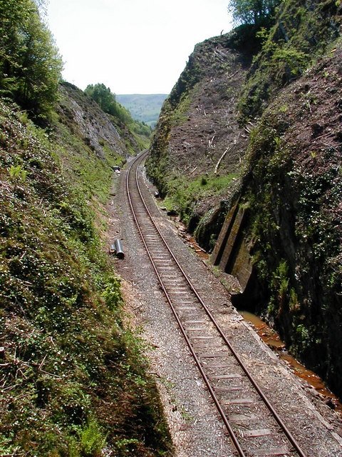
In civil engineering, a cut or cutting is where soil or rock from a relative rise along a route is removed. The term is also used in river management to speed a waterway's flow by short-cutting a meander. Cuts are typically used in road, rail, and canal construction to reduce the length and grade of a route. Cut and fill construction uses the spoils from cuts to fill in defiles to cost-effectively create relatively straight routes at steady grades. Cuts are used as alternatives to indirect routes, embankments, or viaducts. They also have the advantage of comparatively lower noise pollution than elevated or at-grade solutions. History The term ''cutting'' appears in the 19th century literature to designate rock cuts developed to moderate grades of railway lines. ''Railway Age's Comprehensive Railroad Dictionary'' defines a cut as "a passage cut for the roadway through an obstacle of rock or dirt." Creation Cuts can be created by multiple passes of a shovel, grader, scrap ... [...More Info...] [...Related Items...] OR: [Wikipedia] [Google] [Baidu] |
Cholera
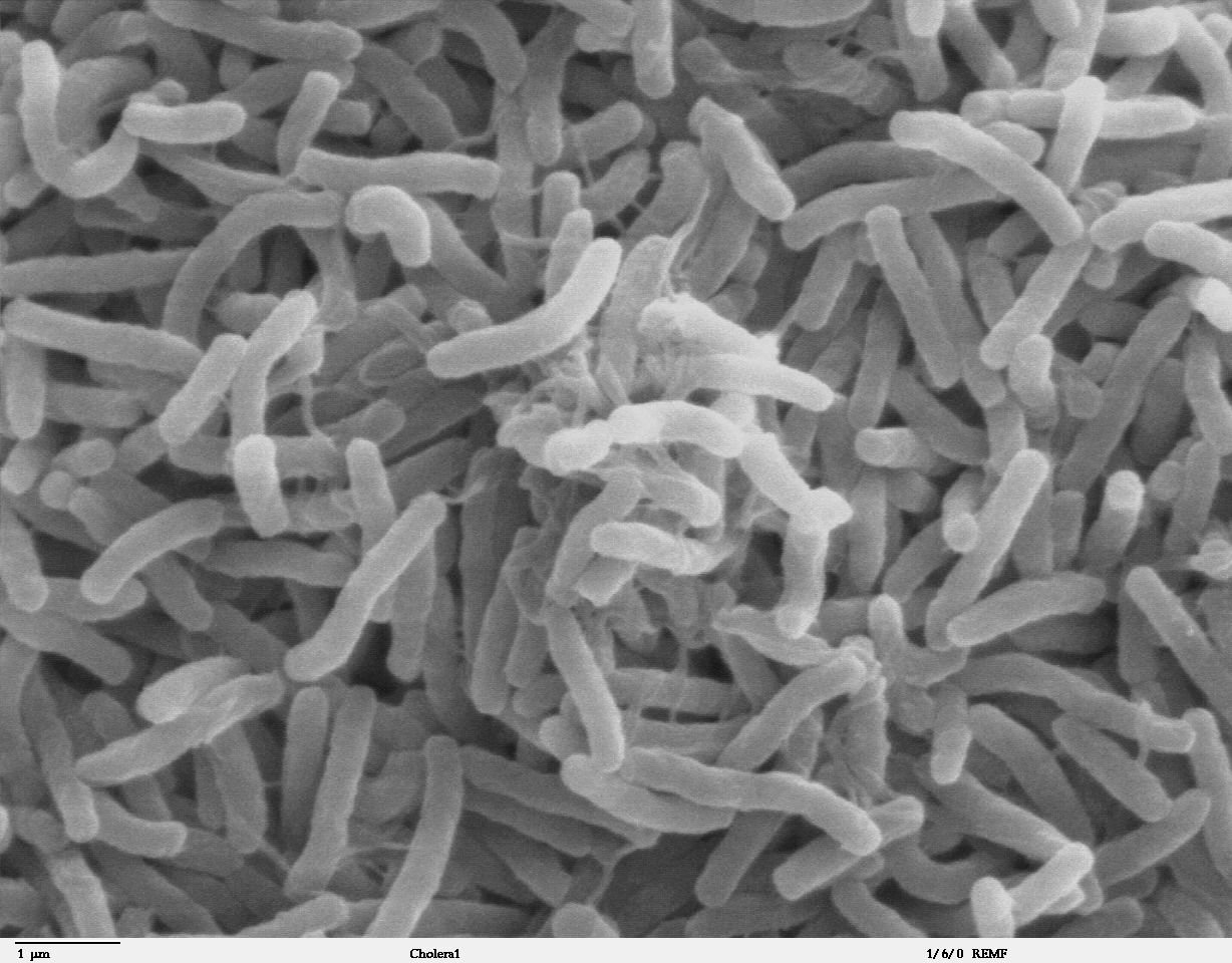
Cholera is an infection of the small intestine by some strains of the bacterium ''Vibrio cholerae''. Symptoms may range from none, to mild, to severe. The classic symptom is large amounts of watery diarrhea that lasts a few days. Vomiting and muscle cramps may also occur. Diarrhea can be so severe that it leads within hours to severe dehydration and electrolyte imbalance. This may result in sunken eyes, cold skin, decreased skin elasticity, and wrinkling of the hands and feet. Dehydration can cause the skin to turn bluish. Symptoms start two hours to five days after exposure. Cholera is caused by a number of types of ''Vibrio cholerae'', with some types producing more severe disease than others. It is spread mostly by unsafe water and unsafe food that has been contaminated with human feces containing the bacteria. Undercooked shellfish is a common source. Humans are the only known host for the bacteria. Risk factors for the disease include poor sanitation, not enough clea ... [...More Info...] [...Related Items...] OR: [Wikipedia] [Google] [Baidu] |


