|
Brooklyn, Baltimore
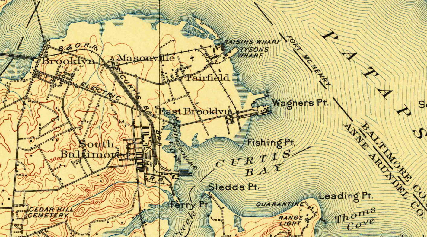
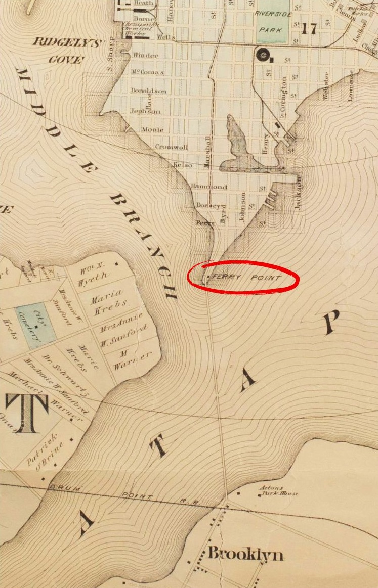
Brooklyn is one of the southernmost neighborhoods in Baltimore, Maryland. It is located near Anne Arundel County along Governor Ritchie Highway which is also Maryland Route 2. Its main roads are South Hanover Street, (formerly First Street - before 1919), Potee Street, and East Patapsco Avenue, Sixth Street, Tenth Street, and West Bay Avenue which borders the neighboring Curtis Bay community to the east, running through Bay Brook Park, which separates the two. South Hanover Street also serves as the dividing line between east–west streets in Brooklyn, as Charles Street (which acts as the east–west divider from downtown north to the city line) does not exist here. Often mistaken for the similarly-named Brooklyn Park area, Brooklyn shares the 21225 ZIP Code with the greater Brooklyn Park area which is across the Baltimore City Line (of the Annexation of 1919) in ( northern Anne Arundel County) and the other neighboring community of Cherry Hill to the west and northwest ... [...More Info...] [...Related Items...] OR: [Wikipedia] [Google] [Baidu] |
List Of Baltimore Neighborhoods
This list of Baltimore neighborhoods includes the neighborhoods of Baltimore, Maryland, divided into nine geographical regions: North, Northeast, East, Southeast, South, Southwest, West, Northwest, and Central. Each district is patrolled by a respective precinct of the Baltimore Police Department. Charles Street (Baltimore), Charles Street down to Maryland Route 2, Hanover Street and Ritchie Highway serve as the east-west dividing line and Maryland Route 150, Eastern Avenue to U.S. Route 40 in Maryland, Route 40 as the north-south dividing line. Baltimore Street is the north-south dividing line for the U.S. Postal Service. It is not uncommon for locals to divide the city simply by East or West Baltimore, using Charles Street or I-83 as a dividing line. The following is a list of major neighborhoods in Baltimore, organized by broad geographical location in the city: Baltimore neighborhoods A list of the neighborhoods of Baltimore listed by planning district: Northwest ... [...More Info...] [...Related Items...] OR: [Wikipedia] [Google] [Baidu] |
Maryland Route 139
139 may refer to: * 139 (number), an integer * AD 139, a year of the Julian calendar * 139 BC, a year of the pre-Julian Roman calendar * 139 (New Jersey bus) * 139 Juewa 139 Juewa ( ) is a very large and dark main belt asteroid. It is probably composed of primitive carbonaceous material. It was the first asteroid discovered from China. Juewa was discovered from Beijing by the visiting American astronomer Jam ..., a main-belt asteroid See also * 139th (other) {{numberdis ... [...More Info...] [...Related Items...] OR: [Wikipedia] [Google] [Baidu] |
Masonville, Baltimore
Masonville was a residential community and suburban List of Baltimore neighborhoods, neighborhood of Baltimore, Maryland. Historically, the town was one of five neighboring communities (along with Brooklyn, Baltimore, Brooklyn, Curtis Bay, Baltimore, Curtis Bay, Fairfield, Baltimore, Fairfield, and Wagner's Point, Baltimore, Wagner's Point) sought and ultimately annexed by Baltimore City from Anne Arundel County in 1918. The town was razed in its entirety in the 1950s, to accommodate the expansion of the Baltimore & Ohio Railroad's Curtis Bay terminal. The site of the former community is now primarily occupied by the Harbor Tunnel Thruway (part of Interstate 895). Etymology According to one source, the name Masonville is attributed to an early resident named Mason, who established a workshop producing crackers and bread there. History Foundation to Annexation The town that would be Masonville was founded in the 1890s, centered on what was then Ninth Street & Chesapeake Avenue, ... [...More Info...] [...Related Items...] OR: [Wikipedia] [Google] [Baidu] |
Interstate 895 (Maryland)
Interstate 895 (I-895) is an auxiliary Interstate Highway in the US state of Maryland. Known as the Harbor Tunnel Thruway, the highway runs between one junction with Interstate 95 in Maryland, I-95 in Elkridge, Maryland, Elkridge and another interchange with I-95 on the east side of Baltimore. I-895 is a toll road that crosses the Patapsco River estuary via the Baltimore Harbor Tunnel, connecting U.S. Route 1 in Maryland, U.S. Route 1 (US 1), Interstate 695 (Maryland), I-695, and the Baltimore–Washington Parkway (B–W Parkway) in the southwestern suburbs of Baltimore with U.S. Route 40 in Maryland, US 40 on the east side of Baltimore. In conjunction with a pair of spurs, unsigned highway, unsigned #Auxiliary routes, I-895A and I-895B, I-895 provides access to the tunnel from Interstate 97, I-97 and Maryland Route 2 (MD 2) in Glen Burnie, Maryland, Glen Burnie. The highway is designed for through traffic by having partial interchanges that require ... [...More Info...] [...Related Items...] OR: [Wikipedia] [Google] [Baidu] |
Baltimore Harbor Tunnel
The Baltimore Harbor Tunnel is a pair of two-lane road tunnels carrying I-895 under the Patapsco River southeast of downtown Baltimore, Maryland. Description The pair of tunnels is long, stretching from the south shore of the Patapsco River to the north shore near Dundalk. Each tunnel is wide and high, and accommodates two lanes of traffic. The maximum speed within the tunnel is . Two-way traffic may occur in either tunnel for overnight roadwork or during emergencies that close down one of the tunnels. The Tunnel has lane control signals to control which lanes are open, closed or as contra-flow traffic. Both portals have ventilation buildings, with a total of 32 fans in place to replace the air within the tunnels, which is drawn in through the tunnel floors and exhausted through the tunnel ceilings. The tubes themselves range from a depth of below ground to below ground. As of July 1, 2015, the toll rate for cars is $4.00 cash or $3.00 E-ZPass, paid in both directions ... [...More Info...] [...Related Items...] OR: [Wikipedia] [Google] [Baidu] |
Heavy Industry
Heavy industry is an industry that involves one or more characteristics such as large and heavy products; large and heavy equipment and facilities (such as heavy equipment, large machine tools, huge buildings and large-scale infrastructure); or complex or numerous processes. Because of those factors, heavy industry involves higher capital intensity than light industry does, and is also often more heavily cyclical in investment and employment. Though important to economic development and industrialization of economies, heavy industry can also have significant negative side effects: both local communities and workers frequently encounter health risks, heavy industries tend to produce byproducts that both pollute the air and water, and the industrial supply chain is often involved in other environmental justice issues from mining and transportation. Because of their intensity, heavy industries are also significant contributors to greenhouse gas emissions that cause climate ... [...More Info...] [...Related Items...] OR: [Wikipedia] [Google] [Baidu] |
Wagner's Point, Baltimore
Wagner's Point is an industrial area in Baltimore, Maryland. The name of the area comes from the Martin Wagner Company, which operated a beef packing plant there before the property was acquired by the Baltimore City government. The Martin Wagner plant was destroyed by a fire in 1913. The City of Baltimore operates its Patapsco Waste Water Treatment Plant on the former Martin Wagner site. Until the late 1990s Wagner's Point included a residential community which was relocated by the City due to environmental concerns. Negotiations with the final 270 residents of Wagner's Point over the city's buyout were bitterly disputed. Representatives of the residents walked out of the third negotiation session on September 17, 1998. Houses of the former residents were demolished after the city's buyout of the properties.Steve Lerner (2005''Diamond: a struggle for environmental justice in Louisiana's chemical corridor'', p. 80.MIT Press. . See also * Old Town Mall * Urban decay References ... [...More Info...] [...Related Items...] OR: [Wikipedia] [Google] [Baidu] |
Hanover Street Bridge
The Hanover Street Bridge, officially the Vietnam Veterans Memorial Bridge, is a double leaf bascule bridge crossing the middle branch of the Patapsco River along Hanover Street (Maryland Route 2) in Baltimore, Maryland. Description The Hanover Street Bridge is a -long Beaux-Arts-style double leaf bascule bridge spanning the middle branch of the Patapsco River in the outer harbor of Baltimore, linking the downtown and the community of Westport. It has 38 spans. History The Hanover Street Bridge replaced the Light Street Bridge, a wooden "long bridge" built in 1858, which had burnt down in 1914. Around the time of the construction of the bridge, trucks had begun to overtake steamboats as the preferred means of transferring goods. It was designed by the J. E. Greiner Company on the behalf of the Maryland State Roads Commission, becoming the longest reinforced concrete bridge in Maryland at its opening in 1916. The bridge's construction spurred residential and indus ... [...More Info...] [...Related Items...] OR: [Wikipedia] [Google] [Baidu] |
Elkridge, Maryland
Elkridge is an unincorporated community and census-designated place (CDP) in Howard County, Maryland, Howard County, Maryland, United States. Elkridge is a rapidly growing area; between the 2010 and the 2020 census, the population had grown from 15,593 to 25,171. Founded early in the 18th century, Elkridge is adjacent to two other counties, Anne Arundel County, Maryland, Anne Arundel and Baltimore County, Maryland, Baltimore. History Elkridge qualifies as the oldest settlement in its present county, when Howard was a part of Anne Arundel County. Its location on the Patapsco River was a key element in its growth. The Maryland General Assembly elected a law to erect a , forty-lot town at the pre-existing settlement of Elkridge Landing to be called "Jansen Town" in 1733. In 1738 an attempt to formalize the town failed with the death of the commissioners before passage. In 1750 a second attempt to formalize the town was attempted around the lands of Phillip Hammond. By comparison, B ... [...More Info...] [...Related Items...] OR: [Wikipedia] [Google] [Baidu] |
Ellicott City, Maryland
Ellicott City is an Unincorporated area#United States, unincorporated community and census-designated place in, and the county seat of, Howard County, Maryland, Howard County, Maryland, United States. Part of the Baltimore metropolitan area, its population was 75,947 at the 2020 United States census, 2020 census, making it the most populous unincorporated county seat in the country. Ellicott City's historic downtownthe Ellicott City Historic Districtlies in the valleys of the Ellicott City#Geography, Tiber and Patapsco River, Patapsco rivers. The historic district includes the Ellicott City Station; it is the oldest surviving train station in the United States, having been built in 1830 as the first terminus of the original Baltimore and Ohio Railroad, B&O Railroad line. The historic district of the town is often called "Historic Ellicott City" or "Old Ellicott City" to distinguish it from the surrounding suburbs that extend south to Columbia, Maryland, Columbia and west to West F ... [...More Info...] [...Related Items...] OR: [Wikipedia] [Google] [Baidu] |
Patapsco River
The Patapsco River ( ) mainstem is a river in central Maryland that flows into the Chesapeake Bay. The river's tidal portion forms the harbor for the city of Baltimore. With its South Branch, the Patapsco forms the northern border of Howard County, Maryland. The name "Patapsco" is derived from the Eastern Algonquian languages, Algonquian ''pota-psk-ut'', which translates to "backwater" or "tide covered with froth". History John Smith of Jamestown, Captain John Smith was the first European to explore the river, noting it on his 1612 map as the Bolus River. The "Red river", named after the clay color, is considered the "old Bolus", as other branches were also labeled Bolus on maps. As the river was not navigable beyond Elkridge, it was not a significant path of commerce; in 1723, only one ship was listed as serving the northern branch, and four others operating around the mouth. The first land record regarding Parr's Springs, the source of the South Branch, dates from 1744, ... [...More Info...] [...Related Items...] OR: [Wikipedia] [Google] [Baidu] |


