|
Brookfield Railway Station (England)
Brookfield (Cumbria) railway station was a short-lived railway station that served Brookfield School The London Borough of Camden () is a London borough in Inner London. Camden Town Hall, on Euston Road, lies north of Charing Cross. The borough was established on 1 April 1965 from the area of the former boroughs of Hampstead, Holborn, and St ... (or Brookfield Academy), a Quaker school situated to the west of Wigton, England, for a few weeks in 1844–45. It was opened on 2 December 1844 by the Maryport and Carlisle Railway, and closed on 10 February 1845. References External linksSite of Brookfield Station on navigable 1947 O.S. map Disused railway stations in Cumbria Former Maryport and Carlisle Railway stations Railway stations in Great Britain opened in 1844 Railway stations in Great Britain closed in 1845 {{NorthWestEngland-railstation-stub ... [...More Info...] [...Related Items...] OR: [Wikipedia] [Google] [Baidu] |
Wigton
Wigton is a market town in the Allerdale borough of Cumbria, England. Historically in Cumberland, it lies just outside the Lake District in the borough of Allerdale. Wigton is at the centre of the Solway Plain, between the Caldbeck Fells and the Solway coast. It is served by Wigton railway station on the Cumbrian Coast Line, and the A596 road to Workington. The town of Silloth-on-Solway lies to the west, beyond Abbeytown. Etymology Wigton is "Wicga's tūn". "Wicga" is an Old English pre-7th-century personal name meaning "a beetle" (as in "earwig"), while "tūn" is Old English for a demarcated plot, a "homestead" or "village", so Wigton is "the hamlet belonging to Wicga". History On the River Wampool and Wiza Beck ( beck being a dialect word meaning "brook" or "stream" – from the Old Norse ''bekkr''), the market town of Wigton is an ancient settlement and evolved from a pre-medieval street plan, which can still be traced today. The Romans had a cavalry station, Maglo ... [...More Info...] [...Related Items...] OR: [Wikipedia] [Google] [Baidu] |
Allerdale
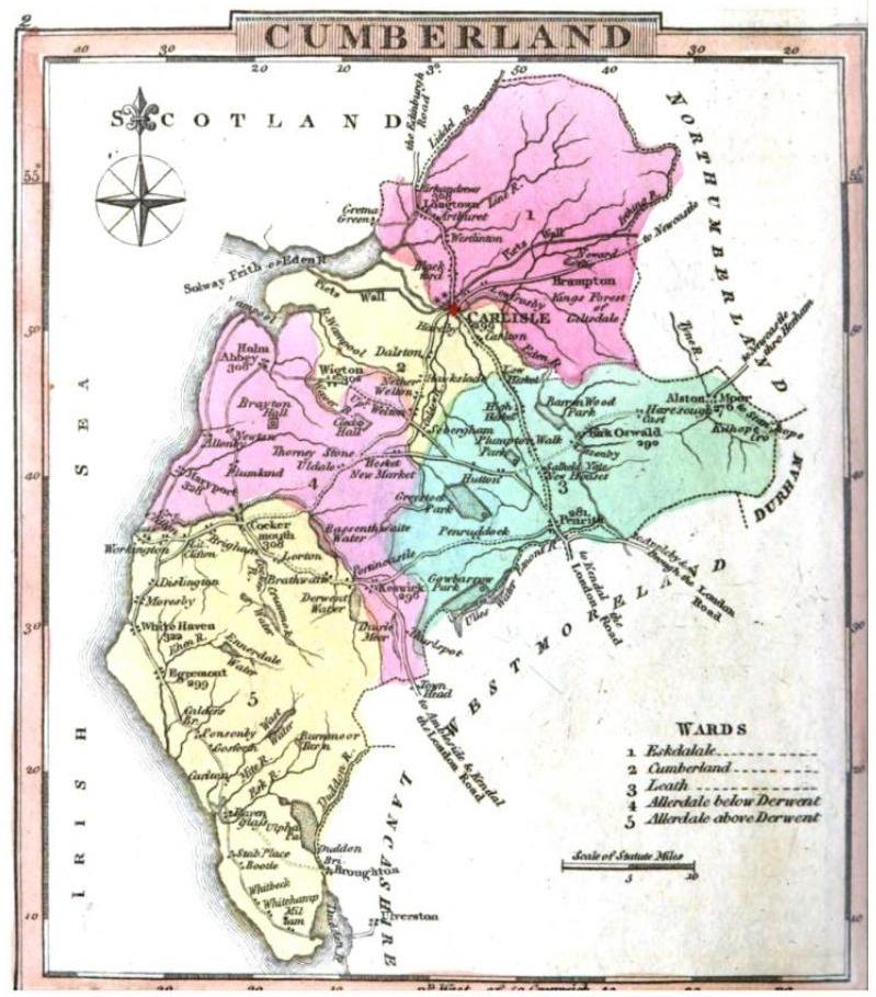
Allerdale is a non-metropolitan district of Cumbria, England, with borough status. Its council is based in Workington and the borough has a population of 93,492 according to the 2001 census, increasing to 96,422 at the 2011 Census. The Borough of Allerdale was formed under the Local Government Act 1972, on 1 April 1974 by the merger of the municipal borough of Workington, the urban districts of Maryport, Cockermouth and Keswick; and the rural districts of Cockermouth and Wigton, all of which were within the administrative county of Cumberland. In 1995 Allerdale was granted borough status. The name derives from the ancient region of Allerdale, represented latterly by the two wards of Cumberland, called Allerdale-above-Derwent and Allerdale-below-Derwent, the present borough corresponding largely to the latter with parts of the former. Much of the area during the medieval period was a royal forest subject to forest law. In July 2021 the Ministry of Housing, Communities an ... [...More Info...] [...Related Items...] OR: [Wikipedia] [Google] [Baidu] |
Ordnance Survey National Grid
The Ordnance Survey National Grid reference system (OSGB) (also known as British National Grid (BNG)) is a system of geographic grid references used in Great Britain, distinct from latitude and longitude. The Ordnance Survey (OS) devised the national grid reference system, and it is heavily used in their survey data, and in maps based on those surveys, whether published by the Ordnance Survey or by commercial map producers. Grid references are also commonly quoted in other publications and data sources, such as guide books and government planning documents. A number of different systems exist that can provide grid references for locations within the British Isles: this article describes the system created solely for Great Britain and its outlying islands (including the Isle of Man); the Irish grid reference system was a similar system created by the Ordnance Survey of Ireland and the Ordnance Survey of Northern Ireland for the island of Ireland. The Universal Transverse Merca ... [...More Info...] [...Related Items...] OR: [Wikipedia] [Google] [Baidu] |
Maryport And Carlisle Railway
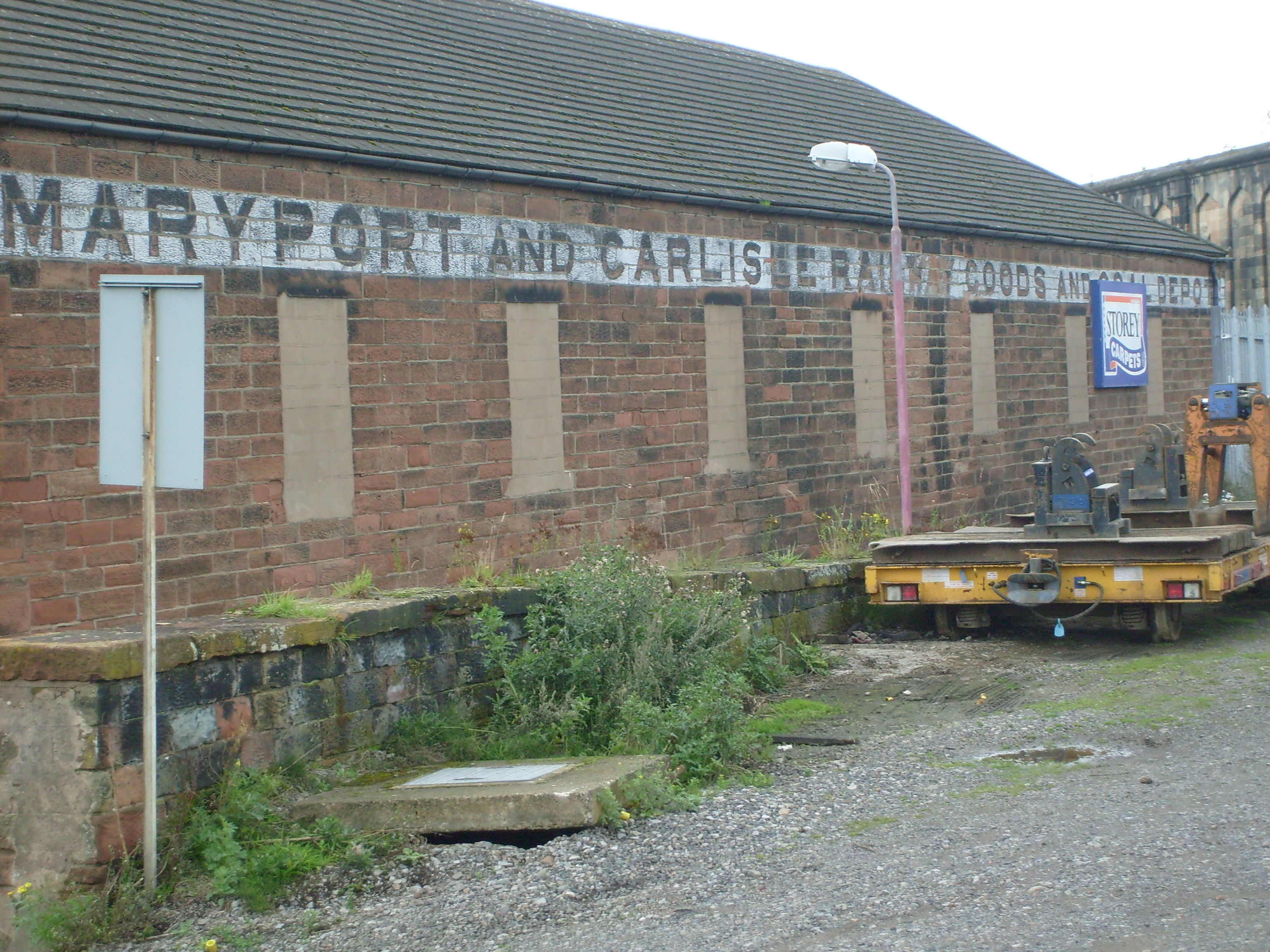
The Maryport & Carlisle Railway (M&CR) was an English railway company formed in 1836 which built and operated a small but eventually highly profitable railway to connect Maryport and Carlisle in Cumbria, England. There were many small collieries in the area and efficient access to the harbour at Maryport was important. The western end, connecting the majority of the collieries to Maryport opened in 1840 and the line was completed throughout to Carlisle in 1845. The considerable resources of coal, and later iron ore, carried by the railway made it especially profitable, and this was redoubled at the height of the iron and steel processing industries around Workington. Branch lines were opened to connect further collieries. After 1918 the industries on which the line was dependent declined steeply, and the railway declined accordingly; the branch lines closed, but the original main line remains open and forms part of the Cumbrian Coast Line between Carlisle and Barrow in Furness. ... [...More Info...] [...Related Items...] OR: [Wikipedia] [Google] [Baidu] |
Wigton School
Wigton School (also called Brookfield School or Friends' School) was an independent boarding school on the outskirts of Wigton, Cumbria. The school was opened on 4 September 1815 by the Society of Friends ( Quakers) for Cumberland Cumberland ( ) is a historic county in the far North West England. It covers part of the Lake District as well as the north Pennines and Solway Firth coast. Cumberland had an administrative function from the 12th century until 1974. From 19 ... and Northumberland. The initial student intake was 9 boys and 8 girls in premises at Highmoor in existing buildings. These first buildings were leased at an annual rent of 27 guineas. In 1826, the main school site opened at Brookfield, commissioned by the Society of Friends. A London architect designed the buildings in classic Georgian style. The school motto was "We seek the truth." The school badge comprised a shield with a green background and diagonal river to represent the school's rural location ... [...More Info...] [...Related Items...] OR: [Wikipedia] [Google] [Baidu] |
List Of Friends Schools
Friends schools are institutions that provide an education based on the beliefs and testimonies of the Religious Society of Friends (Quakers). This article is a list of schools currently or historically associated with the Society of Friends, regardless of their current degree of affiliation. Friends schools vary greatly, both in their interpretation of Quaker principles and in how they relate to formal organizations that make up the Society of Friends. Most Friends schools are similar in their mission however: to provide an academically sound education while also instilling values of community, spirituality, responsibility and stewardship in their students. Some institutions founded by Friends were never formally "Quaker schools." Some historically Friends institutions are no longer formally associated with the Society of Friends. Those that continue to call themselves "Quaker schools" may have formal oversight from a Friends yearly or monthly meetings (often called coming "un ... [...More Info...] [...Related Items...] OR: [Wikipedia] [Google] [Baidu] |
Cumbrian Coast Line
The Cumbrian Coast line is a rail route in North West England, running from Carlisle to Barrow-in-Furness via Workington and Whitehaven. The line forms part of Network Rail route NW 4033, which continues (as the Furness line) via Ulverston and Grange-over-Sands to Carnforth, where it connects with the West Coast Main Line. History George Stephenson favoured, and carried out preliminary surveys for, a scheme to link England and Scotland by a railway running along the coast between Lancaster and Carlisle, but this 'Grand Caledonian Junction Railway' was never built, the direct route over Shap being preferred. Consequently, the line along the Cumbrian coast is the result of piecemeal railway building (largely to serve local needs) by a number of different companies: Maryport and Carlisle Railway Carlisle to Maryport Promoted to link with Newcastle and Carlisle Railway to give "one complete and continuous line of communication from the German Ocean to the Irish Sea" and to op ... [...More Info...] [...Related Items...] OR: [Wikipedia] [Google] [Baidu] |
Former Maryport And Carlisle Railway Stations
A former is an object, such as a template, gauge or cutting die, which is used to form something such as a boat's hull. Typically, a former gives shape to a structure that may have complex curvature. A former may become an integral part of the finished structure, as in an aircraft fuselage, or it may be removable, being using in the construction process and then discarded or re-used. Aircraft formers Formers are used in the construction of aircraft fuselage, of which a typical fuselage has a series from the nose to the empennage, typically perpendicular to the longitudinal axis of the aircraft. The primary purpose of formers is to establish the shape of the fuselage and reduce the column length of stringers to prevent instability. Formers are typically attached to longerons, which support the skin of the aircraft. The "former-and-longeron" technique (also called stations and stringers) was adopted from boat construction, and was typical of light aircraft built until ... [...More Info...] [...Related Items...] OR: [Wikipedia] [Google] [Baidu] |
Railway Stations In Great Britain Opened In 1844
Rail transport (also known as train transport) is a means of transport that transfers passengers and goods on wheeled vehicles running on rails, which are incorporated in tracks. In contrast to road transport, where the vehicles run on a prepared flat surface, rail vehicles ( rolling stock) are directionally guided by the tracks on which they run. Tracks usually consist of steel rails, installed on sleepers (ties) set in ballast, on which the rolling stock, usually fitted with metal wheels, moves. Other variations are also possible, such as "slab track", in which the rails are fastened to a concrete foundation resting on a prepared subsurface. Rolling stock in a rail transport system generally encounters lower frictional resistance than rubber-tyred road vehicles, so passenger and freight cars (carriages and wagons) can be coupled into longer trains. The operation is carried out by a railway company, providing transport between train stations or freight customer ... [...More Info...] [...Related Items...] OR: [Wikipedia] [Google] [Baidu] |


