|
Broek, Gouda
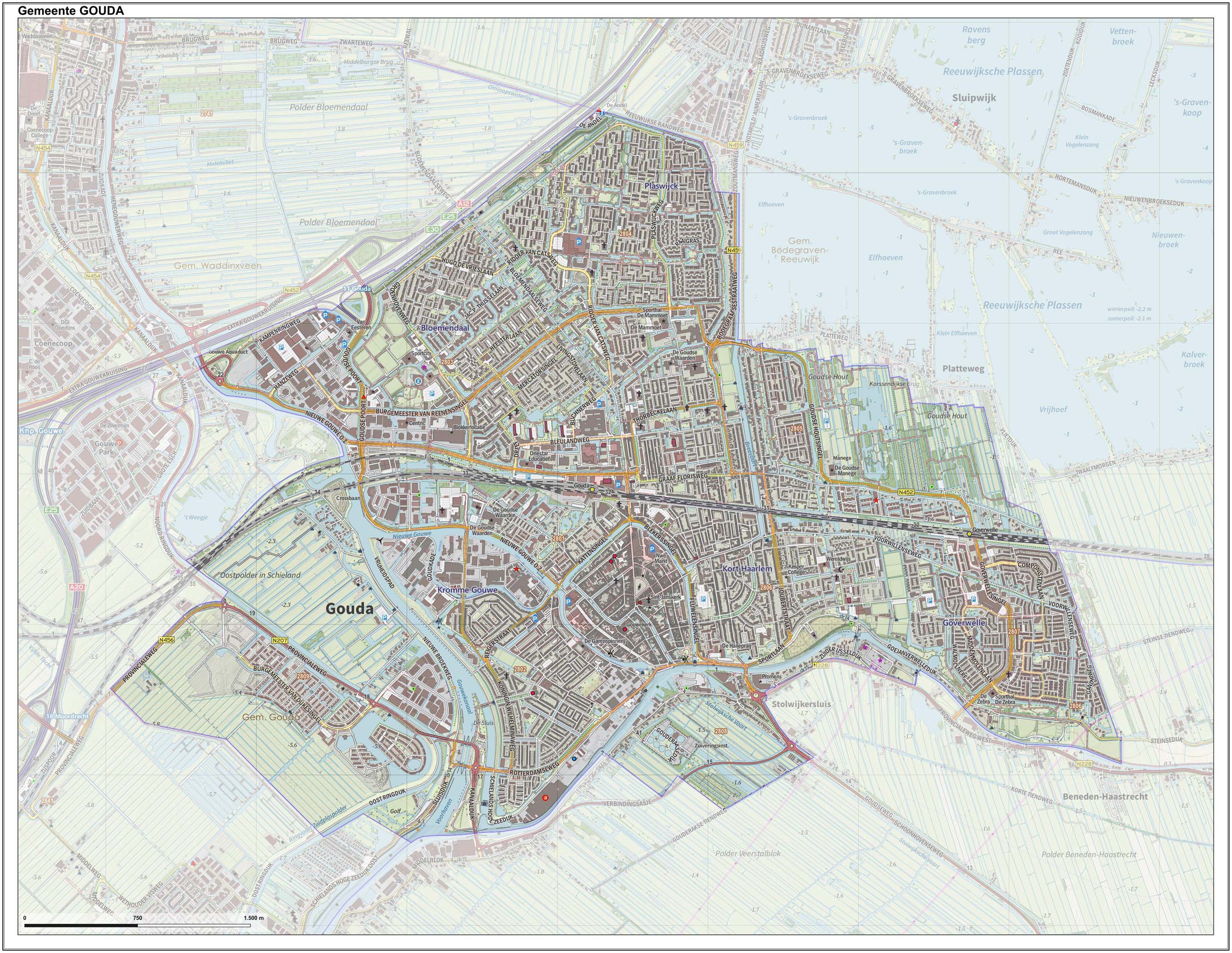
Broek was a municipality in the Dutch province of South Holland, located west and north of Gouda. A longer name of the municipality, Broek, Bloemendaal, Broekhuizen, Thuil en het Weegje names the polders A polder () is a low-lying tract of land that forms an artificial hydrological entity, enclosed by embankments known as dikes. The three types of polder are: # Land reclaimed from a body of water, such as a lake or the seabed # Flood plains s ... that are part of the municipality. Broek was a separate municipality between 1817 and 1870, when it became part of Waddinxveen. The polder "Broek" is now part of the municipality of Gouda, as is part of Bloemendaal. Around 1850, the municipality had a population of more than 1300, on an area of 17.55 km²., References Former municipalities of South Holland {{SouthHolland-geo-stub ... [...More Info...] [...Related Items...] OR: [Wikipedia] [Google] [Baidu] |
Netherlands
) , anthem = ( en, "William of Nassau") , image_map = , map_caption = , subdivision_type = Sovereign state , subdivision_name = Kingdom of the Netherlands , established_title = Before independence , established_date = Spanish Netherlands , established_title2 = Act of Abjuration , established_date2 = 26 July 1581 , established_title3 = Peace of Münster , established_date3 = 30 January 1648 , established_title4 = Kingdom established , established_date4 = 16 March 1815 , established_title5 = Liberation Day (Netherlands), Liberation Day , established_date5 = 5 May 1945 , established_title6 = Charter for the Kingdom of the Netherlands, Kingdom Charter , established_date6 = 15 December 1954 , established_title7 = Dissolution of the Netherlands Antilles, Caribbean reorganisation , established_date7 = 10 October 2010 , official_languages = Dutch language, Dutch , languages_type = Regional languages , languages_sub = yes , languages = , languages2_type = Reco ... [...More Info...] [...Related Items...] OR: [Wikipedia] [Google] [Baidu] |
South Holland
South Holland ( nl, Zuid-Holland ) is a province of the Netherlands with a population of over 3.7 million as of October 2021 and a population density of about , making it the country's most populous province and one of the world's most densely populated areas. Situated on the North Sea in the west of the Netherlands, South Holland covers an area of , of which is water. It borders North Holland to the north, Utrecht and Gelderland to the east, and North Brabant and Zeeland to the south. The provincial capital is the Dutch seat of government The Hague, while its largest city is Rotterdam. The Rhine-Meuse-Scheldt delta drains through South Holland into the North Sea. Europe's busiest seaport, the Port of Rotterdam, is located in South Holland. History Early history Archaeological discoveries in Hardinxveld-Giessendam indicate that the area of South Holland has been inhabited since at least c. 7,500 years before present, probably by nomadic hunter-gatherers. Agriculture and perman ... [...More Info...] [...Related Items...] OR: [Wikipedia] [Google] [Baidu] |
Gouda, South Holland
Gouda () is a city and municipality in the west of the Netherlands, between Rotterdam and Utrecht, in the province of South Holland. Gouda has a population of 75,000 and is famous for its Gouda cheese, stroopwafels, many grachten, smoking pipes, and its 15th-century city hall. Its array of historic churches and other buildings makes it a very popular day trip destination. In the Middle Ages, a settlement was founded at the location of the current city by the Van der Goude family, who built a fortified castle alongside the banks of the Gouwe River, from which the family and the city took its name. The area, originally marshland, developed over the course of two centuries. By 1225, a canal was linked to the Gouwe and its estuary was transformed into a harbour. City rights were granted in 1272. History Around the year 1100, the area where Gouda now is located was swampy and covered with a peat forest, crossed by small creeks such as the Gouwe. Along the shores of this st ... [...More Info...] [...Related Items...] OR: [Wikipedia] [Google] [Baidu] |
Polders
A polder () is a low-lying tract of land that forms an artificial hydrological entity, enclosed by embankments known as dikes. The three types of polder are: # Land reclaimed from a body of water, such as a lake or the seabed # Flood plains separated from the sea or river by a dike # Marshes separated from the surrounding water by a dike and subsequently drained; these are also known as ''koogs'', especially in Germany The ground level in drained marshes subsides over time. All polders will eventually be below the surrounding water level some or all of the time. Water enters the low-lying polder through infiltration and water pressure of groundwater, or rainfall, or transport of water by rivers and canals. This usually means that the polder has an excess of water, which is pumped out or drained by opening sluices at low tide. Care must be taken not to set the internal water level too low. Polder land made up of peat (former marshland) will sink in relation to its previous l ... [...More Info...] [...Related Items...] OR: [Wikipedia] [Google] [Baidu] |


