|
Broadway Street (Chicago)
Broadway is a major street in Chicago's Lake View, Uptown, and Edgewater, Chicago, Edgewater Chicago community areas, community areas on the city's North Side, running from Diversey Parkway (2800 North) to Devon Avenue (Chicago), Devon Avenue (6400 North). Originally called ''Evanston Avenue'', the name of the street was changed to ''Broadway'' on August 15, 1913, as part of 467 road name changes enacted on that date. The new name was taken from New York City's famous theater district. The street runs at a mostly southeast-to-northwest diagonal direction between Diversey Parkway and Lawrence Avenue (4800 North). Between Lawrence Avenue and Devon Avenue, Broadway runs in a north-to-south direction and becomes 1200 West in place of Racine Avenue. The north–south section of Broadway is located a half-block west of and parallel to the Chicago Transit Authority's Red Line (Chicago Transit Authority), Red Line and Purple Line (Chicago Transit Authority), Purple Line elevated tra ... [...More Info...] [...Related Items...] OR: [Wikipedia] [Google] [Baidu] |
Diversey Parkway
Diversey Parkway (, 2800 N.) is a major east–west street on the North Side of Chicago. Diversey separates the Chicago lakefront neighborhoods of Lakeview to the north and Lincoln Park to the south. West of the North Branch of the Chicago River, the street is known as Diversey Avenue, and separates the neighborhoods of Avondale to the north and Logan Square to the south. Further west, Diversey Avenue is a major street in Chicago's Hermosa, Belmont Cragin, and Montclare neighborhoods, and it continues intermittently through the west suburbs. The street is named after 19th century beer brewer Michael Diversey. Points of interest Diversey has a few points of interest such as Mies van der Rohe's Commonwealth Promenade Apartments (1957), the Elks National Memorial Headquarters Building, the Brewster Apartments, the Urantia Foundation Building, the Lathrop Homes, Diversey River Bowl, Kosciuszko Park, and the Brickyard Shopping Center. Diversey also goes by the site of one o ... [...More Info...] [...Related Items...] OR: [Wikipedia] [Google] [Baidu] |
Foster Avenue (Chicago)
Foster Avenue (5200 N) is a major east-west street on the North Side of Chicago as well as the northwestern suburbs. Foster Avenue separates the Chicago lakefront neighborhoods of Edgewater to the north and Uptown to the south. Foster Avenue runs in Chicago from Lake Michigan on the east to East River Road (8800 W.) to the west and picks up again west of Des Plaines River Road to connect Chicago to O'Hare Airport. It carries U.S. Route 41 from Lake Shore Drive to Lincoln Avenue. It is named for early Chicago settler John H. Foster. Major neighborhoods * Edgewater * North Park * Forest Glen * Jefferson Park * Norwood Park * O'Hare Transportation The CTA provides bus service via the 92 Foster bus between Broadway Broadway may refer to: Theatre * Broadway Theatre (other) * Broadway theatre, theatrical productions in professional theatres near Broadway, Manhattan, New York City, U.S. ** Broadway (Manhattan), the street **Broadway Theatre (53rd Stree ... and Milwauk ... [...More Info...] [...Related Items...] OR: [Wikipedia] [Google] [Baidu] |
Sheridan Road
Sheridan Road is a major north-south street that leads from Diversey Parkway in Chicago, Illinois, north to the Illinois-Wisconsin border and beyond to Racine. Throughout most of its run, it is the easternmost north-south through street, closest to Lake Michigan. From Chicago, it passes through Chicago's wealthy lakeside North Shore suburbs, and then Waukegan and Zion, until it reaches the Illinois-Wisconsin state line in Winthrop Harbor. In Wisconsin, the road leads north through Pleasant Prairie and Kenosha, until it ends on the south side of Racine, in Mount Pleasant. From North Chicago to the state line, Sheridan Road is signed as part of Illinois Route 137 in Illinois, and Wisconsin Highway 32 through Kenosha and Racine in Wisconsin. Sheridan Road is known for its historic sites, lakefront parks, and gracious mansion homes in Evanston through Lake Bluff. Sheridan Road is also very popular with cyclists, with many riders using the road north of the terminus of the Lakefr ... [...More Info...] [...Related Items...] OR: [Wikipedia] [Google] [Baidu] |
Devon Avenue
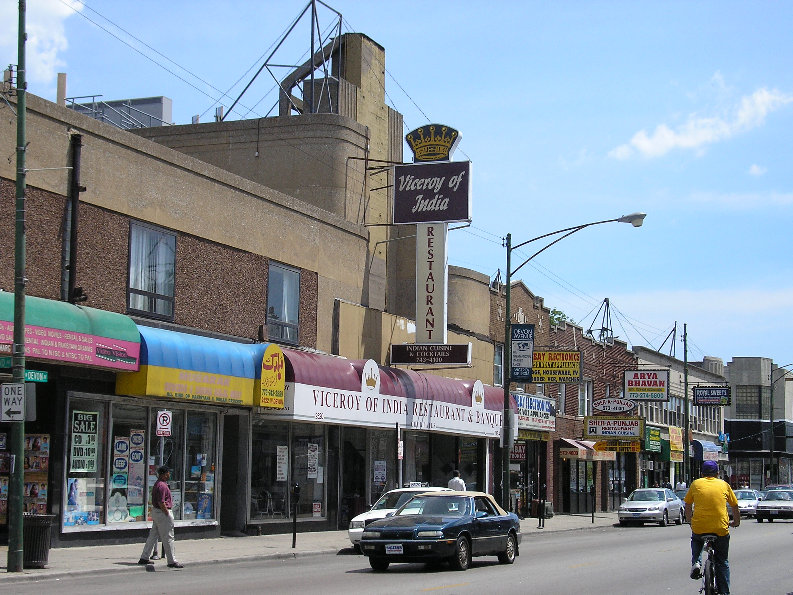
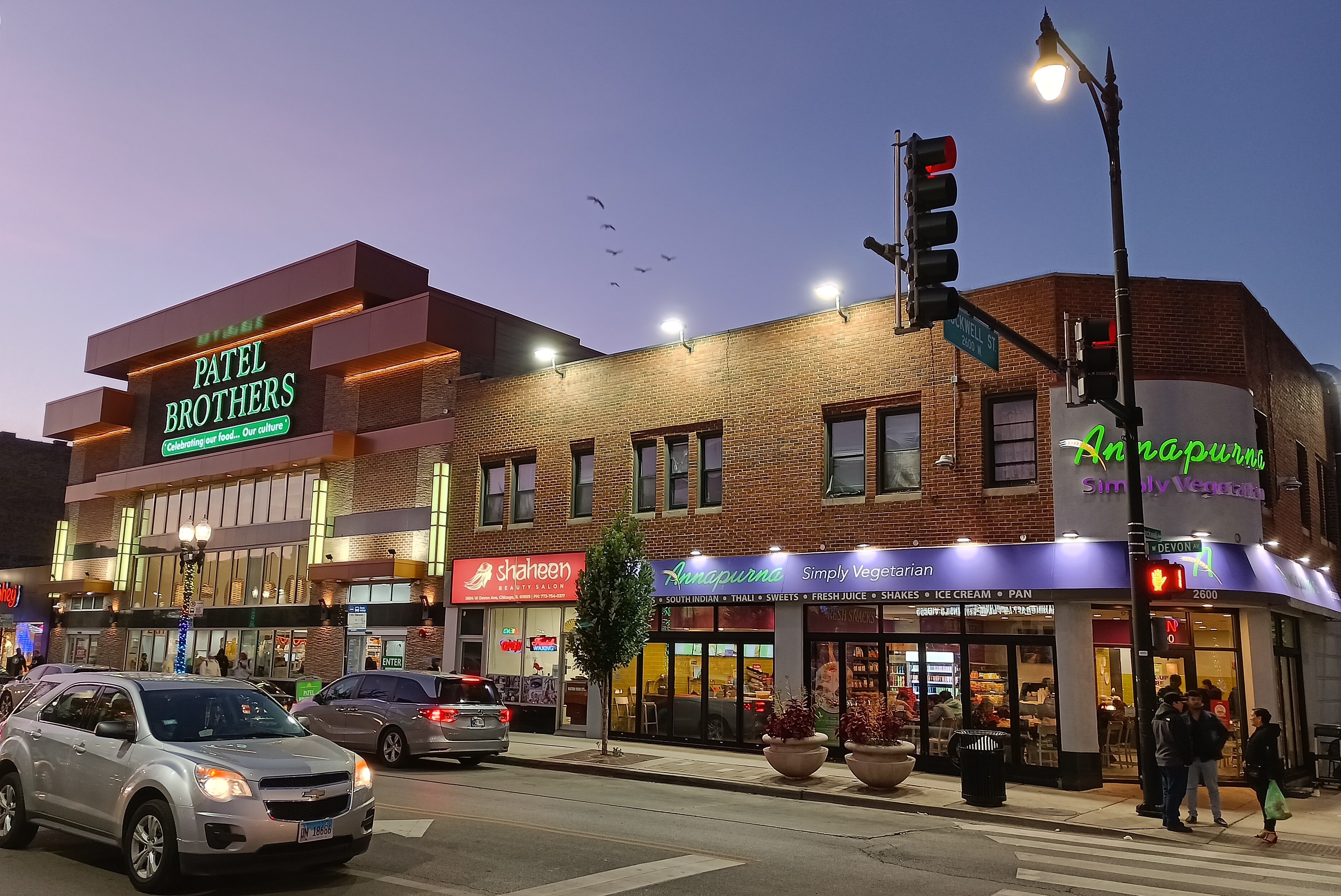
Devon Avenue is a major east-west street in the Chicago metropolitan area. It begins at Chicago's Sheridan Road, which borders Lake Michigan, and it runs west until merging with Higgins Road near O'Hare International Airport. Devon continues on the opposite side of the airport and runs intermittently through Chicago's northwestern suburbs. In the northwest suburbs west of O'Hare Airport, Devon Avenue is the boundary between Cook and DuPage counties. The street is located at 6400 N in Chicago's address system. History Devon Avenue was originally known as Church Road, but it was renamed in the 1880s by Edgewater developer John Lewis Cochran after Devon station on the Main Line north of Philadelphia. The street has been settled by many Asian immigrant groups, which is perhaps most evident between Kedzie and Ridge Avenues in West Ridge, Chicago. Here, one will encounter concentrations of Jewish Americans, Assyrian Americans, Russian Americans, Indian Americans, Pakistani America ... [...More Info...] [...Related Items...] OR: [Wikipedia] [Google] [Baidu] |
Ridge Avenue (Chicago)
Route description Ridge Avenue, also called Ridge Boulevard from Devon Avenue and Howard Street is a street in Chicago and Evanston. It begins at Broadway and Bryn Mawr Avenue in Chicago. From here, it carries U.S. Route 14 to Peterson Avenue. U.S. Route 14 continues south onto Broadway and west onto Peterson Avenue. Between the two intersections, the street also intersects with Clark Street. The next streets that intersect with Ridge Avenue (called Ridge Boulevard between the first and last streets in the upcoming list) are Devon Avenue, Touhy Avenue, and Howard Street. At Howard Street, Ridge Avenue leaves Chicago and enters Evanston. En route to its north end at Sheridan Road, it also intersects with Dempster Street Dempster Street is a major east-west street in the northern suburbs of Chicago. It is assigned 8800 North in the Chicago address system, being located north of Madison Street. The road begins at Illinois Route 62 (Algonquin Road) in Mount Pr .... The roa ... [...More Info...] [...Related Items...] OR: [Wikipedia] [Google] [Baidu] |
Foster Avenue
Foster Avenue (5200 N) is a major east-west street on the North Side of Chicago as well as the northwestern suburbs. Foster Avenue separates the Chicago lakefront neighborhoods of Edgewater to the north and Uptown to the south. Foster Avenue runs in Chicago from Lake Michigan on the east to East River Road (8800 W.) to the west and picks up again west of Des Plaines River Road to connect Chicago to O'Hare Airport. It carries U.S. Route 41 from Lake Shore Drive to Lincoln Avenue. It is named for early Chicago settler John H. Foster. Major neighborhoods * Edgewater * North Park * Forest Glen * Jefferson Park * Norwood Park * O'Hare Transportation The CTA provides bus service via the 92 Foster bus between Broadway Broadway may refer to: Theatre * Broadway Theatre (other) * Broadway theatre, theatrical productions in professional theatres near Broadway, Manhattan, New York City, U.S. ** Broadway (Manhattan), the street **Broadway Theatre (53rd Stree ... and Milwau ... [...More Info...] [...Related Items...] OR: [Wikipedia] [Google] [Baidu] |
Diversey Parkway (Chicago)
Diversey Parkway (, 2800 N.) is a major east–west street on the North Side of Chicago. Diversey separates the Chicago lakefront neighborhoods of Lakeview to the north and Lincoln Park to the south. West of the North Branch of the Chicago River, the street is known as Diversey Avenue, and separates the neighborhoods of Avondale to the north and Logan Square to the south. Further west, Diversey Avenue is a major street in Chicago's Hermosa, Belmont Cragin, and Montclare neighborhoods, and it continues intermittently through the west suburbs. The street is named after 19th century beer brewer Michael Diversey. Points of interest Diversey has a few points of interest such as Mies van der Rohe's Commonwealth Promenade Apartments (1957), the Elks National Memorial Headquarters Building, the Brewster Apartments, the Urantia Foundation Building, the Lathrop Homes, Diversey River Bowl, Kosciuszko Park, and the Brickyard Shopping Center. Diversey also goes by the site of one o ... [...More Info...] [...Related Items...] OR: [Wikipedia] [Google] [Baidu] |
Clark Street (Chicago)
Clark Street is a north-south street in Chicago, Illinois that runs close to the shore of Lake Michigan from the northern city boundary with Evanston, to 2200 South in the city street numbering system. At its northern end, Clark Street is at 1800 West; however the street runs diagonally through the Chicago grid for about to North Avenue (1600 N) and then runs at 100 West for the rest of its course south to Cermak Road. It is also seen in Riverdale beyond 127th street across the Calumet River, along with other nearby streets that ended just south of the Loop. The major length of Clark Street runs a total of 98 blocks. History Clark Street is named for George Rogers Clark, an American Revolutionary War soldier who captured much of the Northwest Territory from the Kingdom of Great Britain, British. Within the Chicago Loop Clark Street is one of the original streets laid out by James Thompson in his 1830 plat of Chicago. North of the Loop, from North Avenue, it roughly foll ... [...More Info...] [...Related Items...] OR: [Wikipedia] [Google] [Baidu] |
Purple Line (Chicago Transit Authority)
The Purple Line of the Chicago "L" is a route on the northernmost section of the system. Normally, it extends south from in Wilmette, passing through Evanston to , on Chicago's North Side. In 2021, the average weekday boardings on the Purple Line was 3,382. It is the shortest route in the CTA rail system except during weekday peaks and rush hours. During weekday rush hours, the Purple Line extends another south from Howard to downtown Chicago running express from Howard to , with a single stop at , and then making all local stops to the Loop. The express service is known as the Purple Line Express (or the Evanston Express). Prior to the color-coding of CTA rail lines in 1993, the Purple Line was known as the Evanston Line, Evanston Service or Evanston Shuttle, and the Purple Line Express was called the Evanston Express. The Purple Line is useful for reaching Northwestern University ( and stops in Evanston), including the sports facilities Ryan Field, Rocky Miller Park, Wel ... [...More Info...] [...Related Items...] OR: [Wikipedia] [Google] [Baidu] |
Devon Avenue (Chicago)
Devon Avenue is a major east-west street in the Chicago metropolitan area. It begins at Chicago's Sheridan Road, which borders Lake Michigan, and it runs west until merging with Higgins Road near O'Hare International Airport. Devon continues on the opposite side of the airport and runs intermittently through Chicago's northwestern suburbs. In the northwest suburbs west of O'Hare Airport, Devon Avenue is the boundary between Cook and DuPage counties. The street is located at 6400 N in Chicago's address system. History Devon Avenue was originally known as Church Road, but it was renamed in the 1880s by Edgewater developer John Lewis Cochran after Devon station on the Main Line north of Philadelphia. The street has been settled by many Asian immigrant groups, which is perhaps most evident between Kedzie and Ridge Avenues in West Ridge, Chicago. Here, one will encounter concentrations of Jewish Americans, Assyrian Americans, Russian Americans, Indian Americans, Pakistani America ... [...More Info...] [...Related Items...] OR: [Wikipedia] [Google] [Baidu] |
Red Line (Chicago Transit Authority)
The Red Line is a rapid transit line in Chicago, run by the Chicago Transit Authority (CTA) as part of the Chicago "L" system. It is the busiest line on the "L" system, with an average of 73,273 passengers boarding each weekday in 2021. The route is long with a total of 33 stations. It runs elevated from the Howard station in the Rogers Park, Chicago, Rogers Park neighborhood on the North Side, through a subway on the Near North Side, Chicago, Near North Side, Downtown Chicago, Downtown, and the Near South Side, Chicago, South Loop, and then through the Dan Ryan Expressway median to 95th Street in the Roseland, Chicago, Roseland neighborhood on the South Side. Like Chicago's Blue Line (CTA), Blue Line, the Red Line runs 24 hours a day, 365 days a year, making Chicago, New York City, and Philadelphia (on the PATCO Speedline) the only cities in the United States that operate train service 24 hours a day. The city of Chicago is planning an extension of the Red Line, adding 5.6 miles ... [...More Info...] [...Related Items...] OR: [Wikipedia] [Google] [Baidu] |
Chicago Transit Authority
The Chicago Transit Authority (CTA) is the operator of mass transit in Chicago, Illinois, United States, and some of its surrounding suburbs, including the trains of the Chicago 'L' and CTA bus service. In , the system had a ridership of , or about per weekday as of . The CTA is an Illinois independent governmental agency that started operations on October 1, 1947, upon the purchase and combination of the transportation assets of the Chicago Rapid Transit Company and the Chicago Surface Lines streetcar system. In 1952, CTA purchased the assets of the Chicago Motor Coach Company, which was under the control of Yellow Cab Company founder John D. Hertz, resulting in a fully unified system. Today, the CTA is one of the three service boards financially supported by the Regional Transportation Authority and CTA service connects with the commuter rail Metra, and suburban bus and paratransit service, Pace. Operations The Chicago Transit Authority provides service in Chicago a ... [...More Info...] [...Related Items...] OR: [Wikipedia] [Google] [Baidu] |


.jpg)