|
Broad Creek, North Carolina
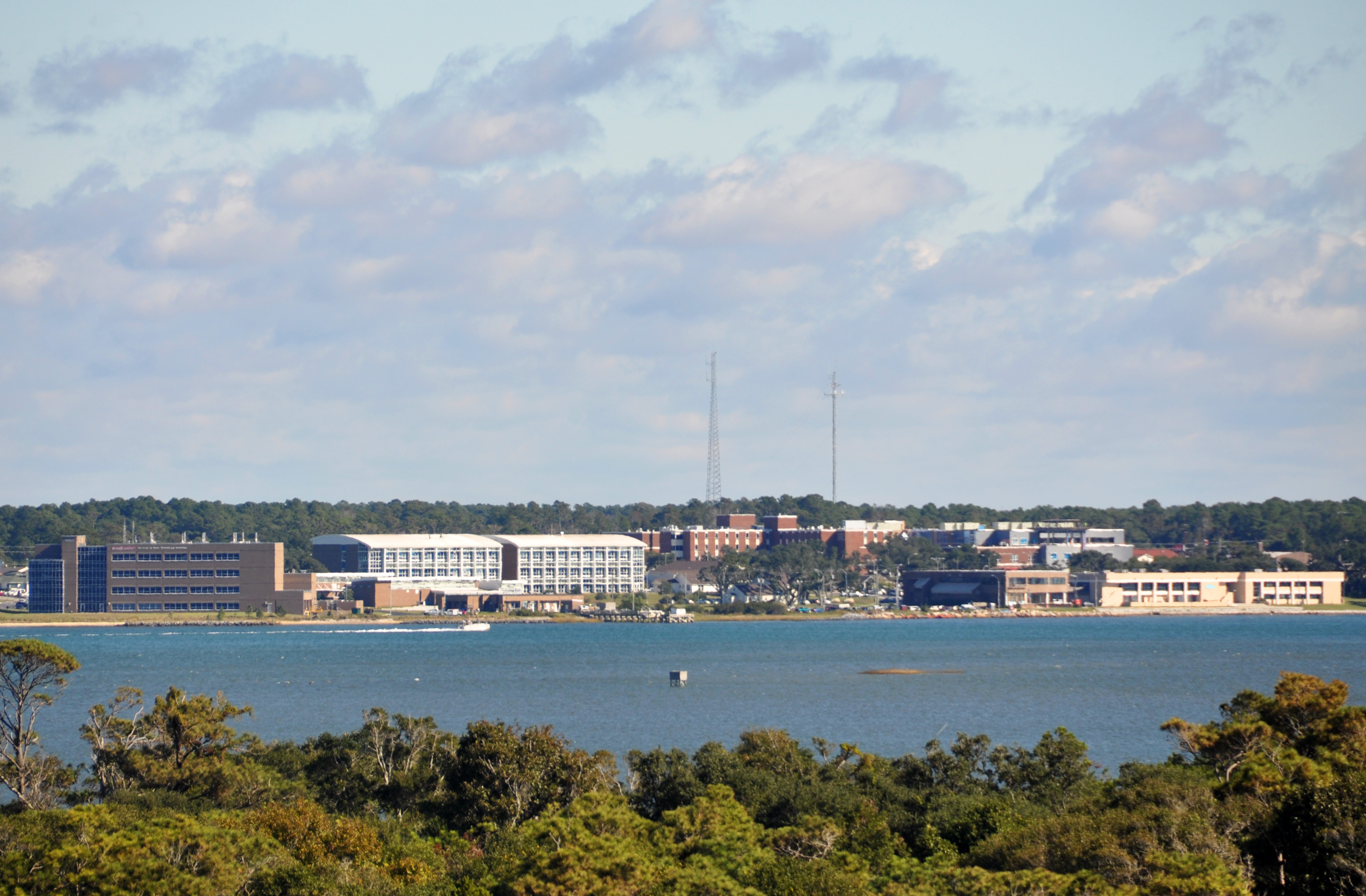
Broad Creek is an unincorporated area and census-designated place (CDP) in Carteret County, North Carolina, United States. As of the 2010 census it had a population of 2,334. It is part of the greater Newport area and currently shares the Newport zip code of 28570. Geography Broad Creek is located in west-central Carteret County, on the north shore of Bogue Sound, between the tidal inlets of Broad Creek to the west and Gales Creek to the east. Bogue Sound is separated from the Atlantic Ocean to the south by Bogue Banks, part of North Carolina's barrier islands known as the Crystal Coast. The Broad Creek community is bordered on the north by Croatan National Forest. North Carolina Highway 24 passes through the community, leading east to Morehead City and west to Cape Carteret. Newport is to the northeast up Hibbs Road. 9 Mile Road runs north from Broad Creek, providing a direct route to Havelock, to the north. Broad Creek Loop Road forms a loop through the center of the c ... [...More Info...] [...Related Items...] OR: [Wikipedia] [Google] [Baidu] |
Census-designated Place
A census-designated place (CDP) is a concentration of population defined by the United States Census Bureau for statistical purposes only. CDPs have been used in each decennial census since 1980 as the counterparts of incorporated places, such as self-governing cities, towns, and villages, for the purposes of gathering and correlating statistical data. CDPs are populated areas that generally include one officially designated but currently unincorporated community, for which the CDP is named, plus surrounding inhabited countryside of varying dimensions and, occasionally, other, smaller unincorporated communities as well. CDPs include small rural communities, edge cities, colonias located along the Mexico–United States border, and unincorporated resort and retirement communities and their environs. The boundaries of any CDP may change from decade to decade, and the Census Bureau may de-establish a CDP after a period of study, then re-establish it some decades later. Most unin ... [...More Info...] [...Related Items...] OR: [Wikipedia] [Google] [Baidu] |
Bogue Sound
Bogue Sound is a lagoon in the state of North Carolina separating the Bogue Banks, a barrier island, from the mainland. The sound is part of North Carolina's "Crystal Coast", a tourism marketing term that is also used interchangeably with the term "Southern Outer Banks." It is the southwestern most sound among the interconnected series of sounds along the Outer Banks that starts in the northeast at Currituck Sound. Nine communities, all located within Carteret County, North Carolina, are located along the shores of the sound. On Bogue Banks are the communities of (from east to west) Atlantic Beach, Pine Knoll Shores, Salter Path, Indian Beach, Emerald Isle, while on the mainland are the communities of (from east to west) Beaufort, Morehead City, Cape Carteret, and Cedar Point. Morehead City's commercial port is accessed via the Bogue Sound. [...More Info...] [...Related Items...] OR: [Wikipedia] [Google] [Baidu] |
Croatan High School
Croatan High School is a public secondary school in Newport, North Carolina. The high school is part of the Carteret County Public Schools system. It serves the westernmost third of Carteret County, including the towns of Peletier, Cape Carteret, Cedar Point and western half of the island of Bogue Banks, which includes the town of Emerald Isle. Awards and recognition In 2009 and 2010, ''U.S. News & World Report'' ranked Croatan among the top high schools in the United States, awarding the school silver medals. Croatan High School's class of 2010 marked combined SAT scores (based on math and critical reading) of 1076, up from 1064 the previous year, this was 59 points higher than the national average. Athletics All athletic teams compete in the 3A division level. Croatan holds several state titles including men’s soccer, wrestling, women's golf, and men's indoor track. *Football *Men's and Women's Soccer *Men's and Women's Golf *Men's and Women's Basketball *Men's and Women' ... [...More Info...] [...Related Items...] OR: [Wikipedia] [Google] [Baidu] |
Havelock, North Carolina
Havelock is a city in Craven County, North Carolina, Craven County, North Carolina, United States. The population was 20,735 at the 2010 census. The city is home to Marine Corps Air Station Cherry Point, the world's largest United States Marine Corps, Marine Corps Airbase, air station, and home to the 2nd Marine Aircraft Wing. Havelock is part of the New Bern Metropolitan Statistical Area. History Havelock is one of eight cities in the world named after Sir Henry Havelock, a British officer in India, who distinguished himself in 1857 during what was known as the Indian Mutiny. The area was originally named "Havelock Station" in the late 1850s, when the Atlantic and North Carolina Railroad built a railroad station, depot where its right-of-way crossed what is now Miller Boulevard. The town was the initial landing point for a American Civil War, Civil War battle known as the Battle of New Bern (1862), Battle of New Bern. On March 11, 1862, Brigadier General Ambrose Burnside's comm ... [...More Info...] [...Related Items...] OR: [Wikipedia] [Google] [Baidu] |
Cape Carteret, North Carolina
Cape Carteret is a town in Carteret County, on the southern coast of North Carolina, United States. It was incorporated in 1959http://townofcapecarteret.com/ and had a population of 2,224 as of the 2020 census. Geography Cape Carteret is located in western Carteret County at (34.694478, -77.059129). It is bordered to the north by Petrified Creek and the Croatan National Forest; to the east by Bogue, and to the west by Cedar Point. To the south is Bogue Sound, with the town of Emerald Isle on the opposite shore, connected to Cape Carteret by the B. Cameron Langston Bridge carrying North Carolina Highway 58. NC 58 leads north to U.S. Route 17 at Maysville. North Carolina Highway 24 leads east to Morehead City and west to Jacksonville. According to the United States Census Bureau, the town of Cape Carteret has a total area of , of which is land and , or 7.04%, is water. Demographics 2020 census As of the 2020 United States census, there were 2,224 people, 934 househol ... [...More Info...] [...Related Items...] OR: [Wikipedia] [Google] [Baidu] |
Morehead City, North Carolina
Morehead City is a port town in Carteret County, North Carolina, United States. The population was 8,661 at the 2010 census. Morehead City celebrated the 150th anniversary of its founding on May 5, 2007. It forms part of the Crystal Coast. History By the early 1850s, a group of investors had been formed and incorporated a land development project known as the "Shepard Point Land Company," which purchased of land on the eastern tip of the peninsula bordering the Newport River, known then as "Shepards Point," which is the present location of Morehead City. The Shepard Point Land Company's objective was to take advantage of the natural deep channel of Topsail Inlet, known today as the Beaufort Inlet, which splits Bogue Banks from Shackleford Banks and provides access to Morehead City, Beaufort, North Carolina, the Newport River and the Intracoastal Waterway. The Shepard Point Land Company was established to construct a deepwater port to allow another access point for North Carolin ... [...More Info...] [...Related Items...] OR: [Wikipedia] [Google] [Baidu] |
North Carolina Highway 24
North Carolina Highway 24 (NC 24) is the longest primary state highway in the U.S. state of North Carolina. Traveling east–west between the Charlotte metropolitan area and the Crystal Coast, connecting the cities of Charlotte, Fayetteville, Jacksonville and Morehead City. Route description Prior to the western terminus of NC 24 at Interstate 485 (I-485), the road begins as an unmarked street named W.T. Harris Boulevard at Mount Holly-Huntersville Road. The road was named for W.T. Harris, better known as one of the founders of Harris Teeter. Along the way NC 24 provides access to I-77, U.S. Route 21 (US 21), NC 115, I-85, US 29, and NC 49. At NC 27 (Albemarle Road) NC 24 makes a sharp left turn and joins that route in a concurrency, while W.T. Harris Boulevard continues further south unmarked towards US 74. NC 24 is both one of the longest and most concurrent routes in the state. Besides the approximately ... [...More Info...] [...Related Items...] OR: [Wikipedia] [Google] [Baidu] |
Croatan National Forest
The Croatan National Forest () , from the North Carolina Collection's website at the . Retrieved 2013-01-31. is a U.S. National Forest, was established on July 29, 1936, and is located on the Atlantic coast of . It is administered by the |
Crystal Coast
In North Carolina, the Crystal Coast is an 85-mile stretch of coastline that extends from the Cape Lookout National Seashore, which includes 56 miles of protected beaches, southwestward to the New River. The Crystal Coast is a popular area with tourists and second-home owners in the summer. The absolute boundaries of this coast are often disputed, but the main area includes all the major Carteret County beaches (those on Bogue Banks, which face south). It also includes eastern portions of Carteret County, such as Harkers Island, Down East and Shackleford Banks, as well as the northern Onslow County beaches (Bear Island/Hammock's Beach), and a few ports along the Intracoastal Waterway. Some tourism marketing describes the region as the Southern Outer Banks, to draw a connection to the main barrier islands of the Outer Banks. The main communities include the coastal resorts of Atlantic Beach, Emerald Isle, Indian Beach, Pine Knoll Shores and Salter Path, as well as the inl ... [...More Info...] [...Related Items...] OR: [Wikipedia] [Google] [Baidu] |
Barrier Island
Barrier islands are coastal landforms and a type of Dune, dune system that are exceptionally flat or lumpy areas of sand that form by wave and tidal action parallel to the mainland coast. They usually occur in chains, consisting of anything from a few islands to more than a dozen. They are subject to change during storms and other action, but absorb energy and protect the coastlines and create areas of protected waters where wetlands may flourish. A barrier chain may extend uninterrupted for over a hundred kilometers, excepting the tidal inlets that separate the islands, the longest and widest being Padre Island of Texas, United States. Sometimes an important inlet may close permanently, transforming an island into a peninsula, thus creating a barrier peninsula, often including a beach, barrier beach. The length and width of barriers and overall morphology of barrier coasts are related to parameters including tidal range, wave energy, Sediment transport, sediment supply, Sea leve ... [...More Info...] [...Related Items...] OR: [Wikipedia] [Google] [Baidu] |
Bogue Banks
Bogue Banks form a barrier island off the mainland of North Carolina in Carteret County. The island, separated from the mainland by Bogue Sound, runs east to west, with the ocean beaches facing due south. Bogue Banks is the only island on the Carteret County shore that has been developed with housing: numerous communities are located on the island and can be accessed by one of two bridges across Bogue Sound, either from Morehead City to Atlantic Beach, which is the more heavily traveled bridge, or from Cape Carteret to Emerald Isle. The communities of Bogue Banks are the most prominent of the Crystal Coast. NC 58 traverses a majority of the island's length. There are several hotels that dot the island, but most of the land contains private houses, some of which are rented out during the summer, or maritime forest. Stores and other commercial properties are limited to the five main communities. History During a survey titled "The Greater Beaufort Area at 1800" completed by t ... [...More Info...] [...Related Items...] OR: [Wikipedia] [Google] [Baidu] |


