|
British Columbia Highway 91
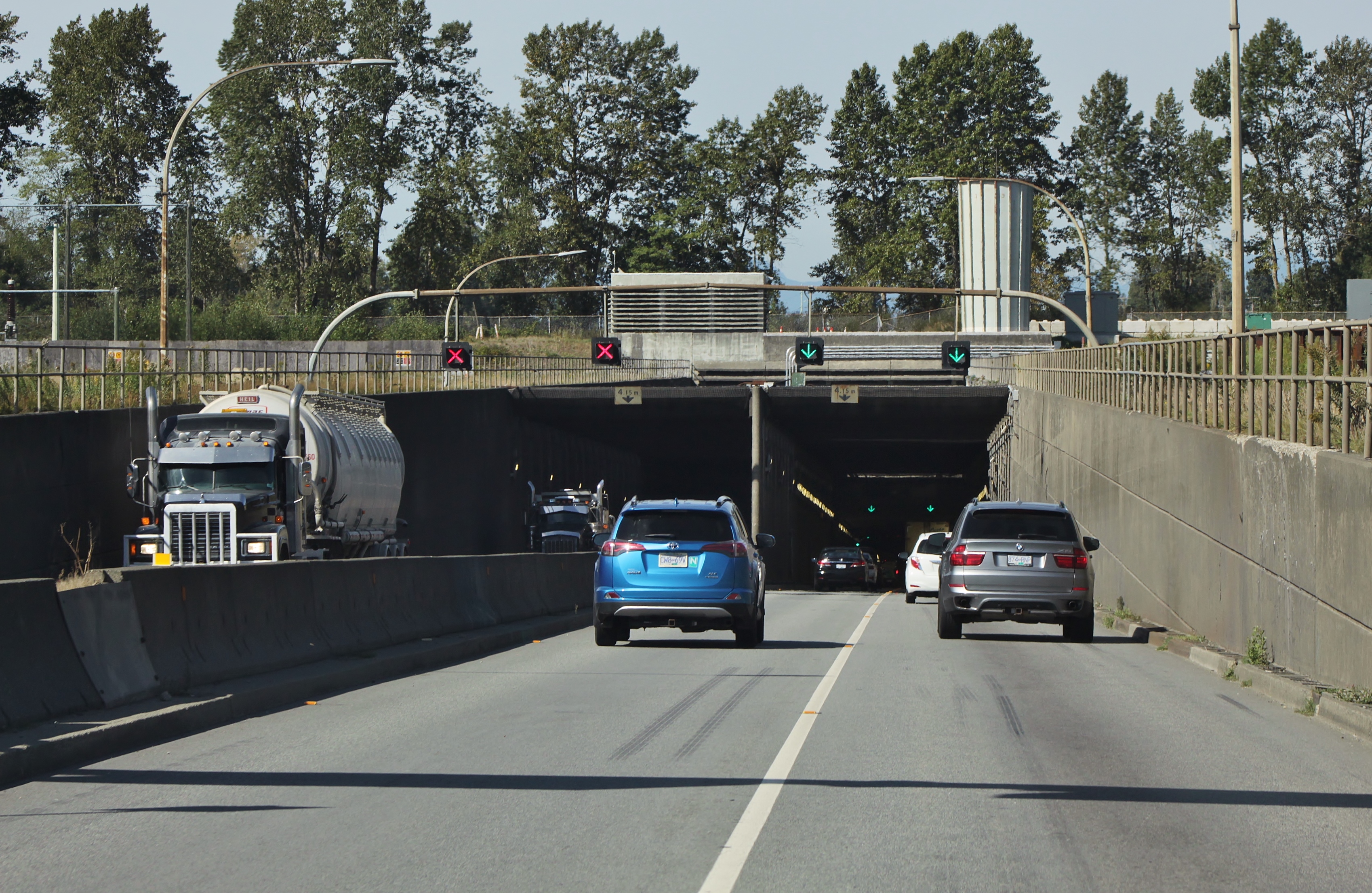
Highway 91 is an alternative freeway route to Highway 99 through Delta, New Westminster and Richmond, British Columbia. The highway was built in two sections, the first section from Delta to East Richmond in 1986, and the second section across Richmond in 1989. It was the highest numbered highway in British Columbia that is not derived from a continuation of a US highway, until the designation of Highway 118 in 2003. Route description The total distance covered by Highway 91 is 22 km (14 mi). Starting at its junction with Highway 99 in East Delta, the route travels north for 2 km (1¼ mi) to a junction with Highway 10, then north for 10 km (6 mi) through three interchanges, over the Alex Fraser Bridge onto Annacis Island, and through another interchange. Highway 91 then crosses the Annacis Channel bridge, ever so briefly passing through the very corner of New Westminster, and then enters Richmond, at which point it veers west. At the southern ... [...More Info...] [...Related Items...] OR: [Wikipedia] [Google] [Baidu] |
Delta, British Columbia
Delta is a city in the Lower Mainland region of British Columbia, Canada, as part of Greater Vancouver. Located on the Fraser Lowland south of Fraser River's south arm, it is bordered by the city of Richmond on the Lulu Island to the north, New Westminster to the northeast, Surrey to the east, the Boundary Bay and the American pene-exclave Point Roberts to the south, and the Strait of Georgia to the west. Encompassing the nearby Annacis Island, Deas Island and Westham Island, Delta is mostly rural and officially composed of three distinct communities: North Delta, Ladner and Tsawwassen. History Prior to European settlement, Delta's flatlands and coastal shores were inhabited by the Tsawwassen First Nation of the Coast Salish. The land was first sighted by Europeans in 1791, when Spanish explorer Lieutenant Francisco de Eliza mistook the area for an island and named it "Isla de Cepeda". The first European settler in Delta was James Kennedy who pre-empted 135 acres in what ... [...More Info...] [...Related Items...] OR: [Wikipedia] [Google] [Baidu] |
Barrier Transfer Machine
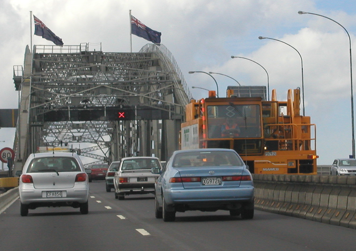
A barrier transfer machine, also known as zipper machine or road zipper, is a type heavy vehicle that is used to transfer concrete lane dividers, such as jersey barriers, which are used to relieve traffic congestion during rush hours. Many other cities use them temporarily during construction work. The lanes created by the machine are sometimes referred to as "zipper lanes". One advantage of barrier systems over other lane management treatments such as traffic cones or overhead directional lights is that a solid, positive barrier prevents vehicle collisions due to motorists crossing over into opposing traffic flow. A disadvantage is that lane widths can be slightly reduced. History The Road Zipper variant has been in existence since 1984–1985. Auckland Harbour Bridge had its original moveable barrier system installed in 1990. The Hawaii Department of Transportation debuted a zipper Lane on Oahu on August 18, 1998. The Benjamin Franklin Bridge has had a permanent barri ... [...More Info...] [...Related Items...] OR: [Wikipedia] [Google] [Baidu] |
Unsigned Highway
Road sign along Aurora_to_exit_the_freeway._The_road_at_this_exit_is_officially_designated_Sigurd_and_Aurora,_Utah">Aurora_to_exit_the_freeway._The_road_at_this_exit_is_officially_designated_Utah_State_Route_259">SR 259,_a_short_connector;_however,_the_sign_instead_shows_Utah_State_Route_24.html" "title="Utah_State_Route_259.html" ;"title="Aurora,_Utah.html" "title="Sigurd,_Utah.html" "title="Interstate 70 in Utah signaling traffic destined for the towns of Sigurd, Utah">Sigurd and Aurora, Utah">Aurora to exit the freeway. The road at this exit is officially designated Utah State Route 259">SR 259, a short connector; however, the sign instead shows Utah State Route 24">SR 24, the highway at the other end of the connector. An unsigned highway is a highway that has been assigned a route number, but does not bear road markings that would conventionally be used to identify the route with that number. Highways are left unsigned for a variety of reasons, and examples are fou ... [...More Info...] [...Related Items...] OR: [Wikipedia] [Google] [Baidu] |
BC Ferries
British Columbia Ferry Services Inc., operating as BC Ferries (BCF), is a former provincial Crown corporation, now operating as an independently managed, publicly owned Canadian company. BC Ferries provides all major passenger and vehicle ferry services for coastal and island communities in the Canadian province of British Columbia. Set up in 1960 to provide a similar service to that provided by the Black Ball Line and the Canadian Pacific Railway, which were affected by job action at the time, BC Ferries has become the largest passenger ferry line in North America, operating a fleet of 36 vessels with a total passenger and crew capacity of over 27,000, serving 47 locations on the B.C. coast. The federal and provincial governments subsidize BC Ferries to provide agreed service levels on essential links between the BC mainland, coastal islands, and parts of the mainland without road access. The inland ferries operating on British Columbia's rivers and lakes are not run by BC Fer ... [...More Info...] [...Related Items...] OR: [Wikipedia] [Google] [Baidu] |
Vancouver International Airport
Vancouver International Airport is an international airport located on Sea Island in Richmond, British Columbia, serving the city of Vancouver and the Lower Mainland region. It is located from Downtown Vancouver. It is the second busiest airport in Canada by passenger traffic (13.7 million), behind Toronto Pearson International Airport. As a trans-Pacific hub, the airport has more direct flights to China than any other airport in North America or Europe. It is a hub for Air Canada and WestJet, and an operating base for Air Transat. Vancouver International Airport is one of eight Canadian airports that have US Border Pre-clearance facilities. It is also one of the few major international airports to have a terminal for scheduled floatplanes. The airport has won several notable international best airport awards. It won the Skytrax Best North American Airport award in 2007 and 2010 through 2022, for a record of 12 consecutive years. The airport also made the top 10 list of ... [...More Info...] [...Related Items...] OR: [Wikipedia] [Google] [Baidu] |
BC-99
Highway 99 is a provincial highway in British Columbia that serves Greater Vancouver and the Squamish–Lillooet corridor over a length of . It is a major north–south artery within Vancouver and connects the city to several suburbs as well as the U.S. border, where it continues south as Interstate 5. The central section of the route, also known as the Sea to Sky Highway, serves the communities of Squamish, Whistler, and Pemberton. Highway 99 continues through Lillooet and ends at a junction with Highway 97 near Cache Creek. The highway's number, assigned in 1940, was derived from former U.S. Route 99, the predecessor to Interstate 5 and a major route for the U.S. West Coast. Highway 99 originally comprised the King George Highway in Surrey, portions of Kingsway from New Westminster to Vancouver, and local streets. It was extended across the Lions Gate Bridge and to Horseshoe Bay in the 1950s along a new highway that would later be incorporated into Highway 1 (the ... [...More Info...] [...Related Items...] OR: [Wikipedia] [Google] [Baidu] |
Vancouver
Vancouver ( ) is a major city in western Canada, located in the Lower Mainland region of British Columbia. As the List of cities in British Columbia, most populous city in the province, the 2021 Canadian census recorded 662,248 people in the city, up from 631,486 in 2016. The Greater Vancouver, Greater Vancouver area had a population of 2.6million in 2021, making it the List of census metropolitan areas and agglomerations in Canada#List, third-largest metropolitan area in Canada. Greater Vancouver, along with the Fraser Valley Regional District, Fraser Valley, comprises the Lower Mainland with a regional population of over 3 million. Vancouver has the highest population density in Canada, with over 5,700 people per square kilometre, and fourth highest in North America (after New York City, San Francisco, and Mexico City). Vancouver is one of the most Ethnic origins of people in Canada, ethnically and Languages of Canada, linguistically diverse cities in Canada: 49.3 percent of ... [...More Info...] [...Related Items...] OR: [Wikipedia] [Google] [Baidu] |
Fraser River
The Fraser River is the longest river within British Columbia, Canada, rising at Fraser Pass near Blackrock Mountain in the Rocky Mountains and flowing for , into the Strait of Georgia just south of the City of Vancouver. The river's annual discharge at its mouth is or , and it discharges 20 million tons of sediment into the ocean. Naming The river is named after Simon Fraser, who led an expedition in 1808 on behalf of the North West Company from the site of present-day Prince George almost to the mouth of the river. The river's name in the Halqemeylem (Upriver Halkomelem) language is , often seen archaically as Staulo, and has been adopted by the Halkomelem-speaking peoples of the Lower Mainland as their collective name, . The river's name in the Dakelh language is . The ''Tsilhqot'in'' name for the river, not dissimilar to the ''Dakelh'' name, is , meaning Sturgeon ''()'' River ''()''. Course The Fraser drains a area. Its source is a dripping spring at Fraser Pas ... [...More Info...] [...Related Items...] OR: [Wikipedia] [Google] [Baidu] |
Highway 91 Connector
A highway is any public or private road or other public way on land. It is used for major roads, but also includes other public roads and public tracks. In some areas of the United States, it is used as an equivalent term to controlled-access highway, or a translation for ''autobahn'', '' autoroute'', etc. According to Merriam Webster, the use of the term predates the 12th century. According to Etymonline, "high" is in the sense of "main". In North American and Australian English, major roads such as controlled-access highways or arterial roads are often state highways (Canada: provincial highways). Other roads may be designated " county highways" in the US and Ontario. These classifications refer to the level of government (state, provincial, county) that maintains the roadway. In British English, "highway" is primarily a legal term. Everyday use normally implies roads, while the legal use covers any route or path with a public right of access, including footpaths etc. T ... [...More Info...] [...Related Items...] OR: [Wikipedia] [Google] [Baidu] |
Tsawwassen Ferry Terminal
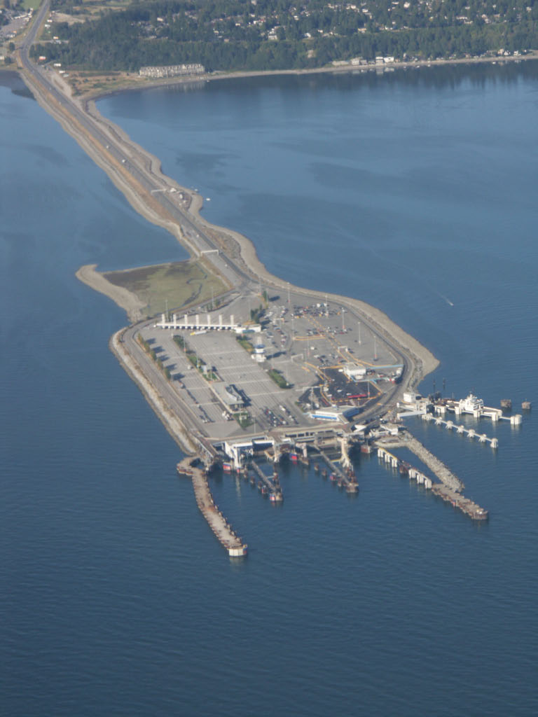
Tsawwassen Ferry Terminal, as part of the BC Ferries system and of Highway 17, is a major transportation facility in Delta, British Columbia, positioned less than from the 49th parallel along the Canada–United States border. It is located at the southwestern end of a artificial causeway that juts out into the Strait of Georgia off the mainland at the community of Tsawwassen. With an approximate size of , it is the largest ferry terminal in North America. History In the late 1950s, the search for a mainland ferry terminal that would connect British Columbia's Lower Mainland with the Victoria area on Vancouver Island involved extensive scouting of locations, from Steveston to White Rock. Despite concerns of rough seas and bad weather, the favoured site soon became the area offshore from the Tsawwassen First Nation Reserve. Construction of the terminal began in 1959, after provincial transportation Minister Phil Gaglardi, on divided engineering advice, selected the site. ... [...More Info...] [...Related Items...] OR: [Wikipedia] [Google] [Baidu] |
Langley, British Columbia (city)
The City of Langley, commonly referred to as Langley City, or just Langley, is a municipality in the Metro Vancouver Regional District in British Columbia, Canada. It lies directly east of Surrey, adjacent to the Cloverdale area, and is surrounded elsewhere by the Township of Langley, bordered by its neighbourhoods of Willowbrook to the north, Murrayville to the east, and Brookswood and Fern Ridge to the south. History Early European settlement in the area was known as "Innes Corners" (after homesteader Adam Innes); in 1911, the area became known as "Langley Prairie", part of the Township of Langley a.k.a. Langley Township since 1873. Twentieth-century improvements in transportation access, including the construction of the British Columbia Electric Railway in 1910, Fraser Highway in the 1920s, and Pattullo Bridge in 1937, profoundly impacted the area, transforming it from rural into the main urban and commercial core of the Township. In turn, this birthed the need for upg ... [...More Info...] [...Related Items...] OR: [Wikipedia] [Google] [Baidu] |


.jpg)

