|
British Columbia Highway 12
{{BritishColumbia-transport-stub ...
Highway 12, opened in 1953, is a connection from the Trans-Canada Highway at Lytton to the town of Lillooet, one of two road connections between the Thompson-Nicola and Squamish-Lillooet Regional Districts. The highway originally went all the way to a junction with Highway 97 at Lower Hat Creek, but when the Duffey Lake Road was paved in 1992, the section of Highway 12 from Lillooet to Highway 97 was renumbered 99. Highway 12 follows the east bank of the Fraser River on the western flank of the small Clear Range for 62 km (39 mi) from a junction with Highway 1 at Lytton to a junction with Highway 99 just across the river from the town of Lillooet. References 012 012 may refer to: * Tyrrell 012, a Formula One racing car * The dialing code for Pretoria Pretoria () is South Africa's administrative capital, serving as the seat of the executive branch of government, and as the host to all foreign embassie ... [...More Info...] [...Related Items...] OR: [Wikipedia] [Google] [Baidu] |
Lytton, British Columbia
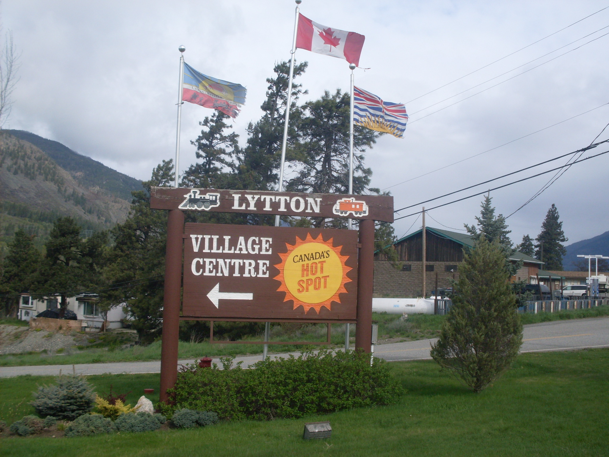
Lytton is a village of about 250 residents in southern British Columbia, Canada, on the east side of the Fraser River and primarily the south side of the Thompson River, where it flows southwesterly into the Fraser. The community includes the Village of Lytton and the surrounding community of the Lytton First Nation, whose name for the place is Camchin, also spelled ''Kumsheen'' ("river meeting"). During heat waves, Lytton is often the hottest spot in Canada despite its location north of 50th parallel north, 50°N in latitude. In three consecutive days of June 2021, it broke the all-time record for List of extreme temperatures in Canada, Canada's highest temperature, ending at on June 29. This is the highest temperature ever recorded north of 45th parallel north, 45°N and higher than the all-time records for Europe and South America. The next day (June 30), Lytton wildfire, a wildfire swept through the valley, destroying the majority of the town. The Lytton area has been ... [...More Info...] [...Related Items...] OR: [Wikipedia] [Google] [Baidu] |
Lillooet, British Columbia
Lillooet () is a district municipality in the Squamish-Lillooet Regional District, Squamish-Lillooet region of southwestern British Columbia. The town is on the west shore of the Fraser River immediately north of the Seton River mouth. On British Columbia Highway 99, BC Highway 99, the locality is by road about northeast of Pemberton, British Columbia, Pemberton, northwest of Lytton, British Columbia, Lytton, and west of Kamloops. First Nations A main population centre of the Stʼatʼimc (Lillooet Nation), who comprise just over 50 per cent of the Lillooet area residents, it is one of the southernmost communities in North America where Indigenous peoples in Canada, indigenous people form the majority. First Nations in Canada, First Nations communities assert the land is traditional territory, having been continuously inhabited for thousands of years. The confluence of several main streams with the Fraser attracted large seasonal and permanent indigenous populations. Situated in ... [...More Info...] [...Related Items...] OR: [Wikipedia] [Google] [Baidu] |
Trans-Canada Highway
The Trans-Canada Highway ( French: ; abbreviated as the TCH or T-Can) is a transcontinental federal–provincial highway system that travels through all ten provinces of Canada, from the Pacific Ocean on the west coast to the Atlantic Ocean on the east coast. The main route spans across the country, one of the longest routes of its type in the world. The highway system is recognizable by its distinctive white-on-green maple leaf route markers, although there are small variations in the markers in some provinces. While by definition the Trans-Canada Highway is a highway ''system'' that has several parallel routes throughout most of the country, the term "Trans-Canada Highway" often refers to the main route that consists of Highway 1 (British Columbia, Alberta, Saskatchewan, and Manitoba), Highways 17 and 417 (Ontario), Autoroutes 40, 20 and 85 (Quebec), Highway 2 (New Brunswick), Highways 104 and 105 (Nova Scotia) and Highway 1 (Newfoundland). This ma ... [...More Info...] [...Related Items...] OR: [Wikipedia] [Google] [Baidu] |
Thompson-Nicola Regional District, British Columbia
The Thompson–Nicola Regional District is a regional district in the Canadian province of British Columbia. The Canada 2021 Census population was 143,680 and the area covers 44,449.49 square kilometres. The administrative offices are in the main population centre of Kamloops, which accounts for 78 percent of the regional district's population. The only other city is Merritt; other municipally-incorporated communities include the District Municipalities of Logan Lake, Barriere and Clearwater and the Villages of Chase, Ashcroft, Cache Creek, Clinton and Lytton, and also the Mountain Resort Municipality of Sun Peaks. The region is named indirectly for the Thompson River by way of the traditional regional names of "the Thompson Country" and "the Nicola Country"; the Nicola Country was named for Chief Nicola and was originally "Nicola's Country", where he held sway; he is also the namesake of that river. The regional district government operates over 15 services including l ... [...More Info...] [...Related Items...] OR: [Wikipedia] [Google] [Baidu] |
Squamish-Lillooet Regional District, British Columbia
The Squamish-Lillooet Regional District is a quasi-municipal administrative area in British Columbia, Canada. It stretches from Britannia Beach in the south to Pavilion in the north. Lillooet, Pemberton, Whistler and Squamish are the four municipalities in the regional district. Its administrative offices are in the Village of Pemberton, although the district municipalities of Squamish and Whistler are larger population centres. The district covers 16,353.68 km² (6,314.19 sq mi) of land area. The southern end of the regional district comprises the northern part of the traditional territory of the Squamish people, and the northern half constitutes the traditional homeland of the St'at'imc people. Demographics As a census division in the 2021 Census of Population conducted by Statistics Canada, the Squamish-Lillooet Regional District had a population of living in of its total private dwellings, a change of from its 2016 population of . With a land area of , ... [...More Info...] [...Related Items...] OR: [Wikipedia] [Google] [Baidu] |
British Columbia Highway 97
Highway 97 is a major highway in the Canadian province of British Columbia. It is the longest continuously numbered route in the province, running and is the only route that runs the entire north–south length of the British Columbia, connecting the Canada–United States border near Osoyoos in the south to the British Columbia–Yukon boundary in the north at Watson Lake, Yukon. The highway connects several major cities in BC Interior, including Kelowna, Kamloops, Prince George, and Dawson Creek. Within and near these cities, Highway 97 varies from a two-lane highway to a freeway with as many as six lanes. Some remote sections also remain unpaved and gravelled. The route takes its number from U.S. Route 97, with which it connects at the international border. The highway was initially designated '97' in 1953. Route description The busiest section of Highway 97 is in West Kelowna, carrying almost 70,000 vehicles per day. Some sections in the northern regions of the provin ... [...More Info...] [...Related Items...] OR: [Wikipedia] [Google] [Baidu] |
British Columbia Highway 99
Highway 99 is a provincial highway in British Columbia that serves Greater Vancouver and the Squamish–Lillooet corridor over a length of . It is a major north–south artery within Vancouver and connects the city to several suburbs as well as the U.S. border, where it continues south as Interstate 5. The central section of the route, also known as the Sea to Sky Highway, serves the communities of Squamish, Whistler, and Pemberton. Highway 99 continues through Lillooet and ends at a junction with Highway 97 near Cache Creek. The highway's number, assigned in 1940, was derived from former U.S. Route 99, the predecessor to Interstate 5 and a major route for the U.S. West Coast. Highway 99 originally comprised the King George Highway in Surrey, portions of Kingsway from New Westminster to Vancouver, and local streets. It was extended across the Lions Gate Bridge and to Horseshoe Bay in the 1950s along a new highway that would later be incorporated into Highway 1 (the ... [...More Info...] [...Related Items...] OR: [Wikipedia] [Google] [Baidu] |
Clear Range
The Clear Range is a small mountain range located in the angle of the Fraser and Thompson Rivers in south-central British Columbia. It has a small subdivision just northeast of that confluence named the Scarped Range. The Clear Range totals 16,270 km² (6,280 mi²) and is 75 km (47 mi) north to south and 35 km (22 mi) east to west (at its widest point). The Clear Range and its northward neighbour the Marble Range are both subranges of the Pavilion Range. It and the neighbouring Marble Range line the east bank of the Fraser River north of the town of Lytton, British Columbia. The Clear Range extends as far as the town of Pavilion, British Columbia, Pavilion and is bounded by the south wall of Marble Canyon (British Columbia), Marble Canyon on the north. The southeast flank of the Clear Range is the Thompson River between Ashcroft, British Columbia, Ashcroft and Lytton, British Columbia, Lytton, while to its northeast are the Cornwall Hills, Cornwall ... [...More Info...] [...Related Items...] OR: [Wikipedia] [Google] [Baidu] |
British Columbia Highway 1
Highway 1 is a Provincial highways in British Columbia, provincial highway in British Columbia, Canada, that carries the main route of the Trans-Canada Highway (TCH). The highway is long and connects Vancouver Island, the Greater Vancouver region in the Lower Mainland, and the British Columbia Interior, Interior. It is the westernmost portion of the main TCH to be numbered "Highway 1", which continues through Western Canada and extends to the Manitoba–Ontario boundary. The section of Highway 1 in the Lower Mainland is the second-busiest freeway in Canada, after Ontario Highway 401 in Toronto. The highway's western terminus is in the provincial capital of Victoria, British Columbia, Victoria, where it serves as a city street and freeway in the suburbs. Highway 1 travels north to Nanaimo, British Columbia, Nanaimo and reaches the Lower Mainland at Horseshoe Bay, British Columbia, Horseshoe Bay via a BC Ferries route across the Strait of Georgia. The highway bypasses Vancouver on ... [...More Info...] [...Related Items...] OR: [Wikipedia] [Google] [Baidu] |


