|
Bridgerule
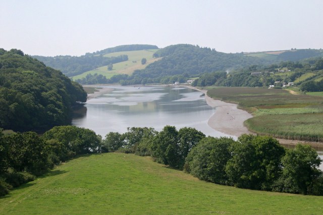
Bridgerule ( kw, Ponsrowald) is a village and civil parish in Devon, England, a mile from the border with Cornwall. The parish is divided by the River Tamar, which no longer forms the border between Devon and Cornwall there. The river often floods the High Street. An electoral ward exists in the area titled Tamarside. The population at the 2011 census was 1,734 History Bridgerule was mentioned (as ''Brige'') in the Domesday Book in 1086, when the local manor was held by a Norman, Ruald Adobed. The name is thought to come from ''bridge'' and Ruald. Until 1844 the Tamar formed the border between Devon and Cornwall, and the western part of the parish was in Cornwall. West Bridgerule was transferred to Devon by the Counties (Detached Parts) Act 1844. When civil parishes were created in 1866, East Bridgerule and West Bridgerule became separate parishes, but the two were re-united in 1950. Whitstone and Bridgerule railway station on the line from Okehampton to Bude served the vil ... [...More Info...] [...Related Items...] OR: [Wikipedia] [Google] [Baidu] |
Whitstone And Bridgerule Railway Station
Whitstone and Bridgerule was a railway station on the Bude Branch that closed in 1966. The station was opened in 1898 by the London and South Western Railway (LSWR) when the line was extended from Holsworthy station to the new terminus of the line at Bude. The station had been proposed for closure in the Beeching Report. The station sat inconveniently between the settlements of Bridgerule in Devon and Whitstone in Cornwall. History The LSWR's branch line from Okehampton to Bude took nineteen years and four Acts of Parliament. The original line had been authorised as far as Holsworthy where a station was opened on 20 January 1879. The Holsworthy and Bude Railway Act (c.ccii) was passed on 20 August 1883. However no works were commenced on the extension and the deadline for completion of the line by October 1891 was looking unlikely to be met. Since by the end of 1891 no progress had been made, a further bill was promoted seeking the abandonment of the line; the Act, the Hols ... [...More Info...] [...Related Items...] OR: [Wikipedia] [Google] [Baidu] |
Counties (Detached Parts) Act 1844
The Counties (Detached Parts) Act 1844 (7 & 8 Vict. c. 61), which came into effect on 20 October 1844, was an Act of Parliament of the United Kingdom which eliminated many outliers or exclaves of counties in England and Wales for civil purposes. The changes were based on recommendations by a boundary commission, headed by the surveyor Thomas Drummond and summarized in a schedule attached to the Parliamentary Boundaries Act 1832. This also listed a few examples of civil parishes divided by county boundaries, most of which were dealt with by later legislation. Antecedents Inclosure Acts The areas involved had already been reorganised for some purposes. This was a process which began with the Inclosure Acts of the later 18th century. A parish on a county boundary which used the open-field system could have its field strips distributed among the two counties in a very complicated way. Enclosure could rationalise the boundary in the process of re-distributing land to the various lan ... [...More Info...] [...Related Items...] OR: [Wikipedia] [Google] [Baidu] |
River Tamar
The Tamar (; kw, Dowr Tamar) is a river in south west England, that forms most of the border between Devon (to the east) and Cornwall (to the west). A part of the Tamar Valley is a World Heritage Site due to its historic mining activities. The Tamar's source is less than from the north Cornish coast, but it flows southward and its course runs across the peninsula to the south coast. The total length of the river is . At its mouth, the Tamar flows into the Hamoaze before entering Plymouth Sound, a bay of the English Channel. Tributaries of the river include the rivers Inny, Ottery, Kensey and Lynher (or ''St Germans River'') on the Cornish side, and the Deer and Tavy on the Devon side. The name Tamar (or Tamare) was mentioned by Ptolemy in the second century in his ''Geography''. The name is said to mean "great water."Furneaux, Robert. The Tamar: A Great Little River. Ex Libris Press. 1992. Foot, Sarah. ''The River Tamar''. Bossiney Books. 1989.Neale, John. Discovering ... [...More Info...] [...Related Items...] OR: [Wikipedia] [Google] [Baidu] |
Bude Railway Station
Bude railway station was the western terminus of the Bude Branch. It was opened in 1898 by the London and South Western Railway (LSWR) to serve the coastal town of Bude and closed in 1966 after having been proposed for closure in the Beeching Report. History The opening of Bude station in 1898 marked the completion of the LSWR's branch line from Okehampton which had taken nineteen years and four Acts of Parliament. The original line had been authorised as far as Holsworthy where a station was opened on 20 January 1879. From there, the LSWR operated a "smart coach service" to Stratton and Bude. When the railway company showed no sign of wishing to extend services westwards towards the coast, the residents of Stratton and Bude, anxious for a connection to the expanding railway network, clubbed together in 1883 to raise £1,000 towards the cost of promoting a bill for a extension to the railway line which would follow a route taking in the two towns as well as the small villag ... [...More Info...] [...Related Items...] OR: [Wikipedia] [Google] [Baidu] |
Emmeline Maria Kingdon
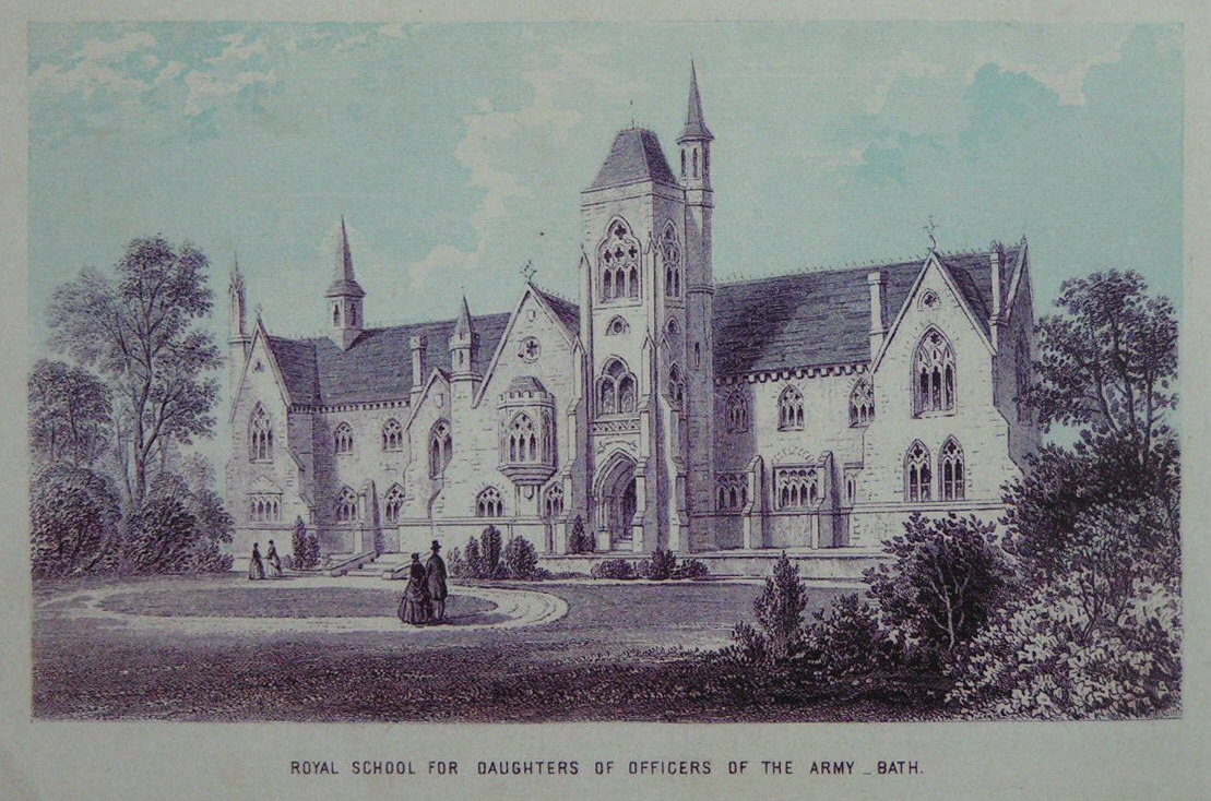
Emmeline Maria Kingdon (1817 – 25 March 1890) was an English headmistress of the Royal School for Daughters of Officers of the Army in Bath. Life Kingdon was born in Bridgerule (probably) in 1817. Her parents were Caroline (born Nicholson) and Reverend Thomas Hockin Kingdon. Her father was a vicar and she had two brothers who followed him into that profession taking over "his" parishes at Bridgerule and Pyworthy. The third and last brother became a barrister. Kingdon became her father's de facto housekeeper and she took an interest in her village school. Her father died in 1853 and at some point she travelled (and met Florence Nightingale). In 1864 the Royal School for Daughters of Officers of the Army was founded by philanthropist Alfred Douglas Hamilton. Funding came in part from Queen Victoria who was a patron. The school's mission was to provide practical and religious education for the daughters of army officers who might otherwise be unable to afford it. The school recei ... [...More Info...] [...Related Items...] OR: [Wikipedia] [Google] [Baidu] |
Torridge District
Torridge is a local government district in north Devon, England. Its council is based in Bideford. Other towns and villages in the district include Holsworthy, Great Torrington, Hartland, and Westward Ho!. The island of Lundy is administratively part of the district. To the south of the district bordering Cornwall, near Welcombe, the rugged coastline has a wild untouched beauty, due to its inaccessibility, but the South West Coast Path is well defined. The district is named after the River Torridge. Governance The district was formed on 1 April 1974, under the Local Government Act 1972, by the merger of the boroughs of Bideford and Great Torrington, the Northam urban district, Bideford Rural District, Holsworthy Rural District and Torrington Rural District. Torridge District Council is elected every four years, with currently 36 councillors being elected at each election. In 2007, Torridge registered the high number of opposed candidates in the country, with seven. Ind ... [...More Info...] [...Related Items...] OR: [Wikipedia] [Google] [Baidu] |
Villages In Devon
A village is a clustered human settlement or community, larger than a hamlet but smaller than a town (although the word is often used to describe both hamlets and smaller towns), with a population typically ranging from a few hundred to a few thousand. Though villages are often located in rural areas, the term urban village is also applied to certain urban neighborhoods. Villages are normally permanent, with fixed dwellings; however, transient villages can occur. Further, the dwellings of a village are fairly close to one another, not scattered broadly over the landscape, as a dispersed settlement. In the past, villages were a usual form of community for societies that practice subsistence agriculture, and also for some non-agricultural societies. In Great Britain, a hamlet earned the right to be called a village when it built a church. [...More Info...] [...Related Items...] OR: [Wikipedia] [Google] [Baidu] |
Anglo-Saxons
The Anglo-Saxons were a Cultural identity, cultural group who inhabited England in the Early Middle Ages. They traced their origins to settlers who came to Britain from mainland Europe in the 5th century. However, the ethnogenesis of the Anglo-Saxons happened within Britain, and the identity was not merely imported. Anglo-Saxon identity arose from interaction between incoming groups from several Germanic peoples, Germanic tribes, both amongst themselves, and with Celtic Britons, indigenous Britons. Many of the natives, over time, adopted Anglo-Saxon culture and language and were assimilated. The Anglo-Saxons established the concept, and the Kingdom of England, Kingdom, of England, and though the modern English language owes somewhat less than 26% of its words to their language, this includes the vast majority of words used in everyday speech. Historically, the Anglo-Saxon period denotes the period in Britain between about 450 and 1066, after Anglo-Saxon settlement of Britain, th ... [...More Info...] [...Related Items...] OR: [Wikipedia] [Google] [Baidu] |
Baptismal Font
A baptismal font is an article of church furniture used for baptism. Aspersion and affusion fonts The fonts of many Christian denominations are for baptisms using a non-immersive method, such as aspersion (sprinkling) or affusion (pouring). The simplest of these fonts has a pedestal (about tall) with a holder for a basin of water. The materials vary greatly consisting of carved and sculpted marble, wood, or metal. The shape can vary. Many are eight-sided as a reminder of the new creation and as a connection to the practice of circumcision, which traditionally occurs on the eighth day. Some are three-sided as a reminder of the Holy Trinity: Father, Son, and Holy Spirit. Fonts are often placed at or near the entrance to a church's nave to remind believers of their baptism as they enter the church to pray, since the rite of baptism served as their initiation into the Church. In many churches of the Middle Ages and Renaissance there was a special chapel or even a separate build ... [...More Info...] [...Related Items...] OR: [Wikipedia] [Google] [Baidu] |
Brigit Of Kildare
Saint Brigid of Kildare or Brigid of Ireland ( ga, Naomh Bríd; la, Brigida; 525) is the patroness saint (or 'mother saint') of Ireland, and one of its three national saints along with Patrick and Columba. According to medieval Irish hagiographies, she was an abbess who founded several convents of nuns, most notably that of Kildare, which was one of the most important in Ireland. There are few historical facts about her, and early hagiographies are mainly anecdotes and miracle tales, some of which are rooted in pagan folklore.Farmer, David. ''The Oxford Dictionary of Saints'' (Fifth Edition, Revised). Oxford University Press, 2011. p.66 She is patroness of many things, including poetry, learning, healing, protection, blacksmithing, livestock and dairy production. The saint shares her name with a Celtic goddess. Brigid's feast day is 1 February, which was originally a pre-Christian festival called Imbolc, marking the beginning of spring. From 2023 it will be a public holiday i ... [...More Info...] [...Related Items...] OR: [Wikipedia] [Google] [Baidu] |
Bridestowe
Bridestowe () is a civil parish and village in the district of West Devon, Devon, England. The parish is surrounded clockwise from the north by the parishes of Bratton Clovelly, Sourton, Bridestowe and Sourton Common, Lydford, Lewtrenchard and Thrushelton. The village is 6 miles south-west of Okehampton on the edge of Dartmoor and on the A30 main road. It has a primary school, pre-school, village stores and post office, a number of public houses and accommodation providers, Methodist chapel and village hall. Landmarks The parish church, St Bridget's Church, is mostly 13th and 15th century, with a west tower and some fragments of Norman work. It is dedicated to the Irish Saint Bride or Bridget, who is depicted in one of the stained glass windows, and from whom the place-name is derived. The church's distinctive gateway is described in White's Directories as "a fine Norman arch". The village contains the Georgian mansion Millaton House, the childhood home of Lord Carrington ... [...More Info...] [...Related Items...] OR: [Wikipedia] [Google] [Baidu] |
Okehampton To Bude Line
Okehampton ( ) is a town and civil parish in West Devon in the English county of Devon. It is situated at the northern edge of Dartmoor, and had a population of 5,922 at the 2011 census. Two electoral wards are based in the town (east and west). Their joint population at the same census was 7,500. Okehampton is 21 miles (33 km) west of Exeter, 26 miles (42 km) north of Plymouth and 24 miles (38 km) south of Barnstaple. History Okehampton was founded by the Saxons. The earliest written record of the settlement is from 980 AD as , meaning settlement by the Ockment, a river which runs through the town. It was recorded as a place for slaves to be freed at cross roads. Like many towns in the West Country, Okehampton grew on the medieval wool trade. Notable buildings in the town include the 15th century chapel of St. James and Okehampton Castle, which was established by the Norman Sheriff of Devon, Baldwin FitzGilbert (d.1090), and the 17th century Okehampton Town ... [...More Info...] [...Related Items...] OR: [Wikipedia] [Google] [Baidu] |


