|
Bridesburg
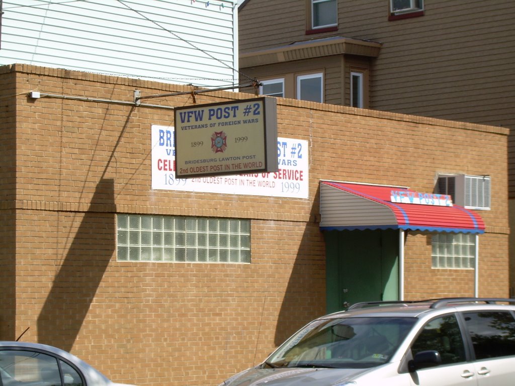
Bridesburg is the northernmost neighborhood in the River Wards, Philadelphia, River Wards section of Philadelphia, Pennsylvania, United States. Bridesburg is an historically German and Irish community, with a significant community of Poles, Polish immigrants who arrived mostly in the early- to mid-twentieth century. The community is home to two Catholic churches: All Saints Church, designed by Edwin Forrest Durang, built in 1889; and St. John Cantius Roman Catholic Church, Philadelphia, Saint John Cantius Church, built some time after 1892 in Polish Cathedral style. Boundaries The historic boundaries of the former borough of Bridesburg were the original course of Frankford Creek around the south and west, the Delaware River to the southeast, and Port Richmond, Philadelphia, Pennsylvania, Port Richmond to the southwest, along a border at Pike Street near Wheatsheaf Lane. Torresdale Avenue is the border to the western edge of the neighborhood that borders frankford, Philadelphia, Penn ... [...More Info...] [...Related Items...] OR: [Wikipedia] [Google] [Baidu] |
Betsy Ross Bridge
The Betsy Ross Bridge, also known as the Ross Memorial Bridge, is a continuous steel truss bridge spanning the Delaware River from Philadelphia, Pennsylvania to Pennsauken, New Jersey. It was built from 1969 to 1974, and opened in April 1976, during the American Bicentennial Year. It was originally planned to be named as the "Delair Bridge", after a paralleling vertical lift bridge owned by Pennsylvania Railroad (which is now used by Conrail and New Jersey Transit's Atlantic City Line), but was instead later named for Betsy Ross, a Philadelphia seamstress and reputed creator of the first American flag in 1776, making it the first automotive bridge named for a woman in America and the second bridge overall (after Iowa's Boone High Bridge was renamed the Kate Shelley High Bridge in 1912). Betsy Ross Bridge is located adjacent to the mouth of Frankford Creek. During construction, thousands of headstones from historic Monument Cemetery were used as riprap on the embankments built ... [...More Info...] [...Related Items...] OR: [Wikipedia] [Google] [Baidu] |
Frankford Creek
Frankford Creek is a minor tributary of the Delaware River in southeast Pennsylvania. It derived its name from the nearby town of Frankford, Philadelphia County. The stream originates as Tookany Creek at Hill Crest in Cheltenham Township and meanders eastward, then southeastward, throughout Cheltenham Township, until a sharp bend near the Philadelphia border at Lawncrest, where the place names Toxony and Tookany were used in historic times; the stream is still known as Tookany Creek in this region, where it flows southwest. Turning south into Philadelphia at the crotch of Philadelphia's V-shaped border, the creek is called Tacony Creek; from here southward, it is considered the informal boundary separating Northeast Philadelphia from the rest of the city. The Philadelphia neighborhoods of Olney and Feltonville lie on the western side of the stream in this area while Northwood, Lawncrest, Summerdale, and Frankford lie on the eastern side. It continues to be called the Tacony at ... [...More Info...] [...Related Items...] OR: [Wikipedia] [Google] [Baidu] |
River Wards, Philadelphia
The River Wards is a section of Philadelphia, Pennsylvania, United States located along the Delaware River to the northeast of Center City Philadelphia. 'River Wards' is the commonly used name for an area including several neighborhoods, such as Fishtown, Kensington, Port Richmond and Olde Richmond.https://www.dvrpc.org/mapping/maps/pdf/Philadelphia_Planning_Districts.pdf The River Wards are located at the border of North Philadelphia and Northeast Philadelphia, and may be considered part of one or the other, or as a separate entity. The area is sometimes also known as 'Kensington-Richmond'. The area is defined by its industrial past, having suffered the effects of deindustrialization in the 20th century. Today, the River Wards are known both for gentrification, which has brought an arts, culture, and dining scene to the area (particularly in Fishtown), and for disinvestment, with outer Kensington hosting an infamous open-air drug market. Included neighborhoods * Fishtown * ... [...More Info...] [...Related Items...] OR: [Wikipedia] [Google] [Baidu] |
Whitehall Borough, Pennsylvania
Whitehall Borough is a defunct borough that was located in Philadelphia County, Pennsylvania. The borough ceased to exist when it was incorporated into the City of Philadelphia on the passage of the Act of Consolidation, 1854. History The area takes its name from White Hall, a grand mansion built there by Jesse Waln.''The Bristol Pike'', by Samuel Fitch Hotchkin, published by George W. Jacobs, 1893 When it was incorporated into a borough on April 9, 1849, it covered what today is called East Frankford, between the Little Tacony (or Tackawanna) and Frankford Creeks, including Frankford and Bridesburg Stations on the former Pennsylvania Railroad, Whitehall Commons, and the Frankford Arsenal The Frankford Arsenal is a former United States Army ammunition plant located adjacent to the Bridesburg neighborhood of Northeast Philadelphia, Pennsylvania, north of the original course of Frankford Creek. History Opened in 1816 on of land pu .... It lay northwest of Bridesburg Borough, a ... [...More Info...] [...Related Items...] OR: [Wikipedia] [Google] [Baidu] |
Wissinoming, Philadelphia, Pennsylvania
Wissinoming is a neighborhood in the Near Northeast section of Philadelphia. It was the site of locomotive builder Matthias Baldwin's estate "Wissinoming", which was located near Tacony and Van Kirk Streets. The current Wissinoming is bordered by Mayfair and Tacony on the north, Bridesburg on the south, I-95 and the Delaware River on the east, and Frankford on the west. Wissinoming has two zipcodes 19135 and 19124. Physical boundaries are: The south side of Robbins Street on the north, Cheltenham Avenue on the south, I-95 and the Delaware River on the east, and the east side of Frankford Avenue on the west. Its borders with Frankford and Bridesburg are often disputed, with some pushing the southern boundary further to either Sanger Street or Bridge Street. In addition, its northern border with Tacony is often disputed, with some claiming the border to be as far north as Magee Avenue to as far south as Devereaux Avenue. Schools Wissinoming has three public elementary schools: ... [...More Info...] [...Related Items...] OR: [Wikipedia] [Google] [Baidu] |
Frankford, Philadelphia, Pennsylvania
Frankford is a neighborhood in the Northeast section of Philadelphia situated about six miles (10 km) northeast of Center City. Although its borders are vaguely defined, the neighborhood is bounded roughly by the original course of Frankford Creek on the south to Castor Avenue on the southwest, to Cheltenham Avenue on the north and to the Torresdale Avenue on the east. Adjacent neighborhoods are Bridesburg, Kensington, Juniata, Oxford Circle, Summerdale, and Wissinoming. Historically, Frankford had an unofficial division separating Frankford (proper) from East Frankford encompassing the area east of Frankford Avenue. The division divided the community first along racial lines, with African Americans on the east of Frankford Avenue and Caucasians to the west. As the community has become less homogeneous, the division is more of a vestige of the past. In 2005, the 19124 ZIP code, which roughly contains Frankford and Juniata, had a median home sale price of $81,075, an ... [...More Info...] [...Related Items...] OR: [Wikipedia] [Google] [Baidu] |
Edwin Forrest Durang
Edwin Forrest Durang (April 17, 1829June 7, 1911) was an American architect. He kept offices in Philadelphia and specialized in ecclesiastical and theatrical design. Life and career Durang was born in New York City, into a distinguished theatrical family. His grandfather, John Durang (1768–1822), has been credited with being the first native-born American actor, and his parents, Charles Durang (1791–1870) and Mary White Durang (b. London, England, 1802), were also well known for their contributions to the stage. His father and uncle, Richard Ferdinand Durang, were the first to perform "The Star-Spangled Banner", and his father also worked as the director and prompter at both the Chestnut Street Theater and the American Theater in Philadelphia. After his retirement in 1853, Charles Durang taught dancing and wrote several books on dance and a history of the Philadelphia stage. In addition to her stage work, Edwin Durang's mother wrote six children's books. Durang was named for ... [...More Info...] [...Related Items...] OR: [Wikipedia] [Google] [Baidu] |
Act Of Consolidation, 1854
The Act of Consolidation, more formally known as the act of February 2, 1854 (P.L. 21, No. 16), is legislation of the Pennsylvania General Assembly that created the consolidated City and County of Philadelphia, expanding the city's territory to the entirety of Philadelphia County and dissolving the other municipal authorities in the county. The law was enacted by the General Assembly and approved February 2, 1854, by Governor William Bigler. This act consolidated all remaining townships, districts, and boroughs within the County of Philadelphia, dissolving their governmental structures and bringing all municipal authority within the county under the auspices of the Philadelphia government. Additionally, any unincorporated areas were included in the consolidation. The consolidation was drafted to help combat lawlessness that the many local governments could not handle separately and to bring in much-needed tax revenue for the State. Background and reasons In early 1854, the ... [...More Info...] [...Related Items...] OR: [Wikipedia] [Google] [Baidu] |
Port Richmond, Philadelphia, Pennsylvania
Port Richmond is a neighborhood in the River Wards section of Philadelphia, Pennsylvania. It is notable for its extremely large Polish immigrant and Polish American community. The neighborhood is also home to a large Irish American community and sizable German and Italian communities as represented in the various churches and organizations. In more recent years, a sizable Albanian community has moved in. The Richmond Zip Code is 19134 and 19125. The neighborhood is bounded by the Castor Avenue to the northeast, Somerset Street to the southwest, the Delaware River to the southeast, and Trenton Avenue/the railroad to the northwest. While there is some dispute about the western boundary of the neighborhood, some people stating either Aramingo Avenue or Frankford Avenue, general consensus among residents on either side of Trenton Avenue or the railroad is that those east of it claim Port Richmond and those west of it claim Kensington. While some have referred to Port Richmond as Richm ... [...More Info...] [...Related Items...] OR: [Wikipedia] [Google] [Baidu] |
Philadelphia County, Pennsylvania
Philadelphia County is a county in the Commonwealth of Pennsylvania. It is the most populous county in Pennsylvania. As of the 2020 census, Philadelphia County had a population of 1,603,797. The county is the second smallest county in Pennsylvania by land area, after Montour County. Philadelphia County is one of the three original counties, along with Chester and Bucks counties, created by William Penn in November 1682. Since 1854, the county has been coextensive with the City of Philadelphia which is also its county seat. Philadelphia County is the core county in the Philadelphia- Camden- Wilmington Combined Statistical Area (PA- NJ- DE- MD, also known as the Delaware Valley), located along the lower Delaware and Schuylkill Rivers, within the Northeast megalopolis. Philadelphia County is the economic and cultural anchor of the Delaware Valley, the eighth-largest combined statistical area in the United States with an estimated population of 6.096 million as of 2020. H ... [...More Info...] [...Related Items...] OR: [Wikipedia] [Google] [Baidu] |
Joseph Kirkbride
Joseph is a common male given name, derived from the Hebrew Yosef (יוֹסֵף). "Joseph" is used, along with "Josef", mostly in English, French and partially German languages. This spelling is also found as a variant in the languages of the modern-day Nordic countries. In Portuguese and Spanish, the name is "José". In Arabic, including in the Quran, the name is spelled ''Yūsuf''. In Persian, the name is "Yousef". The name has enjoyed significant popularity in its many forms in numerous countries, and ''Joseph'' was one of the two names, along with ''Robert'', to have remained in the top 10 boys' names list in the US from 1925 to 1972. It is especially common in contemporary Israel, as either "Yossi" or "Yossef", and in Italy, where the name "Giuseppe" was the most common male name in the 20th century. In the first century CE, Joseph was the second most popular male name for Palestine Jews. In the Book of Genesis Joseph is Jacob's eleventh son and Rachel's first son, and kn ... [...More Info...] [...Related Items...] OR: [Wikipedia] [Google] [Baidu] |


.jpg)


