|
Brickaville
Brickaville is a town and commune in Atsinanana Region, Madagascar. Also known as Ampasimanolotra, Brickaville is located along Route nationale 2 (RN 2), 105 km south of Toamasina (the primary seaport of the country) and 220 km east of Antananarivo Antananarivo ( French: ''Tananarive'', ), also known by its colonial shorthand form Tana, is the capital and largest city of Madagascar. The administrative area of the city, known as Antananarivo-Renivohitra ("Antananarivo-Mother Hill" or "An ... (the capital). It is also situated alongside the Rianila river. It is a railway station on the Antananarivo - East Coast line. Its only industry is a sugar refinery plant. It had stopped its production for 13 years but took up operations in 2020. References Populated places in Atsinanana {{Atsinanana-geo-stub ... [...More Info...] [...Related Items...] OR: [Wikipedia] [Google] [Baidu] |
Brickaville District
Brickaville District is an administrative district in Atsinanana Region, Madagascar; also known as Ampasimanolotra and Vohibinany. Brickaville is located along Route nationale 2 (RN 2), 105 km south of Toamasina (the primary seaport of the country) and 220 km east of Antananarivo (the capital). It is also situated alongside the Rianila river. It is a railway station on the Antananarivo - East Coast line. Its main industries revolve around sugar.Lonely Planet Madagascar & Comoros p. 197 (2008) Communes The district is further divided into 17 communes; which are further sub-divided into 180 villages (fokontany): * *[...More Info...] [...Related Items...] OR: [Wikipedia] [Google] [Baidu] |
Districts Of Madagascar
Districts are second-level administrative divisions of Madagascar below the regions. There are 114 districts in Madagascar. Districts are in their turn divided into communes; while some of the districts in urban areas (such as the City districts of Antananarivo, Antsirabe I, Antsiranana I, Fianarantsoa I, Toamasina I and Toliara I) and offshore islands (such as the districts of Nosy Be and Nosy Boraha) each consist of only one commune, most of the districts are divided typically into 5–20 communes. List of districts * Note that Isandra, Lalangina and Vohibato Districts previously formed Fianarantsoa II District (within Haute Matsiatra Region) which has now been split into these three new districts. Another new district was formed by the splitting off of the new Mandoto District from Betafo District (within Vakinankaratra Region). See also * Subdivisions of Madagascar * Provinces of Madagascar * Regions of Madagascar * List of cities in Madagascar References ... [...More Info...] [...Related Items...] OR: [Wikipedia] [Google] [Baidu] |
Atsinanana
Atsinanana is a coastal region in eastern Madagascar. It borders Analanjirofo region in the north, Alaotra-Mangoro in the west, Vakinankaratra and Amoron'i Mania in the southwest, and Vatovavy and Fitovinany in south. The region contains over 285km of coastline, which includes many beaches and cultural heritage sites. Atsinanana is known for its fish breeding and fishing near its ports, ore claims and mining activity, as well as its agriculture. The capital of the region is Toamasina, and the population was 1,484,403 in 2018. The area of Atsinanana is , almost exactly the same as its neighbor, Analanjirofo. The current governor of Atsinanana is Richard Théodore Rafidison. Administrative divisions Atsinanana Region is divided into seven districts, which are sub-divided into 82 communes. * Antanambao Manampotsy District - 5 communes * Mahanoro District - 11 communes * Marolambo District - 12 communes * Toamasina I District - 1 commune * Toamasina II District - 15 communes * V ... [...More Info...] [...Related Items...] OR: [Wikipedia] [Google] [Baidu] |
Route Nationale 2 (Madagascar)
Route nationale 2 (RN2) is a primary highway in Madagascar. The route runs from the capital city of Antananarivo to Toamasina, a city on the eastern coast of the Madagascar. The twisting route is served by taxi-brousses and buses.Lonely Planet Madagascar & Comoros p. 190 (2008) Selected locations on route (from west to east) * * * * |
Regions Of Madagascar
Madagascar is divided into 23 regions (''faritra''). These formerly second-tier administrative divisions became first-level administrative divisions when the former six provinces were dissolved on 4 October 2009. Elections Elections for the regional councils were held on 16 March 2008. See also * Subdivisions of Madagascar * Provinces of Madagascar * Districts of Madagascar *List of regions of Madagascar by Human Development Index * List of cities in Madagascar References Sources * Population, area: ''Madagascar: Profil des marchés pour les évaluations d’urgence de la sécurité alimentaire'* (in French:Découpage Territorial - L'Express.mg Regions of Madagascar, Subdivisions of Madagascar Madagascar, Regions Madagascar 2 ''Madagascar: Escape 2 Africa'' (also known as ''Madagascar 2: Escape to Africa'') is a 2008 American computer-animated adventure comedy film produced by DreamWorks Animation and distributed by Paramount Pictures. It is the sequel ... [...More Info...] [...Related Items...] OR: [Wikipedia] [Google] [Baidu] |
Tamatave
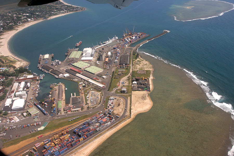
Toamasina (), meaning "like salt" or "salty", unofficially and in French Tamatave, is the capital of the Atsinanana region on the east coast of Madagascar on the Indian Ocean. The city is the chief seaport of the country, situated northeast of its capital and biggest city Antananarivo. In 2018 Toamasina had a population of 325,857. History Under French rule, Toamasina was the seat of several foreign consuls, as well as of numerous French officials, and was the chief port for the capital and the interior. Imports consisted principally of piece-goods, farinaceous foods, and iron and steel goods; main exports were gold dust, raffia, hides, caoutchouc (natural rubber) and live animals. Communication with Europe was maintained by steamers of the Messageries Maritimes and the Havraise companies, and also with Mauritius, and thence to Sri Lanka, by the British Union-Castle Line. During the colonial period, owing to the character of the soil and the formerly crowded native population, ... [...More Info...] [...Related Items...] OR: [Wikipedia] [Google] [Baidu] |
East Africa Time
East Africa Time, or EAT, is a time zone used in eastern Africa. The time zone is three hours ahead of UTC ( UTC+03:00), which is the same as Moscow Time, Arabia Standard Time, Further-eastern European Time and Eastern European Summer Time. As this time zone is predominantly in the equatorial region, there is no significant change in day length throughout the year and so daylight saving time is not observed. East Africa Time is observed by the following countries: * * * * * * * * * See also *Moscow Time, an equivalent time zone covering Belarus, Turkey and most of European Russia, also at UTC+03:00 *Arabia Standard Time, an equivalent time zone covering Bahrain, Iraq, Kuwait, Qatar, Saudi Arabia and Yemen, also at UTC+03:00 *Eastern European Summer Time, an equivalent time zone covering European and Middle Eastern countries during daylight saving, also at UTC+03:00 *Israel Summer Time, an equivalent time zone covering the State of Israel during daylight saving, also at U ... [...More Info...] [...Related Items...] OR: [Wikipedia] [Google] [Baidu] |
Madagascar
Madagascar (; mg, Madagasikara, ), officially the Republic of Madagascar ( mg, Repoblikan'i Madagasikara, links=no, ; french: République de Madagascar), is an island country in the Indian Ocean, approximately off the coast of East Africa across the Mozambique Channel. At Madagascar is the world's List of island countries, second-largest island country, after Indonesia. The nation is home to around 30 million inhabitants and consists of the island of Geography of Madagascar, Madagascar (the List of islands by area, fourth-largest island in the world), along with numerous smaller peripheral islands. Following the prehistoric breakup of the supercontinent Gondwana, Madagascar split from the Indian subcontinent around 90 million years ago, allowing native plants and animals to evolve in relative isolation. Consequently, Madagascar is a biodiversity hotspot; over 90% of wildlife of Madagascar, its wildlife is endemic. Human settlement of Madagascar occurred during or befo ... [...More Info...] [...Related Items...] OR: [Wikipedia] [Google] [Baidu] |
Toamasina
Toamasina (), meaning "like salt" or "salty", unofficially and in French Tamatave, is the capital of the Atsinanana region on the east coast of Madagascar on the Indian Ocean. The city is the chief seaport of the country, situated northeast of its capital and biggest city Antananarivo. In 2018 Toamasina had a population of 325,857. History Under French rule, Toamasina was the seat of several foreign consuls, as well as of numerous French officials, and was the chief port for the capital and the interior. Imports consisted principally of piece-goods, farinaceous foods, and iron and steel goods; main exports were gold dust, raffia, hides, caoutchouc (natural rubber) and live animals. Communication with Europe was maintained by steamers of the Messageries Maritimes and the Havraise companies, and also with Mauritius, and thence to Sri Lanka, by the British Union-Castle Line. During the colonial period, owing to the character of the soil and the formerly crowded native population, ... [...More Info...] [...Related Items...] OR: [Wikipedia] [Google] [Baidu] |
Antananarivo
Antananarivo ( French: ''Tananarive'', ), also known by its colonial shorthand form Tana, is the capital and largest city of Madagascar. The administrative area of the city, known as Antananarivo-Renivohitra ("Antananarivo-Mother Hill" or "Antananarivo-Capital"), is the capital of Analamanga region. The city sits at above sea level in the center of the island, the highest national capital by elevation among the island countries. It has been the country's largest population center since at least the 18th century. The presidency, National Assembly, Senate and Supreme Court are located there, as are 21 diplomatic missions and the headquarters of many national and international businesses and NGOs. It has more universities, nightclubs, art venues, and medical services than any city on the island. Several national and local sports teams, including the championship-winning national rugby team, the Makis are based here. Antananarivo was historically the capital of the Merina peop ... [...More Info...] [...Related Items...] OR: [Wikipedia] [Google] [Baidu] |

